
By Rich McKay and Letitia Stein
(Reuters) – Hurricane Florence strengthened early on Monday, packing maximum sustained winds of 105 mph (170 kph), and forecasters warned that it is “expected to become a major hurricane very soon” as it churns toward the U.S. East Coast.
The category 2 hurricane was mustering might as it traveled over warm Atlantic waters, about 625 miles southeast of Bermuda at 5.am. ET, the National Hurricane Center (NHC) said in an advisory.
It is expected to pickup speed, moving between Bermuda and the Bahamas on Tuesday and Wednesday and could make landfall possibly as a category 3 or higher on the five-step Saffir-Simpson scale, forecasters said.
Landfall could be made between South Carolina and North Carolina on Thursday, according to NHC predictions.
Storm-force winds could begin buffeting the Carolina coast by Wednesday night, forecasters said.
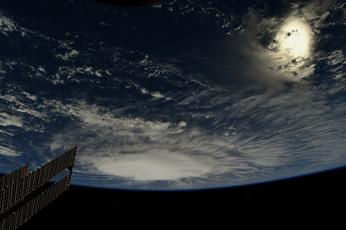
A photo taken from the International Space Station by astronaut Ricky Arnold shows Hurricane Florence over the Atlantic Ocean in the early morning hours of September 6, 2018. Courtesy @astro_ricky/NASA/Handout via REUTERS
“Make your plans now,” South Carolina Governor Henry McMaster urged residents during a news conference on Sunday. “Presume that a major hurricane is going to hit right smack dab in the middle of South Carolina.”
McMaster said he had asked President Donald Trump to declare a federal emergency in South Carolina in anticipation of the storm’s arrival.
Residents as far north as Virginia were warned that Florence posed an increasing risk of generating a life-threatening coastal storm surge, as well as flooding from heavy rainfall should the slow-moving storm stall over the southeast.
North Carolina Governor Roy Cooper also urged his state’s residents to get ready, noting the storm already was generating swelling waves and dangerous currents along the coast.
“Everyone in North Carolina needs to keep a close eye on Florence and take steps now to get ready for impacts later this week,” Cooper said in a statement on Sunday.
The governors of Virginia, North Carolina and South Carolina have all declared states of emergency.
The storm’s center was on track to pass between Bermuda and the Bahamas on Wednesday, the NHC said.
The NHC was also tracking two other storms farther out in the Atlantic.
Isaac, previously a tropical storm, strengthened into the fifth hurricane of the 2018 Atlantic season on Sunday, the NHC said.
As of early Monday, Isaac was about 1,230 miles east 1,305 miles (1,985 km) east of the Windward Islands with maximum sustained winds of 75 mph (120 kph), the NHC said.
Hurricane Helene, was spinning in the Atlantic off West Africa’s Cape Verde islands with 85-mph (140-kph) winds on Monday, but did not appear to pose an immediate threat to land.
(This refiled version of the story corrects to show strength of hurricane as category 2 not category 1 in paragraph 2.)
(Reporting by Rich McKay and Letitia Stein; Editing by Alison Williams)


