Cyclone batters south India coast killing four

Policemen remove a tree that fell on a road after it was uprooted by strong winds in Chennai, India,

HENNAI, India (Reuters) – A cyclone barreled into the southeast coast of India on Monday, killing at least four people and bringing down trees and power lines as authorities moved tens of thousands of people from low-lying areas.

Cyclone Vardah moved west over the Bay of Bengal before hitting Chennai, capital of the southern state of Tamil Nadu, as well as neighboring Andhra Pradesh, the Indian Meteorological Department said, describing it as a “very severe storm”.

Strong wind of up to 140 kph (87 mph) battered the densely populated coast, uprooting trees and bringing down electricity pylons.

Flights at Chennai airport were canceled, railway services in the area suspended and schools and colleges were closed.

Chennai is home to Indian operations of major auto firms such as Ford Motor, Daimler, Hyundai and Nissan.

The National Disaster Management Authority (NDMA) said Vardah is passing over Chennai, drenching the city in heavy rain, but is expected to ease in intensity later.

“Winds and rains might still intensify. Do not venture out,” the NDMA said on Twitter, adding that four people had been killed.

More than 23,000 people in Tamil Nadu have been moved to relief centers, with plans for tens of thousands more to be evacuated if needed, a senior state official, K. Satyagopal, told Reuters.

More than 10,000 people from two districts in Andhra Pradesh state had also been moved, its disaster management commissioner, M.V. Seshagiri Babu, said.

The NDMA warned fishermen not to venture out to sea for the next 36 hours, and urged residents to stay in safe places.

Navy ships and aircraft, as well as 30 diving teams, were on standby to help move people and deliver aid if needed, a navy spokesman said.

India’s cyclone season usually runs from April to December, with storms often causing dozens of deaths, evacuations of tens of thousands of people and widespread damage to crops and property.

Wind speeds topped 300 km per hour (186 mph) in an Indian “super-cyclone” that killed 10,000 people in 1999, while a cyclone packing speeds of more than 200 kph (124 mph) lashed the east coast in 2013.

(Reporting by Jatindra Dash, Tommy Wilkes and Anuradha Nagaraj; Editing by Catherine Evans)

Snow, cold to sweep across U.S. Northeast ahead of arctic blast

Person walking in high snow

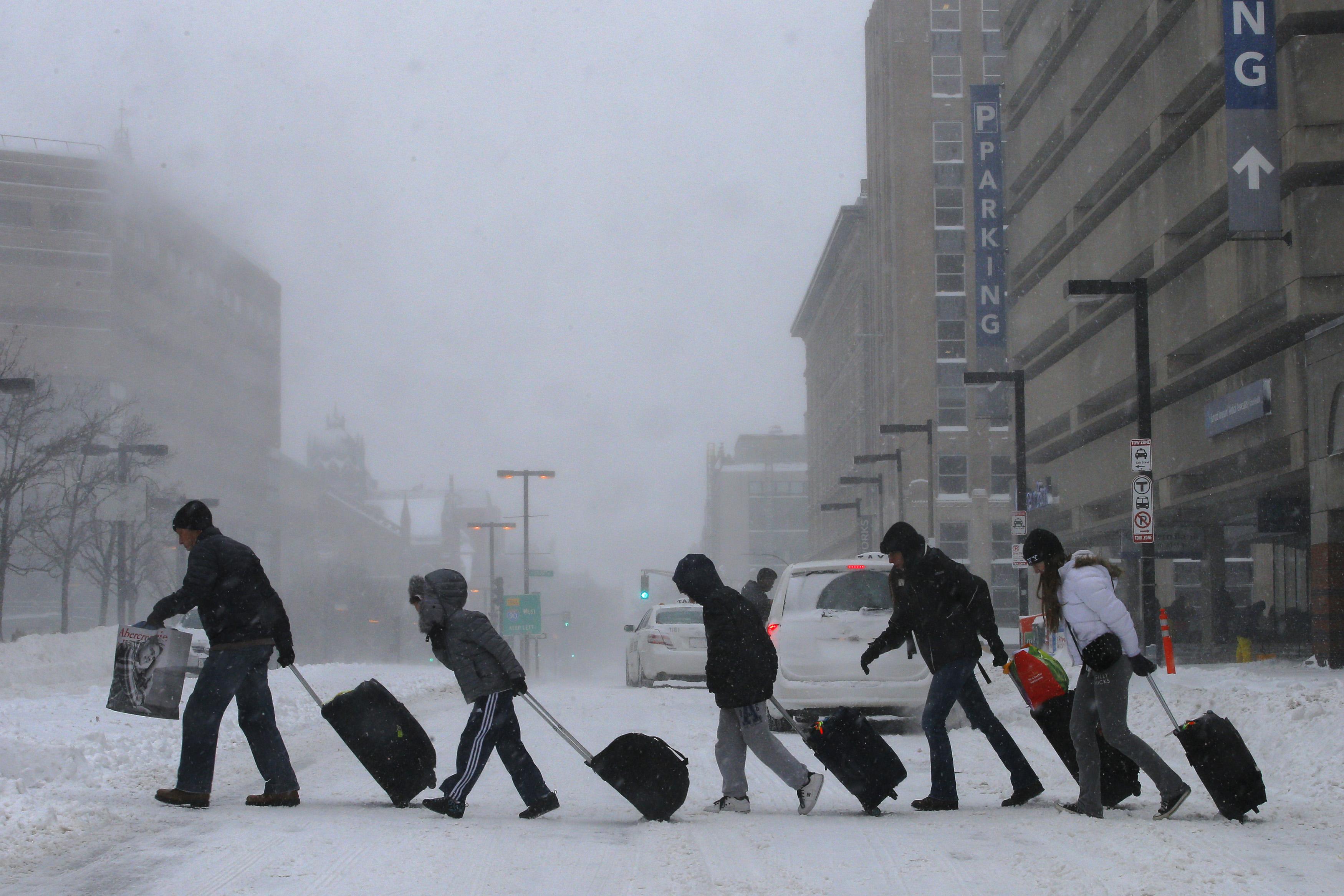
(Reuters) – A snowstorm that pummeled the Midwest and grounded hundreds of flights will sweep across the U.S. Northeast on Monday, creating tough travel conditions ahead of the season’s first arctic blast, forecasters said.

The cold front that dumped more than 10 inches (25 cm) of snow on northern Illinois has prompted winter storm warnings and advisories as it also brings sleet and rain to New England and parts of the Middle Atlantic states, the National Weather Service said.

Accuweather, a private forecaster, said three to six inches (7.5 to 15 cm) of snow was expected to snarl travel in northern New York and New England. Local accumulations could be higher.

Conditions were expected to improve late on Monday as the system moves through the region. FlightAware, which tracks air travel, said 190 U.S. flights had been canceled on Monday after 1,800 were grounded on Sunday, mostly at Chicago’s two main airports.

The National Weather Service said another arctic air mass would spread over the northern Great Plains and Midwest in the next couple of days and then head east.

In the Northeast, “the cold weather will be more significant as we get into Thursday,” weather service meteorologist Brian Hurley said.

Accuweather said high temperatures would be in the single digits F (-17 to -12 C) to just below zero F (-18 C) from the Dakotas through Minnesota and Wisconsin as the cold air grips the region.

(Reporting By Ian Simpson in Washington; Editing by Daniel Wallis and Meredith Mazzilli)

Midwest snow storm grounds hundreds of Chicago flights

Person walking in high snow

(Reuters) – Hundreds of flights into and out of Chicago’s O’Hare and Midway airports were canceled on Sunday as a winter storm system dumped moderate to heavy snow on the Upper Midwest and Lower Great Lakes regions before heading toward the U.S. Northeast.

A winter storm warning was in effect in the Chicago area on Sunday afternoon, with total accumulations of up to 10 inches (25 cm) expected by midnight CST, the National Weather Service said.

It warned of difficult driving conditions in and around the country’s third-biggest metropolitan area, where snow began falling on Saturday afternoon.

As much as 13 inches of snow fell in parts of Michigan and up to 9 inches in parts of Minnesota by 8 a.m. CST on Sunday, according to the National Weather Service.

At O’Hare International Airport, the world’s fourth-busiest airport, United Air Lines and American Airlines have scratched most regional flights and some mainline service, while Southwest Air has canceled most flights out of Midway International on Sunday evening and Monday morning, the airports said.

Passengers took to Twitter to vent their frustrations over one of the first winter storms to snarl air traffic in the region this season.

“To all our fans in Vegas – we are stuck in Chicago from the snow storm, we are so so sorry. Winter weather is (sic) wrecked our plans. This sucks,” wrote the rock band One Republic in a Twitter post. The group had a show scheduled on Sunday night at the Hard Rock Hotel & Casino in Las Vegas, Nevada.

All told, more than 1,200 flights into and out of O’Hare were canceled as of Sunday afternoon, according to the Flightaware tracking service, while nearly 200 Midway flights were scratched.

At Detroit’s Metropolitan Wayne County Airport, a Delta flight arriving from Buffalo, New York, skidded off the runway and came to a stop on a grassy verge around midday on Sunday, but there were no injuries, local media reported.

Representatives of the airport and the airline could not be reached immediately to confirm the reports.

(Reporting By Frank McGurty; Editing by Alan Crosby)

Weekend weather, freezing, dangerous Conditions in Ohio cause deadly pileups

weather map from Noaa weather service 12-9-16

By Kami K

Cold weather is in store for almost the entire nation this weekend as frigid temperatures dive in from Canada. Highs will be reaching in the low 40’s for Texas and frigid low temps of -22 degrees in the Dakotas.  According to the National Weather Service, a system moving into the Pacific Northwest will spread heavy rain and snow over the region today.  Snow levels will start off very low with snow accumulations likely even in Portland and Seattle with the probability of at least 4” of snow through Saturday evening.   

Twelve to fourteen inches of accumulation will be seen in some areas in the north from lake effect snowfall along areas close to the Great Lakes. These lake effect snows have caused dangerous conditions on roads and highways. In a report from The Weather Channel, heavy lake-effect snowfall made travel dangerous along Interstate 90 near the Ohio-Pennsylvania border Thursday, causing a pair of pileups 50 miles apart that left more than a dozen injured.

Shortly before 3 p.m. EST, the Lake County, Ohio Sheriff’s Office said that a pileup involving more than 50 vehicles occurred along I-90 southeast of Painesville. As a result, authorities closed both directions of the interstate. The road was closed for more than 14 hours and about 20 people were injured, according to the Associated Press.

Another pile-up occurred earlier Thursday along the same interstate, but this one was on the other side of the Ohio-Pennsylvania border. The Weather Channel reported that at least 15 people were injured in a pileup that involved at least a dozen vehicles between Exits 9 and 16 near Girard Township, Pennsylvania.

A more deadly chain reaction crash in Michigan resulted in the deaths of 3 people when slick road conditions caused a 30 to 40 car pileup on Interstate 96 Thursday morning.

“Bands of lake-effect snow are streaming through the Great Lakes region as arctic air flows over the relatively warmer lake waters,” said weather.com meteorologist Chris Dolce. “Those snow squalls can lead to visibility that deteriorates quickly, along with slick roads.”

Police and weather specialists are cautioning all drivers about respecting the weather conditions and being cautious.  

Michigan State Police Lt. Mike Shaw told CBS Detroit, “We’re just trying to tell people I know it’s the first snowstorm, I know it’s the first time we’ve seen snow in a long time, but you gotta slow down and you gotta take a look at those closing distances between the cars in front of you.”

Polar vortex redux? U.S. forecasters say it could hit next week

File photo: The Chicago skyline is framed by icicles in Chicago, Illinois,

By Timothy Mclaughlin

CHICAGO (Reuters) – Forecasters are sending chills down some spines with a prediction that much of the northern half of the United States could see frigid weather next week similar to life-threatening lows the polar vortex brought to parts of the country in 2014.

Anticipation of a freezing blast began to build this week when weather maps and forecast models showed similarities between next week’s system and one that developed in January 2014.

“Upper-level atmosphere configuration very similar in scale magnitude as infamous Jan 2014 #PolarVortex popularized by me and @afreedma,” meteorologist Ryan Maue said on Twitter on Tuesday alongside maps comparing the two weather systems.

The southward shift in the polar vortex in 2014 brought the Midwest some of its coldest weather in two decades. Icy conditions snarled travel and thousands of flights were canceled or delayed.

Frigid temperatures combined with gusting winds to create life-threatening wind chills as low as 60 degrees Fahrenheit below zero (minus 51 Celsius) that killed at least nine people.

Travelers leave the Back Bay train and subway station during a winter polar vortex snow storm in Boston, Massachusetts, U.S. on

Travelers leave the Back Bay train and subway station during a winter polar vortex snow storm in Boston, Massachusetts, U.S. on January 3, 2014. REUTERS/Brian Snyder/File Photo

The coldest weather next week is expected in the Midwest and Northeastern starting around Tuesday, according to forecasts that show temperatures in the single digits in some cities.

“The air mass on the way for the middle of December is likely to be substantially colder when compared to that of this past week and this weekend,” AccuWeather meteorologist Paul Pastelok wrote on Thursday.

Temperatures from the Northern and Central plains to wide swathes of the Midwest are likely to drop by between 5 and 20 degrees Fahrenheit compared to temperatures this week, according to AccuWeather.

It is unclear how far south the cold air will be felt, according to Pastelok.

Chicago, the largest city in the Midwest, is bracing for temperatures in the teens next week, according to an AccuWeather forecast, which showed a low of 17 Fahrenheit (minus 8 Celsius) for Wednesday and Thursday.

Further north in Minnesota, Minneapolis-St. Paul NBC affiliate KARE forecasted temperatures dropping to 10 degrees Fahrenheit (minus 12 Celsius) on Tuesday of next week, then 8 degrees (minus 13 Celsius) on Wednesday.

(Reporting by Timothy McLaughlin in Chicago; Editing by James Dalgleish)

U.S. veterans head to pipeline protest camp in North Dakota

A tipi is seen in the Oceti Sakowin camp during a protest against plans to pass the Dakota Access pipeline near the Standing Rock Indian Reservation, near Cannon Ball, North Dakota,

CANNON BALL, N.D. (Reuters) – U.S. military veterans were set to arrive at a camp to join thousands of activists braving snow and freezing temperatures to protest a pipeline project near a Native American reservation in North Dakota.

Protesters have spent months rallying against plans to route the $3.8 billion Dakota Access Pipeline beneath a lake near the Standing Rock Sioux reservation, saying it poses a threat to water resources and sacred Native American sites.

State officials had issued an order on Monday for activists to vacate the Oceti Sakowin camp, located on U.S. Army Corps of Engineers land near Cannon Ball, North Dakota, citing harsh weather conditions. Officials said on Wednesday they will not actively enforce that order.

The Standing Rock Sioux, in a statement on Wednesday, scoffed at the state order, noting that because “the Governor of North Dakota and Sheriff of Morton County are relative newcomers” to the land, “it is understandable they would be concerned about severe winter weather.”

They said the camp has adequate shelter to handle the cold weather, adding that the Great Sioux Nation has survived “in this region for millennia without the concerns of state or county governments.”

The temperature in Cannon Ball is expected to fall to 6 degrees Fahrenheit (-2 Celsius) by the middle of next week, according to Weather.com forecasts.

The 1,172-mile (1,885 km) pipeline project, owned by Texas-based Energy Transfer Partners LP, is mostly complete, except for a segment planned to run under Lake Oahe, a reservoir formed by a dam on the Missouri River.

Veterans Stand for Standing Rock, a contingent of more than 2,000 U.S. military veterans, intends to reach North Dakota by this weekend and form a human wall in front of police, protest organizers said on a Facebook page.

Protesters, who refer to themselves as “water protectors,” have been gearing up for the winter while they await the Army Corps decision on whether to allow Energy Transfer Partners to tunnel under the river. That decision has been delayed twice by the Army Corps.

(Reporting by Terray Sylvester; Editing by Meredith Mazzilli)

Traveling this Thanksgiving? Here’s the weather to watch out for!

Thanksgiving weekend forecast map

Be ready to snuggle up, watch a little football, get out the board games and enjoy Thanksgiving with the family!  Much of the country will be dealing with a wet and sometimes snowy mess for the Thanksgiving holiday weekend especially in the Northern and Northeast parts of the country.  There will be some wet and wintry travel spots from coast to coast so be sure that you take it slow and listen to local forecasts along the way to Grandma’s house!  

Snow and ice accumulations are expected to be light in most of the country where winter weather is a factor but with the amount of people on the roads this holiday, any wet or snowy conditions are hazardous.  

The National Weather Service reports that today’s current storm located now in the center of the country will be spreading rain and snow across the Upper Midwest and is forecasted to move into the Northeast by the evening and early Thanksgiving morning, according to the National Weather Service.  

Although wintry weather will expand from northern Pennsylvania and New York on Wednesday night  and into parts of Connecticut, Massachusetts, Vermont and New Hampshire on Thursday, The Macy’s Thanksgiving Day Parade in New York City is expected to proceed under cloudy and damp conditions.  

A significant winter storm over the Great Basin will impact much of the state of Wyoming where there will be white out conditions and ground blizzards expected in some counties.

Possible Airports that could be impacted for the long holiday weekend are: JFK, LaGuardia, Newark, Philadelphia, Washington DC, Boston, and San Francisco, mostly due to low clouds and rain.

Be sure to stay up to date with your local forecasts!  Drive carefully, respect the weather conditions and have a HAPPY THANKSGIVING!

Hurricane Matthew closes schools for thousands of Haiti’s children

partially destroyed school in Haiti

By Makini Brice

LES CAYES, Haiti (Reuters) – As Haiti cleans up the destruction wrought by Hurricane Matthew, which killed more than 1,000 people and destroyed thousands of homes, the storm has also disrupted the education of many school children in the country.

School has resumed for students in many parts of Haiti that escaped the worst of Matthew’s wrath, but an estimated 100,000 children are missing class after their schools were either reduced to rubble or converted to makeshift shelters.

In battered Les Cayes in southwest Haiti, many whose homes were blown away by Matthew remain holed up in Dumarsais Estime National School, meaning children were unable to resume class.

Bernadette Saint-Louis, a 38-year-old hawker of bananas and beans, said she came to the shelter with her four children as the storm approached.

Like her, many who lost everything to the hurricane had little if any money to send their children to school – and little option when nearby schools had been knocked down.

“Only God knows what I will do for them,” she said. “I have nothing to live on.”

While the capital, Port-au-Prince, sustained little lasting damage from the hurricane, the damage to schools along Haiti’s southern coast has raised questions about how to resume the school year in the area.

At least 300 schools in the region were destroyed or were being used as shelters, meaning over 100,000 children were missing class, UNICEF said.

Education in Haiti is a political hot-button issue ahead of a looming presidential election, which has been delayed again by the storm. Virtually every major presidential candidate has promised to expand access to schooling.

At the start of the school year in September, amid persistently high unemployment, inflation and stagnant economic growth, the cost of school fees, books and uniforms was a major topic in local media for weeks.

Interim President Jocelerme Privert cited the damage to schools in an interview on Tuesday. “We must find a way to make them functional,” he said.

That is also the hope of Haitian school director Jean-Emmanuel Pierre-Louis. Shortly after the storm passed over the area, he stood in the remains of his office in the Centre of Classical Training College of Port Salut.

The damage was severe. The private school, which had been built on the side of the mountain where teachers and students had views of green, rolling hills, no longer had a roof and chunks of its walls were now rubble scattered across the floor.

Pierre-Louis pointed to a periodic table of elements, all that was left of the chemistry lab. Files of some of the 350 students had been laid out to dry on surfaces under the sun.

Salvaged benches sat stacked outside. The remains of some classrooms were too precarious to venture into.

Pierre-Louis’ home was destroyed by the hurricane, as were those of family members and students.

“What will we do with the students if the state and the international community does not intervene?” he asked.

(Editing by Simon Gardner and Peter Cooney)

Historic town swamped, 22 dead in North Carolina flooding

Flooded motor homes

By Jonathan Drake

TARBORO, N.C. (Reuters) – Floodwaters inundated the historic black town of Princeville, North Carolina, on Thursday, leaving homes submerged to their roof lines as the state’s death toll in the aftermath of Hurricane Matthew climbed to 22.

Flooding from the Tar River had been expected in Princeville, which was founded in 1885 and believed to be the oldest U.S. town incorporated by freed slaves, and most of its 2,000 residents evacuated.

North Carolina Governor Pat McCrory described a dramatic rise in the water level in the town, long been plagued by flooding and devastated by floods after Hurricane Floyd in 1999.

Areas that had about a foot of water on Thursday morning were covered in up to 12 feet by afternoon, he said.

“Princeville is basically under water at this time,” McCrory told a news conference after flying over the town. “You gotta see it to believe it.”

The governor praised the town’s residents for heeding evacuation orders, saying no one there had died.

However, McCrory announced two additional fatalities after the storm death toll rose to 20 late on Wednesday. The latest victims included someone who drowned in Lenoir County after driving around a barricade for a washed-out roadway. Most of the state’s deaths from the hurricane have been drownings, he said.

“Stay off the roads,” McCrory said. “Stay out of the water.”

More than 30 deaths in the United States have been blamed on Matthew, with a fourth death announced in South Carolina by that state’s governor on Thursday. Before hitting the southeast U.S. coast, the fierce storm killed around 1,000 people on its rampage through Haiti last week.

The recovery effort in central and eastern North Carolina is expected to take weeks or months. So far, the federal government has disbursed about $2.6 million to individual flooding victims and approved $5 million for emergency road repairs.

(Additional reporting and writing by Colleen Jenkins; Editing by Tom Brown)

Death toll climbs as floods swamp North Carolina after Hurricane Matthew

rescue workers during floods in North Carolina

(Adds additional death and other details on flooding)

By Carlo Allegri and Gene Cherry

LUMBERTON, N.C./KINSTON, N.C., Oct 11 (Reuters) – Flooding in the aftermath of Hurricane Matthew has displaced several thousand people in North Carolina, and authorities were helping more evacuate on Tuesday as swollen rivers threatened a wide swath of the state.

Governor Pat McCrory warned of “extremely dangerous” conditions in the coming days in central and eastern North Carolina, where several rivers were at record or near-record levels.

Matthew, the most powerful Atlantic storm since 2007, killed at least 1,000 people in Haiti last week before barreling up the U.S. southeastern coast and causing at least 30 deaths in Florida, Georgia and the Carolinas.

McCrory’s office said four additional deaths were confirmed on Tuesday in North Carolina, raising the death toll in the state to 18. One person was reported as missing.

An additional U.S. death occurred on Monday night in Lumberton, North Carolina, where officials said a highway patrol officer fatally shot a man who became hostile and flashed a handgun during search-and-rescue efforts in fast-running floodwater.

Nearly 4,000 people have taken refuge in North Carolina shelters, including about 1,200 people in the hard-hit Lumberton area, where the Lumber River had crested at almost 4 feet (1.2 meters) above the prior record set in 2004 after Hurricane Frances.

Water blanketed the city of 21,000 people, leaving businesses flooded, homes with water up to their roof lines and drivers stranded after a stretch of Interstate-95 became impassable.

“We lost everything,” said Sarah McCallum, 62, who was staying in a shelter set up in an agricultural center after floodwaters drove her from her home of 20 years.

State officials are particularly concerned about victims like McCallum, who have no flood insurance because they do not live in areas typically prone to inundation. U.S. President Barack Obama on Monday signed a disaster declaration for North Carolina, which will make federal funding available to people in the hardest-hit areas.

Obama approved a similar declaration on Tuesday for South Carolina, where Matthew made landfall on Saturday. State officials are now urging residents to prepare for potential flooding from the Waccamaw and Little Pee Dee rivers.

About 532,000 homes and businesses remained without power in the U.S. Southeast on Tuesday, down from the peak of around 2.2 million on Sunday morning when the storm was still battering the Carolina coasts.

WORST FLOODING SINCE FLOYD

Matthew dumped more than a foot (30 cm) of rain in areas of North Carolina already soaked from heavy September rainfall. Ithas triggered the worst flooding in the state since Hurricane Floyd in September 1999, the National Weather Service said.

That storm caused devastating floods in North Carolina, resulting in 35 deaths, 7,000 destroyed homes and more than $3 billion in damages in the state.

In Matthew’s wake, officials are monitoring a number of overtopped or breaching dams in addition to the threat of inland river flooding, the governor’s office said.

Concerns about a potential breach of the Woodlake Dam, which led to overnight evacuations in the central North Carolina town of Spring Lake, had eased by Tuesday afternoon after it was reinforced with 700 sandbags, but a mandatory evacuation was still in effect for nearby residents.

McCrory warned that the Tar River was expected to crest on Wednesday in Greenville, where a mandatory evacuation order is already in place.

Officials remain concerned about Kinston, where significant flooding was already occurring from the Neuse River, which is expected to crest at about 27 feet (8 meters) on Saturday, just shy of the Floyd record.

Retired construction worker Wesley Turner, 71, said he fled his home near Kinston with his dogs on Friday after his power went out and the water quickly rose to about chest deep.

After several nights in a shelter, he did not know on Tuesday whether he had anything to return to.

“I can’t get to my house because it is under water,” Turner said.

(Additional reporting by Letitia Stein and Joseph Ax; Writing by Colleen Jenkins; Editing by Bill Trott, Tom Brown and Bill Rigby)