Indonesia’s latest tsunami raises global questions over disaster preparedness

Debris are seen after the tsunami damage at Sunda strait at Kunjir village in South Lampung, Indonesia, December 28, 2018. Antara Foto/Ardiansyah via REUTERS

By Fergus Jensen and Fanny Potkin

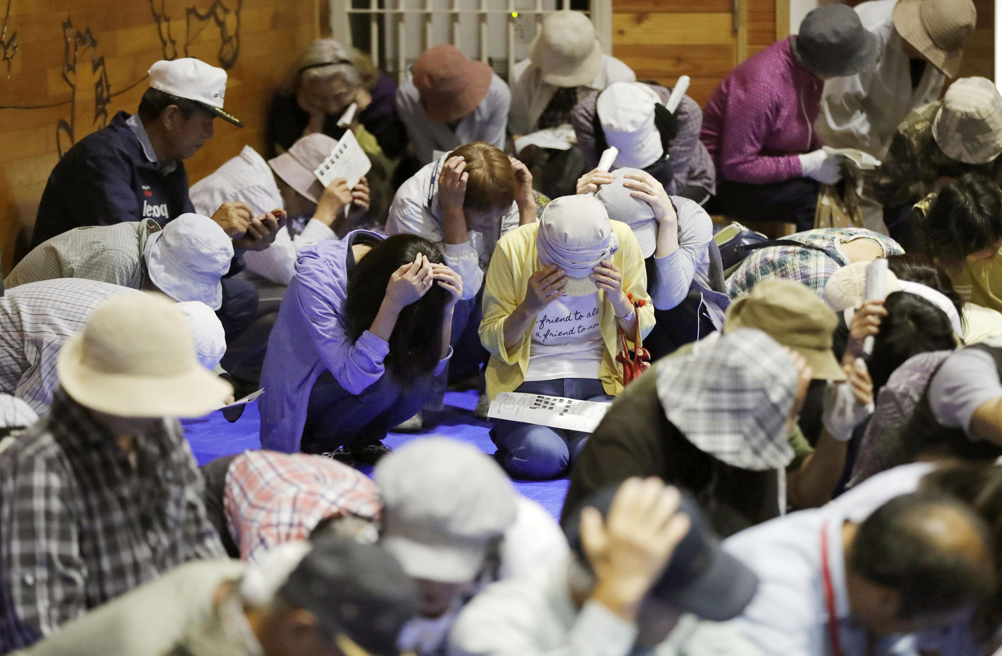
CIGONDONG/JAKARTA, Indonesia (Reuters) – As Indonesia reels from the carnage of yet another natural disaster, authorities around the globe are working on how they can prepare for the kind of freak tsunami that battered coasts west of Jakarta this month.

The Dec. 23 tsunami killed around 430 people along the coastlines of the Sunda Strait, capping a year of earthquakes and tsunamis in the vast archipelago, which straddles the seismically active Pacific Ring of Fire.

No sirens were heard in those towns and beaches to alert people before the deadly series of waves hit shore.

Seismologists and authorities say a perfect storm of factors caused the tsunami and made early detection near impossible given the equipment in place.

But the disaster should be a wake-up call to step up research on tsunami triggers and preparedness, said several of the experts, some of whom have traveled to the Southeast Asian nation to investigate what happened.

“Indonesia has demonstrated to the rest of the world the huge variety of sources that have the potential to cause tsunamis. More research is needed to understand those less-expected events,” said Stephen Hicks, a seismologist at the University of Southampton.

Most tsunamis on record have been triggered by earthquakes. But this time it was an eruption of Anak Krakatau volcano that caused its crater to partially collapse into the sea at high tide, sending waves up to 5 meters (16 feet) high smashing into densely populated coastal areas on Java and Sumatra islands.

During the eruption, an estimated 180 million cubic meters, or around two-thirds of the less-than-100-year-old volcanic island, collapsed into the sea.

But the eruption didn’t rattle seismic monitors significantly, and the absence of seismic signals normally associated with tsunamis led Indonesia’s geophysics agency (BMKG) initially to tweet there was no tsunami.

Muhamad Sadly, head of geophysics at BMKG, later told Reuters its tidal monitors were not set up to trigger tsunami warnings from non-seismic events.

The head of Japan’s International Research Institute of Disaster, Fumihiko Imamura, told Reuters he did not believe Japan’s current warning system would have detected a tsunami like the one in the Sunda Strait.

“We still have some risks of this in Japan…because there’s 111 active volcanoes and low capacity to monitor eruptions generating a tsunami,” he said in Jakarta.

Scientists have long flagged the collapse of Anak Krakatau, around 155 km (100 miles) west of the capital, as a concern. A 2012 study published by the Geological Society of London deemed it a “tsunami hazard.”

Anak Krakatau has emerged from the Krakatoa volcano, which in 1883 erupted in one of the biggest explosions in recorded history, killing more than 36,000 people in a series of tsunamis and lowering the global surface temperature by one degree Celsius with its ash.

BROKEN WARNING SYSTEM

Some experts believe there was enough time for at least a partial detection of last week’s tsunami in the 24 minutes it took waves to hit land after the landslide on Anak Krakatau.

But a country-wide tsunami warning system of buoys connected to seabed sensors has been out of order since 2012 due to vandalism, neglect and a lack of public funds, authorities say.

“The lack of an early warning system is why Saturday’s tsunami was not detected,” said disaster agency spokesman Sutopo Nugroho, adding that of 1,000 tsunami sirens needed across Indonesia, only 56 are in place.

“Signs that a tsunami was coming weren’t detected and so people did not have time to evacuate.”

President Joko Widodo this week ordered BMKG to purchase new early warning systems, and the agency later said it planned to install three tsunami buoys on the islands surrounding Anak Krakatau.

The cost of covering the country is estimated at 7 trillion rupiah ($481.10 million). That is roughly equivalent to Indonesia’s total disaster response budget of 7.19 trillion rupiah for 2018, according to Nugroho.

But other experts say even if this network had been working, averting disaster would have been difficult.

“The tsunami was very much a worst-case scenario for any hope of a clear tsunami warning: a lack of an obvious earthquake to trigger a warning, shallow water, rough seabed, and the close proximity to nearby coastlines,” said seismologist Hicks.

In the Philippines, Renato Solidum, undersecretary for disaster risk reduction, said eruptions from the country’s Taal volcano had caused tsunami waves before in the surrounding Taal Lake.

He told Reuters that what happened in Indonesia showed the need to “re-emphasize awareness and preparedness” regarding volcanic activity and its potential to trigger tsunamis in the Philippines.

The United States has also suffered several tsunamis caused by volcanic activity, including in Alaska, Hawaii, and Washington, according to the national weather service.

MORE EDUCATION

In Indonesia earlier this year, a double quake-and-tsunami disaster killed over 2,000 people on Sulawesi island, while at least 500 died when an earthquake flattened much of the northern coastline of the holiday island of Lombok.

In a country where, according to government data, 62.4 percent of the population is at risk of being struck by earthquakes and 1.6 percent by tsunamis, attention is now focused on a continued lack of preparedness.

“Given the potential for disasters in the country, it’s time to have disaster education be part of the national curriculum,” Widodo told reporters after the latest tsunami.

For Ramdi Tualfredi, a high school teacher who survived last week’s waves, these improvements cannot come soon enough.

He told Reuters that people in his village of Cigondong on the west coast of Java and close to Krakatau had never received any safety drills or evacuation training.

“I’ve never received education on safety steps,” he said.

“The system…totally failed.”

(Additional reporting by Wilda Asmarini, Tabita Diela, Bernadette Christina Munthe in Jakarta, Linda Sieg and Tanaka Kiyoshi in Tokyo, and Neil Jerome Morales in Manila.; Writing by Kanupriya Kapoor; Editing by Raju Gopalakrishnan)

Indonesia’s double disaster exposes earthquake lessons not learned

A man salvages wood from the ruins of a house in the Petobo neighbourhood which was hit by an earthquake and liquefaction in Palu, Central Sulawesi, Indonesia October 10, 2018. REUTERS/Darren Whiteside

By Kanupriya Kapoor

PALU, Indonesia (Reuters) – The young man standing atop a mound of gray mud and debris on the Indonesian island of Sulawesi, waiting for an excavator he hoped would dig out the bodies of his parents, voiced the exasperation many feel in his earthquake-plagued country.

“This is something that happens all the time in Indonesia. Why aren’t we getting better at handling it?” Bachtiar cried as the machine clanked through the ruins of someone’s kitchen in the city of Palu.

A 7.5-magnitude earthquake on Sept. 28 triggered a tsunami and extensive soil liquefaction, a phenomenon that turns soft soil into a seething mire, killing 2,073 people, according to the latest official estimate. Up to 5,000 more may be missing.

“In every disaster, there’s always a lesson to be learned,” Sutopo Purwo Nugroho, spokesman for the national disaster mitigation agency, said this week.

Nugroho conceded that Indonesia’s preparedness for disasters and capacity to respond still fall woefully short, not least because public funding is so low. He said the country’s disaster response budget is currently 4 trillion rupiah ($262 million) a year, equivalent to 0.002 percent of the state budget.

“We should not forget that there will be many disasters to come. It needs budget,” he said. “We need to learn from Japan as they are consistent in preparation.”

Critics say that, despite improvements at a national level in disaster management since a devastating Indian Ocean tsunami in 2004, local authorities often lack know-how and equipment, and so rescue efforts are delayed until the military can reach the area.

Also, a lack of education and safety drills means people don’t know how to protect themselves when an earthquake strikes.

Palu was Indonesia’s second earthquake disaster of 2018. In August, the island of Lombok was rocked by quakes that flattened villages and killed more than 500 people.

It was also only the latest in a string of deadly tsunamis to hit the archipelago in 2005, 2006 and 2010. But none of those compare with the 2004 tsunami that killed some 226,000 people in 13 countries, more than 120,000 of them in Indonesia alone.

Indonesia straddles the southwestern reaches of the Pacific Ring of Fire and is practically defined by the tectonic plates that grind below its lush islands and blue seas.

The archipelago is strung out along a fault line under the Indian Ocean off its west coast. Others run northwards in the Western Pacific, including those under Sulawesi.

Volcanoes that dot the islands have brought fiery destruction and remarkable fertility, but rapid population growth over recent decades means that many more people are now living in hazardous areas.

For a graphic on destruction in Palu, click https://tmsnrt.rs/2IDFukK

‘NEW SCIENCE’

The biggest – and most unexpected – killer in Sulawesi was soil liquefaction, a phenomenon where intense tremors cause saturated sand and silt to take on the characteristics of a liquid.

The liquefaction swallowed up entire neighborhoods of Palu.

With communications and power down, rescuers focused first on Palu’s tsunami-battered beachfront in the north and on collapsed hotels and shopping centers in its business district.

Roads to the south, where the city has spread out as it has grown, were initially impassable – damaged or blocked by debris.

So it took days for rescuers to reach the neighborhoods of Balaroa, Petobo, and Sigi, where traumatized survivors said the ground came alive when the quake hit, swallowing up people, vehicles and thousands of homes.

Liquefaction is a fairly common characteristic of high-magnitude earthquakes, but the Indonesian government says there is still insufficient understanding of the phenomenon and how to reduce exposure to it.

“Liquefaction is a new science. There are no guidelines on how to handle it,” Antonius Ratdomopurbo, secretary of the Geological Agency at the Ministry of Energy and Mineral Resources, told reporters this week.

‘EDUCATION’

A tsunami warning system set up after 2004 failed to save lives in Sulawesi: it emerged too late that, due to neglect or vandalism, a network of 22 buoys connected to seabed sensors had been inoperable since 2012.

With power and communications knocked out in Palu, there was no hope of warning people through text messages or sirens that tsunami waves of up to six meters (20 feet) were racing towards the city.

But that highlights what some experts say is the most important lesson: No one in a coastal area should wait for a warning if they feel a big quake.

“The earthquake is the warning,” said Adam Switzer, a tsunami expert at the Earth Observatory of Singapore. “It’s about education.”

Unlike in quake-prone Japan and New Zealand, earthquake education and drills are only sporadic in Indonesia, so there is little public awareness of how to respond.

“The problem in tsunami early warning systems is not the structure … but the culture in our communities,” said Nugroho.

That culture includes a resilience that emerged within days as the people of Palu picked up the pieces of their lives.

“Palu is not dead,” is daubed on a billboard by the beach.

Eko Joko, his wife and two children have been salvaging wood and metal to reconstruct their flattened beachfront shop-house.

“I tell my family they have to be strong, not scared so that I can be strong,” said Joko, 41.

“This disaster has not destroyed us.”

(Additional reporting by Bernadette Christina Munthe in Jakarta; Editing by Robert Birsel and John Chalmers)

Japan braces as typhoon charts course for main island

Super typhoon Trami is seen from the International Space Station as it moves in the direction of Japan, September 25, 2018 in this image obtained from social media on September 26, 2018. ESA/NASA-A.Gerst/via REUTERS

By Elaine Lies

TOKYO (Reuters) – Japan braced for high winds and heavy rain as a typhoon roared north on Friday, enveloping outlying islands in high seas before taking aim at the rest of the nation and raking across its biggest main island at the weekend.

Typhoon Trami, rated category 2 by Tropical Storm Risk, with category 5 the highest, is the latest storm to threaten Japan in a year filled with more than the usual number of disasters, including punishing heat, heavy rains, and landslides.

Less than a month ago, a typhoon flooded Kansai International airport near Osaka, leaving thousands of tourists stranded.

Outlying islands in the Okinawan chain, some 1,000 km southwest of Tokyo, were being pounded by heavy seas and strong winds, just two days before an Okinawan gubernatorial election, forcing some areas to hold voting early. The central government set up an emergency office to deal with the storm.

Trami was about 300 km (186 miles) southeast of Miyako island, with winds gusting as high as 216 kilometers an hour (134 mph).

Churning north across Okinawa on Saturday, Trami is then predicted to rake across the islands of Kyushu and the main island of Honshu on Sunday, a path similar to that taken by typhoon Jebi early in September.

Though the Japanese capital of Tokyo is set for heavy rain, current predictions show it avoiding a direct hit.

Jebi, the most powerful storm to hit Japan in 25 years, brought some of the highest tides since a 1961 typhoon and flooded Kansai airport near Osaka, taking it out of service for days.

Seventeen people died in the storm, whose high winds sent trees crashing to the ground and cars scudding across parking lots.

Even for a nation accustomed to disasters, this year has been hard for Japan, starting with a volcanic eruption in January that rained rocks down on a ski resort, killing one.

July brought record-breaking heat that killed at least 80 people and sent over 20,000 to the hospital for treatment, along with torrential rains in western Japan that set off floods and landslides, killing more than 200.

Just two days after Jebi hit in September, the northernmost main island of Hokkaido was rocked by an earthquake that set off landslides, knocked out power throughout the island and killed at least 44 people.

(Editing by Nick Macfie)

Japanese towns hold drills for natural disasters, and missiles too

School students take part in an evacuation drill based on the scenario of a launch of North Korean missiles towards the U.S. Pacific territory of Guam that would fly over their homes, in the town of Kotoura, Tottori prefecture, Japan in this photo taken by Kyodo

TOKYO (Reuters) – Japan held annual exercises on Friday to prepare for disasters but this year it was not just the danger of earthquakes and tsunamis that was on the minds of many people – the threat of North Korean missiles also loomed large.

Japan is one of the world’s most earthquake-prone countries and it carries out disaster drills every year on Sept. 1, the anniversary of the Great Kanto Earthquake of 1923 that killed at least 100,000 people and devastated Tokyo.

Military helicopters clattered over Tokyo as authorities practised for a 7.3 magnitude quake directly under the capital.

“In order to save even one additional life, we will promote preventive measures to tackle various types of disasters and a well-balanced disaster prevention plan based on self-help, public assistance and cooperation,” Prime Minister Shinzo Abe said after taking part in a drill.

Towns in north Japan took the opportunity to remind residents what to do, not only when Mother Nature strikes but when a North Korean missile approaches too.

Local residents take part in an emergency drill in the wake of repeated missile launches by North Korea, in Takikawa on Japan's northernmost main island of Hokkaido, in this photo taken by Kyodo September 1, 2017.

Local residents take part in an emergency drill in the wake of repeated missile launches by North Korea, in Takikawa on Japan’s northernmost main island of Hokkaido, in this photo taken by Kyodo September 1, 2017. Kyodo/via REUTERS

On Tuesday, North Korea fired a ballistic missile over northern Japan, triggering widespread emergency warnings that jolted millions awake, before it splashed down in the Pacific Ocean.

Sirens blared again on Friday in towns like Takikawa in the northernmost main island of Hokkaido, and residents took cover inside, in line with government warnings to seek shelter below ground or in a solid building.

Not that residents needed a reminder of the danger.

“The real thing happened before the drills, so today everyone took part with a sense of urgency,” one resident of a northern town told a broadcaster.

The government says there is a 70 percent chance a magnitude 7 earthquake right under Tokyo in the next 30 years.

On March 11, 2011, Japan’s northeast coast was struck by a magnitude 9 earthquake, the strongest quake in Japan on record, which triggered huge tsunami waves.

About 20,000 people were killed and the tsunami triggered a meltdown at a nuclear plant, the world’s worst nuclear crisis since Chernobyl a quarter of a century earlier.


(Reporting by Elaine Lies and Minami Funakoshi; Editing by Robert Birsel)


New Law in Philippines to protect children after disasters

A boy wades through a flooded street in Jaen, Nueva Ecija in northern Philippines October 20, 2015, after the province was hit by Typhoon Koppu.

By Alisa Tang

BANGKOK (Thomson Reuters Foundation) – Child rights groups welcomed a new law in the Philippines requiring special emergency plans to protect children after disasters and said the legislation, the first of its kind in Asia, should send a message to other countries to follow suit.

President Benigno Aquino on Wednesday signed the Children’s Emergency Relief and Protection Act into law, mandating the government to draw up plans to ensure the welfare of children affected by natural disasters, accidents and other unforeseen events.

“We know for a fact that the children are at risk in these kinds of situations because they are helpless,” Aquino said at the signing ceremony at the presidential palace in Manila.

“We hope to make a strong foundation and basis to take care of Filipino children whoever is elected into office,” the outgoing Philippine leader said in a statement posted online.

The law clarifies the responsibilities of various government sectors, ensures children’s basic needs are met, and strengthens the government’s mandate to build evacuation centers and temporary shelters with facilities for children as well as pregnant women, he said.

Save the Children described the law as an “enormous victory for children.”

“We know from experience that when disasters strike, children are always the most vulnerable,” Ned Olney, Save the Children’s country director who was present at the signing, said in a statement.

“This legislation … ensures that children have targeted humanitarian intervention, and that government services and communities are better prepared for future disasters.”

With the law signed a few days before the first-ever World Humanitarian Summit opens in Istanbul, Olney said “the Philippines is sending a strong signal to world leaders that children caught in disasters must be better protected.”

Plan International also welcomed the law and urged the government to fully implement it.

“Children often feel voiceless in times of disasters. This victory proves that they do have a voice,” Plan said.

The Philippines is one of the most disaster-prone countries in the world, hit by an average of 20 typhoons a year.

(Reporting by Alisa Tang, additional reporting by Manuel Mogato in Manila, editing by Ros Russell. Please credit the Thomson Reuters Foundation, the charitable arm of Thomson Reuters, that covers humanitarian news, women’s rights, corruption and climate change. Visit http://news.trust.org to see more stories)

United States sees one of its warmest, wettest and wildest years on record

The continental United States experienced one of its warmest and wettest years in history in 2015, the National Oceanic and Atmospheric Administration (NOAA) announced Thursday.

Temperatures and precipitation totals were well above long-term averages, according to the year-end report published by the NOAA’s National Centers for Climate Information, and the final numbers indicated the nation had its second-warmest and third-wettest year on record.

The nation also was hit by five different types of weather and climate disasters — flooding, droughts, wildfires, extreme cold and severe storms — a variety the NOAA said is not usually seen. There were 10 disasters in total, and each of them caused at least $1 billion in losses.

The NOAA reported the average temperature in the United States last year was 54.4 degrees Fahrenheit, 2.4 degrees above the nation’s 20th-century average, but .88 degrees lower than the record-setting year of 2012. The average precipitation total in the lower 48 states was 34.47 inches, 4.53 inches above the average level, and the influx of rainfall helped reduce the national drought footprint by about 10 percent. The only wetter years on record are 1973 and 1983.

Every single one of the lower 48 states posted above-average yearly temperatures, the NOAA said, and Washington, Florida and Oregon all posted their warmest years on record. The same can be said of southeastern Louisiana and western Montana.

The temperature and precipitation records date to 1895.

The NOAA also said 10 weather and climate disasters occurred across the nation last year, including wildfires and droughts in the west, flooding in South Carolina, Texas and the midwest, a cold wave in the northeast, tornadoes in Oklahoma and Texas, and severe thunderstorms across the Great Plains. Together, the NOAA said the disasters killed 155 people nationwide.

It’s not common, but also not unheard of, for the United States to see that many different kinds of disasters causing $1 billion in losses in a year. According to the NOAA, the nation usually sees three or four kinds of disasters every year, but five have occurred five other times since 1989.

The overall total of 10 billion-dollar disasters was slightly below the nation’s five-year average of 10.8, the report indicates, but it was still nearly double the 35-year average of 5.2.

The NOAA added the United States has now been the victim of 188 billion-dollar weather and climate disasters since 1980, and they have cumulatively caused more than $1 trillion in losses.