Storm Michael expected to hit Florida as a hurricane midweek

A satellite image of Tropical Storm Michael taken Monday. NOAA/via REUTERS

By Rich McKay and Jon Herskovitz

(Reuters) – Tropical Storm Michael is on track to hit the Florida Panhandle midweek as a Category 2 hurricane packing 100 miles per hour (160 kmh) or stronger winds, the U.S. National Hurricane Center (NHC) said early Monday in an advisory.

The tropical storm is expected to swell into a Category 1 hurricane as soon as Monday night or early Tuesday as it rolls into the U.S. Gulf of Mexico, with winds of 70 mph, as of 5 a.m. eastern time, forecasters said, just shy of being named a hurricane.

A storm is designated a Category 1 hurricane if it reaches speeds of 74 mph (119 km) or more, and a Category 2 hurricane at 96 mph (154 km) or more on the Saffir-Simpson hurricane wind scale.

Florida Gov. Rick Scott declared a state of emergency in more than 20 counties along the Florida Panhandle and Big Bend on Sunday and has put more than 5,000 National Guard soldiers on alert.

“Our state understands how serious tropical weather is and how devastating any hurricane of tropical storm can be,” Scott said in a statement.

He advised Gulf Coast residents to prepare for possible evacuation orders.

Michael battered parts of Mexico and Cuba with powerful winds and drenching rains on Sunday and into early Monday as it churned in the Caribbean.

The storm moved north on a path between Cozumel in southeastern Mexico and the western tip of Cuba, the Miami-based hurricane center said.

A hurricane watch has been issued from the Alabama-Florida border eastward to the Suwanee River, Florida.

Outer bands from Michael are expected produce as much as 4 inches (10 cm) of rain through Tuesday in the Florida Keys, one of several areas in the state devastated by Hurricane Irma last year.

After hitting Florida, the storm is then forecast to move northeast along the Atlantic Coast and batter the Carolinas, which are still recovering from Hurricane Florence last month. That hurricane killed at least 50 people and caused billions of dollars in damage.

The Commodity Weather Group said on Sunday some oil rigs in the gulf area may be evacuated as a precaution, which may slow down operations but was not likely cause much interruption.

The Gulf of Mexico is home to 17 percent of U.S. crude oil and 5 percent of natural gas output daily, according to the U.S. Energy Information Administration.

More than 45 percent of the nation’s refining capacity is located along the U.S. Gulf Coast, which also is home to 51 percent of total U.S. natural gas processing capability.

(Reporting by Rich McKay in Atlanta and Jon Herskovitz in Austin, Texas; Editing by Raissa Kasolowsky)

Storm Gordon starts kicking up waves on U.S. Gulf Coast

Tropical Storm Gordon is pictured nearing Florida, U.S. in this September 2, 2018 NASA satellite handout photo. NASA/Handout via REUTERS

(Reuters) – Waves began to batter parts of the U.S. Gulf Coast on Tuesday as the region felt the first hit of Tropical Storm Gordon, which is expected to become a hurricane before it comes ashore with high winds and heavy rain, forecasters said.

The storm also caused a jump in global oil prices after the evacuation of two oil platforms in the Gulf of Mexico.

Gordon was due to come ashore late on Tuesday near the border between Louisiana and Mississippi, and drop as much as 12 inches (30 cm) of rain in areas still recovering from last year’s hurricanes, the National Hurricane Center said.

Currently carrying winds of around 65 miles per hour (105 km per hour), the storm was expected to pack hurricane-force winds – of at least 74 mph (119 kph) – when it reached the north-central Gulf Coast, the center said.

High surf was already hitting Alabama’s Dauphin Island early Tuesday, the National Weather Service office in Mobile said on Twitter.

Louisiana Governor John Bel Edwards declared a state of emergency and said 200 Louisiana National Guardsmen were being deployed, along with 63 high-water trucks, 39 boats, and four helicopters.

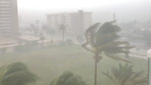
Trees sway as Storm Gordon descends on Fort Lauderdale, Florida, U.S., September 3, 2018 in this still image taken from a video obtained from social media. @Saralina77/via REUTERS

Trees sway as Storm Gordon descends on Fort Lauderdale, Florida, U.S., September 3, 2018 in this still image taken from a video obtained from social media. @Saralina77/via REUTERS

New Orleans’ mayor, LaToya Cantrell, declared her own state of emergency and closed all non-essential government offices.

Storm surge of as much as 5 feet (1.5 m) could hit a stretch of coast from Shell Beach, Louisiana, to Dauphin Island, Alabama, forecasters said. The Mississippi Emergency Management Agency told South Mississippi residents to be prepared to evacuate.

As of Tuesday morning, Gordon was located about 190 miles (305 km) east-southeast of the mouth of the Mississippi River, and was heading west-northwest, the Miami-based hurricane center said.

U.S. oil producer Anadarko Petroleum Corp evacuated workers and shut production at two offshore oil platforms on Monday, and other companies with production and refining operations along the Gulf Coast said they were securing facilities.

The Gulf of Mexico is home to 17 percent of U.S. crude oil and 5 percent of natural gas output daily, according to the U.S. Energy Information Administration. More than 45 percent of the nation’s refining capacity is located along the Gulf Coast.

The U.S. Coast Guard said the ports of New Orleans as well as Gulfport and Pascagoula, Mississippi, may have to close within 48 hours.

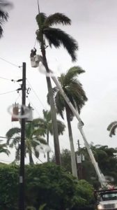
Maintenance crew work near power lines during an outage after Storm Gordon descended on Miami Beach, Florida, U.S., September 3, 2018 in this still image taken from a video obtained from social media. @ZwebackHD/via REUTERS

Maintenance crew work near power lines during an outage after Storm Gordon descended on Miami Beach, Florida, U.S., September 3, 2018 in this still image taken from a video obtained from social media. @ZwebackHD/via REUTERS

Last year, powerful hurricanes hit Texas, Florida and Puerto Rico, causing thousands of deaths, hundreds of billions of dollars worth of damage and massive power outages.

Gordon passed over Florida’s southern tip on Monday afternoon. There were no reports of any injuries or deaths or any damage to buildings, said Alberto Moscoso, a spokesman for the Florida Division of Emergency Management.

(Reporting Brendan O’Brien in Milwaukee and Scott Malone in Boston; Editing by Louise Heavens, Andrew Heavens and Frances Kerry)

‘Jackpotting’ hackers steal over $1 million from ATM machines across U.S.: Secret Service

A hooded man holds a laptop computer as blue screen with an exclamation mark is projected on him in this illustration picture taken on May 13, 2017.

By Dustin Volz

WASHINGTON (Reuters) – A coordinated group of hackers likely tied to international criminal syndicates has pilfered more than $1 million by hijacking ATM machines across the United States and forcing them to spit out bills like slot machines dispensing a jackpot, a senior U.S. Secret Service official said on Monday.

Within the past few days there have been about a half-dozen successful “jackpotting” attacks, the official said.

The heists, which involve hacking ATMs to rapidly shoot out torrents of cash, have been observed across the United States spanning from the Gulf Coast in the southern part of the country to the New England region in the northeast, Matthew O’Neill, a special agent in the criminal investigations division, told Reuters in an interview.

The spate of attacks represented the first widespread jackpotting activity in the United States, O’Neill said. Previous campaigns have been spotted in parts of Europe and Latin America in recent years.

“It was just a matter of time until it hit our shores,” O’Neill said.

Diebold Nixdorf Inc and NCR Corp, two of the world’s largest ATM makers, warned last week that cyber criminals are targeting ATMs with tools needed to carry out jackpotting schemes.

The Diebold Nixdorf alert described steps that criminals had used to compromise ATMs. They include gaining physical access, replacing the hard drive and using an industrial endoscope to depress an internal button required to reset the device.

A confidential U.S. Secret Service alert seen by Reuters and sent to banks on Friday said machines running XP were more vulnerable and encouraged ATM operators to update to Windows 7 to protect against the attack, which appeared to be targeting ATMs typically located in pharmacies, big box retailers and drive-thrus.

While initial intelligence suggested only ATMs running on outdated Windows XP software were being targeted, the Secret Service has seen successful attacks within the past 48 hours on machines running updated Windows 7, O’Neil said.

“There isn’t one magic solution to solve the problem,” he said.

A local electronic crimes task force in the Washington, D.C., metropolitan area first reported an unsuccessful jackpotting attempt last week, O’Neill said.

A few days later another local partner witnessed similar activity and “developed intelligence” that indicated a sustained, coordinated attack was likely to occur over the next two weeks, O’Neill said. He declined to say where that partner was located.

Jackpotting has been rising worldwide in recent years, though it is unclear how much cash has been stolen because victims and police often do not disclose details.

(Reporting by Dustin Volz in Washington, D.C.; Editing by David Gregorio)

Hurricane Nate threatens U.S. central Gulf Coast after killing 25

Heavy machinery is used to remove mud from a highway that connects with the south of the country collapsed by Storm Nate in Casa Mata, Costa Rica October 6, 2017. REUTERS/Juan Carlos Ulate

By Oswaldo Rivas

MANAGUA (Reuters) – Hurricane Nate may strengthen on Saturday, threatening to hit the U.S. central Gulf Coast with strong winds and storm surges after it killed at least 25 people in Central America.

New Orleans evacuated some residents from areas outside its levee system as Nate, a Category 1 hurricane, the weakest on a five-category scale used by meteorologists, churned towards the central Gulf of Mexico.

“Nate is at our doorstep or will be soon,” New Orleans Mayor Mitch Landrieu said, adding that the winds could cause significant power outages, and storm surges are projected to be six to nine feet (1.8 to 2.7 meters) high.

“We have been through this many, many times. There is no need to panic,” Landrieu told a news conference.

The storm brushed by Mexico’s Yucatan peninsula, home to beach resorts such as Cancun and Playa del Carmen, as it headed north, the U.S. National Hurricane Center in Miami said.

With maximum sustained winds of 80 miles per hour (130 kmh), Nate was about 345 miles (550 km) south-southeast of the Mississippi river and expected to strengthen before it makes landfall, the NHC said.

A state of emergency was declared for 29 Florida counties and states – Alabama, Louisiana and Mississippi – as well as the New Orleans, which was devastated by Hurricane Katrina in 2005.

The NHC issued a hurricane watch from Grand Isle, Louisiana to the Alabama-Florida border.

“By Saturday noon you should be in your safe place,” Alabama Governor Kay Ivey told a news conference. “This is a fast-moving storm and we must begin preparing now.”

Nearly three-quarters of U.S. Gulf of Mexico oil production was offline ahead of the storm, and more oil companies halted operations on Friday.

On Saturday morning, Nate was moving north-northwest at 22 miles per hour (35 kmh), a fast pace which if maintained could mean the storm does less damage when it hits land.

CENTRAL AMERICA DEATHS

The storm doused Central America with heavy rains on Thursday, killing at least 12 people in Nicaragua, nine in Costa Rica, two in Honduras and two in El Salvador.

Thousands were forced to evacuate their homes and Costa Rica’s government declared a state of emergency.

Costa Rican President Luis Guillermo Solis urged residents to remain vigilant, noting rains would likely resume.

In Honduras, residents wondered whether they would have to flee. Norma Chavez and her two children anxiously watched a river rise outside their home in Tegucigalpa, the capital.

“We are worried that it will grow more and carry away the house,” said Chavez, 45.

Through Monday, Nate is expected to produce two to four inches (5 to 10 cm) more rain in eastern Yucatan and western Cuba and three to six inches (8 to 15 inches) in the U.S. central Gulf Coast.

About 71 percent of U.S. Gulf of Mexico oil production and 53 percent of natural gas output is offline ahead of Nate’s arrival, the U.S. Department of the Interior’s Bureau of Safety and Environmental Enforcement (BSEE) said on Friday.

Oil companies have evacuated staff from 66 platforms and five drilling rigs, it said. Oil production equaling 1.24 million barrels of crude per day is offline, according to BSEE.

(Reporting by Brendan O’Brien in Milwaukee; editing by Alexander Smith)

Morningside and The Jim Bakker Show Sending Team to Texas

Jim and Lori Bakker ready to leave for the Houston area to bring food, comfort and prayer to those needing our help September 4, 2017

By Kami Klein

Pastor Jim and Lori Bakker left today for the Houston area to help local churches struggling to keep up with the needs from the disaster left behind from Hurricane Harvey.  Jim and Lori, along with The Jim Bakker Show team will be there to feed, comfort and pray with those who have lost so much and are struggling to rebuild.  They will witness with you scenes that are left from this devastating storm, and share with you the stories of heroism, courage and the humanity of the people that have been affected by this tragic event.

Yesterday, a truck loaded full with pallets of food buckets, water purification products, Bibles and other survival supplies left Morningside bound for Houston.  In an email from Pastor Jim he wrote,


“Never before have you been “the hands and feet of Jesus” as much as this moment.  Because you have been prepared and have prepared to share with others, we are able to make this trip possible.  

We appreciate all you do for this Ministry and for allowing us to represent you to thousands of hurting people in need. We could not be doing this without you.

Please continue to pray for us in our journey.  Pray for those still in harm’s way. And, most importantly, continue to pray that each one will experience the love of Jesus through us to His glory. ”


We will be sharing what is happening in Houston directly from our team as they work alongside these true survivors that have shown the world what being a Christian and an American is all about. Please keep them in your prayers!  

Morningside and The Jim Bakker Show team ready to leave for Houston.

Morningside and The Jim Bakker Show team ready to leave for Houston.

We are now asking for your help by donating funds towards supporting and helping in areas where there is the greatest need.

The people of Houston and the gulf coast are only at the beginning of an incredibly daunting challenge as they rebuild their lives.  Now is the time to remember that we are all part of God’s family.

Now is the time for compassion!  Now is the time to act!

 Follow this link to our slideshow that will be updated throughout our team’s time in Texas!  

Please donate today!   


Death toll rises to 8 as tornadoes sweep through Southeast

The death toll from the severe thunderstorms and tornadoes that damaged homes and businesses across the United States over the past two days now stands at eight, officials said.

The National Weather Service received 68 reports of tornadoes in the Gulf Coast and Southeast on Tuesday and Wednesday, along with about 500 reports of wind damage from Florida to Maine. The reports mentioned damages to homes and businesses, indicating some were destroyed, as well as numerous downed trees and power lines throughout the storm area.

Tornadoes were reported in Louisiana, Mississippi, Alabama, Georgia and Florida on Tuesday, and Florida, Virginia and North Carolina on Wednesday. It’s possible that some of those storm reports reference the same funnel cloud, as there are numerous counties listed multiple times.

Officials said severe weather killed five people Wednesday, four in Virginia and one in South Carolina. They came a day after tornadoes killed two people in Louisiana and one in Mississippi.

The Virginia State Police said three people were killed in Waverly, where a funnel cloud was reportedly spotted, and “significant debris” left two state highways impassible in the area.

Officials in Appomattox County said one person was killed after a reported tornado left a trail of destruction that stretched at least eight miles. In a Facebook post, they said some 100 structures were damaged — 20 severely — and 40 percent of the county’s homes were without power.

Virginia Governor Terry McAuliffe declared a state of emergency, joining governors in Louisiana, Alabama and Mississippi who issued similar decrees for the severe weather.

McAuliffe’s office said the governor was heading out to survey the damage on Thursday.

The National Weather Service’s reports indicate multiple houses were destroyed near Richmond, Virginia, and five houses were damaged near Granville, North Carolina, a snippet of the storm’s impact.

The reports also say winds toppled trees and power lines in areas where tornadoes weren’t seen.

In South Carolina, the Darlington County Coroner’s Office said a 58-year-old man was killed by a falling tree as he tried to remove storm debris from a road near his home.

Those downed trees and limbs helped knock out power to tens of thousands of people along the East Coast, some of whom were still without electricity on Thursday morning.

That included about 45,000 customers in Connecticut, local utility company Eversource said.

Tornadoes kill three in the South, more possible along East Coast

Tornadoes killed at least three people and damaged dozens of homes and businesses as a powerful storm system swept through the Gulf Coast on Tuesday evening, officials said.

More tornadoes were possible along the East Coast today, the National Weather Service warned, saying parts of Virginia and North Carolina had the highest chance of seeing extreme weather.

The service’s Storm Prediction Center received 31 reports of tornadoes in Louisiana, Alabama, Mississippi, Georgia and the Florida panhandle on Tuesday. Some of those reports may reference the same tornado, as several counties had multiple damage summaries listed.

The National Weather Service said one person was killed when a tornado destroyed a mobile home near Purvis, Mississippi. The St. James (Louisiana) Parish’s official Facebook page added that a tornado hit a mobile home park in Convent, killing two people and sending 30 to the hospital with injuries. The storm also damaged about 100 RVs and trailers there, officials wrote.

Elsewhere in Louisiana, the National Weather Service’s reports indicate tornadoes caused “significant damage” to a gym in Ascension Parish and “widespread structural damage” to homes and businesses in St. John the Baptist Parish. There were also several reports of winds knocking down trees and power lines, and one mention of a 120 mph gust near Mandeville.

Louisiana Governor John Bel Edwards declared a state of emergency in seven parishes.

“I ask all Louisianans to pray for the victims of the terrible storms that touched down in Louisiana today and especially at the Sugar Hill RV Park in Convent,” he said in a statement.

Governors in Alabama and Mississippi also declared states of emergency ahead of the storms.

The National Weather Service is expecting strong-to-severe thunderstorms from New York to Florida on Wednesday, but said severe weather was most likely to hit northeast North Carolina and southeast Virginia. The service said there was a “moderate risk” of severe thunderstorms in those areas, the second-highest level on a five-tier system, and tornadoes were a possibility.

The service issued several flash flood watches and wind advisories throughout the mid-Atlantic and southeast. Residents in the storm’s path are encouraged to monitor their local forecasts.

Tornadoes possible as strong thunderstorms set sights on Gulf Coast

Forecasts are calling for severe thunderstorms along the Gulf Coast later today, according to the National Weather Service, some of which could generate tornadoes and powerful wind gusts.

The service’s Storm Prediction Center says there is a moderate risk, the second-highest level on a five-tier system, of severe thunderstorms in parts of Louisiana, Mississippi, Alabama and the Florida panhandle. It said the strongest storms could generate tornadoes, high winds and hail.

About 2.8 million people live in the “moderate risk” area, according to the center, a roughly 39,000-square-mile swath that includes cities like Baton Rouge, Louisiana, Montgomery, Alabama, and Hattiesburg, Mississippi. Other Southern states had lesser risks of severe weather, but areas from Texas to Tennessee and Georgia could see at least isolated storms.

The National Weather Service had not issued any watches or warnings for thunderstorms or tornadoes as of 9:30 a.m. CT on Tuesday. But wind advisories were issued in Texas, Oklahoma, Arkansas, Louisiana Mississippi and Alabama, warning of gusts of up to 45 mph later today.

The storm is also expected to produce heavy rain, and flash flood watches were issued in parts of Mississippi, Georgia, Tennessee, South Carolina, North Carolina, Virginia and West Virginia.

Residents of the affected states should monitor their local forecasts.

Seperately, the National Weather Service issued winter storm watches in parts of Illinois and Michigan, where between 4 and 11 inches of snow was expected to fall tomorrow and Thursday.

Winter weather advisories were also issued for parts of Pennsylvania, New York and New England, where a wintry mix was expected tonight and Wednesday morning.

Tropical Storm Karen Aims For Gulf Coast

Tropical Storm Karen is bearing down on the Gulf Coast with winds near 65 m.p.h. and should make landfall this weekend.

Heavy rain, damaging winds and high tides are being predicted as the storm is likely to make landfall near the Mississippi/Alabama borderline and move northeast through Alabama and the Florida panhandle.

Hurricane forecasters say the storm is trying to build an eye by wrapping a heavy thunderstorm band around the storm center. If the storm can completely wrap around the center forecasters think Karen could reach Category 1 Hurricane status before making landfall.

The White House and FEMA have recalled some employees laid off during the government shutdown because of the impending storm. Hurricane forecasters are exempt from the shutdown because their work is deemed “vital to protecting life and property.”