By Devika Krishna Kumar
TALLAHASSEE, Fla. (Reuters) – U.S. authorities ordered tens of thousands of people to heed warnings of life-threatening coastal floods, wind and rain and get out of harm’s way as Hurricane Michael churned over the Gulf of Mexico toward the Florida Panhandle on Tuesday.
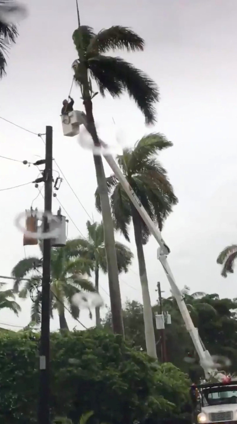
Residents and tourists were told to evacuate coastal areas in at least 20 counties in Florida. The Category 2 storm, which has already disrupted oil production in the Gulf of Mexico, strengthened as it headed north, carrying winds of 110 miles per hour (175 km per hour).
It was forecast to become a Category 3 storm on the five-step Saffir-Simpson scale before coming ashore on Wednesday over the Florida Panhandle or the Big Bend area in the northwest of the state, the National Hurricane Center (NHC) said. At that strength, it would rank as the most powerful storm to strike the Panhandle in more than a decade.
“Hurricane Michael is a monster storm and it keeps getting more dangerous,” Florida Governor Rick Scott told a news conference on Tuesday. “The time to prepare is now.”
The Republican governor, who is campaigning for a U.S. Senate seat in the November congressional elections, warned of the potential for a deadly storm surge that could be as much as 12 feet (3.7 meters) over normal sea water levels.
People in areas that could be affected should take no chances against such a powerful surge, Scott said, adding, “No one’s going to survive,” such a wall of water.
As Michael moved over open water, energy companies halted nearly one-fifth of Gulf of Mexico oil production and evacuated personnel from 10 platforms on Monday.
The Gulf of Mexico produces 17 percent of daily U.S. crude oil output and 5 percent of daily natural gas output, according to the U.S. Energy Information Administration. The partial shutdown ahead of Michael helped push oil prices slightly higher on Tuesday.
Scott declared a state of emergency in 35 counties along the Panhandle and Florida’s Big Bend regions, mostly rural areas known for small tourist cities, beaches and wildlife reserves, as well as the state capital, Tallahassee.
A hurricane warning was in effect for a more than 300-mile (480-km) stretch of coastline from the Florida-Alabama border to the Suwannee River in Florida.
The Federal Emergency Management Agency had numerous teams deployed and ready to respond, said FEMA spokesman Jeff Byard. About 1,250 National Guard soldiers were assisting and more than 4,000 troops were on standby.
President Donald Trump, speaking to reporters at the White House, said the country was very well prepared for the hurricane, adding it was much bigger than had been expected.
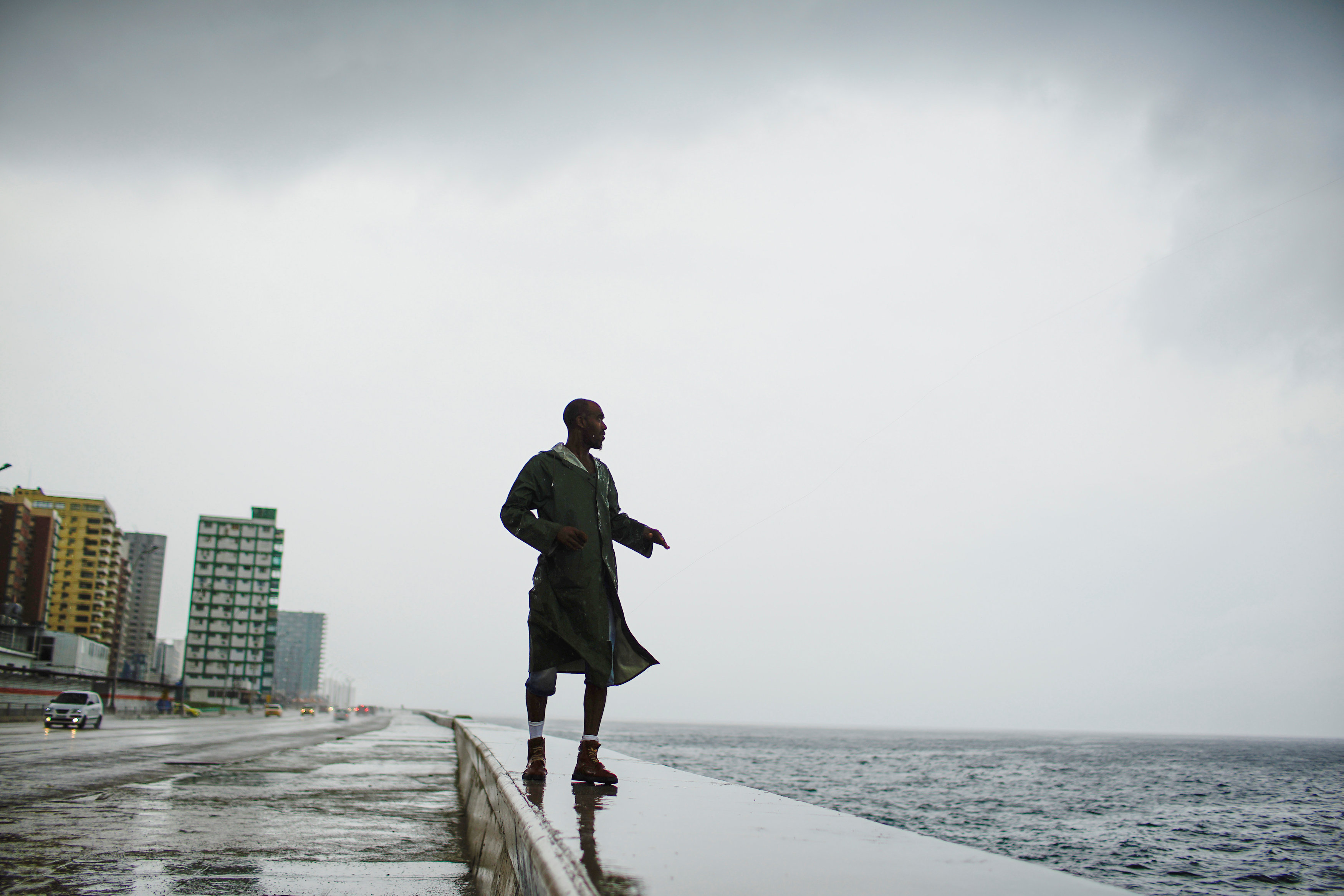
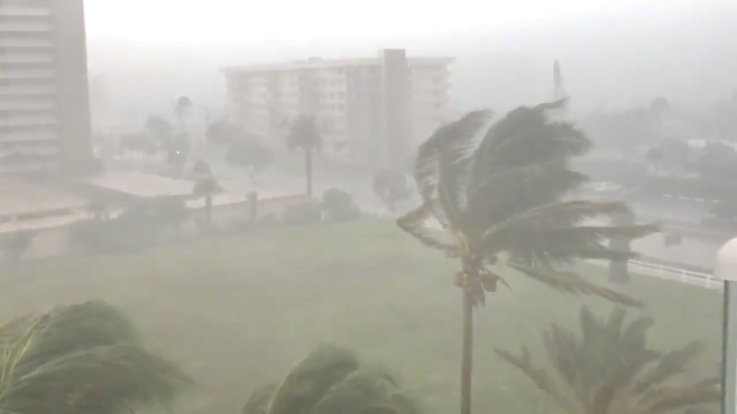
Alexander Charnicharo fishes at the seafront in Havana as Hurricane Michael passes by western Cuba on October 8, 2018. REUTERS/Alexandre Meneghini
CLOSURES AND LINES FOR GAS
State offices, schools and universities were closed through the end of the week in Panhandle counties. Lines at gasoline stations grew as people left. Those who stayed emptied grocery store shelves of water and other supplies.
Regus, an international office provider, offered temporary space for rent in Birmingham, Alabama, for businesses evacuating neighboring Florida.
“If you’re evacuating #HurricaneMichael and need a place to work, come visit a business lounge at any of our 5 locations in Birmingham! #evacuate #HurricanePrep #Michael,” the company wrote on Twitter.
The last major hurricane – Category 3 or above – to hit the Panhandle was Hurricane Dennis, which made landfall near Pensacola in 2005, according to hurricane center data.
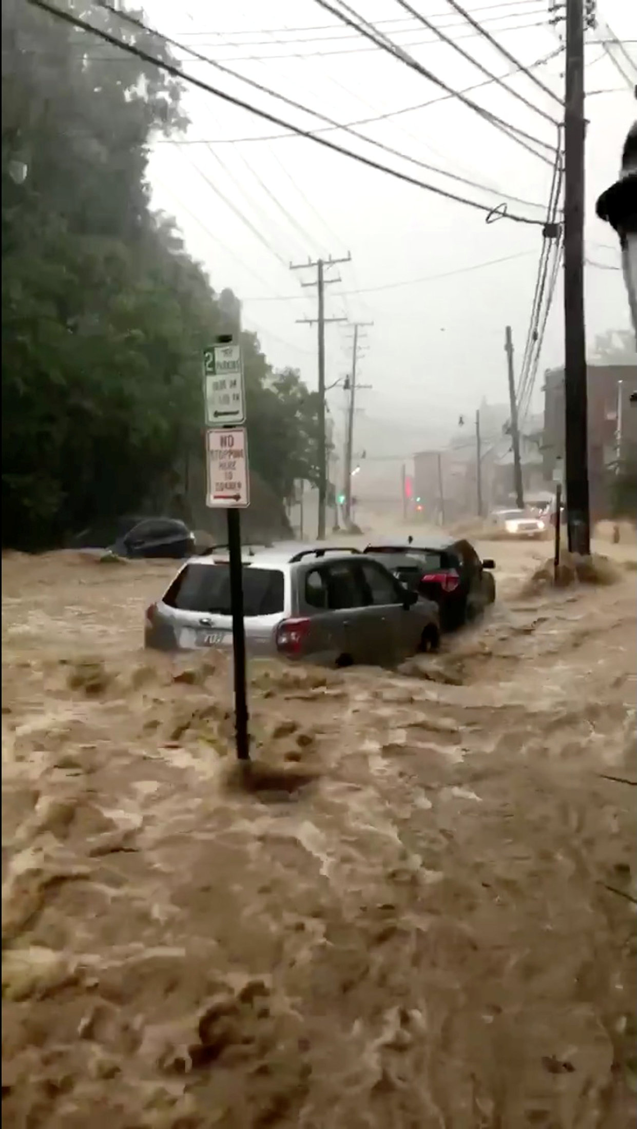
Torrential downpours and flash flooding caused by the storm over the weekend caused 13 deaths in Central America.
At 11 a.m. ET (1500 GMT) on Tuesday, Michael’s center was about 335 miles (535 km) south-southwest of Apalachicola, Florida, heading north at around 12 mph (19 kph), the NHC said.
On its current track, it would make landfall somewhere along a coastline that includes the cities and towns of Fort Walton Beach, Panama City Beach, Port St. Joe, St. Teresa and the wildlife reserves bordering Apalachee Bay. However, forecasters always note it is not possible to predict where a hurricane will land until it is closer to the coast.
The storm was forecast to move through the southeastern United States on Wednesday and Thursday, passing through the Carolinas, which are still recovering from Hurricane Florence last month. It would head off the Mid-Atlantic coast by Friday, the NHC said.
The Miami-based center forecast as much as 1 foot (30 cm) of rain in parts of Florida, Georgia and South Carolina.
(Reporting by Devika Krishna Kumar; Additional reporting by Susan Heavey and Roberta Rampton in Washington, Gina Cherelus and Barbara Goldberg in New York, Brendan O’Brien in Milwaukee; Editing by Lisa Shumaker and Frances Kerry)