Volcano-triggered tsunami kills at least 43 in Indonesia, injures hundreds

Residents sit inside a mosque as they evacuated following high waves and the eruption of Anak Krakatau volcano at Labuan district in Pandeglang regency, Banten province, Indonesia, December 22, 2018 in this photo taken by Antara Foto. Picture taken December 22, 2018. Antara Foto/Muhammad Bagus Khoirunas/ via REUTERS

By Jessica Damiana

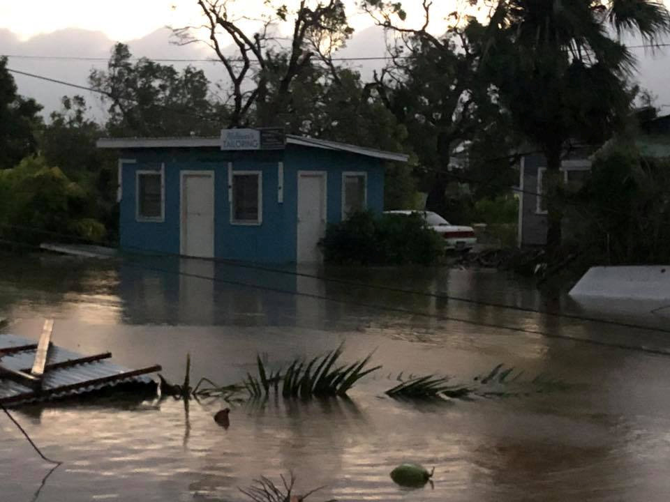
JAKARTA (Reuters) – A tsunami killed at least 43 people on the Indonesian islands of Java and Sumatra and injured hundreds following an underwater landslide caused by a volcanic eruption, the disaster mitigation agency said on Sunday.

Some 584 people were injured and hundreds of homes and other buildings were “heavily damaged” in the tsunami which struck late on Saturday.

On Dec. 26 in 2004, an Indian Ocean tsunami triggered by an earthquake killed 226,000 people in 13 countries, including more than 120,000 in Indonesia.

Endan Permana, head of the agency in Pandeglang, told Metro TV police were providing immediate assistance to victims in Tanjung Lesung in Banten province, a popular tourist getaway not far from the capital, Jakarta, as emergency workers had not arrived in the area yet.

“Many are missing,” Permana said.

The agency said it was still compiling information and there was a “possibility that data on the victims and damage will increase”.

The tsunami was caused by “an undersea landslide resulting from volcanic activity on Anak Krakatau” and was exacerbated by abnormally high tide because of the current full moon, disaster agency spokesman Sutopo Purwo Nugroho said.

According to a statement from the Meteorology, Climatology and Geophysics Agency (BMKG), Krakatau erupted at just after 9 p.m. and the tsunami struck at around 9.30 p.m. on Saturday.

“The tsunami hit several areas of the Sunda Strait, including beaches in Pandeglang regency, Serang, and South Lampung,” the agency said.

Nugroho told Metro TV that tsunamis triggered by volcanic eruptions were “rare” and that the Sunda Strait tsunami had not resulted from an earthquake.

“There was no earthquake, and the Anak Krakatau eruption also wasn’t that big,” Nugroho told Metro TV, noting there were no “significant” seismic tremors to indicate a tsunami was coming.

The Krakatau eruption created a column of volcanic ash estimated to be up 500 meters high.

(Reporting by Gayatri Suroyo, Tabita Diela and Jessica Damiana; Writing by Fergus Jensen; Editing by Nick Macfie)

Cyclone wreaks havoc in Tonga’s capital, parliament flattened, homes wrecked

The aftermath of cyclone Gita is seen in Nuku'alofa, Tonga, February 13, 2018 in this picture obtained from social media. Twitter Virginie Dourlet/via REUTERS THIS IMAGE HAS BEEN SUPPLIED BY A THIRD PARTY. MANDATORY CREDIT. NO RESALES. NO ARCHIVES

By John Mair

WELLINGTON (Reuters) – Tonga’s neighbors scrambled to deliver emergency relief on Tuesday after Cyclone Gita tore across the Pacific island nation in the middle of the night, flattening the parliament, tearing roofs off homes and causing widespread flooding.

There were no confirmed reports of deaths from the Category 4 storm that bought winds of around 200 km (125 miles) per hour, but there were a lot of injured people, some seriously, said Graham Kenna, an Australian government adviser at Tonga’s National Emergency Management Office.

Photos posted on social media showed a wrecked Parliament House building in the capital, as well as extensive flooding and downed power lines. Access to areas outside the capital were hindered by the storm damage and debris.

“The full extent of damage caused by Cyclone Gita is still being assessed but there is an immediate need for assistance on the ground,” NZ Foreign Affairs Minister Winston Peters said in a statement.

“About 5,700 people sought shelter in evacuation centres overnight, and it is expected these numbers will increase substantially tonight.”

New Zealand is donating NZ$750,000 ($545,000) in aid, and a NZ Air Force Hercules aircraft was due to fly emergency relief supplies into Tonga on Tuesday.

Australia is donating A$350,000 ($275,000) worth of emergency shelter, kitchen and hygiene kits, while the country’s foreign minister said the Australian Defence Force personnel would assist with clean-up efforts.

The cyclone was heading towards Fiji’s southern islands on Tuesday, with some forecasts reporting it intensifying towards a Category 5 storm. Fijian Prime Minister Frank Bainimarama warned residents to “heed warnings and prepare”, although the storm is expected to bypass heavily populated areas.

Gita had pummeled Samoa and American Samoa, about 900 km (560 miles) to the northeast, over the weekend, flooding the Samoan capital, Apia.

The aftermath of cyclone Gita is seen in Nuku'alofa, Tonga, February 13, 2018 in this picture obtained from social media. Facebook Noazky Langi/via REUTERS THIS IMAGE HAS BEEN SUPPLIED BY A THIRD PARTY. MANDATORY CREDIT. NO RESALES. NO ARCHIVES

The aftermath of cyclone Gita is seen in Nuku’alofa, Tonga, February 13, 2018 in this picture obtained from social media. Facebook Noazky Langi/via REUTERS THIS IMAGE HAS BEEN SUPPLIED BY A THIRD PARTY. MANDATORY CREDIT. NO RESALES. NO ARCHIVES

POWER DOWN

Tonga’s clean-up began in the early hours of Tuesday as the tail of the cyclone was still over the capital, Nuku’alofa.

“Every second power pole has been knocked over and the lines are just everywhere,” Kenna said, saying it would likely be days before power could be restored. Water supplies and radio networks were also disrupted.

“They turned the power off very early before the cyclone came, knowing that the power lines would be blown down, which was a good move.”

The worst of the cyclone hit around a low tide, so there were no reports of storm surges worsening the impact of the wind and rains.

Kenna estimated around 40 percent of houses in the capital had suffered some damage, many with roofs blown off.

“A lot of the older houses, especially some of the older heritage houses, have been badly damaged or destroyed, which is very sad, they’re quite historical,” he said. “They’ve been through cyclones before, but this is the biggest cyclone this island has had for at least 60 odd years.”

($1 = 1.3776 New Zealand dollars)

($1 = 1.2718 Australian dollars)

(Reporting by John Mair in Wellington.; Additional reporting by Colin Packham in Sydney; Editing by Jane Wardell and SImon Cameron-Moore)

End ‘containment’ of asylum-seekers on islands, aid groups tell Greek PM

: Refugees and migrants line up for food distribution at the Moria migrant camp on the island of Lesbos, Greece October 6, 2016.

ATHENS (Reuters) – Over a dozen human rights groups and aid organizations wrote to Greek Prime Minister Alexis Tsipras on Monday urging him to end the “containment” of asylum seekers in island camps.

More than 13,000 people, mostly Syrians and Iraqis fleeing years of war, are living in five camps on Greek islands close to Turkey, government figures show. Four of those camps are holding two to three times as many people as they were designed for.

Those who arrive on Greek islands following a European deal with Turkey last year to stem the flow are forbidden from traveling to mainland until their asylum applications are processed, and those who do not qualify are deported.

Applications have piled up and rulings can take weeks. A recent sharp rise in arrivals has piled additional misery on overcrowded facilities.

The 19 signatories, which include Amnesty International, Human Rights Watch, the International Rescue Committee and Oxfam, said the islands of Lesbos, Samos, Kos, Chios and Leros had been “transformed into places of indefinite confinement.”

“We urge you to put an end to the ongoing ‘containment policy’ of trapping asylum seekers on the islands … and to immediately transfer asylum seekers to the mainland and meet their protection needs,” they wrote.

They described conditions as “abysmal” and said many asylum-seekers lacked access to adequate and timely procedures and protection. Some have been on the islands for 19 months.

“Reception conditions are deteriorating, and gaps in basic services, especially medical, are increasing,” they wrote.

Thousands of people, including young children, are crammed into tents with only a cloth separating one family from another, the groups said, and conditions were particularly harsh for pregnant women.

Nearly 23,000 people have arrived in Greece this year, a fraction compared to the nearly 1 million who arrived in 2015, but state-run camps are struggling to cope with the numbers.

As an emergency measure, the government has said it plans to move about 2,000 people from Samos and Lesbos to the mainland.

In recent weeks, Doctors Without Borders (MSF) its research showed a mental health emergency was unfolding in migrant camps on the islands, fueled by poor living conditions, neglect and violence.

The United Nations refugee agency called on Greece to speed up preparations at those camps, saying they were ill-prepared for winter.


(Reporting by Karolina Tagaris; Editing by Toby Chopra)


Maria becomes major hurricane, powers through Caribbean

Hurricane Maria is shown in the Atlantic Ocean about 85 miles east of Martinique in this September 17, 2017 NASA handout satellite photo. NASA/Handout via REUTERS

By Robert Sandiford

BRIDGETOWN, Barbados (Reuters) – Hurricane Maria picked up strength and roared toward the Leeward Islands on Monday on a track that could whip several eastern Caribbean islands with their second major storm this month.

Maria grew into a Category 3 storm on the five-step Saffir-Simpson scale, with maximum sustained winds of 120 miles per hour (195 km per hour). It was located about 60 miles (95 km) east of Martinique, the U.S. National Hurricane Center said at 11 a.m. ET (1500 GMT).

It was headed west-northwest at about 10 mph (17 kph) on a track that would put it over the U.S. territory of Puerto Rico by Wednesday.

Maria was expected to be the second major hurricane this year to hit the Leeward Islands, which were hammered by Hurricane Irma earlier this month, the center said.

Streets were flooded in some residential parts of the island of Barbados, which had been experiencing heavy rain since Sunday as the storm approached.

Maria was expected to bring storm surges – seawater driven ashore by wind – of up to 6 feet to 9 feet (1.8-2.7 m), the NHC said. Parts of the central and southern Leeward Islands could see as much as 20 inches (51 cm) of rain, it said.

Hurricane and tropical storm warnings and watches were in effect for a string of islands in the area, including the U.S. and British Virgin Islands, Antigua and Barbuda and the French-Dutch island of Saint Martin.

Several of those islands were devastated earlier this month when Hurricane Irma rampaged through the Caribbean as one of the most powerful Atlantic hurricanes ever recorded, killing more than 80 people on the islands and the U.S. mainland.

The deck of a U.S. Navy landing craft is crowded with Army soldiers and their belongings as they are evacuated in advance of Hurricane Maria, off St. Thomas shore, U.S. Virgin Islands September 17, 2017. REUTERS/Jonathan Drake

The deck of a U.S. Navy landing craft is crowded with Army soldiers and their belongings as they are evacuated in advance of Hurricane Maria, off St. Thomas shore, U.S. Virgin Islands September 17, 2017. REUTERS/Jonathan Drake

Puerto Rico, a U.S. territory which Irma grazed as it headed toward Cuba and Florida, opened shelters and began to dismantle construction cranes that could be vulnerable to high winds as it prepared for Maria.

“It is time to seek refuge with a family member, friend, or move to a state shelter because rescuers will not go out and risk their lives once winds reach 50 miles per hour,” Puerto Rico Governor Ricardo Rosselló told reporters on Monday.

Some 450 shelters were open, including one in San Juan that is already housing people evacuated by nearby islands hit by Irma, the government said.

More than 1,700 residents of Barbuda were evacuated to neighboring Antigua after Irma damaged nearly every building there.

Further north, forecasters were also tracking Category 1 Hurricane Jose, which was carrying 75-mph (120-kph) winds and was located about 265 miles (430 km) east-southeast of Cape Hatteras, North Carolina.

The eye of that storm was forecast to remain off the east coast of the United States for the next few days, bringing dangerous surf and rip currents to beaches from Delaware through Massachusetts.


(Additional reporting by Tracy Rucinski in Chicago; Writing by Scott Malone; Editing by Frances Kerry)