Hundreds flee homes as 4.4 magnitude quake strikes Indonesia

Rescue workers and volunteers clear an area of debris following yesterday's 4.4 magnitude quake in Kertosari Village, Banjarnegara, Central Java, Indonesia April 19, 2018 in this photo taken by Antara Foto. Antara Foto/Idhad Zakaria / via REUTERS

JAKARTA (Reuters) – A shallow earthquake brought down hundreds of poorly built buildings in Indonesia, forcing more than 2,000 people to flee their homes, rescue officials said on Thursday. The 4.4 magnitude quake hit the Banjarnegara district of Central Java late on Wednesday, killing two people and injuring more than 20.

“Victims were killed or injured by falling buildings,” the national rescue agency said in a statement. “People are being treated in hospital or have been evacuated to temporary shelters.”

Quakes are common in Indonesia, which straddles the Pacific “Ring of Fire”, a hot spot for seismic activity due to friction between tectonic plates.

(Reporting by Kanupriya Kapoor; Editing by Nick Macfie)

Major quake cuts communications, halts oil and gas operations in Papua New Guinea

A supplied image shows a landslide and damage to a road located near the township of Tabubil after an earthquake that struck Papua New Guinea's Southern Highlands, February 26, 2018. Jerome Kay/Handout via REUTERS

By Charlotte Greenfield and Sonali Paul

WELLINGTON/MELBOURNE (Reuters) – At least one company began evacuating non-essential personnel after a powerful 7.5 magnitude earthquake hit Papua New Guinea’s energy-rich interior on Monday, causing landslides, damaging buildings and closing oil and gas operations.

The tremor hit in the rugged, heavily forested Southern Highlands about 560 km (350 miles) northwest of the capital, Port Moresby, at around 3.45 a.m. local time (1545 GMT Sunday), according to the U.S. Geological Survey (USGS).

A spokesman at Papua New Guinea’s National Disaster Center said by telephone the affected area was very remote and the agency could not properly assess damage until communication was re-established.

He said there were no confirmed casualties, although the International Red Cross (IRC) in Papua New Guinea said some reports indicated there were “fears of human casualties”.

“It’s a very serious all across the Southern Highlands and also all over the western highlands. People are definitely very frightened,” Udaya Regmi, the head of the IRC in Papua New Guinea, said by telephone from Port Moresby.

A supplied image shows a landslide and damage to a road located near the township of Tabubil after an earthquake that struck Papua New Guinea's Southern Highlands, February 26, 2018. Jerome Kay/Handout via REUTERS

A supplied image shows a landslide and damage to a road located near the township of Tabubil after an earthquake that struck Papua New Guinea’s Southern Highlands, February 26, 2018. Jerome Kay/Handout via REUTERS

The PNG government also said it had sent disaster assessment teams. At least 13 aftershocks with a magnitude of 5.0 or more rattled the area throughout the day, according to USGS data, but no tsunami warnings were issued.

“The Papua New Guinea Defense Force has also been mobilized to assist with the assessment and the delivery of assistance to affected people as well as the restoration of services and infrastructure,” Isaac Lupari, the chief secretary to the government, said in a statement.

ExxonMobil said it had shut its Hides gas conditioning plant and that it believed administration buildings, living quarters and a mess hall had been damaged. It also said it had suspended flights into the nearby Komo airfield until the runway could be surveyed.

“Due to the damage to the Hides camp quarters and continuing aftershocks, ExxonMobil PNG is putting plans in place to evacuate non-essential staff,” the company said in an emailed statement.

Gas is processed at Hides and transported along a 700 km (435 miles) line that feeds a liquefied natural gas plant near Port Moresby for shipping.

PAPUA PANIC

PNG oil and gas explorer Oil Search said in a statement it had also shut production in the quake-affected area.

The giant Grasberg copper mine operated by the Indonesian unit of Freeport McMoRan in neighboring Papua province was not affected, a Jakarta-based spokesman said.

However, the quake and several aftershocks caused panic in Jayapura, the capital of Indonesian Papua, Indonesia’s disaster mitigation agency said in a statement, but there were no reports of casualties or damage there.

The IRC’s Regmi said communications were “completely down” in Tari, one of the larger settlements near the quake’s epicenter, and that landslides had cut roads.

Several other aid and missionary agencies said poor communications in the area made damage and injury assessment difficult.

“The bush structures that they build tend to handle earthquakes extremely well,” Christian missionary Brandon Buser told Reuters after contacting several remote villages by shortwave radio.

Earthquakes are common in Papua New Guinea, which sits on the Pacific’s “Ring of Fire”, a hotspot for seismic activity due to friction between tectonic plates.

“This is the Papuan fold-and-thrust belt, so it’s a typical movement of faults in that region, but it’s big,” said Chris McKee, acting director of the Geohazards Management Division in Port Moresby.

Part of PNG’s northern coast was devastated in 1998 by a tsunami, generated by a 7.0 quake, which killed about 2,200 people.

(For a graphic on ‘Papua New Guinea’s 7.5 magnitude earthquake’ click http://tmsnrt.rs/2ow1YLR)

(Reporting by Charlotte Greenfield in WELLINGTON and Sonali Paul in MELBOURNE; Additional reporting by Fergus Jensen in JAKARTA and Tom Westbrook in SYDNEY; Writing by Jonathan Barrett; Editing by Paul Tait)

Magnitude 4.1 quake strikes Delaware, equals estimated state record

(Reuters) – A magnitude 4.1 earthquake struck Delaware on Thursday in a rare seismological occurrence for the U.S. Northeast, officials said, with the temblor’s strength equaling the estimated magnitude of an 1871 quake that was believed to be the largest ever in the state.

The quake, previously reported at magnitude 5.1 and then at 4.4, was centered in the Bombay Hook National Wildlife Refuge, according to a statement from the Delaware Emergency Management Agency. It was less than 10 miles (17 km) from the city of Dover and less than a mile (0.8 km) from Donas Landing.

There were no reports of injuries or damage, officials said.

In 1871, a quake believed to have been of magnitude 4.1 struck in Delaware, according to the website for the Delaware Geological Survey, a state agency.

The 1871 quake had been the largest on record for Delaware, according to the survey, but its strength has only been estimated.

The largest quake ever recorded in Delaware was a magnitude 3.8 temblor in 1973, according to the Delaware Geological Survey.

Earthquakes in Delaware do not occur on the edge of a tectonic plate, as is more common in places such as California, where fault lines between plates generate earthquakes. Generations of California residents have been bracing for the so-called “Big One” along the San Andreas Fault.

Instead, the Delaware temblor occurred far from the edge of a plate, said Thomas Pratt, a research geophysicist at the U.S. Geological Survey who is based in Virginia.

“There’s a lot of speculation, but we don’t have a good answer for why these earthquakes are occurring in the middle of the plates,” Pratt said.

The latest quake was downgraded to a magnitude 4.1 after data came in from several monitoring stations, U.S. Geological Survey geophysicist Rafael Abreu said by telephone.

It was felt in Philadelphia in the neighboring state of Pennsylvania, some 53 miles (85 km) from the epicenter.

The quake was shallow, only 5 miles (8 km) deep, which would have amplified its effect, and some people reported feeling light shaking in areas around New York City and Baltimore, according to the USGS website.

Many social media users also confirmed feeling the temblor and #earthquake had quickly risen to the top of trending topics on Twitter with more than 11,000 tweets mentioning the hashtag.

(Reporting by Sandra Maler in Washington and Alex Dobuzinskis in Los Angeles; Editing by Sandra Maler and Dan Grebler)

Quake hits southeast Iran, destroys homes; no fatalities reported

Quake hits southeast Iran, destroys homes; no fatalities reported

By Parisa Hafezi

ANKARA (Reuters) – A strong earthquake of magnitude 6.0 struck southeastern Iran on Friday, injuring at least 42 people and destroying several homes in an area where most people live in villages of mud-walled homes. State media said no deaths had been reported.

Rescue workers, special teams with sniffer dogs and units of Iran’s Revolutionary Guards and Basij militia forces were sent to the quake-hit areas in Kerman province, Iran’s semi-official Fars news agency said.

State TV said many residents rushed out of houses in Kerman city and nearby villages and towns, fearing more tremors after some 51 aftershocks following the 6:32 a.m. (0232 GMT) quake.

“The quake destroyed some houses in 14 villages but so far there has been no fatalities,” a local official told state TV. “Fortunately no deaths have been reported so far.”

The quake struck less than three weeks after a magnitude 7.3 earthquake hit villages and towns in Iran’s western Kermansheh province along the mountainous border with Iraq, killing 530 people and injuring thousands of others.

The U.S. Geological Survey said Friday’s quake, at first reported as magnitude 6.3, was centered 36 miles (58 km) northeast of Kerman city, which has a population of more than 821,000. The quake was very shallow, at a depth of 6.2 miles (10 km), which would have amplified the shaking in the poor, sparsely populated area.

Head of Relief and Rescue Organization of Iran’s Red Crescent Morteza Salimi told state television that at least 42 people were injured. Iran’s state news agency IRNA said most of those hurt had minor injuries.

“Assessment teams are surveying the earthquake-stricken areas and villages in Kerman province,” IRNA quoted local official Mohammadreza Mirsadeqi as saying.

Iran’s semi-official Tasnim news agency said the quake had caused heavy damage in Hojedk town and some villages were hit by power and water cuts.

State TV aired footage of damaged buildings in remote mountainous villages near Hojedk town, the epicenter of the earthquake with a population of 3,000 people. TV said coal mines in the area had been closed because of aftershocks.

Iran’s Red Crescent said emergency shelter, food and water had been sent to the quake-hit areas.

Criss-crossed by several major fault lines, Iran is one of the most earthquake-prone countries in the world. In 2003, a magnitude 6.6 quake in Kerman province killed 31,000 people and flattened the ancient city of Bam.

(Additional reporting by Sandra Maler in Washington; Writing by Parisa Hafezi; Editing by William Maclean and Peter Graff)

South Korea postpones university exam after rare earthquake

By Christine Kim and Cynthia Kim

SEOUL (Reuters) – South Korea postponed its annual university entrance exam by a week on Wednesday after a rare earthquake rattled the country, shaking buildings and causing damage but no deaths.

Minister of Education Kim Sang-kon said the hugely competitive exam, scheduled for Thursday, would be postponed for the first time ever because of a natural disaster. It was the country’s second-biggest earthquake on record.

“A fair amount of damage was reported,” Kim told a media briefing.

“Due to the continued aftershocks, we are seeing many citizens, including students, unable to return home.”

The exam would now be held on Nov. 23 to ensure conditions were fair for everyone, he said.

The 5.4 magnitude quake struck about 9 km (5 miles) north of the southeastern port city of Pohang, the Korea Meteorological Administration said.

Shaking was felt across the country and there were numerous reports of minor damage. Operations at nuclear reactors were not affected, the state-run nuclear operator Korea Hydro & Nuclear Power Co said.

The university entrance exam is taken very seriously. Commercial airliners do not fly during listening portions of the exam, while financial markets open later in the day to ensure light traffic for students to get to their exam centers.

The country’s foreign exchange and stock markets will still open an hour late (0100 GMT) on Thursday, South Korean financial authorities said in text messages.

South Korea has relatively little seismic activity, compared with Japan to the east.

Its strongest quake on record was magnitude 5.8 in September last year.

The Meteorological Administration said nearly 20 aftershocks had shaken the region and more were expected in coming days.

(Reporting by Christine Kim and Cynthia Kim; Additional reporting by Jane Chung, Haejin Choi; Editing by Robert Birsel)

Collapsed state housing in Iranian quake shows corruption: Rouhani

Collapsed state housing in Iranian quake shows corruption: Rouhani

BEIRUT (Reuters) – The ease with which some state-built homes collapsed in Sunday’s earthquake in western Iran showed corrupt practices when they were constructed, Iranian President Hassan Rouhani said on Wednesday in a sentiment shared by many ordinary Iranians.

Some of the houses which collapsed in an earthquake that killed at least 530 people and injured thousands of others were built under an affordable housing scheme initiated in 2011 by Rouhani’s predecessor, Mahmoud Ahmadinejad.

“That a house built by (ordinary) people in the Sarpol-e Zahab region has remained standing while in front of it a government-built building has collapsed is a sign of corruption,” Rouhani told a cabinet meeting, state media said.

“It’s clear there has been corruption in construction contracts,” he said.

Sarpol-e Zahab is the town hardest hit by Sunday’s 7.3 magnitude quake, the deadliest in Iran in more than a decade.

A picture widely circulated by ordinary Iranians on social media shows a building with relatively little damage in Sarpol-e Zahab next to a heavily damaged government-constructed building.

This has fueled speculation that shoddy construction in the building of government housing had led to a higher number of casualties from the earthquake.

Rouhani said on Tuesday that any shortcomings in government constructed buildings in the earthquake zone will be punished.

Mohammad Hossein Sadeghi, the prosecutor general in Kermanshah, the largest city in the earthquake zone, said on Wednesday that the quality of construction of new buildings that were heavily damaged would be investigated and charges may be brought against anyone deemed responsible.

“If there are any problems with the construction, the individuals who were negligent must answer for their deeds,” Sadeghi said, according to the Iranian Students’ News Agency (ISNA).

An arrest warrant has been issued for a contractor responsible for a recently built hospital which was heavily damaged in the town of Islamabad-e Gharb, parliamentarian Heshmatollah Falahatpisheh said on Tuesday, according to the Iranian Labour News Agency (ILNA).

Residents in the earthquake zone have also complained about the slow and inadequate government response as they struggle to find food, water and shelter.

(Reporting By Babak Dehghanpisheh; Editing by Richard Balmforth)

In Mexican slum, a decades-long wait for quake relief

In Mexican slum, a decades-long wait for quake relief

By Carlos Jasso

MEXICO CITY (Reuters) – I first visited Camp No. 3 a few days after the Sept. 19 earthquake.

After reporting from collapsed buildings around the city, this was a different type of shock. Row after row of tiny tin shacks crammed into a small lot hidden behind a high fence in the middle class neighborhood of Lindavista.

Here, hundreds of families who lost their homes in an earthquake 32 years ago are living in deplorable conditions, with children and grandchildren born during the interminable wait for promised government-subsidized homes.

The 1985 earthquake was a defining moment for the Mexican capital. The death toll is still disputed, but at least 5,000 were killed. Some say many more died.

Three decades on, hundreds of its victims are still living in hovels in encampments across the sprawling city of 20 million and now the latest quake has made thousands more people homeless.

Maria de Lourdes Rosales, 64, who lost her home in the 1985 earthquake, answers her phone in her house at the camp known as No.3 in Mexico City, Mexico, October 16, 2017. The camp was founded in 1985 after an earthquake, which killed around 5,000 people. REUTERS/Carlos Jasso

Maria de Lourdes Rosales, 64, who lost her home in the 1985 earthquake, answers her phone in her house at the camp known as No.3 in Mexico City, Mexico, October 16, 2017. The camp was founded in 1985 after an earthquake, which killed around 5,000 people. REUTERS/Carlos Jasso

On first impression the camp is a little menacing, the smell of marijuana hangs in the air and residents warn of thieves and petty crime they blame on new arrivals – people who have moved in to occupy shacks left by families who have received new homes.

A strong sense of community prevails among the 1985 earthquake survivors, necessary perhaps for families who share outdoor toilets and use bared electric cables to heat water to bathe.

And as I have seen among many of Latin America’s poorest people, there is resourcefulness. Most families had some kind of work, many setting up small businesses like food stands selling tacos, or makeshift photocopy shops on the roadside.

One woman made her living charging for toilet paper and access to a bathroom.

According to the leaders of the Lindavista camp, its ramshackle shacks are home to around 750 people, divided into roughly 250 families.

There are almost 200 children who are the grandchildren of those originally resettled here, according to local leaders.

At least six such camps exist in the capital. Mexico City’s housing institute said that since 2016, it has delivered 173 homes to victims of the 1985 quake and expects to hand over 120 more before the end of next year.

A cross is displayed at the home of Martha Mejia at the camp known as No.3, in Mexico City, Mexico, October 17, 2017. The camp was founded in 1985 after an earthquake, which killed around 5,000 people. Mejia lost her home in the 1985 earthquake. REUTERS/Carlos Jasso

A cross is displayed at the home of Martha Mejia at the camp known as No.3, in Mexico City, Mexico, October 17, 2017. The camp was founded in 1985 after an earthquake, which killed around 5,000 people. Mejia lost her home in the 1985 earthquake. REUTERS/Carlos Jasso

Click on http://reut.rs/2go1OS4 for related photo essay

(Reporting by Carlos Jasso; Additional reporting by Noe Torres; Writing by Frank Jack Daniel; Editing by Toni Reinhold)

After massive quakes, millions in Mexico turn to early warning app

After massive quakes, millions in Mexico turn to early warning app

By Sheky Espejo

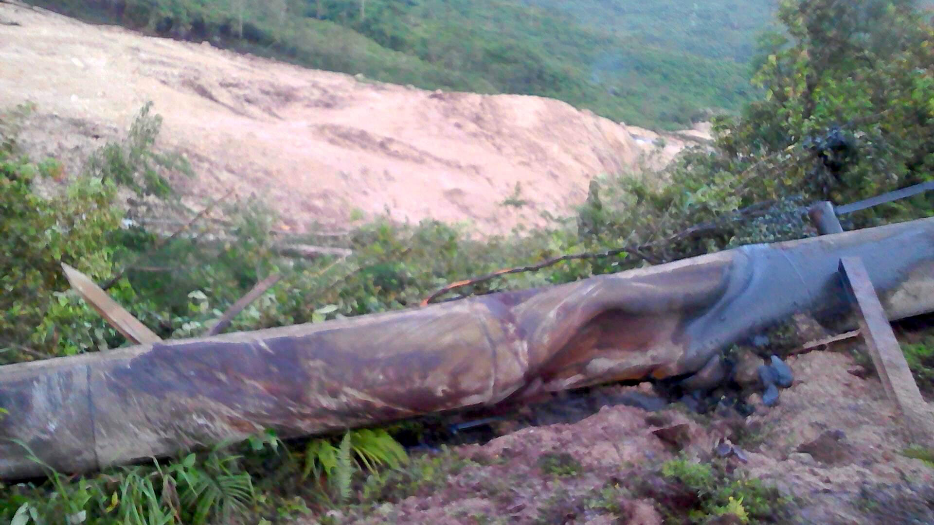
MEXICO CITY (Reuters) – Since two massive earthquakes hit Mexico in September, claiming more than 460 lives, an early warning start-up called SkyAlert has doubled its users to 5.8 million, making it one of the country’s most downloaded apps.

SkyAlert has also found a market selling alarms to small businesses in the capital, said its co-founder and director Alvaro Velasco. And it is looking to expand to Latin America, mainly Colombia, Peru and Chile, which lack an official alerting system despite frequent quakes in those countries.

Velasco said that he and SkyAlert co-founder Alejandro Cantú are talking to investors from Mexico and elsewhere about raising 100 million pesos ($5.35 million) in capitalization in 2018.

He said the surge in users after the most recent deadly quake in Mexico City had heightened the interest of existing investors including U.S.-based American Messaging and attracted interest from two Mexico-based private equity funds.

American Messaging did not respond to requests to comment on any potential new investment.

Velasco said SkyAlert was in talks with those funds and existing investors to inject around 20 million pesos (1.05 million dollars) into SkyAlert.

Still, finding a sustainable business model for the quake monitoring app has been a challenge partly because recent regulation in Mexico City has limited SkyAlert’s ability to access funds through public financing.

MAKING A PROFIT NOT EASY

Shomit Ghose at Onset Ventures, a U.S. private equity company with experience in software start-ups, said quake apps have struggled to get adequate financing because of the lack of a clear path to profits.

“If the business model is B2B where the earthquake early-warning is sent to companies, or railways, or hospitals, or high-buildings then perhaps a strong B2B case can be made for start-up investment,” Ghose said.

SkyAlert’s predicament echoes that of companies seeking funding to develop earthquake alert apps in the United States. Seismic activity is hard to monetize without government support.

It competes with its former partner, Mexico’s official alerting system run by government-funded non profit CIRES, which was created after an earthquake in 1985 killed thousands in the country.

One of the world’s few widely deployed seismic alarms, CIRES runs a network of sirens positioned around Mexico City that warn of a coming quake. SkyAlert mainly warns people through a mobile app.

Both sell quake warning systems, but a 2016 regulatory reform requires public buildings in Mexico City to purchase alarm systems from CIRES, limiting SkyAlert’s public financing.

SkyAlert initially replicated CIRES’ alerts, but in 2015 it decided to deploy its own detection sensors to increase coverage with greater accuracy, Velasco said.

“After a few false alerts from CIRES that affected SkyAlert’s credibility, we decided to invest in our own technology,” he said.

SkyAlert also is exploring ways to monetize its free app.

Currently, it sells a “premium” version for $4 a year that allows users to personalize alerts. However, Mexico has an average per capita income of $8,200, and the company said only around 4 percent of users pay for it.

Velasco said SkyAlert’s revenue is split fairly evenly between those fees and income from selling to businesses.

The newest version of the app allows for paid advertising, but ads would not be visible during a seismic alert.

SkyAlert, founded in 2011, has few peers, but one similar service in Japan is called YureKuru Call, which relies on government seismic data. YureKuru has received some government funding on an ad-hoc basis, but like SkyAlert is mostly funded by fees, said Rina Suzuki, an official at RC Solution Co., the Tokyo-based firm that developed YureKuru.

Detection technologies are evolving and they are all perfectible, Jennifer Strauss, external relations officer at the Berkeley Seismology Lab told Reuters.

“In the end, what matters is how effective they are at alerting people to save lives,” said Strauss.

(Additional reporting by Christine Murray in Mexico City and Minami Funakoshi in Tokyo; Editing by Frank Jack Daniel and Diane Craft)

California prepares for the ‘big one’ with earthquake drill

California prepares for the 'big one' with earthquake drill

By Steve Gorman

LOS ANGELES (Reuters) – Millions of Californians were due on Thursday to simultaneously drop to the floor, clamber under tables and cover their heads for a minute or two of imagined seismic turmoil during the latest annual “Great ShakeOut” earthquake drill.

The event, first held nine years ago in the Los Angeles area, was organized by scientists and emergency officials as part of a campaign to prepare the region’s inhabitants for a catastrophic quake that experts say is inevitable and long overdue.

The exercise has since expanded to encompass all of California and most other states, as well as some other countries, including Canada and Japan. In many places, entire school districts, colleges, workplaces and municipalities have registered to take part.

In keeping with the drill’s quake-survival message, participants are urged to “drop, cover and hold” – meaning get down on hands and knees, cover their heads and necks under a sturdy piece of furniture and hang on until the hypothetical shaking stops.

To help participants get into the mood, organizers have even prepared audio recordings of quake-rumbling sounds that can be downloaded, with or without narration, and played during the drill.

Such rehearsals are especially important in regions such as Southern California, where “it’s not a matter of if but when that catastrophic earthquake will strike,” said Ken Kondo, spokesman for Los Angeles County’s emergency management office.

One of the larger gatherings planned is to be held at the Natural History Museum in Exposition Park near downtown Los Angeles.

Following the drill, the city fire department, American Red Cross, police and other agencies will stage a full-scale earthquake-response exercise, setting up a medical triage area, emergency shelters and mass-feeding operation, Kondo said.

That drill is based on the premise of a magnitude 7.8 quake striking the southern end of the San Andreas Fault, a subterranean chasm between two massive plates of the Earth’s crust that extends hundreds of miles across California.

The scenario was devised by geophysicists and engineers who envisioned a calamity that would leave 1,800 people dead, 50,000 injured and 250,000 homeless while severing highways, power lines, pipelines, railroads, communications networks and aqueducts, and toppling some 1,500 buildings.

As of late Wednesday, nearly 53 million participants were registered for ShakeOut drills worldwide, including more than 10.2 million in California, organizers said.

The exercise is set to begin at 10:19 a.m. local time, corresponding with the date of the event.

A rupture of the San Andreas Fault in northern California caused the massive quake that laid waste to San Francisco in 1906. The last “big one” to strike south of the San Gabriel Mountains near Los Angeles was 300 years ago. The average interval between such quakes in that region is just 150 years, experts say.

(Reporting by Steve Gorman; Editing by Leslie Adler)

Magnitude 5.4 quake rumbles southern Mexico, no reports of damage

MEXICO CITY (Reuters) – A 5.4 magnitude quake struck southern Mexico on Friday, according to the U.S. Geological Survey, but there were no immediate reports of damage.

It was not immediately clear if the tremor was an aftershock from a powerful series of quakes last month that destroyed buildings in Mexico City and killed nearly 500 people.

The epicenter of Friday’s tremor was just off the coast of Oaxaca state, in Mexico’s southwest, and it struck at a depth of 59.5 kilometers (37 miles), according to the USGS.

An 8.1 magnitude earthquake struck Oaxaca on Sept. 7 near the town of Juchitan, flattening thousands of buildings in the humid market town.

Fausto Lugo, Mexico City’s emergency services chief, said on local television that Friday’s earthquake was felt lightly in the capital, but there were no reports of damages.

(Reporting by Gabriel Stargardter; Editing by Andrew Hay)