Hawaii volcano eruption slows to virtual halt after more than three months

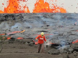
FILE PHOTO: Lava erupts in Leilani Estates during ongoing eruptions of the Kilauea Volcano in Hawaii, U.S., June 5, 2018. REUTERS/Terray Sylvester

By Steve Gorman

(Reuters) – The destructive lava eruption at the foot of Kilauea Volcano on the Big Island of Hawaii has slowed to a virtual halt in recent days for the first time in over three months, geologists said on Monday, although it was too soon to tell what might happen next.

The lone volcanic fissure that was still active last week has dwindled from a fountain of molten rock to a bubbling pond of lava no longer spilling out of the blackened cone surrounding it, said Tina Neal, chief scientist at the U.S. Geological Survey’s Hawaiian Volcano Observatory.

Levels of sulfur dioxide gas vented from the fissure, located on the lower east flank of Kilauea, about 25 miles (40 km) from its summit crater, have also dropped dramatically, she said.

The subdued activity there coincided with another major collapse in the outer wall of the summit crater last Thursday, followed by a final flurry of earthquakes before the peak of the volcano grew still.

“The system appears to have almost shut down completely over the course of a couple of days,” Neal told reporters on a conference call. She said it was “all consistent with something turning off the spigot to the surface.”

At this point, the volcanic reservoir at the bottom of the summit crater appeared “significantly drained” of magma – the term for molten rock before it erupts – that was feeding the lava vents downslope at the surface.

At the height of Kilauea’s current eruption, which began on May 3, a total of two dozen fissures had opened in the ground at the foot of the volcano, in an area scientists call the lower east rift zone. But only one vent, dubbed Fissure 8, was still active last week.

It was a river of lava from Fissure 8 that had crept eastward to the ocean, engulfing two seaside housing developments before pouring into the Pacific. Hundreds more dwellings have been swallowed closer to the eruption site.
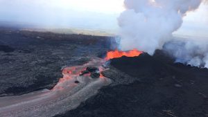
FILE PHOTO: Lava fragments falling from lava fountains at fissure 8 are building a cinder-and-spatter cone around the erupting vent, with the bulk of the fragments falling on the downwind side of the cone as it continues to feed a channelized lava flow that reaches the ocean at Kapoho during ongoing eruptions of the Kilauea Volcano in Hawaii, U.S. June 11, 2018. USGS/Handout via REUTERS

FILE PHOTO: Lava fragments falling from lava fountains at fissure 8 are building a cinder-and-spatter cone around the erupting vent, with the bulk of the fragments falling on the downwind side of the cone as it continues to feed a channelized lava flow that reaches the ocean at Kapoho during ongoing eruptions of the Kilauea Volcano in Hawaii, U.S. June 11, 2018. USGS/Handout via REUTERS

The property losses marked the most destructive eruption event of Kilauea or any other volcano in Hawaii’s recorded history.

Neal said it remains to be seen whether the reduced flow at Fissure 8 will turn out to be a brief pause or an extended lull, or whether other vents will reactivate. A similar 88-day eruption in the lower east rift zone in 1955 was punctuated by one pause of five days and one lasting 16 days, Neal said.

Neal said scientists would be surprised if the summit crater produced any new major eruptions in the near future.

The current shift in volcanic activity happened as Hurricane Hector churned across the Pacific toward Hawaii, with forecasters predicting it would skirt past the southern coast of the Big Island on Wednesday.

Neal said the storm would have no effect on the volcano, except for the possibility of large steam clouds producing “white-out” conditions in areas where heavy rain falls on top of molten lava that has yet to thoroughly cool.

(Reporting by Steve Gorman in Los Angeles; Editing by Paul Tait)

Tourists flee Indonesia’s Lombok island after earthquake kills 98

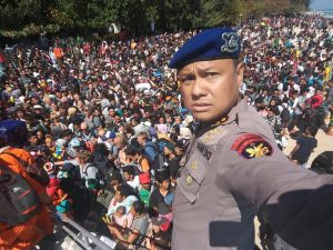
People crowd on the shore as they attempt to leave the Gili Islands after an earthquake Gili Trawangan, in Lombok, Indonesia, August 6, 2018, in this still image taken from a video. Indonesia Water Police/Handout/via REUTERS

By Kanupriya Kapoor

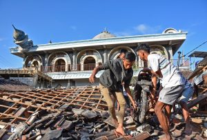
PEMENANG, Indonesia (Reuters) – Scenes of destruction greeted rescue workers across Indonesia’s resort island of Lombok on Monday, after an earthquake of magnitude 6.9 killed at least 98 people and prompted an exodus of tourists rattled by the second powerful quake in a week.

People recover a motorcycle from a damaged home near a mosque after a strong earthquake in Gunungsari, West Lombok, Indonesia, August 6, 2018 in this photo taken by Antara Foto. Antara Foto/Ahmad Subaidi/ via REUTERS

People recover a motorcycle from a damaged home near a mosque after a strong earthquake in Gunungsari, West Lombok, Indonesia, August 6, 2018 in this photo taken by Antara Foto. Antara Foto/Ahmad Subaidi/ via REUTERS

The National Disaster Mitigation Agency (BNPB) said it expected the death toll to rise once the rubble of more than 13,000 flattened and damaged houses was cleared away.

Power and communications were severed in some areas, with landslides and a collapsed bridge blocking access to areas around the quake epicenter in the north. The military said it would send a ship with medical aid, supplies and logistics support.

In a message on social network Twitter, the Indonesian Red Cross said it helped a woman give birth after the quake at a health post. One of the names she gave the baby boy was ‘Gempa’, which means earthquake.

Lombok was hit on July 29 by a 6.4 magnitude quake that killed 17 people and briefly stranded several hundred trekkers on the slopes of a volcano.

The Indonesian Agency for Meteorology, Climatology and Geophysics (BMKG) said more than 120 aftershocks were recorded after Sunday evening’s quake, whose magnitude the U.S. Geological Survey (USGS) revised down to 6.9 from an initial 7.0. At that magnitude it released more than five times the energy of the quake a week earlier, the USGS website showed.

The dead included no foreigners and there were 236 people injured, BNPB spokesman Sutopo Purwo Nugroho told a news conference.

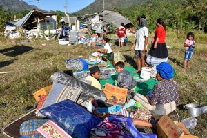
Residents sit outside their home with their belongings following a strong earthquake in Pemenang, North Lombok, Indonesia August 6, 2018 in this photo taken by Antara Foto. Antara Foto/Ahmad Subaidi/ via REUTERS

Residents sit outside their home with their belongings following a strong earthquake in Pemenang, North Lombok, Indonesia August 6, 2018 in this photo taken by Antara Foto. Antara Foto/Ahmad Subaidi/ via REUTERS

HOSPITALS OVERFLOWING

The tremor was powerful enough to be felt on the neighboring island of Bali where, BNPB said, two people died. The first quake was also felt on Bali.

Indonesia sits on the geologically active Pacific Ring of Fire and is regularly hit by earthquakes. In 2004, the Indian Ocean tsunami killed 226,000 people in 13 countries, including more than 120,000 in Indonesia.

Nugroho said more than 20,000 people had been displaced.

Among them were residents of a northern village called Mentigi, who fled to nearby hills. Blue tarpaulins dotted the landscape as people prepared to spend the nights outdoors because of aftershocks or because their homes were destroyed.

“We are getting some aid from volunteers, but we don’t have proper tents yet,” said a 50-year-old villager sheltering with his wife and children, who gave his name only as Marhun.

Ambulances with sirens blaring raced along the coast from north Lombok, but BNPB spokesman Nugroho said emergency units in its hospitals were overflowing and some patients were being treated in parking lots.

The main hospital in the town of Tanjung in the north was severely damaged, so staff set up about 30 beds in the shade of trees and in a tent on a field to tend to the injured.

A boy with a heavily bandaged leg wailed in pain, an elderly man wore a splint improvised from cardboard strips of cardboard on a broken arm, and some hurt by falling debris still had dried blood on their faces.

Chief Water Police of Lombok Dewa Wijaya takes a picture in front of hundreds of people attempting to leave the Gili Islands after an earthquake Gili Trawangan, in Lombok, Indonesia, August 6, 2018, in this picture obtained from social media. Indonesia Water Police/Handout/via REUTERS

Chief Water Police of Lombok Dewa Wijaya takes a picture in front of hundreds of people attempting to leave the Gili Islands after an earthquake Gili Trawangan, in Lombok, Indonesia, August 6, 2018, in this picture obtained from social media. Indonesia Water Police/Handout/via REUTERS

“THIS IS IT FOR ME INDONESIA”

Sengiggi, a seaside tourist strip on Lombok, wore an abandoned look. Amid collapsed homes, some hotels seemed to have shut, restaurants were empty and beaches deserted.

Long lines formed at the airport of Lombok’s main town, Mataram, as foreign visitors cut their holidays short. BNPB said 18 extra flights had been added for leaving tourists.

“I was at the rooftop of my hotel and the building started swaying very hard … I could not stand up,” said Gino Poggiali, a 43-year-old Frenchman, who was with his wife and two children at the airport.

His wife Maude, 44, said the family was on Bali for the first quake and Lombok for the second.

“This is it for me in Indonesia. Next time we will stay in France, or somewhere close,” she said.

Dutch tourist Marc Ganbuwalba injured his knee in a stampede of diners from a restaurant after the quake.

“We are cutting short our holiday because I can’t walk and we’re just not in the mood anymore,” said the 26-year-old, sitting on a trolley at the airport with his leg bandaged.

Officials said more than 2,000 people had been evacuated from the three Gili islands off the northwest coast of Lombok, where fears of a tsunami spread among tourists.

Michelle Thompson, an American holidaying on one of the Gilis, described a “scramble” to get on boats leaving for the main island during which her husband was injured.

“People were just throwing their suitcases on board and I had to struggle to get my husband on, because he was bleeding,” she said.

(Additional reporting by Fransiska Nangoy, Gayatri Suroyo, Fanny Potkin, Agustinus Beo da Costa, Bernadette Christina Munthe, Tabita Diela, Cindy Silviana and Jessica Damiana in JAKARTA, Jamie Freed and Jack Kim in SINGAPORE, and Colin Packham in SYDNEY; Writing by John Chalmers; Editing by Neil Fullick and Clarence Fernandez)

Geologists eye Hawaii volcano for signs eruption may be easing

FILE PHOTO: Lava fragments falling from lava fountains at fissure 8 are building a cinder-and-spatter cone around the erupting vent, with the bulk of the fragments falling on the downwind side of the cone as it continues to feed a channelized lava flow that reaches the ocean at Kapoho during ongoing eruptions of the Kilauea Volcano in Hawaii, U.S. June 11, 2018. USGS/Handout via REUTERS

(Reuters) – Geologists are keeping a close eye on the crater of Hawaii’s Kilauea volcano and a lava-spouting cone on its flank for possible signs a nearly three-month eruption may be slowing.

Up until Thursday, Kilauea had not had an explosion in 53 hours, the longest break in such activity since May, government geologists said on the last in a series of regularly scheduled news briefings since the eruption began on May 3.

Down Kilauea’s east side, a lava channel flowing from its fissure 8 cone has turned sluggish and its level has dropped, said U.S. Geological Survey geologist Janet Babb.

Could the lava eruption in the southeast corner of Hawaii’s Big Island be easing after destroying over 700 houses and forcing thousands to flee their homes?

“That really is the million-dollar question right now,” said Babb. “We’re watching this closely. I think it all depends what we see after the next collapse (explosion) event.”

Right on cue, a collapse explosion came during the news briefing, kicking out the equivalent energy of a 5.4 magnitude earthquake.

It was the 58th such event in the current eruption cycle as magma steadily drains from the volcano’s summit lava reservoir, causing its crater to collapse.

The USGS released a report last week saying the eruption could last months or years and a main hazard was a possible collapse of fissure 8, or a blockage or breach in its lava channel, that could send some or all lava in a new direction.

Geologist Rick Hazlett of the University of Hawaii at Hilo said material breaking off the cone had so far been flushed down the channel in “lava bergs.”

He did not see any more structures in danger, other than the Pohoiki boat landing, which is 500 feet (152 meters) from the lava.

“We’re not very worried at the moment about the loss of further facilities,” said Hazlett. “This can be maintained for many months without the risks of a major diversion.”

As to whether crater explosions are winding down, Babb said it was too early to say.

“We need to wait and watch and see how the next collapses occur, to see if this interval between collapses is indeed increasing, or if this was an anomaly,” she said.

(Reporting by Andrew Hay in Taos, New Mexico; Editing by Bill Tarrant and Sandra Maler)

Scientists defy ‘force of nature’ to unlock secrets of Hawaii volcano

A USGS geologist making observations of the fissure 8 lava channel at sunset is pictured in this July 3, 2018 fisheye lens handout photograph near the Kilauea volcano eruption in Hawaii, U.S. USGS/Handout via REUTERS

By Terray Sylvester and Jolyn Rosa

PAHOA, Hawaii (Reuters) – Dressed in heavy cotton, a helmet and respirator, Jessica Ball worked the night shift monitoring “fissure 8,” which has been spewing fountains of lava as high as a 15-story building from a slope on Hawaii’s Kilauea volcano.

The lava poured into a channel oozing toward the Pacific Ocean several miles away. In the eerie orange nightscape in the abandoned community of Leilani Estates, it looked like it was flowing toward the scientist, but that was an optical illusion, Ball said.

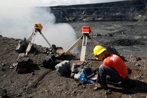
Kelly Wooten, a geologist and volcanologist at Hawaiian Volcano Observatory (HVO) is downloading radiometer data on rim of Halema‘uma‘u Crater in Kilauea Volcano, Hawaii, U.S., December 19, 2008. Picture taken on December 19, 2008. Courtesy USGS/Handout via REUTERS

Kelly Wooten, a geologist and volcanologist at Hawaiian Volcano Observatory (HVO) is downloading radiometer data on rim of Halema‘uma‘u Crater in Kilauea Volcano, Hawaii, U.S., December 19, 2008. Picture taken on December 19, 2008. Courtesy USGS/Handout via REUTERS

“The volcano is doing what it wants to. … We’re reminded what it’s like to deal with the force of nature,” said Ball, a geologist with the U.S. Geological Survey.

Scientists have been in the field measuring the eruptions 24 hours a day, seven days a week since Kilauea first exploded more than two months ago. They are a mix of USGS staff, University of Hawaii researchers and trained volunteers working six-to-eight-hour shifts in teams of two to five.

They avoid synthetics because they melt in the intense heat and wear gloves to protect their hands from sharp volcanic rock and glass. Helmets protect against falling lava stones, and respirators ward off sulfur gases.

This is not a job for the faint hearted. Geologists have died studying active volcanoes. David Alexander Johnston, a USGS volcanologist was killed by the 1980 eruption of Mount St. Helens in Washington state. In 1991, American volcanologist Harry Glicken and his French colleagues Katia and Maurice Krafft were killed while conducting avalanche research on Mount Unzen in Japan.

Ball, a graduate of the State University of New York at Buffalo, located in upstate New York near the Canadian border, compared Kilauea’s eruptions to Niagara Falls.

“It gives you the same feeling of power and force,” she said.

A geologist is collecting sample of molten lava from 2011 Kamoamoa eruption, at Kilauea Volcano, Hawaii, U.S., March 6, 2011. Picture taken on March 6, 2011. Courtesy USGS/Handout via REUTERS

A geologist is collecting sample of molten lava from 2011 Kamoamoa eruption, at Kilauea Volcano, Hawaii, U.S., March 6, 2011. Picture taken on March 6, 2011. Courtesy USGS/Handout via REUTERS

WORTH THE RISKS

Kilauea, which has been erupting almost continuously since 1983, is one of the world’s most closely monitored volcanoes, largely from the now-abandoned Hawaiian Volcano Observatory at the summit. But the latest eruption is one of Kilauea’s biggest and could prove to be a bonanza for scientists.

Ball and the USGS teams are studying how the magma – molten rock from the earth’s crust – tracks through a network of tubes under the volcano in what is known as the “Lower East Rift Zone,” before ripping open ground fissures and spouting fountains of lava.

They are trying to discover what warning signs may exist for future eruptions to better protect the Big Island’s communities, she said.

Fissure 8 is one of 22 around Kilauea that have destroyed over 1,000 structures and forced 2,000 people to evacuate. They are what make this volcanic eruption a rare event, Ball said.

“They’re common for Kilauea on a geologic time scale, but in a human time scale it’s sort of a career event,” she said.

Meanwhile, the summit is erupting almost every day with steam or ash, said Janet Snyder, spokeswoman for the County of Hawaii, where Kilauea is located.

Scientists had thought the steam explosions resulted from lava at the summit dropping down the volcano’s throat into groundwater. This was based on Kilauea’s 1924 eruption, to which the current one is most often compared.

But the explosions this time have released lots of sulfur dioxide gas, which means magma is involved, said Michael Poland, scientist-in-charge at Yellowstone Volcano Observatory, one of many volcanologists seconded to Kilauea.

“So we have already made a conceptual leap, leading us to believe it was different from what we had understood,” he said.

Poland and other scientists pulled equipment and archives out of the abandoned observatory at the volcano summit after hundreds of small eruption-induced quakes damaged the structure, and have decamped to the University of Hawaii in Hilo on the Big Island.

The archives included photos, seismic records and samples, some 100 or more years old, Poland said. “These materials are invaluable to someone who says, ‘I have this new idea, and I want to test it using past data.'”Now the second longest Kilauea eruption on record, surpassed only by one in 1955, this eruption offers far better research opportunities than previous events, Ball said.

“We’ve got much better instruments and we’ve got longer to collect the data,” she said.

(Reporting by Terray Sylvester and Jolyn Rosa; writing by Bill Tarrant; Editing by Leslie Adler)

Minor explosion at Hawaii volcano spews more ash into the air

FILE PHOTO: Journalists and National Guard soldiers watch as lava erupts in Leilani Estates during ongoing eruptions of the Kilauea Volcano in Hawaii, U.S., June 9, 2018. REUTERS/Terray Sylvester

(Reuters) – Another small explosion at the summit of Hawaii’s Kilauea Volcano shot more ash high into the atmosphere, putting communities in the southern part of the Big Island at risk, the U.S. Geological Survey (USGS) said.

The volcano, which has been erupting since early May, has sent occasional columns of ash and volcanic gas into the atmosphere at between 10,000 (3,050 meters) and 30,000 feet (9,145 meters) above sea level, it said.

On Sunday, another explosion spewed ash from the volcano, creating a driving hazard for roads on parts of the Big Island.

A fissure in the volcano spewed molten rock 160 feet (49 meters) on Tuesday, slightly lower than the 180 feet (55 meters) it reached from Saturday night into Sunday, pushing a steady flow of lava into the ocean, the USGS said.

A representative for the Hawaii Emergency Management Agency did not immediately respond to a request for comment.

The eruption, which entered its 40th day on Tuesday, stands as the most destructive in the United States since at least the violent 1980 eruption of Mount St. Helens in Washington state that reduced hundreds of square miles to wasteland and killed nearly 60 people, according to geologist Scott Rowland, a volcanologist at the University of Hawaii at Manoa.

The Hawaii eruption has caused no casualties, but lava flows have swallowed about 600 homes since May 3, Hawaii County Mayor Harry Kim said last week.

Vacationland, a private development believed to comprise about 160 homes, was completely erased, and at least 330 houses were devoured by lava at Kapoho Beach Lots, Kim said.

On Saturday, hundreds of construction workers and volunteers, including officials from the Hawaii National Guard and the Hawaii Regional Council of Carpenters, began building 20 temporary housing units in Pahoa for families forced from their homes.

(Reporting by Gina Cherelus in New York; Editing by Bill Berkrot)

Volcanic lava buries two housing tracts on Hawaii’s Big Island

Lava destroys homes in the Kapoho area, east of Pahoa, during ongoing eruptions of the Kilauea Volcano in Hawaii, U.S., June 5, 2018. REUTERS/Terray Sylvester

By Terray Sylvester

PAHOA, Hawaii (Reuters) – An ever-creeping wall of lava from Kilauea Volcano has engulfed two entire seaside housing tracts at the eastern tip of Hawaii’s Big Island, government scientists reported on Wednesday, an area where civil defense officials said nearly 280 homes once stood.

The obliteration of the Kapoho Beach Lots and Vacationland subdivisions by a river of molten rock some 10 to 15 feet (3 to 4.6 meters) tall brings to at least 400 the number of homes and other structures consumed by lava during the past month.

That latest toll of property losses from Kilauea’s ongoing upheaval, which entered its 35th day on Wednesday, far surpasses the 215 structures destroyed by lava during all 35 years of the volcano’s last eruption cycle, which began in 1983.

“Vacationland is gone, there’s no evidence of any properties there at all,” Wendy Stovall, a vulcanologist with the U.S. Geological Survey (USGS), told reporters on a conference call. At the adjacent Kapoho Beach Lots to the north. “Just a few homes” are left standing, she added.

County property tax records show a total of 279 homes existed in the two subdivisions combined, according to David Mace, a Federal Emergency Management Agency spokesman currently assigned to the Hawaii County Civil Defense authority.

Several miles (km) to the west, another 130 homes have been confirmed destroyed in and around the Leilani Estates community, where lava-spouting fissures in the ground first opened May 3 on the volcano’s lower flank, according to civil defense officials.

Mace said property losses in the east-end developments of Kapoho Beach Lots and Vacationland have yet to be officially documented.

The two communities, comprising a quiet vacation spot once popular for its snorkeling and tide pools, sat at the edge of a small, shallow inlet called Kapoho Bay. Lava pouring into the ocean there has completely filled in the bay, extending nearly a mile (1.6 km) out from what had been the shoreline, USGS scientists said.

Plumes of white steam and hydrochloric acid fumes, a vaporous, corrosive mix formed from lava reacting with seawater as it enters the ocean, could be seen rising from a distance.

‘EMOTIONAL ROLLER COASTER’

Authorities began evacuating the Kapoho area last week, with most residents ushered to safety by early on Saturday, hours before lava severed all road access to the region.

“I just locked my doors and walked away,” said Betty Oberman, a 28-year Vacationland resident who headed the neighborhood watch group there. “It’s an emotional roller coaster.”

The river of lava then spread out into a towering blob about a half-mile (800 meters) wide as it crept through the flat, open expanse of the subdivisions, swallowing everything in its path over the next few days.

A handful of residents who initially stayed behind rather than heed evacuation orders were airlifted by helicopter on Sunday.

Most of the two dozen volcanic vents have grown largely quiet over the past week, with just one, Fissure 8, still spewing large volumes of molten rock from the ground as of Wednesday, the USGS said. That fissure is the origin of the lava flow that devastated Kapoho.

Lava had covered nearly 8 square miles (20.7 sq km) of landscape as of Monday, and some 9,900 earthquakes had been recorded on the Big Island since Kilauea rumbled back to life last month. That’s nearly 10 times the monthly historic average for seismic activity on Hawaii Island, the USGS said.

(Additional reporting and writing by Steve Gorman in Los Angeles; Editing by Bill Tarrant and Michael Perry)

‘Ballistic blocks’ shoot from Hawaii volcano, may mark start of violent eruptions

People watch as ash erupt from the Halemaumau crater near the community of Volcano during ongoing eruptions of the Kilauea Volcano in Hawaii, U.S., May 15, 2018. REUTERS/Terray Sylvester

By Terray Sylvester

VOLCANO, Hawaii (Reuters) – “Ballistic blocks” the size of microwave ovens shot from Hawaii’s Kilauea volcano on Wednesday in what may be the start of explosive eruptions that could spew huge ash plumes and hurl smaller rocks for miles (km), the U.S. Geological Survey said.

Such eruptions, last seen nearly a century ago, have been a looming threat since Kilauea, one of the world’s most active volcanoes, erupted nearly two weeks ago.

Explosions in Kilauea’s crater sparked an aviation red alert due to risks the ash plume could blow into aircraft routes and damage jet engines.

More explosions are expected and may be more powerful, the USGS warned. These steam-driven blasts could send a 20,000-foot (6,100-meter) ash plume out of the crater, hurling 10-12 ton boulders up to half a mile (800 meters) and scatter pebble-sized rocks over 12 miles (19 km), the USGS has said.

This type of eruption has the potential to carpet the Big Island in much thicker ash than current dustings and possibly spread the powder and volcanic smog across the Hawaiian islands and farther afield if it enters the stratosphere.

“This morning dense ballistic blocks up to 60 cm (2 feet) across were found in the parking lot a few hundred yards (meters) from Halemaumau (Kilauea’s crater),” the USGS said in a statement. “These reflect the most energetic explosions yet observed and could reflect the onset of steam-driven explosive activity.

A 4.2 magnitude earthquake at the volcano at 8.36 a.m. (2:36 p.m. EDT) prompted authorities to issue an alert reassuring rattled Big Island residents that there was no risk of a tsunami from the volcanic activity.

‘DISARRAY AND FRANTIC’

In the community of Volcano, just north of Kilauea’s crater, business was way down and people were on edge.

In just a few hours residents had been shaken by an earthquake, dusted with ash and for the first time since the start of the eruption smelled the rotten-egg stench of toxic sulfur-dioxide gas.

“They’re just in disarray and frantic,” Adele Tripp, an employee at the Kilauea General Store, said of other residents. She said she had lived in Volcano for 30 years and was not personally concerned as she trusted scientists to tell her when to get out.

Smog from Kilauea drifted north up the island chain as the districts of Kau, Puna, and North and South Hilo were told by the National Weather Service to expect ashfall. Hawaii County Civil Defense said a dusting of ash was visible on property and advised residents to avoid exposure to the powdered rock, which can cause irritation to eyes and airways.

There was no effect on air carrier operations to Hawaii on Wednesday, Federal Aviation Administration spokesman Ian Gregor said in an email.

Ash is a new hazard for Hawaii’s Big Island, already grappling with volcanic gas and lava that has destroyed 37 homes and other structures and forced the evacuation of about 2,000 residents from a small area in the southeast Puna district.

Lava has burst from 21 giant ground cracks or fissures and torn through housing developments and farmland, threatening two highways that are exit routes for coastal areas.

Several fissures shot lava into the air on Wednesday but one flow advanced only 100 yards (meters) toward coastal Highway 137, which remains around a mile (1.6 km) distant, County of Hawaii Civil Defense said in a statement.

No serious injuries or deaths have been reported from the eruption.

(Reporting by Terray Sylvester; Additional reporting and writing by Andrew Hay in Taos, New Mexico; Editing by Tom Brown and Sandra Maler)

6.2 Earthquake shakes Mexico, rescue efforts suspended

6.2 Earthquake shakes Mexico, rescue efforts suspended

By Noe Torres

MEXICO CITY (Reuters) – A magnitude 6.2 earthquake shook southern Mexico on Saturday and spread alarm in the capital, where rescuers temporarily suspended a search for survivors of a bigger tremor earlier this week out of fear of further building collapses.

The United States Geological Survey said the new quake was relatively shallow with an epicenter near Juchitan, a tropical region of Oaxaca state hard hit by another major earthquake on Sept 7.

Already shaken by the two recent earthquakes that have killed at least 384 people in Mexico this month, thousands of people ran out onto the streets again in Oaxaca and Mexico City, many in pajamas, when seismic alarms sounded before the new tremor was felt shortly before 8 a.m. (1300 GMT).

“I heard the alarm and ran downstairs with my family,” said Sergio Cedillo, 49, who was watching rescuers’ efforts to find survivors from Tuesday’s quake when the alarm sounded. A smaller earthquake was felt in Oaxaca at 8:24 a.m. (1324 GMT)

In a shelter housing those who have lost their homes in the quakes, people stood in a circle and prayed after the alarm sounded on Saturday.

Local media reports said a bridge collapsed near Juchitan on Saturday, after suffering damage in the earlier quakes.

The tremors were mild in Mexico City. No new damage was immediately reported, but to keep workers safe, rescue efforts were suspended in areas affected by Tuesday’s quake, Luis Felipe Puente, the head of Mexico’s civil protection agency said.

Rescue workers in hard hats stood around at some rescue sites awaiting further instructions.

“We have to be very careful with the damaged buildings, because there is a risk of collapse,” Puente told TV network Azteca.

When Tuesday’s 7.1 magnitude quake hit, Mexico was already reeling from the Sept. 7 earthquake that killed at least 98 people and was the strongest in the country in 85 years.

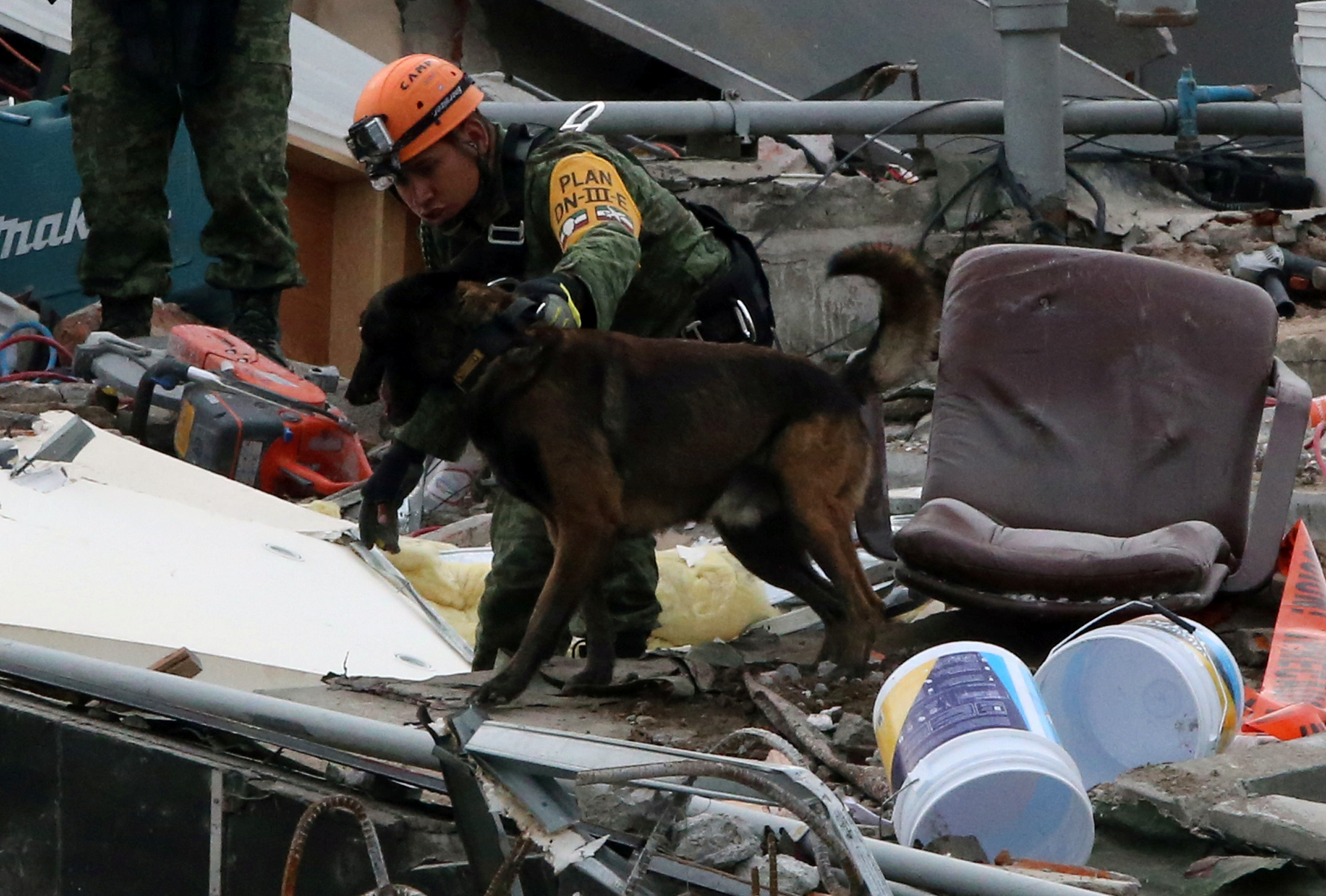
A Mexican soldier and his dog search for survivors in the rubble of a collapsed building after an earthquake in Mexico City, Mexico September 23, 2017. REUTERS/Henry Romero

A Mexican soldier and his dog search for survivors in the rubble of a collapsed building after an earthquake in Mexico City, Mexico September 23, 2017. REUTERS/Henry Romero

RESCUE EFFORTS

At least 52 buildings were brought to the ground by Tuesday’s earthquake and an army of trained rescuers and scores of volunteers have been frantically removing rubble in a day and night search for survivors.

Officials said there could be some 20,000 badly damaged homes in the adjacent states of Morelos and Puebla.

Mexican volunteers, professionals and soldiers backed by teams from countries as far away as Japan have so far saved 60 people from the rubble but nobody has been found alive in the past 24 hours. The quake killed at least 296 people.

Apartment buildings, offices, a school and a textile factory were among the structures flattened, leaving thousands homeless.

After several days of searching, rescuers had been finding more corpses than survivors before labors were suspended, and frustration was mounting at what some said were insufficient efforts by the government to save people and hand out aid.

Tuesday’s massive quake hit on the anniversary of the deadly 1985 tremor that by some estimates killed as many as 10,000 people and destroyed scores of older buildings in the Mexican capital.

Mexico is better prepared to deal with the aftermath of earthquakes nowadays, helped by disaster planning, civic groups, a stringent building code and communication technology.

Despite the shrinking odds that more survivors would be pulled out from huge piles of debris, workers at many sites said they would not give up if there was the faintest chance at success.

At a collapsed office building in the trendy Roma district, volunteer coordinator Angel Ortiz, a 36-year-old taxi driver, pointed to the results of heat-sensing detectors that appeared to show signs of life somewhere underneath the rubble.

“There are still people alive down there,” he said.

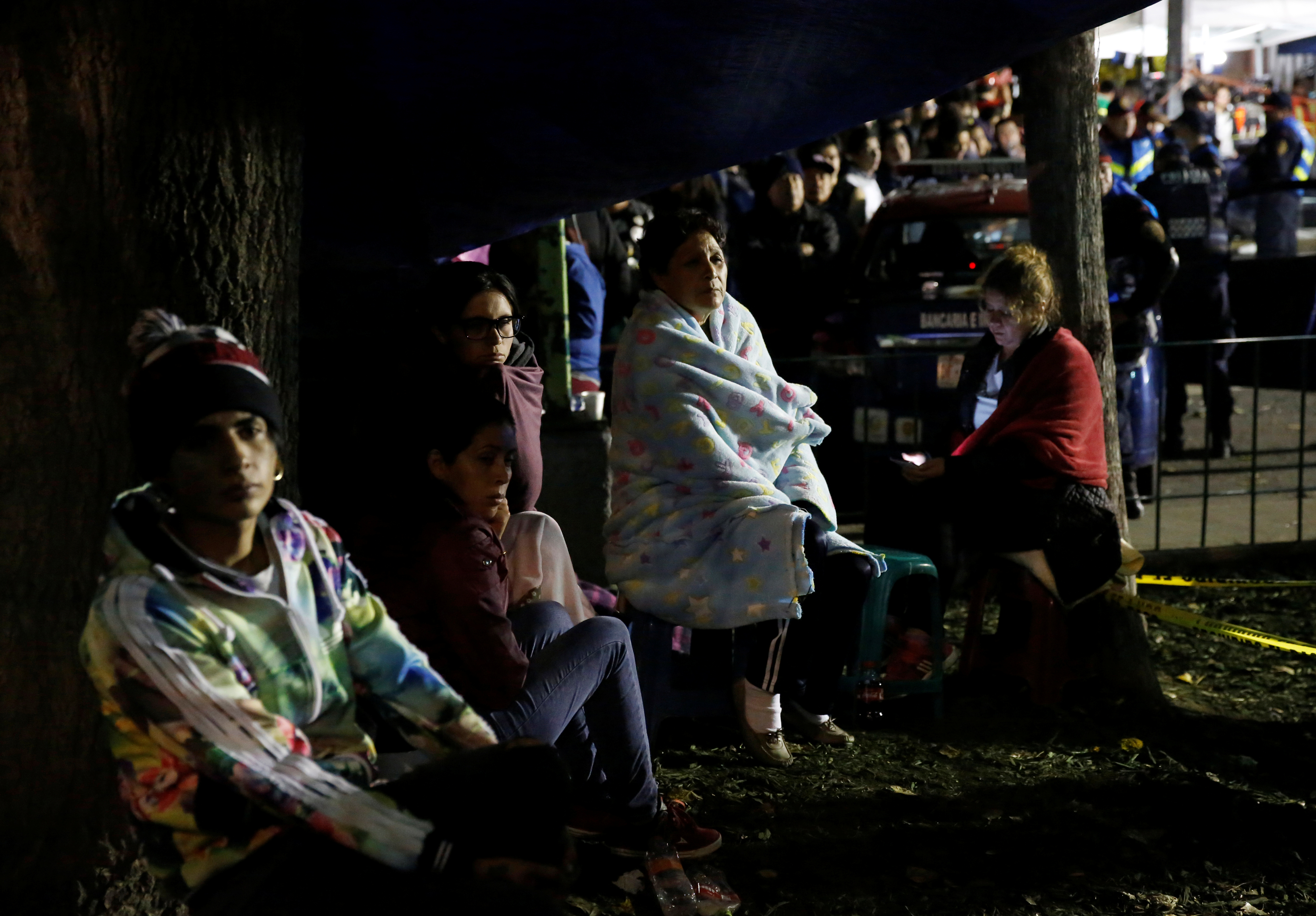
People sit next to a collapsed building as they wait for news of their loved ones after an earthquake in Mexico City, Mexico September 23, 2017. REUTERS/Henry Romero

People sit next to a collapsed building as they wait for news of their loved ones after an earthquake in Mexico City, Mexico September 23, 2017. REUTERS/Henry Romero

(Reporting by Julia Love and Alexandra Alper; Writing by David Alire Garcia; Editing by Muralikumar Anantharaman and Franklin Paul)

Desperate night search in Mexico school, other ruins as quake deaths pass 200

Desperate night search in Mexico school, other ruins as quake deaths pass 200

By David Alire Garcia and Adriana Barrera

MEXICO CITY (Reuters) – Desperate rescue workers scrabbled through rubble in a floodlit search on Wednesday for dozens of children feared buried beneath a Mexico City school, one of hundreds of buildings wrecked by the country’s most lethal earthquake in a generation.

The magnitude 7.1 shock killed at least 217 people, nearly half of them in the capital, 32 years to the day after a devastating 1985 quake. The disaster came as Mexico still reels from a powerful tremor that killed nearly 100 people in the south of the country less than two weeks ago.

Among the twisted concrete and steel ruin of the Enrique Rebsamen school, soldiers and firefighters found at least 22 dead children and two adults, while another 30 children and 12 adults were missing, President Enrique Pena Nieto said.

There were chaotic scenes at the school as bulldozers moved rubble under the buzz and glare of floodlights powered by generators, with parents clinging to hope their children had survived.

“They keep pulling kids out, but we know nothing of my daughter,” said 32-year-old Adriana D’Fargo, her eyes red after hours waiting for news of her seven-year-old.

Three survivors were found at around midnight as volunteer rescue teams formed after the 1985 quake and known as “moles” crawled deep under the rubble.

TV network Televisa reported that 15 more bodies, mostly children, had been recovered, while 11 children were rescued. The school is for children aged 3 to 14.

The earthquake toppled dozens of buildings, broke gas mains and sparked fires across the city and other towns in central Mexico. Falling rubble and billboards crushed cars.

In a live broadcast, one newsreader had time to say “this is not a drill”, before weaving his way out of the buckling studio.

Parts of colonial-era churches crumbled in the state of Puebla, where the U.S. Geological Survey (USGS) located the quake’s epicenter, some 100 miles (158 km) southwest of the capital, at a depth of 51 km (32 miles).

As the earth shook, Mexico’s Popocatepetl volcano, visible from the capital on a clear day, had a small eruption. On its slopes, a church in Atzitzihuacan collapsed during mass, killing 15 people, Puebla Governor Jose Antonio Gali said.

U.S. President Donald Trump mentioned the earthquake in a tweet, saying: “God bless the people of Mexico City. We are with you and will be there for you.”

In Rome, Pope Francis told pilgrims that he was praying for all the victims, the wounded, their families and the rescue workers in the majority Catholic country. “In this moment of pain, I want to express my closeness and prayers to all the beloved Mexican people,” he said.

NIGHT SEARCHES

Residents of Mexico City, a metropolitan region of some 20 million people, slept in the streets while authorities and volunteers set up tented collection centers to distribute food and water.

Volunteers, soldiers and firefighters formed human chains and dug with hammers and picks to find dust-covered survivors and dead bodies in the remains of apartment buildings, schools and a factory.

The middle-class neighborhood of Del Valle was hit hard, with several buildings toppling over on just one street. Reserve rescue workers arrived late at night and were still pulling survivors out in the small hours of Wednesday.

With power out in much of the city, the work was carried out in the dark or with flashlights and generators. Rescue workers requested silence as they listened for signs of life.

Some soldiers were armed with automatic weapons. Authorities said schools would be shut on Wednesday as damage was assessed.

Emergency personnel and equipment were being deployed across affected areas so that “throughout the night we can continue aiding the population and eventually find people beneath the rubble,” Peña Nieto said in a video posted on Facebook earlier on Tuesday evening.

In Obrera, central Mexico City, people applauded when rescuers managed to retrieve four people alive, with cheers of “si se puede” — “yes we can” — ringing out.

Volunteers continued arriving throughout the night, following calls from the civil protection agency, the Red Cross and firefighters.

The quake had killed 86 people in the capital by early Wednesday morning, according to Civil Protection chief Luis Felipe Puente — fewer than he had previously estimated. In Morelos State, just to the south, 71 people were killed, with hundreds of homes destroyed. In Puebla at least 43 died.

Another 17 people were reported killed in the states of Mexico, Guerrero and Oaxaca.

As many as 4.6 million homes, businesses and other facilities had lost electricity, according to national power company Comisión Federal de Electricidad, including 40 percent of homes in Mexico City.

Moises Amador Mejia, a 44-year-old employee of the civil protection agency, was working late into the night to rescue people trapped in a collapsed building in Mexico City’s bohemian Condesa neighborhood.

“The idea is to stay here until we find who is inside. Day and night.”

(Additional reporting by Anthony Esposito, Lizbeth Diaz, Daina Beth Solomon, Stefanie Eschenbacher, Julia Love, Noe Torres; Writing by Frank Jack Daniel; Editing by Catherine Evans and Chizu Nomiyama)

Major earthquake hits near Mexico City, dozens dead

People clear rubble after an earthquake hit Mexico City, Mexico September 19, 2017. REUTERS/Carlos Jasso

By Anthony Esposito

MEXICO CITY (Reuters) – A major earthquake of magnitude 7.1 struck central Mexico on Tuesday, toppling dozens of buildings in the heavily populated capital and killing at least 49 people nearby.

President Enrique Pena said 27 buildings had collapsed in Mexico City, one of the world’s biggest cities. The first reports of fatalities were from surrounding areas.

In the state of Morelos, just south of Mexico City, 42 people died, the state’s governor said. Authorities reported other deaths in neighboring Puebla and the State of Mexico.

“People are really scared right now,” said dentist Claudia Meneses who was in her clinic in Mexico City’s Lindavista neighborhood when the earthquake struck mid-afternoon. “We’re going to go to a building that fell to see if we can help.”

Earthquakes of magnitude 7 or above are regarded as major and are capable of causing widespread heavy damage.

Television images showed a multi-story building in the capital with a middle floor collapsed as sirens blared and first responders rushed to the scene. Other video showed the side of a government building shearing off and falling into the street as bystanders screamed.

Rescue workers pulled at least one survivor from a collapsed building in the Condesa neighborhood near the center of Mexico City.

U.S. President Donald Trump said on Twitter: “God bless the people of Mexico City. We are with you and will be there for you.” The city and its surrounding area are home to about 20 million people.

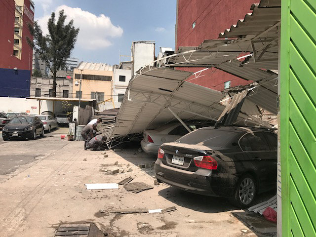
Damages are seen after an earthquake hit in Mexico City, Mexico September 19, 2017. REUTERS/Carlos Jasso

Damages are seen after an earthquake hit in Mexico City, Mexico September 19, 2017. REUTERS/Carlos Jasso

In Cuernavaca, a city south of Mexico City, there were unconfirmed reports on local radio of people trapped beneath collapsed buildings.

Mexican TV and social media showed cars crushed by debris. Many people fled into the streets, and electricity and phone lines were down in parts of the capital.

“We got out really fast, leaving everything as it was and just left,” said Rosaura Suarez, as she stood with a crowd on the street.

The quake hit only hours after many people participated in earthquake drills around the nation on the anniversary of a devastating quake that killed thousands in Mexico City in 1985.

Many people were also still shaken from another quake on Sept. 7 in southern Mexico that killed at least 98 people.

The epicenter of Tuesday’s quake was located in the central state of Puebla, the U.S. Geological Survey said.

(Reporting by Mexico City newsroom; Editing by Cynthia Osterman and Alistair Bell)