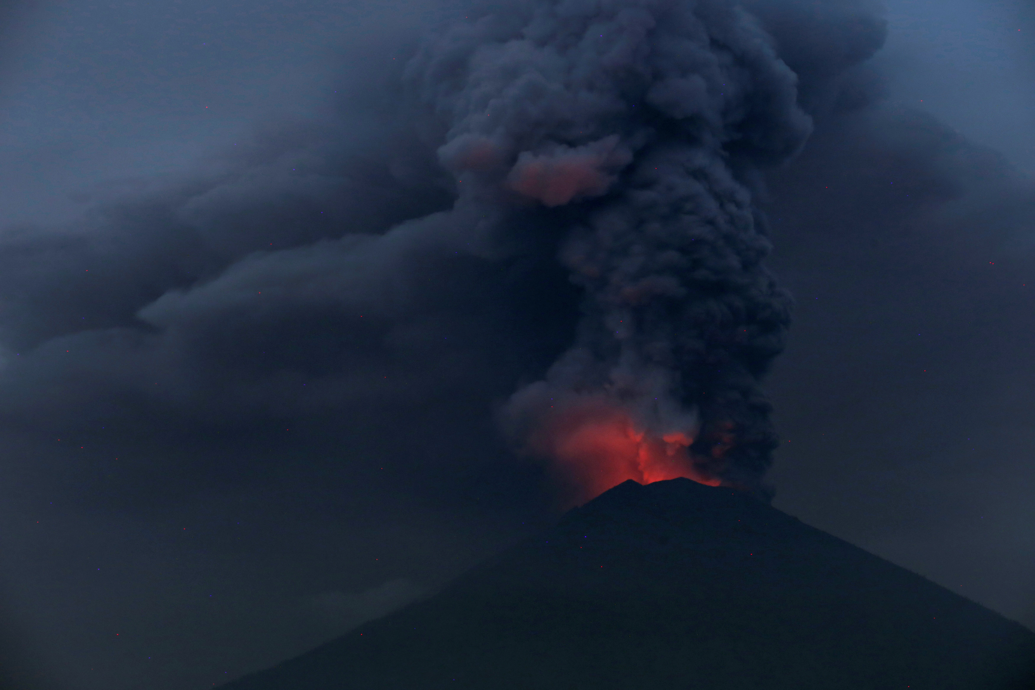
Volcano-triggered tsunami kills at least 43 in Indonesia, injures hundreds

Residents sit inside a mosque as they evacuated following high waves and the eruption of Anak Krakatau volcano at Labuan district in Pandeglang regency, Banten province, Indonesia, December 22, 2018 in this photo taken by Antara Foto. Picture taken December 22, 2018. Antara Foto/Muhammad Bagus Khoirunas/ via REUTERS

By Jessica Damiana

JAKARTA (Reuters) – A tsunami killed at least 43 people on the Indonesian islands of Java and Sumatra and injured hundreds following an underwater landslide caused by a volcanic eruption, the disaster mitigation agency said on Sunday.

Some 584 people were injured and hundreds of homes and other buildings were “heavily damaged” in the tsunami which struck late on Saturday.

On Dec. 26 in 2004, an Indian Ocean tsunami triggered by an earthquake killed 226,000 people in 13 countries, including more than 120,000 in Indonesia.

Endan Permana, head of the agency in Pandeglang, told Metro TV police were providing immediate assistance to victims in Tanjung Lesung in Banten province, a popular tourist getaway not far from the capital, Jakarta, as emergency workers had not arrived in the area yet.

“Many are missing,” Permana said.

The agency said it was still compiling information and there was a “possibility that data on the victims and damage will increase”.

The tsunami was caused by “an undersea landslide resulting from volcanic activity on Anak Krakatau” and was exacerbated by abnormally high tide because of the current full moon, disaster agency spokesman Sutopo Purwo Nugroho said.

According to a statement from the Meteorology, Climatology and Geophysics Agency (BMKG), Krakatau erupted at just after 9 p.m. and the tsunami struck at around 9.30 p.m. on Saturday.

“The tsunami hit several areas of the Sunda Strait, including beaches in Pandeglang regency, Serang, and South Lampung,” the agency said.

Nugroho told Metro TV that tsunamis triggered by volcanic eruptions were “rare” and that the Sunda Strait tsunami had not resulted from an earthquake.

“There was no earthquake, and the Anak Krakatau eruption also wasn’t that big,” Nugroho told Metro TV, noting there were no “significant” seismic tremors to indicate a tsunami was coming.

The Krakatau eruption created a column of volcanic ash estimated to be up 500 meters high.

(Reporting by Gayatri Suroyo, Tabita Diela and Jessica Damiana; Writing by Fergus Jensen; Editing by Nick Macfie)

Japan braces as typhoon charts course for main island

Super typhoon Trami is seen from the International Space Station as it moves in the direction of Japan, September 25, 2018 in this image obtained from social media on September 26, 2018. ESA/NASA-A.Gerst/via REUTERS

By Elaine Lies

TOKYO (Reuters) – Japan braced for high winds and heavy rain as a typhoon roared north on Friday, enveloping outlying islands in high seas before taking aim at the rest of the nation and raking across its biggest main island at the weekend.

Typhoon Trami, rated category 2 by Tropical Storm Risk, with category 5 the highest, is the latest storm to threaten Japan in a year filled with more than the usual number of disasters, including punishing heat, heavy rains, and landslides.

Less than a month ago, a typhoon flooded Kansai International airport near Osaka, leaving thousands of tourists stranded.

Outlying islands in the Okinawan chain, some 1,000 km southwest of Tokyo, were being pounded by heavy seas and strong winds, just two days before an Okinawan gubernatorial election, forcing some areas to hold voting early. The central government set up an emergency office to deal with the storm.

Trami was about 300 km (186 miles) southeast of Miyako island, with winds gusting as high as 216 kilometers an hour (134 mph).

Churning north across Okinawa on Saturday, Trami is then predicted to rake across the islands of Kyushu and the main island of Honshu on Sunday, a path similar to that taken by typhoon Jebi early in September.

Though the Japanese capital of Tokyo is set for heavy rain, current predictions show it avoiding a direct hit.

Jebi, the most powerful storm to hit Japan in 25 years, brought some of the highest tides since a 1961 typhoon and flooded Kansai airport near Osaka, taking it out of service for days.

Seventeen people died in the storm, whose high winds sent trees crashing to the ground and cars scudding across parking lots.

Even for a nation accustomed to disasters, this year has been hard for Japan, starting with a volcanic eruption in January that rained rocks down on a ski resort, killing one.

July brought record-breaking heat that killed at least 80 people and sent over 20,000 to the hospital for treatment, along with torrential rains in western Japan that set off floods and landslides, killing more than 200.

Just two days after Jebi hit in September, the northernmost main island of Hokkaido was rocked by an earthquake that set off landslides, knocked out power throughout the island and killed at least 44 people.

(Editing by Nick Macfie)

Playing with fire: tens of thousands refuse to leave Bali volcano homes

Playing with fire: tens of thousands refuse to leave Bali volcano homes

By Kanupriya Kapoor

KARANGASEM, Indonesia (Reuters) – Tens of thousands of villagers on the Indonesian holiday island of Bali are refusing to evacuate a 10-km (six-mile) danger zone around an erupting volcano, putting their fate in the hands of the gods or simply staying put to protect homes and livestock.

The glowing, 3,000-metre Mount Agung, considered sacred by many on the Hindu-majority island, started spewing huge columns of ash at the weekend and there have been constant tremors and volcanic mud flows since.

Search and rescue teams making daily forays into the zone say some are refusing to leave their cattle unattended, while others have spiritual reasons.

“The government has been clear about evacuation orders, but some people are slow to act or want to stay,” said Gede Ardana, head of Bali’s search and rescue agency.

“We cannot force them – but we will be held responsible, so we need to convince them.”

For cattle farmer Ketut Suwarte, there was no question of staying put.

“There was thick ash falling around us and we could smell sulfur. We were scared and we decided to leave immediately,” said Suwarte, 47, now staying in an evacuation camp just outside the danger zone.

Suwarte’s father recalls the last time Mount Agung exploded, in 1963, killing about 1,000 people as pyroclastic flows – made up of hot gas and volcanic matter – raced down the mountain.

Sutopo Purwo Nugroho, of the disaster mitigation agency, said about 43,000 people had heeded advice to take shelter, but with an estimated population of 90,000 to 100,000 in the danger area, many had not.

Ika Wardani, 33, sleeps with her family at an evacuation center at night but during the day returns to her cattle farm about 10 km north of the volcano.

‘THEY ARE STUBBORN’

“During the day at least we can see the volcano. But we’re uncomfortable sleeping here at night because an earthquake or loud explosion would cause panic,” she said. “We would have to drive our motorbikes at night and the roads are narrow so it’s safer to spend the nights at the evacuation center.”

She says there are people only five km from the crater who have refused to evacuate.

“They are stubborn,” she said. “Some of them survived 1963 so they believe it’s all right now.”

The government has set up radio stations and chat groups on social media to warn people of the risks.

“Many people have made the decision to stay inside the exclusion zone, and that is clearly very dangerous,” said Sutopo Purwo Nugroho, a spokesman for the disaster management agency.

Others, including tourists, are taking unnecessary risks by trying to take selfies as close as possible, officials say. Last month, a Frenchman shared a video of himself at the crater’s edge on social media.

In September, when authorities first raised the warning alert to the highest level, an exclusion zone of up to 12 km was imposed, prompting nearly 150,000 to leave, but when no major eruption occurred, many returned and the warning status was lowered. When authorities again raised the warning level this week, many were reluctant to move again.

“If (Mount Agung) follows the most frequent trend, it is likely to continue increasing in explosivity – but at what rate and how large, nobody knows,” said Dr Carmen Solana, a volcanologist at the University of Portsmouth.

President Joko Widodo on Wednesday urged people to leave the exclusion zone before it’s too late.

“There must not be any victims,” he said.

(Additional reporting by Johannes P. Christo; Editing by Ed Davies and Nick Macfie)

Indonesia orders immediate evacuation as highest alert issued for Bali volcano

Mount Agung volcano erupts as seen from Culik Village, Karangasem, Bali,

By Nyimas Laula

DENPASAR, Indonesia (Reuters) – Indonesia closed the airport on the tourist island of Bali on Monday and ordered 100,000 residents living near a grumbling volcano spewing columns of ash to evacuate immediately, warning that the first major eruption in 54 years could be “imminent”.

The airport was closed for 24 hours from Monday morning, disrupting 445 flights and some 59,000 passengers, after Mount Agung, which killed hundreds of people in 1963, sent volcanic ash high into the sky, and officials said cancellations could be extended.

“Plumes of smoke are occasionally accompanied by explosive eruptions and the sound of weak blasts that can be heard up to 12 km (7 miles) from the peak,” the Disaster Mitigation Agency (BNPB) said in a statement after raising the alert from three to its highest level of four.

“The potential for a larger eruption is imminent,” it said, referring to a visible glow of magma at Mount Agung’s peak overnight, and warning residents to evacuate a danger zone at a radius of 8-10 km (5-6 miles).

Sutopo, a BNPB spokesman, said there had been no casualties so far and 40,000 people had left the area, but tens of thousands still needed to move.

Video footage shared by the agency showed volcanic mud flows (lahar) on the mountainside. Lahar carrying mud and large boulders can destroy houses, bridges and roads in its path.

Glowing light of hot lava is seen during the eruption of Mount Agung as seen from Amed in Karangasem, Bali, Indonesia.

Glowing light of hot lava is seen during the eruption of Mount Agung as seen from Amed in Karangasem, Bali, Indonesia.
REUTERS/Johannes P. Christo

Bali, famous for its surf, beaches and temples, attracted nearly 5 million visitors last year, and its airport serves as a transport hub for the chain of islands in Indonesia’s eastern archipelago.

But tourism has slumped in parts of Bali since September when Agung’s volcanic tremors began to increase and the alert level was raised to maximum before being lowered in October when seismic activity calmed.”I’m really worried. Maybe I’ll go somewhere south that I think will be safe to avoid being trapped by the ashfall,” said Maria Becker, a German tourist staying in Amed, around 15 km (9 miles) from the volcano.

Agung rises majestically over eastern Bali to a height of just over 3,000 metres (9,800 feet). Northeastern Bali is relatively undeveloped compared to the more heavily populated southern tourist hub of Kuta-Seminyak-Nusa Dua.

Indonesia’s Vulcanology and Geological Disaster Mitigation Centre (PVMBG), which is using drones, satellite imagery and other equipment, said predictions were difficult in the absence of instrumental recordings from the last eruption 54 years ago.

In 1963, an eruption of Agung killed more than 1,000 people and razed several villages by hurling out pyroclastic material, hot ash, lava and lahar.

Recordings now show the northeast area of Agung’s peak has swollen in recent weeks “indicating there is fairly strong pressure toward the surface”, PVMBG said.

It warned that if a similar eruption occurred, it could send rocks bigger than fist-size up to 8 km (5 miles) from the summit and volcanic gas to a distance of 10 km (6 miles) within three minutes.

Some analysis, however, suggests the threat should not be as great this time because “energy at Mount Agung’s magma chamber is not as big” and the ash column only around a quarter as high so far as the 20 km (12 miles) reached in 1963, Sutopo said.


“CHECK-INS CLOSED”

Bali airport, about 60 km (37 miles) from the volcano, will be closed for 24 hours, its operator said.

Ten alternative airports have been prepared for airlines to divert inbound flights, including in neighboring provinces.

Virgin Australia Holdings Ltd said it was cancelling flights on Tuesday, while Jetstar was offering to exchange Bali bound tickets for other destinations.

Television footage showed hundreds of holidaymakers camped inside the airport terminal, some sleeping on their bags, others using mobile telephones.

“We have been here (in Bali) for three days we are about to leave today, but just found out our flights have been canceled. We have got no information because the gates, the check-ins, have been closed indefinitely,” said Carlo Oben from Los Angeles.

Cover-More, Australia’s biggest travel insurer, said on its website customers would only be covered if they had bought policies before the volcano alert was first issued on Sept. 18.

Indonesia’s hotel and restaurant association said stranded tourists at member hotels would get one night’s free stay.

The main airport on Lombok, next to Bali, was closed after being open for much of the day, a spokesman said.

Airlines avoid flying when volcanic ash is present because it can damage engines and can clog fuel and cooling systems and hamper visibility.


(For interactive package on Agung eruptions, click http://tmsnrt.rs/2AayRVh)(For graphic on Pacific ring of fire, click http://tmsnrt.rs/2AzR9jv)


(Additonal reporting by Reuters Bali stringer in DENPASAR, Angie Teo, Fransiska Nangoy and Bernadette Christina Munthe in JAKARTA and Jamie Freed in SINGAPORE; Writing by Ed Davies and Fergus Jensen; Editing by Michael Perry and Nick Macfie)


Thousands stranded as Bali volcano alert raised to highest level

Mount Agung volcano is seen erupting from Lempuyang Temple in Karangasem, Bali, Indonesia November 27, 2017.

By Nyimas Laula

DENPASAR, Indonesia (Reuters) – Indonesia raised its warning for Bali’s Mount Agung volcano to the top level four alert on Monday, closed the holiday island’s airport and told residents around the mountain to immediately evacuate, warning of an “imminent” risk of a larger eruption.

Bali’s airport was closed for 24 hours from Monday morning, disrupting 445 flights and some 59,000 passengers, due to the eruption and the presence of volcanic ash from Agung, but local officials said the closure could be extended.

Video footage shared by the disaster agency showed cold lava flows (lahar) at a number of locations on the mountainside. Lahar carrying mud and large boulders can destroy houses, bridges and roads in its path.

“Plumes of smoke are occasionally accompanied by explosive eruptions and the sound of weak blasts that can be heard up to 12 km (7 miles) from the peak,” the Disaster Mitigation Agency (BNPB) said in a statement after raising the alert level from three to four.

“The potential for a larger eruption is imminent,” it said, referring to the visible glow of magma at Agung’s peak overnight.

Residents were warned to “immediately evacuate” a danger zone that circles Agung in a radius of 8-10 km (5-6 miles).

Sutopo, a BNPB spokesman, said there had been no casualties so far and 40,000 people had left the area, but tens of thousands still needed to move and warned authorities would move them by force if necessary.

Agung rises majestically over eastern Bali to a height of just over 3,000 metres (9,800 feet). Eastern Bali is relatively undeveloped, with traditional rice paddies doting the landscape and the occasional budget resort, unlike the heavily populated southern tourist hub of Kuta-Seminyak-Nusa Dua.

Agung’s last eruption in 1963 left more than 1,000 people dead and razed several villages.

Analysis suggested the threat should not be as great this time because “energy at Mount Agung’s magma chamber is not as big” and with the ash column only around a quarter as high so far as the 20 km (12 miles) reached in 1963, said Sutopo.

“I’m not worried (but) my friends in Russia are a little bit,” said a Russian tourist, who only wanted to be identified as Dmitry, at an observation post in Rendang in Bali’s east.

Bali, famous for its surf, beaches and temples, attracted nearly 5 million visitors last year, and its international airport serves as a transport hub for the chain of islands in Indonesia’s eastern archipelago.

Tourism business has slumped in Bali since September when Agung’s volcanic tremors began to increase.


TRAVELLERS STRANDED

According to the Volcanic Ash Advisory Centre in nearby Darwin, Australia, there is “ash confirmed on the ground at Denpasar Airport” as well as ash at FL300 (which refers to flight level at 30,000 feet) in the vicinity of the volcano.

Bali’s I Gusti Ngurah Rai airport, which is about 60 km (40 miles) from the volcano, will be closed for 24 hours, according to its operator. A total of 445 flights – 196 international and 249 domestic – and 59,000 passengers had been affected.

Ten alternative airports have been prepared for airlines to divert inbound flights, including in neighbouring provinces.

The airport operator said it was providing buses to take travellers to ferry ports for alternative travel arrangements.

Bali airport’s official website showed flights operated by Singapore Airlines, Sriwijaya, Garuda Indonesia, Malaysia Airlines and Jetstar had been cancelled.

Television footage showed hundreds of holidaymakers camped inside the airport terminal, some sleeping on their bags, others using mobile telephones.

“We have been here (in Bali) for three days we are about to leave today, but just found out our flights have been cancelled. We have got no information because the gates, the check-ins have been closed indefinitely,” said Carlo Oben from Los Angeles.
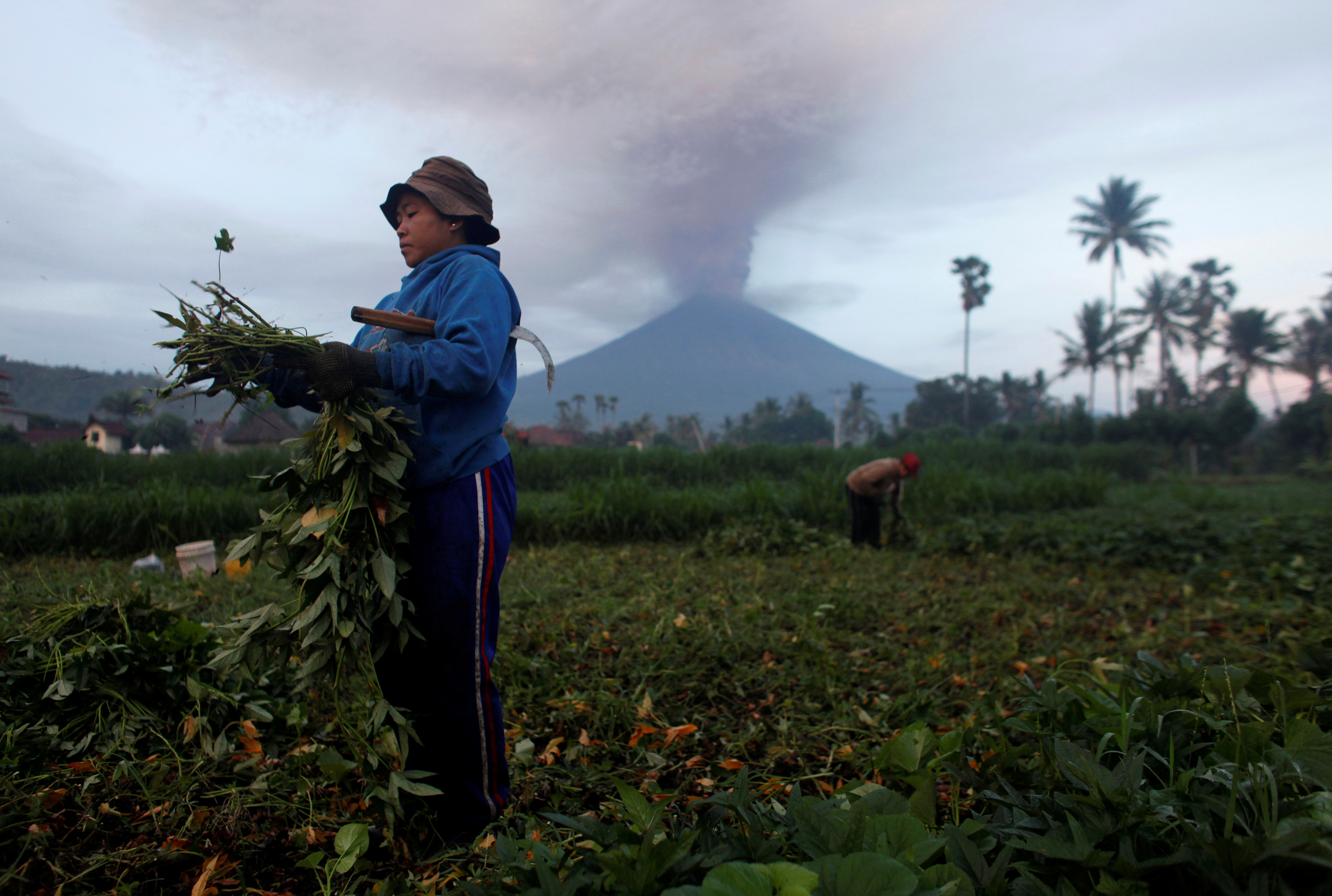
Farmers tend their crops as Mount Agung erupts in the background in Amed, Karangasem Regency, Bali, Indonesia, November 27, 2017

Farmers tend their crops as Mount Agung erupts in the background in Amed, Karangasem Regency, Bali, Indonesia, November 27, 2017. REUTERS/Nyimas Laula

AIRLINE RISK FROM ASH

Cover-More, Australia’s biggest travel insurer, said on its website customers would only be covered if they had bought policies before the volcano alert was first issue on Sept. 18.

Indonesia’s hotel and restaurant association said stranded tourists at member hotels would get one night’s free stay.

A transport ministry spokesman said the main airport on the neighbouring island of Lombok had reopened after “no volcanic ash was detected”.

Airlines avoid flying when volcanic ash is present because it can cause significant damage to aircraft engines, leading to possible engine failure, and can clog fuel and cooling systems and hamper pilot visibility.

In June 1982, a British Airways 747 suffered severe damage and had all four engines flame out after encountering ash from Mount Galunggung in Indonesia. It descended to 12,000 feet before being able to restart some engines and make an emergency landing in Jakarta.

The alert level on Agung had been raised to the maximum in September, but was lowered in October when seismic activity calmed. However, volcanologists now say the volcano has entered a new phase with magma now visible at Agung’s peak, meaning a greater risk of a larger eruption.


(Additonal reporting by Reuters Bali stringer in DENPASAR, Angie Teo, Fransiska Nangoy and Bernadette Christina Munthe in JAKARTA and Jamie Freed in SINGAPORE; Writing by Ed Davies and Fergus Jensen; Editing by Michael Perry)


Volcanic explosion on Mount Etna injures 10 people

FILE PHOTO A tourist stands in front of Italy's Mount Etna, Europe's tallest and most active volcano, as it spews lava during an eruption on the southern island of Sicily, Italy February 28, 2017. REUTERS/Antonio Parrinello/File photo

ROME (Reuters) – Ten people were injured in an eruption on Mount Etna on Thursday when magma flowing into snow caused a violent explosion that sent stones and rocks flying into the air, emergency services said.

Amongst those hurt near the summit of Etna on the island of Sicily were members of a television crew filming for the BBC.

“Running down a mountain pelted by rocks, dodging burning boulders and boiling steam – not an experience I ever ever want to repeat,” the BBC’s science correspondent Rebecca Morelle wrote on Twitter.

“BBC team all ok – some cuts/ bruises and burns. Very shaken though – it was extremely scary,” she said.

Italian officials said six people had to be taken to hospital, but none were in a serious condition.

Etna is Europe’s most active volcano. After a quiet couple of years it burst into action in February with repeated explosive eruptions that sent orange plumes of lava into the air.

Thursday’s explosion was the result of a so-called phreatomagmatic eruption, caused by magma hitting water — in this case snow.

(Reporting by Crispian Balmer; editing by Richard Lough)