Punishing Hurricane Michael bears down on Florida Panhandle

Hurricane Michael is seen in this National Oceanic and Atmospheric Administrations's Geostationary Operational Environmental Satlellite (NOAA GOES-East satellite) image in the Gulf of Mexico, October 9, 2018. Courtesy NOAA GOES-East/Handout via REUTERS

By Devika Krishna Kumar

TALLAHASSEE, Fla. (Reuters) – Hurricane Michael was still strengthening as it closed in on the Florida Panhandle on Wednesday with the threat of catastrophic surges of sea water and roof-shredding winds, and was expected to be the worst hurricane ever recorded in the region.

Michael caught many by surprise with its rapid intensification as it churned north over the Gulf of Mexico. Shortly after 11 a.m. ET (1500 GMT) it was carrying top winds of 150 miles per hour (241 km per hour), making it a very dangerous Category 4 storm on five-step Saffir-Simpson scale, the National Hurricane Center said.

Authorities told residents along the affected areas of Florida’s northwest coast that they had run out of time to evacuate and should hunker down.

The storm caused major disruption to oil and gas production in the U.S. Gulf of Mexico.

Michael’s core was forecast to make landfall on Wednesday afternoon on Florida’s Panhandle and could drive sea water levels as high as 14 feet (4.3 meters) above normal in some areas, the hurricane center said. The storm could still strengthen further before coming ashore, it said.

As the outer bands arrived, ocean water was already flooding parts of Port St. Joe.

Mayor Bo Patterson said about 2,500 of the town’s 3,500 people were still there, including about 100 in a beachside area who did not follow a mandatory evacuation order. The two bridges leading out of Port St. Joe were closed, meaning no one could get out now.

“People are finally getting it, that this is going to be pretty strong,” Patterson said. “This happened so quickly, we weren’t exactly prepared.”

Michael grew from a tropical storm to Category 4 hurricane in about 40 hours.

“This kind of sprung up for us quite quickly,” said Andrew Gillum, mayor of the state capital, Tallahassee, which lies about 25 miles (40 km) from the coast and was preparing for a battering.

“We honestly felt we might have a tropical system and weren’t sure where it would go and now we’re staring down the barrel of a Category 4 storm,” Gillum told CNN.

“Satellite images of Michael’s evolution on Tuesday night were, in a word, jaw-dropping,” wrote Bob Henson, a meteorologist with weather site Weather Underground.

People in coastal parts of 20 Florida counties had been told to leave their homes. Much of the area is rural and known for small tourist cities, beaches and wildlife reserves, as well as Tallahassee.
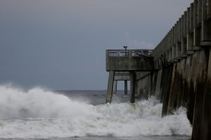
Waves crash along a pier as Hurricane Michael approaches Panama City Beach, Florida, U.S. October 9, 2018. REUTERS/Jonathan Bachman

Waves crash along a pier as Hurricane Michael approaches Panama City Beach, Florida, U.S. October 9, 2018. REUTERS/Jonathan Bachman

TOO LATE TO LEAVE

Governor Rick Scott said on Twitter on Wednesday morning that it was too late to evacuate the target zone and that people who had stayed should immediately seek refuge.

Hurricane center Director Ken Graham said on Facebook that Michael would be the worst storm in recorded history to hit the Panhandle.

“Going back through records to 1851 we can’t find another Cat 4 in this area, so this is unfortunately a historical and incredibly dangerous and life-threatening situation,” he said.

Nearly 40 percent of daily crude oil production and more than one-third of natural gas output was lost from offshore U.S. Gulf of Mexico wells on Wednesday because of platform evacuations and shut-ins caused by Michael.

The hurricane was about 60 miles (95 km) south-southwest of Panama City, Florida, and moving north-northeast at 14 mph (22 kph), the hurricane center said in its 11 a.m. ET advisory.

Apalachicola Mayor Van Johnson said his city, which could suffer some of the worst of the storm surge, was under mandatory evacuation orders.

“My greatest concern is that some people are just now starting to take this storm seriously and are evacuating,” he told CNN. “And I just hope the others that have not made that decision get out while the roads are still passable and before the bridges close.”

President Donald Trump declared a state of emergency for the entire state of Florida, freeing up federal assistance to supplement state and local disaster responses.

POWER CUTS START

Authorities warned of coming disruptions for those in Michael’s path. About 10,000 customers were already without power around midday.

The region should brace for “major infrastructure damage,” specifically to electricity distribution, wastewater treatment systems and transportation networks, Jeff Byard, associate administrator for the Federal Emergency Management Agency, told reporters on a conference call.

Many state offices, schools and universities in the area have been closed since Tuesday.

Helen Neal, 88, and her husband, J.W. Neal, 87, preferred to take their chances in a hotel rather than in their two-story beachfront house about a mile away in Panama City.

“We just finished renovating and updating,” she said. “We’re kind of nervous. God willing we’ll still have some place.”

About 2,500 National Guard troops were deployed to assist with evacuations and storm preparations, and more than 4,000 others were on standby. Some 17,000 utility restoration workers were also on call.

NHC Director Graham said Michael represented a “textbook case” of a hurricane system growing stronger as it drew near shore, in contrast to Hurricane Florence, which struck North Carolina last month after weakening in a slow, halting approach.

He said the storm would still have hurricane-force winds as it pushed through Florida into Georgia and tropical storm-force winds when it reaches the Carolinas, which are still reeling from post-Florence flooding. Up to a foot (30 cm) of rainfall was forecast for some areas.

Scott, a Republican running for the U.S. Senate in November’s congressional elections, declared a state of emergency in 35 Florida counties.

Georgia Governor Nathan Deal declared a state of emergency on Tuesday for 92 counties in his state and a state of emergency also was announced in North Carolina.

The last major hurricane, a storm of Category 3 or above, to hit the Panhandle was Dennis in 2005, according to hurricane center data.

(Reporting by Devika Krishna Kumar in Tallahassee, Florida; additional reporting by Rod Nickel in Panama City, Florida, Susan Heavey and Roberta Rampton in Washington, Gina Cherelus and Barbara Goldberg in New York, Brendan O’Brien in Milwaukee, Liz Hampton in Houston, Andrew Hay in New Mexico; Writing by Lisa Shumaker and Bill Trott; Editing by Frances Kerry)

Hundreds flee Australian bushfires that kill cattle, destroy homes

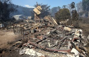
Smoke rises from a destroyed home after a bushfire swept through the town of Tathra, located on the south-east coast of New South Wales in Australia, March 19, 2018. AAP/Dean Lewins/via REUTERS

SYDNEY (Reuters) – Australian authorities urged people to remain alert on Monday as bushfires that have destroyed dozens of homes, killed cattle and forced hundreds of residents to flee continued to burn out of control in the southeast of the country.

No deaths or serious injuries were reported on Monday but the bushfires have caused extensive damage in rural areas of Victoria and New South Wales (NSW), Australia’s two most populous states. More than 100 houses were damaged or destroyed, authorities said.

“At this stage (there have been) no lives lost,” Prime Minister Malcolm Turnbull said at a news conference in the small NSW coastal town of Tathra.

“It is just a great credit to the firefighters, to the volunteers, the emergency workers – all of the community has pulled together and provided such great support,” he said.

The fires, believed to have been sparked by lightning on Saturday, were fanned by dry, hot winds as temperatures reached 41 degrees Celsius (106 Fahrenheit) on Sunday.

Emergency officials said conditions should ease later on Monday but “watch and act” warnings remained in place for five locations.

A house thats has been destroyed by a bushfire can be seen near the town of Cobden, located south west of Melbourne in Australia, March 18, 2018. AAP/David Crosling/via REUTERS

A house thats has been destroyed by a bushfire can be seen near the town of Cobden, located south west of Melbourne in Australia, March 18, 2018. AAP/David Crosling/via REUTERS

The fire also set off an argument among Australia’s politicians on whether climate change was a contributing factor to the blazes.

“You can’t attribute any particular event, whether it’s a flood or fire or a drought …to climate change. We are the land of droughts and flooding rains, we’re the land of bushfires,” Turnbull said.

Authorities said some 69 houses were destroyed and a further 39 were damaged and 30 caravans or cabins were also wiped out in Tathra, where residents fled to the beach on Sunday to avoid the flames as flying embers quickly carried the firefront forward.

About 700 residents were evacuated to centers set up at the nearby town of Bega and several schools in affected areas were closed on Monday.

NSW Rural Fire Service Deputy Commissioner Rob Rogers earlier told the Australian Broadcasting Corporation that five of 22 fires had not yet been contained.

“There’s still a lot of fire around the landscape,” he said, warning that it would still be several days before they were extinguished.

About 280 firefighters were battling the blazes, while 22,000 homes were without power in the region after high winds brought down trees, Emergency Management Commissioner Craig Lapsley said late on Sunday.

Bushfires are a common and deadly threat in Australia’s hot, dry summers, fueled by highly flammable eucalyptus trees.

In January, hundreds of holidaymakers had to be evacuated by boat from the beaches of the Royal National Park south of Sydney when they became trapped by bushfires.

The 2009 Black Saturday bushfires in Victoria killed 173 people and injured more than 400.

(Reporting by Jane Wardell and Tom Westbrook in SYDNEY; Additional reporting by Melanie Burton in MELBOURNE; Editing by Susan Fenton and Paul Tait)

Three still missing in California’s deadly mudslides

Rescue workers scour through cars for missing persons after a mudslide in Montecito, California, U.S. January 12, 2018. REUTERS/Kyle Grillot

(Reuters) – The number of people missing from last week’s deadly Southern California mudslides fell to three on Monday as hundreds of rescue workers searched for survivors from the rain-driven slides that killed 20 people.

A 53-year-old transient, John Keating, had been listed among the four still missing but was found safely in Ventura, California, with his dog, the Santa County Sheriff’s Office said in a statement.

Three people ages 2 to 28 are still listed as missing after sheriff’s detectives investigated more than 100 missing persons cases, the statement said.

Emergency officials said hopes were diminishing that they would pull more survivors from the ravaged landscape of hardened muck, boulders and twisted debris left behind by the Tuesday mudslides that scoured a landscape already barren from last year’s record-setting wildfires.

The mudslides that scoured the affluent community of Montecito, 85 miles (137 km) northwest of Los Angeles, caused the greatest loss of life from a California mudslide in at least 13 years.

A search and rescue dog is guided through properties after a mudslide in Montecito, California, U.S. January 12, 2018. REUTERS/ Kyle Grillot

A search and rescue dog is guided through properties after a mudslide in Montecito, California, U.S. January 12, 2018. REUTERS/ Kyle Grillot

Ten people perished in January 2005 when a hillside saturated by weeks of torrential rains collapsed in the seaside hamlet of La Conchita, 18 miles (29 km) southeast of Montecito, burying more than a dozen homes in seconds.

The White House on Monday said that President Donald Trump had been briefed on the situation.

“The President and First Lady extend their deepest sympathies to the families affected, their appreciation for the first responders saving lives, and their prayers for those who remain missing,” the White House said in a statement.

Another 900 emergency personnel arrived this weekend to join the relief effort conducted by more than 2,100 personnel from local, state and federal agencies.

The destruction covered 30 square miles (78 square km), leaving 65 single-family homes demolished and more than 450 damaged. Nearly 30 commercial properties were damaged or destroyed, officials said.

As a precaution against further slides, officials have ordered residents in most of the southeastern corner of Montecito to leave their homes for what was likely to be one or two weeks.

(Reporting by Scott Malone in Boston; Editing by Chizu Nomiyama and Lisa Shumaker)

People evacuated from Papua New Guinea island after volcano explodes

The remote island volcano of Kadovar spews ash into the sky in Papua New Guinea, January 6, 2018. SAMARITAN AVIATION/via REUTERS

By Alison Bevege

SYDNEY (Reuters) – About 1,500 people are being evacuated from an island off the northern coast of Papua New Guinea (PNG) after a nearby volcano erupted, the local Red Cross said on Sunday.

A volcano on the island of Kadovar, located about 24 km (15 miles) north of the Papuan mainland, began erupting on Jan. 5. That prompted the evacuation of 590 people on Kadovar to the nearby island of Blup Blup.

After venting ash for several days, the volcano exploded on Friday, blasting out glowing red rocks and sulphur dioxide, the Rabaul Volcanological Observatory said in a bulletin. The PNG government then decided to evacuate Blup Blup as well because of issues with supplying people on the island along with the danger from the eruption.

The evacuees are being moved to the mainland and the International Red Cross is providing about 87,000 kina ($26,274) in funding to help them, said PNG Red Cross Secretary General Uvenama Rova by telephone from the capital of Port Moresby.

“The people there, as the volcano erupted, they rushed immediately to escape. So they are in immediate need of food, water, shelter and clothing as well,” he said.

In the latest bulletin issued on Sunday, the Observatory said a dome of lava on Kadover was visible in the sea at the base of thick white steam clouds that are rising to 600 meters (1,969 feet) above sea level.

Australia’s Foreign Minister Julie Bishop announced on twitter that the Australian Government was contributing A$25,000 ($19,775) worth of humanitarian supplies for those affected.

There are no confirmed records of a previous eruption of Kadovar, said Chris Firth, a vulcanologist at Macquarie University, but scientists speculate it could have been one of two “burning islands” mentioned in the journals of a 17th-century English pirate and maritime adventurer, William Dampier.

(Reporting by Alison Bevege; Editing by Christian Schmollinger)

Philippines raises volcano alert level after lava flow

Mount Mayon erupts in Legazpi City, Philippines, January 13, 2018 in this still obtained from social media. Picture taken January 13, 2018.

By Enrico Dela Cruz

MANILA (Reuters) – The Philippines raised the alert level at its rumbling Mayon volcano to “level 3” on Sunday after detecting lava flow and indications of activity that could lead to eruptions of magma.

More than 900 families have been evacuated from villages near Mayon, a tourist attraction because of its near-perfect cone shape, following a “steam-driven eruption” on Saturday.

Authorities advised people to cover their noses and mouths with a damp, clean cloth or dust mask if they were exposed to ash from the eruptions, and said aircraft must avoid flying close to the volcano’s summit.[nL4N1P807T]

Two similar “phreatic” eruptions occurred at the volcano in central Albay province on Sunday, unleashing more ash.

“Mayon’s summit crater is now exhibiting bright crater glow that signifies the growth of a new lava dome and beginnings of lava flow towards the southern slopes,” the Philippine Institute of Volcanology and Seismology (Phivolcs) said.

Residents wait for a military truck as they flee home for safety after Mayon volcano erupted in Camalig town, Albay province, south of Manila, Philippines January 14, 2018.

Residents wait for a military truck as they flee home for safety after Mayon volcano erupted in Camalig town, Albay province, south of Manila, Philippines January 14, 2018. REUTERS/Rhadyz Barcia

Phivolcs chief Renato Solidum said the volcano appeared due for another major eruption as it has been displaying abnormal behaviour since late last year.

“Alert level 3 is what we considered critical, 4 is when eruption is imminent, and 5 is eruption in progress,” Cedric Daep, head of the Albay Provincial Disaster Risk Reduction and Management Office, said in a radio interview.

Mayon’s most destructive eruption was in February 1841, when lava buried a town and killed 1,200 people. It last erupted in 2014, spewing lava and forcing thousands of people to evacuate.

The latest eruptions began on Saturday, unleashing ash, rocks and sulphur fumes and accompanied by rumbling sounds.

Phivolcs had earlier raised the alert to “level 2”, saying the activity was “probably of magmatic origin, which could lead to more phreatic eruptions or eventually to hazardous magmatic eruptions.”

Since Saturday’s first eruption, Phivolcs said it had recorded 158 rockfall events and urged people to stay away from a 6-kilometre (3.7 mile) radius Permanent Danger Zone and a 7-km Expanded Danger Zone on the volcano’s southern flank.

Landslides and sudden explosions or a dome collapse that may generate hazardous volcanic flows are also possible, it said.

People within the slope of the volcano, but outside the danger zones, were told to take precautionary measures against possible roof collapses due to accumulated ash and rainwater, and “lahar”, an Indonesian term for a volcanic mudflow.

And the provincial government suspended Monday’s classes from kindergarten to senior high school in some areas.

(Reporting by Enrico dela Cruz; Additional reporting by Manuel Mogato; Editing by Simon Cameron-Moore and Alexander Smith)

Thousands in California flee homes ahead of possible mudslides

California wildfire fight aided by better weather

(Reuters) – Thousands of Southern Californians fled their homes on Monday as a powerful rain storm that could cause flash floods and trigger mudslides soaked steep slopes where a series of intense wildfires burned off vegetation last month.

Heavy downpours that could produce more than 1 inch (2.5 cm) of rain per hour were expected through Tuesday evening, forcing officials to order or advise Ventura, Santa Barbara and Los Angeles county residents who live near where wildfires burned to evacuated their homes.

“Recent burn areas will be especially vulnerable where dangerous mud and debris flows are possible,” the National Weather Service said in a statement.

Several December wildfires, included a blaze known as the Thomas Fire which was the largest in the state’s history, burned away vegetation that holds the soil in place and baked a waxy layer into the earth that prevents water from sinking deeply into the ground.

About 30,000 residents were under evacuation orders or advisories on Monday, ABC news reported.

“I’m just tired. I can’t seem to get my life kick-started,” Teri Lebow, whose Montecito, California was damaged by the wildfires, told the Los Angeles Times.

The storm system was expected to produce 4 inches to 7 inches (10 to 18 cm) in the foothills and mountains with 9 inches (23 cm) in isolated areas. Three inches (7 cm) to two feet (61 cm) of snow was also forecast for higher elevations, the National Weather Service said.

(Reporting by Brendan O’Brien in Milwaukee; Editing by Robin Pomeroy)

London tower blocks evacuated as 27 buildings fail fire tests

Residents are evacuated from the Taplow Tower residential block as a precautionary measure following concerns over the type of cladding used on the outside of the building on the Chalcots Estate in north London, Britain, June 23, 2017. REUTERS/Hannah McKay

By Kate Holton and Jamillah Knowles

LONDON (Reuters) – Britain said 27 high-rise apartment blocks had failed fire safety checks carried out after the deadly Grenfell Tower blaze, including several in north London where residents were forced to evacuate amid chaotic scenes late on Friday.

British officials have conducted tests on some 600 high-rise buildings across England after fire ravaged the Grenfell social tower block in west London on June 14, killing at least 79 people in the capital’s most deadly blaze since World War Two.

The Department for Communities said 27 apartment blocks had failed tests, from London in the southeast to Manchester in the north and Plymouth on the southwest coast.

Prime Minister Theresa May, who was forced to apologize for the government’s initial slow response to the tragedy, said the authorities were now racing to establish what needed to be done.

“In some cases it’s possible to take mitigating action,” she told Sky news. “In others it’s been necessary for people to move out on a temporary basis and that is what happened in Camden last night.”

Some 4,000 residents of the Chalcots Estate in Camden, north London, were told to vacate their apartments on Friday after the Fire Brigade ruled that their tower blocks were unsafe.

Emerging into the streets on a hot night, residents clutched children, pets and small amounts of clothing and food to try to find a bed in a local hotel or with family or friends. Many were directed to inflatable beds laid out on the floor of the local sports hall.

“I know it’s difficult but Grenfell changes everything,” Georgia Gould, Leader of Camden Council, said in a statement. “I don’t believe we can take any risks with our residents’ safety.”

May said the local authority would be given all the means necessary to make sure people had somewhere to stay.

Residents complained of first hearing about the evacuation from the media and getting very short notice to leave from city officials going door-to-door. Not all residents agreed to go, as they felt the evacuation was an over-reaction.

PUBLIC ANGER

“It was farcical communication,” 21-year-old Daniel Tackaberry told Reuters outside a nearby sports center where the local council had laid out air beds. “You don’t get everyone to leave this quickly.”

Several local councils said they were removing cladding from the facades of buildings that had failed the tests. In Camden, however, the London Fire Brigade found a number of faults, including concern about cladding, faulty fire doors and holes in compartment walls that could help a fire to spread.

Gould, the Camden council’s leader, Gould, said it would take up to four weeks to repair the blocks that were evacuated. and that around 4,000 residents were affected.

Police investigating the cause of the 24-storey Grenfell Tower blaze have said the fire started in a fridge but spread rapidly due to the use of external cladding on the building, trapping residents in their beds as they slept.

The cladding has since failed all safety checks and prompted a nationwide review of the materials used on everything from hospitals to hotels and apartment blocks.

The fire has become a flashpoint for public anger at the record of May’s Conservative Party in government following austerity-driven cuts to local authority budgets. Grenfell Tower is located in Kensington, one of the richest boroughs in Europe.

Battling to save her position after losing her majority in a June 8 election, May has promised to do everything she can to protect those residents who survived the fire and to improve the quality and safety of public housing in Britain.

British police have said they are considering bringing manslaughter charges over the Grenfell fire.

(Reporting by Kate Holton; Editing by Mark Heinrich)

Workers at Washington nuclear waste plant take cover after tunnel collapse

The Purex (Plutonium Uranium Extraction Plant) separations facility at the Hanford Works is seen in an undated aerial photo. The building has been vacant for nearly twenty years but remains highly contaminated, according to the Department of Energy. DOE/Handout via REUTERS

By Tom James

SEATTLE (Reuters) – A tunnel partly collapsed on Tuesday at a plutonium handling facility at the Hanford Nuclear Reservation in Washington state, leading authorities to evacuate some workers and instruct others to take cover, federal officials said.

Workers took cover and turned off ventilation systems after minor damage was discovered in the wall of a transport tunnel, a spokeswoman for the Department of Energy said by telephone from the Hanford Joint Information Center.

The damage was more serious than initially reported, and the take-cover order was expanded to cover the entire facility after response crews found a 400-square-foot section of the decommissioned rail tunnel had collapsed, she said.

“The tunnel itself was breached. There was a 20-foot wide hole,” the spokeswoman said.

No spent nuclear fuel is stored in the tunnel, and no further evacuations have been ordered for workers, nor have any warnings for civilians around the site been issued, she said.

She declined to identify herself, citing agency policy.

The site is in southeastern Washington on the Columbia River, about 170 miles (270 km) east of Seattle. Operated by the federal government, it was established in the 1940s and manufactured plutonium that was used in the first nuclear bomb as well as other nuclear weapons. It is now being dismantled and cleaned up by the Energy Department.

“This is a potentially serious event,” said Edwin Lyman, a senior scientist at the Union of Concerned Scientists. “I can see why the site ordered emergency measures. Collapse of the earth covering the tunnels could lead to a considerable radiological release.”

Lyman pointed to a description of the storage tunnels from a report from the Consortium For Risk Evaluation with Stakeholder Participation in 2015 about the Hanford site, saying there is quite a lot of cesium-137 and plutonium in those tunnels. Those are radioactive materials that can cause radiation sickness and death depending on the amount and length of exposure.

Mostly decommissioned, Hanford has been a subject of controversy and conflict between state and local authorities, including a lawsuit over worker safety and ongoing cleanup delays. The site has been described in media reports as the most contaminated nuclear site in the United States.

The evacuation did not affect the nearby nuclear power plant operated by Energy Northwest, company spokesman John Dobken said. The Columbia nuclear plant was located about 12 miles southeast of where the incident at Hanford occurred, he said.

(Reporting by Tom James in Seattle; Additional reporting by Scott DiSavino in New York; Editing by Cynthia Osterman and Lisa Shumaker)

Rain threatens U.S. Midwest as flooding force hundreds from homes

Long Creek Bridge on 86 highway, flooding Photo By Austin Metcalf

(Reuters) – Unrelenting rain will drench the already saturated U.S. Midwest on Thursday and Friday, forecasters said, after floods in the region killed at least five people and forced residents in vulnerable areas to evacuate their flooded communities.

Parts of Missouri, Illinois, Arkansas, Indiana and Oklahoma could see as much as an additional 4 inches (10 cm) of rain as a slow-moving system is expected to hover over the region for at least one more day, the National Weather Service said in flood warnings and watches.

“The flooding in the middle part of the county has been unbelievable over the last couple of days … and we have more rain on the way, if you can believe that,” Weather.com meteorologist Ari Sarsalari said during his forecast on Wednesday night.

The National Weather Service issued flash flood warnings and watches along waterways from eastern Texas north through Indiana and into northwestern Ohio as forecasters expected most of the rivers across the U.S. Midwest to crest over the weekend.

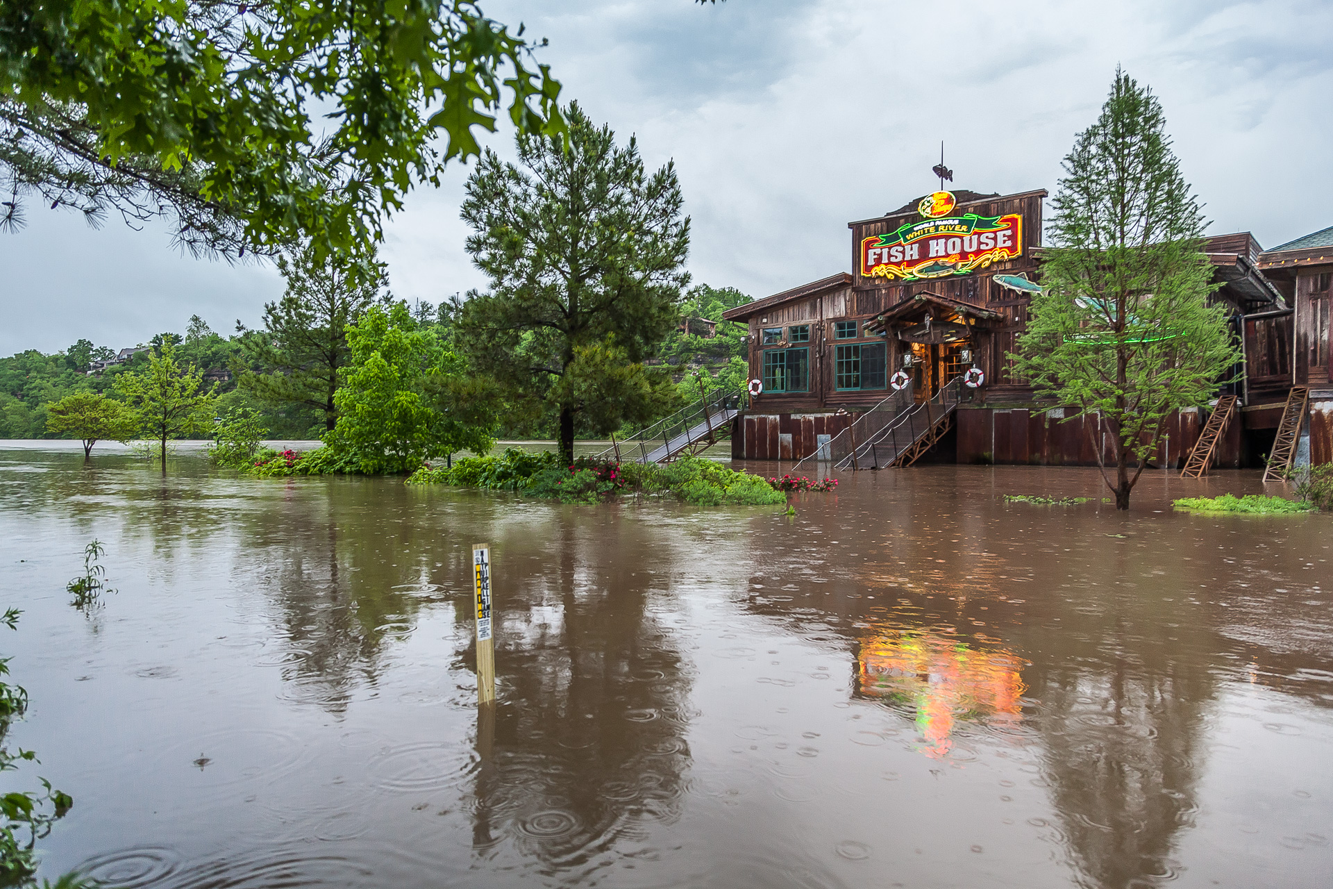
Branson Landing in Branson, Missouri. Photo by Austin Metcalf

Branson Landing in Branson, Missouri.
Photo by Austin Metcalf

The rain comes after five people were killed in flooding in Missouri, the last two of them swept from their cars on Monday and Tuesday, after a storm dumped almost 12 inches (30 cm) of rain in the region over the weekend, the National Weather Service said.

Schools throughout the Midwest canceled classes on Thursday as dozens of roadways and parts of interstate highways remained under water. Amtrak also suspended service in Missouri until at least Saturday, it said in a statement.

The heavy rains have caused levees to fail or to be breached along the Missouri, Mississippi and Ohio rivers and their tributaries over the last few days.

Hundreds of people in places like Eureka, Missouri and Pocahontas, Arkansas have heeded evacuation orders and advisories after building walls of sandbags to protect their homes and businesses from the rising waters.

(Reporting by Brendan O’Brien in Milwaukee; Editing by Toby Chopra)

U.N. aborts plan to evacuate patients from Aleppo – Blames ALL parties

A Civil Defence member stands as a front loader removes debris after an air strike Sunday in the rebel-held besieged al-Qaterji neighbourhood of Aleppo, Syria.

BEIRUT (Reuters) – The United Nations has abandoned plans to evacuate patients from besieged rebel-held east Aleppo which it had hoped to accomplish during a three day lull in fighting last week, blaming all parties to the conflict for obstructing efforts.

“The evacuations were obstructed by various factors, including delays in receiving the necessary approvals from local authorities in eastern Aleppo, conditions placed by non-state armed groups and the government of Syria’s objection to allowing medical and other relief supplies into the eastern part of the city,” U.N. Under-Secretary-General for humanitarian affairs and emergency relief coordinator Stephen O’Brien said in a statement on Monday.

O’Brien said no patients and family members were evacuated during the three-day Russian unilateral ceasefire last week which ended on Saturday with a resumption of air strikes and a surge in ground fighting.

“I am outraged that the fate of vulnerable civilians – sick and injured people, children and the elderly, all in need of critical and life-saving support – rests mercilessly in the hands of parties who have consistently and unashamedly failed to put them above narrow political and military interests,” he said.

The U.N. has been unable to access east Aleppo since July, when Syrian government and allied forces put the eastern part of the city under siege.

(Reporting by Lisa Barrington Editing by Jeremy Gaunt)