Hurricane Michael, among strongest in U.S. history, slams Florida Panhandle

Waves crash on stilt houses along the shore due to Hurricane Michael at Alligator Point in Franklin County, Florida, U.S., October 10, 2018. REUTERS/Steve Nesius

By Rod Nickel

PANAMA CITY, Fla. (Reuters) – Hurricane Michael, the fiercest storm to hit Florida in a quarter century and the third-most powerful ever to strike the U.S. mainland, roared into the state’s Gulf coast on Wednesday with tree-snapping winds and towering waves.

Michael, whose rapid intensification as it churned north over the Gulf of Mexico caught many by surprise, made landfall early in the afternoon near Mexico Beach, about 20 miles (32 km) southeast of Panama City in Florida’s Panhandle region, with top sustained winds reaching 155 miles per hour (249 kph).

The storm came ashore as a Category 4 hurricane on the five-step Saffir-Simpson wind scale. Its sustained winds were just 2 mph (3.2 kph) shy of an extremely rare Category 5.

As predicted, the storm was downgraded hours later to a still-formidable Category 3 with maximum sustained winds of 125 mph (205 kph) and higher gusts as it pushed inland to the Alabama-Georgia border.

Causing major disruptions to oil and gas production in the Gulf even before its arrival, the storm was forecast to unleash waves as high as 14 feet (4.3 meters) above normal sea levels in some areas, the National Hurricane Center said.

“My God, it’s scary. I didn’t expect all this,” said Bill Manning, 63, a grocery clerk who fled his camper van in Panama City for safer quarters in a hotel, only to see the electricity there go out. “Panama City, I don’t know if there will be much left.”

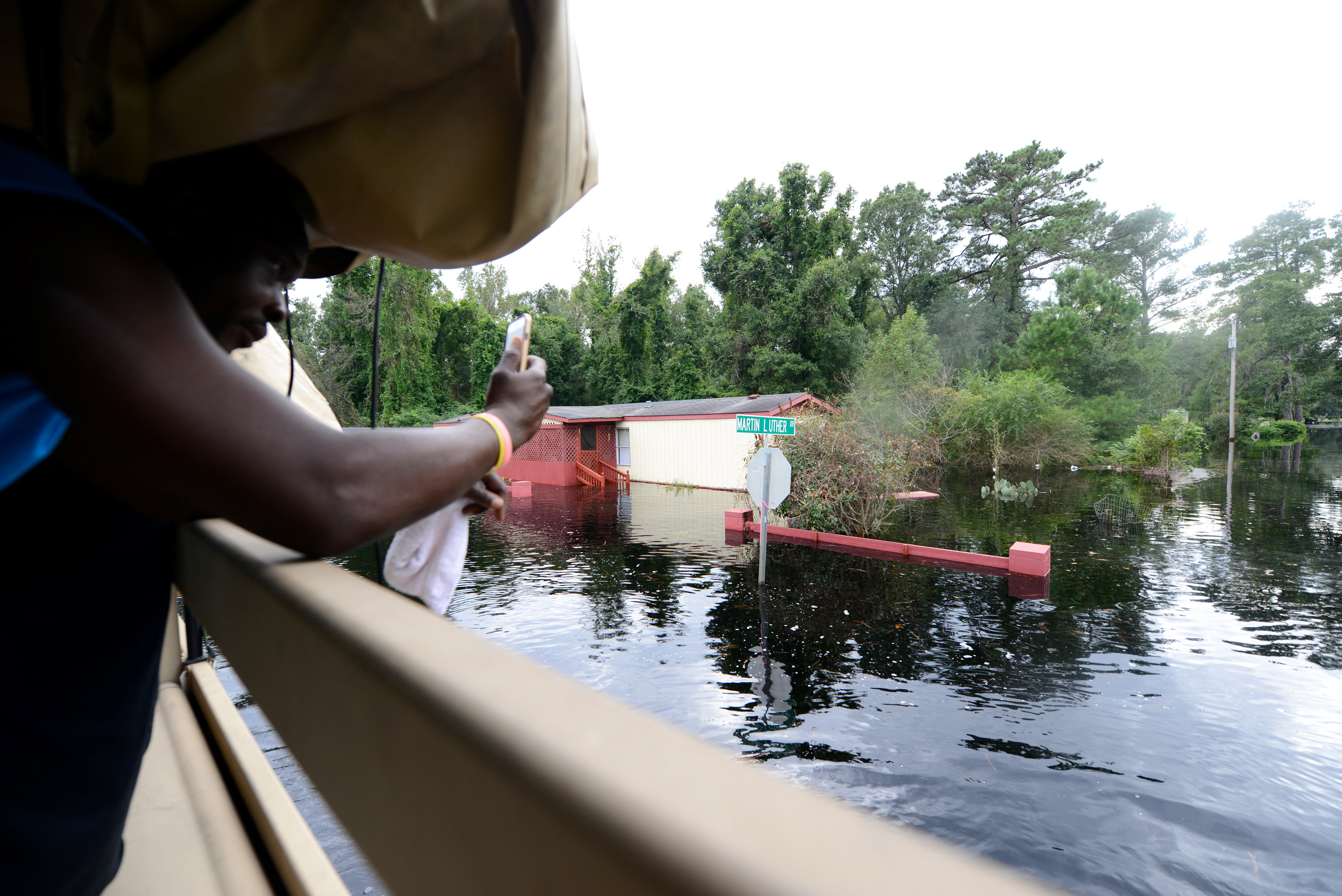
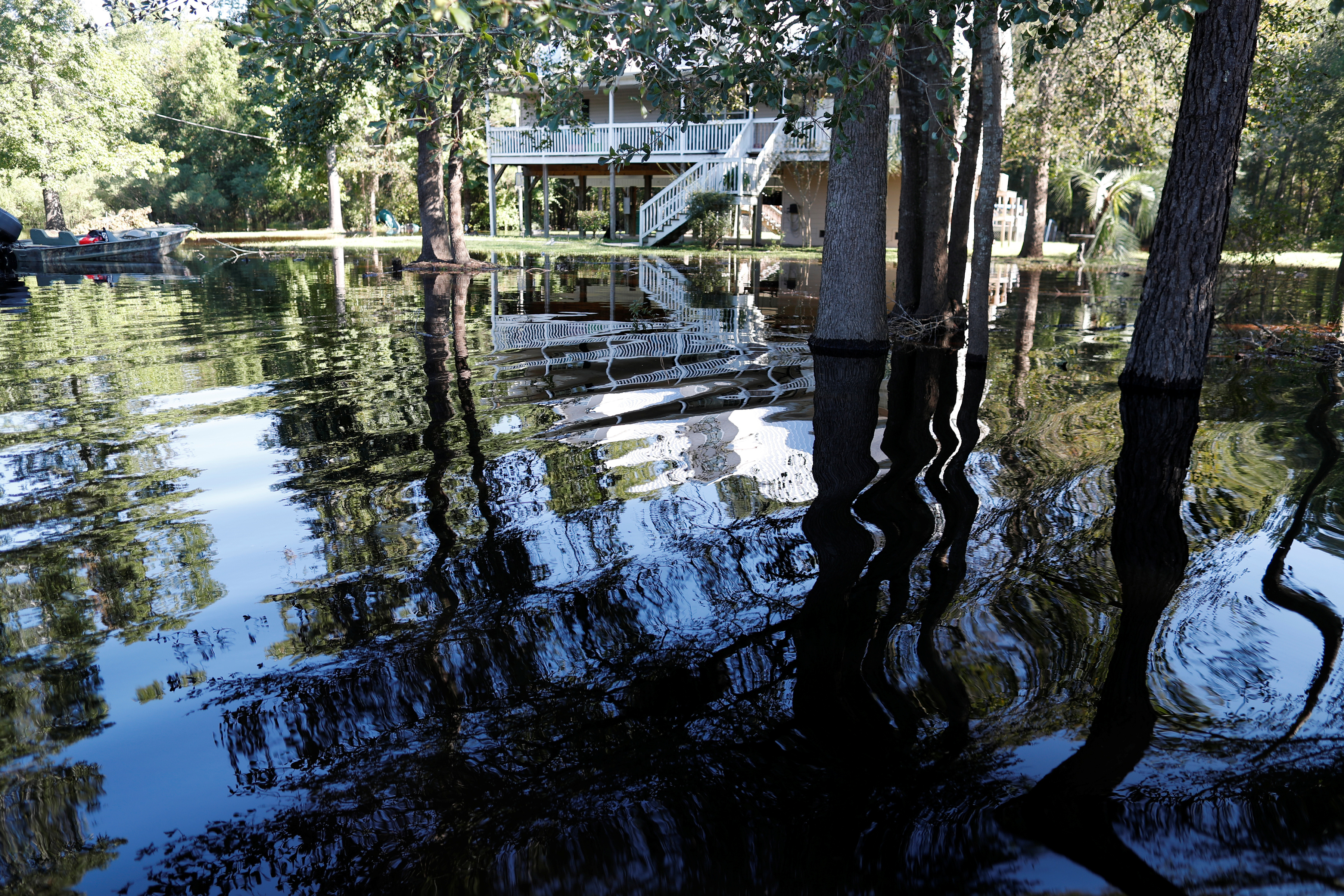
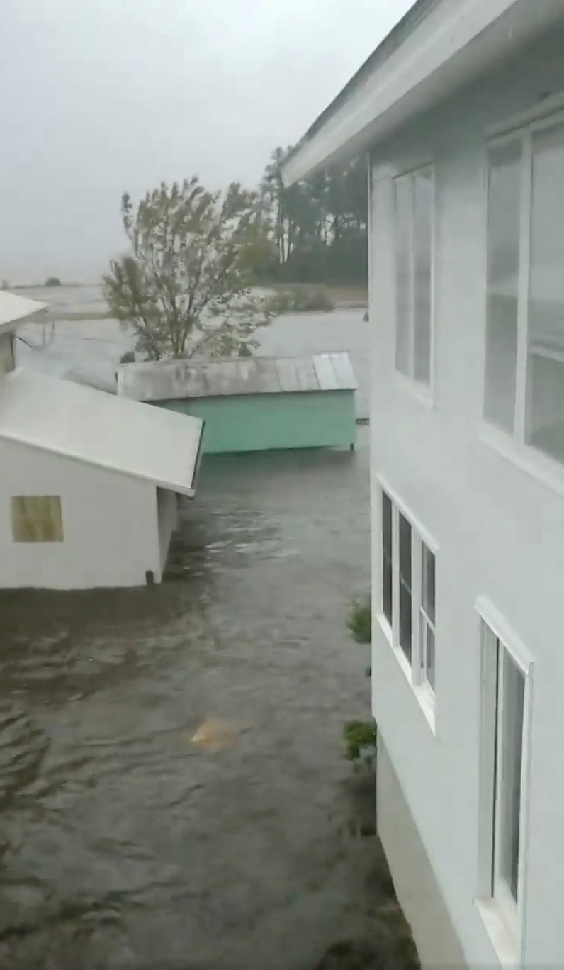
Only a couple of hours after Michael came ashore, floodwaters were more than 7-1/2 feet (2.3 meters) deep near Apalachicola on Florida’s Panhandle, National Hurricane Center Director Ken Graham said.

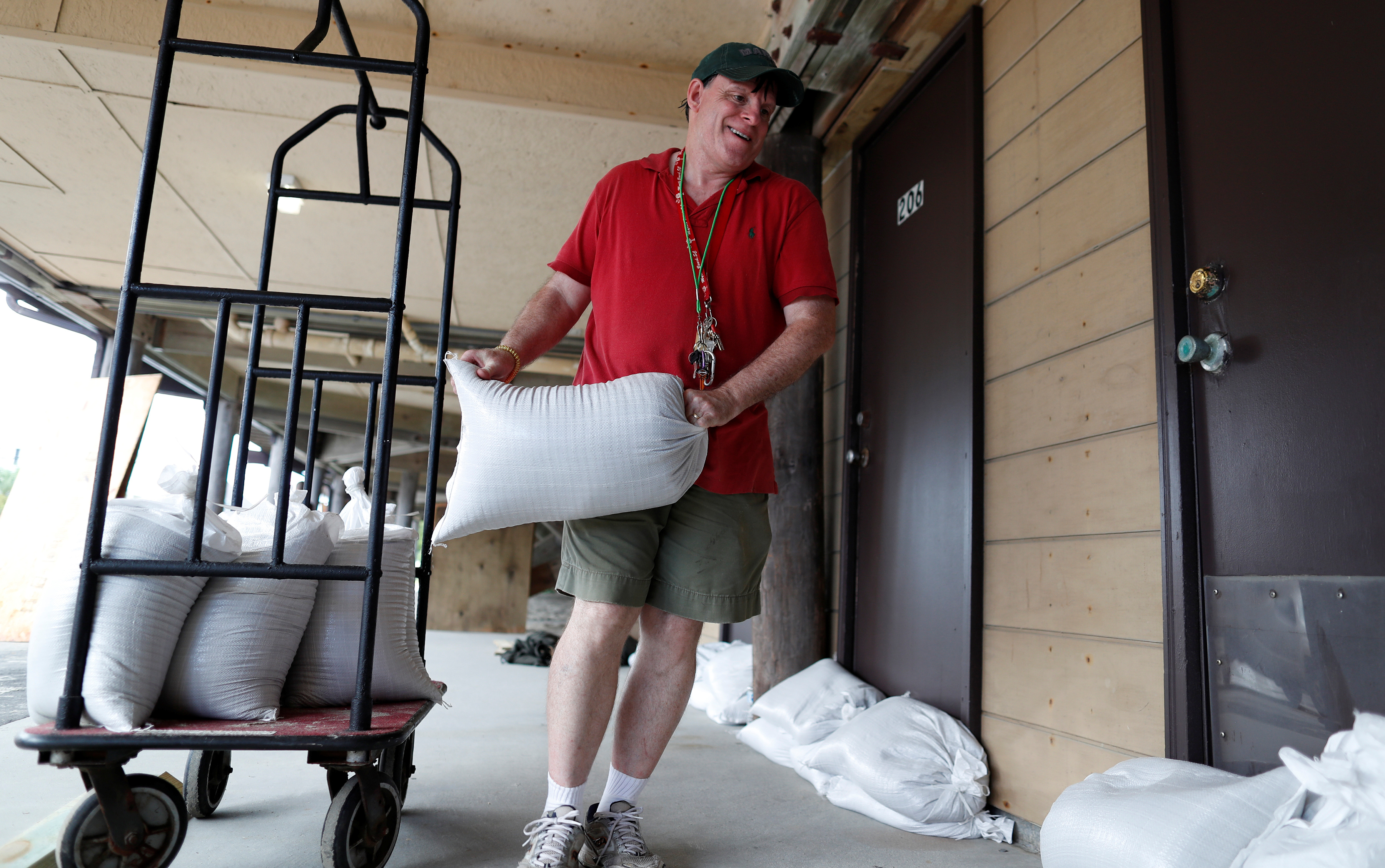
Authorities had urged coastal residents in 20 Florida counties along a 200-mile (320-km) stretch of shoreline to head to higher ground before the storm, but anyone who had not fled by Wednesday morning was told it was too late to evacuate.

An estimated 6,000 evacuees took cover in emergency shelters, most of them in Florida, and that number was expected to swell to 20,000 across five states by week’s end, said Brad Kieserman of the American Red Cross.

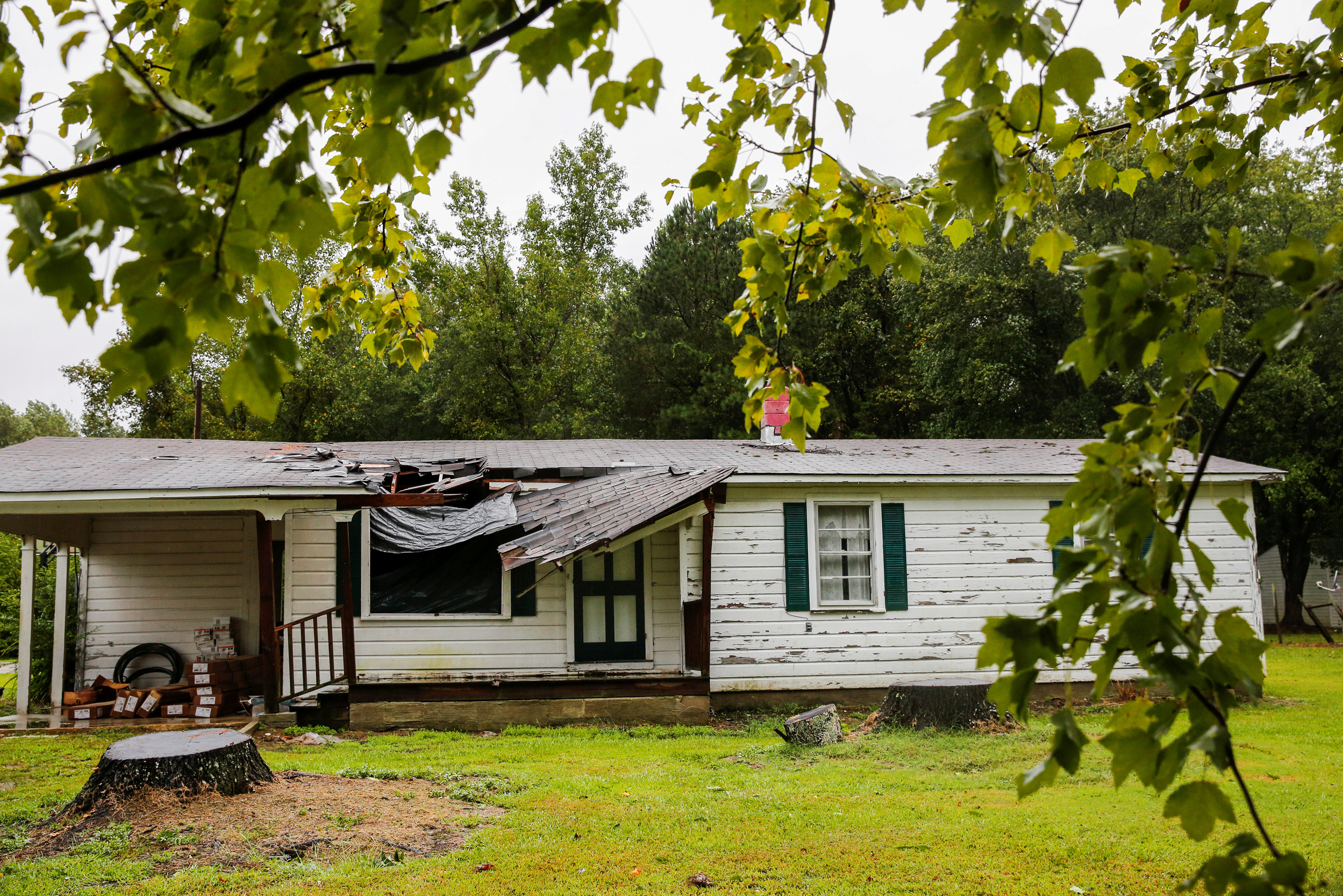
Even before Michael made full landfall, it was whipping trees with its winds and flooding the town of Port St. Joe.

“It feels like you don’t know when the next tree is going to fall on top of you because its blowing so ferociously,” said Port St. Joe Mayor Bo Patterson. “It’s very, very scary. We have trees being uprooted, heavy, heavy rain.”

Palm trees are seen during a Hurricane Michael in Panama City, Florida, U.S., October 10, 2018 in this picture obtained from social media. WeatherNation/via REUTERS

Palm trees are seen during a Hurricane Michael in Panama City, Florida, U.S., October 10, 2018 in this picture obtained from social media. WeatherNation/via REUTERS

‘JAW-DROPPING’ STRENGTH

Patterson said about 2,500 of the town’s 3,500 people had stayed put, including about 100 in a beachside area who ignored a mandatory evacuation order. “This happened so quickly, we weren’t exactly prepared,” he said.

Brock Long, head of the Federal Emergency Management Agency (FEMA), said early evacuation efforts in the area were slow.

Michael grew from a tropical storm into a Category 4 hurricane over the course of about 40 hours.

“Satellite images of Michael’s evolution on Tuesday night were, in a word, jaw-dropping,” wrote Bob Henson, a meteorologist with weather site Weather Underground.

With minimum barometric pressure recorded at 919 millibars, a measure of hurricane strength, Michael stood as the strongest storm ever to hit Florida’s Panhandle and the most intense anywhere in the state since Hurricane Andrew in 1992.

Michael also ranked as the third-most powerful storm on record to make landfall in the continental United States, after Hurricane Camille on the Mississippi Gulf Coast in 1969 and the so-called Labor Day hurricane of 1935 in the Florida Keys.

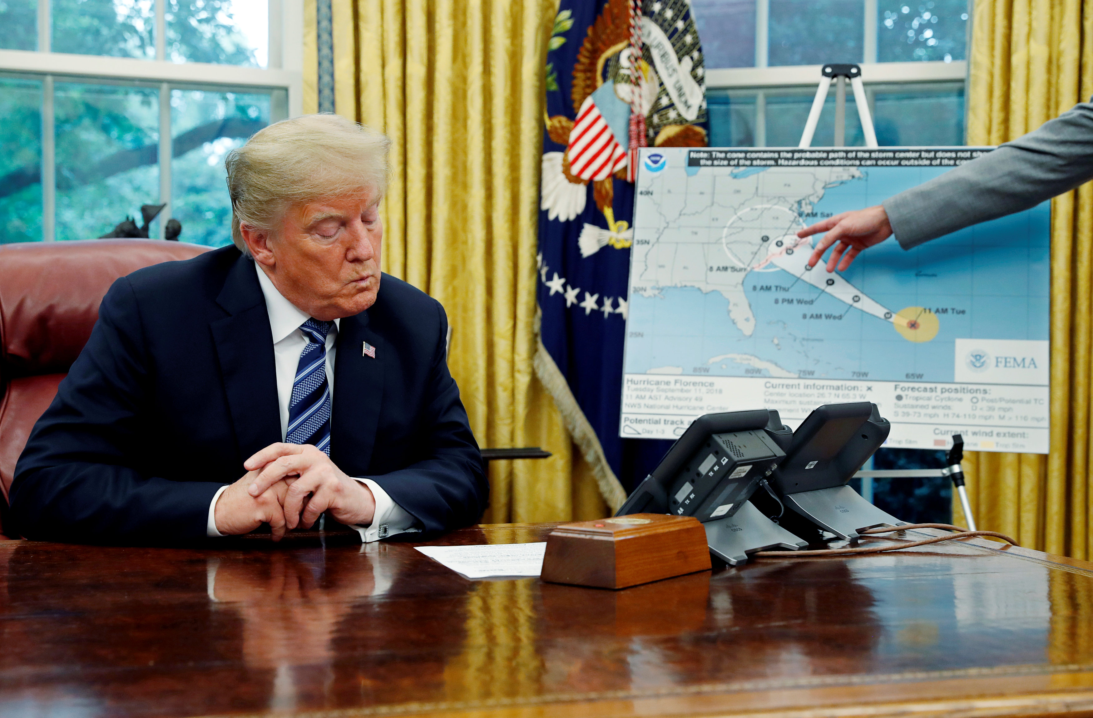
President Donald Trump declared a state of emergency for the entire state of Florida, freeing up federal assistance to supplement state and local disaster responses. He was briefed by FEMA’s Long in the Oval Office on preparations.

At mid-afternoon, about 192,000 homes and business customers were already without power in Florida alone, with more outages reported in Georgia and Alabama, utility companies said.

Michael was forecast to move across southeastern Alabama and southwestern Georgia on Wednesday night.

Helen Neal, 88, and her husband, J.W. Neal, 87, preferred to take their chances in a hotel rather than stay in their two-story Panama City Beach beachfront house about a mile away.

“We just finished renovating and updating,” she said. “We’re kind of nervous. God willing, we’ll still have some place.”

About 3,500 Florida National Guard troops were deployed to assist with evacuations and storm recovery, along with more than 1,000 search-and-rescue personnel, Governor Rick Scott said.

NHC’s Graham warned that the storm would continue to pack tropical storm-force winds when it reached the Carolinas, still reeling from severe flooding in the aftermath of Hurricane Florence last month. Up to a foot (30 cm) of rainfall was forecast for some areas from Michael.

Scott declared a state of emergency in 35 Florida counties. Georgia Governor Nathan Deal declared an emergency for 92 counties in his state, and a state of emergency also was announced in North Carolina.

(Reporting by Devika Krishna Kumar in Tallahassee, Florida; Additional reporting by Rod Nickel in Panama City, Florida, Susan Heavey, Steve Holland and Roberta Rampton in Washington, Gina Cherelus and Barbara Goldberg in New York, Brendan O’Brien in Milwaukee, Liz Hampton in Houston, Andrew Hay in New MexicoWriting by Lisa Shumaker and Bill Trott; Editing by Bill Berkrot and Cynthia Osterman)

En route to Florida, ‘monster’ Hurricane Michael strengthens

Hurricane Michael in a satellite image taken Tuesday. NOAA/via REUTERS

By Devika Krishna Kumar

TALLAHASSEE, Fla. (Reuters) – U.S. authorities ordered tens of thousands of people to heed warnings of life-threatening coastal floods, wind and rain and get out of harm’s way as Hurricane Michael churned over the Gulf of Mexico toward the Florida Panhandle on Tuesday.

Residents and tourists were told to evacuate coastal areas in at least 20 counties in Florida. The Category 2 storm, which has already disrupted oil production in the Gulf of Mexico, strengthened as it headed north, carrying winds of 110 miles per hour (175 km per hour).

It was forecast to become a Category 3 storm on the five-step Saffir-Simpson scale before coming ashore on Wednesday over the Florida Panhandle or the Big Bend area in the northwest of the state, the National Hurricane Center (NHC) said. At that strength, it would rank as the most powerful storm to strike the Panhandle in more than a decade.

“Hurricane Michael is a monster storm and it keeps getting more dangerous,” Florida Governor Rick Scott told a news conference on Tuesday. “The time to prepare is now.”

The Republican governor, who is campaigning for a U.S. Senate seat in the November congressional elections, warned of the potential for a deadly storm surge that could be as much as 12 feet (3.7 meters) over normal sea water levels.

People in areas that could be affected should take no chances against such a powerful surge, Scott said, adding, “No one’s going to survive,” such a wall of water.

As Michael moved over open water, energy companies halted nearly one-fifth of Gulf of Mexico oil production and evacuated personnel from 10 platforms on Monday.

The Gulf of Mexico produces 17 percent of daily U.S. crude oil output and 5 percent of daily natural gas output, according to the U.S. Energy Information Administration. The partial shutdown ahead of Michael helped push oil prices slightly higher on Tuesday.

Scott declared a state of emergency in 35 counties along the Panhandle and Florida’s Big Bend regions, mostly rural areas known for small tourist cities, beaches and wildlife reserves, as well as the state capital, Tallahassee.

A hurricane warning was in effect for a more than 300-mile (480-km) stretch of coastline from the Florida-Alabama border to the Suwannee River in Florida.

The Federal Emergency Management Agency had numerous teams deployed and ready to respond, said FEMA spokesman Jeff Byard. About 1,250 National Guard soldiers were assisting and more than 4,000 troops were on standby.

President Donald Trump, speaking to reporters at the White House, said the country was very well prepared for the hurricane, adding it was much bigger than had been expected.

Alexander Charnicharo fishes at the seafront in Havana as Hurricane Michael passes by western Cuba on October 8, 2018. REUTERS/Alexandre Meneghini

Alexander Charnicharo fishes at the seafront in Havana as Hurricane Michael passes by western Cuba on October 8, 2018. REUTERS/Alexandre Meneghini

CLOSURES AND LINES FOR GAS

State offices, schools and universities were closed through the end of the week in Panhandle counties. Lines at gasoline stations grew as people left. Those who stayed emptied grocery store shelves of water and other supplies.

Regus, an international office provider, offered temporary space for rent in Birmingham, Alabama, for businesses evacuating neighboring Florida.

“If you’re evacuating #HurricaneMichael and need a place to work, come visit a business lounge at any of our 5 locations in Birmingham! #evacuate #HurricanePrep #Michael,” the company wrote on Twitter.

The last major hurricane – Category 3 or above – to hit the Panhandle was Hurricane Dennis, which made landfall near Pensacola in 2005, according to hurricane center data.

Torrential downpours and flash flooding caused by the storm over the weekend caused 13 deaths in Central America.

At 11 a.m. ET (1500 GMT) on Tuesday, Michael’s center was about 335 miles (535 km) south-southwest of Apalachicola, Florida, heading north at around 12 mph (19 kph), the NHC said.

On its current track, it would make landfall somewhere along a coastline that includes the cities and towns of Fort Walton Beach, Panama City Beach, Port St. Joe, St. Teresa and the wildlife reserves bordering Apalachee Bay. However, forecasters always note it is not possible to predict where a hurricane will land until it is closer to the coast.

The storm was forecast to move through the southeastern United States on Wednesday and Thursday, passing through the Carolinas, which are still recovering from Hurricane Florence last month. It would head off the Mid-Atlantic coast by Friday, the NHC said.

The Miami-based center forecast as much as 1 foot (30 cm) of rain in parts of Florida, Georgia and South Carolina.

(Reporting by Devika Krishna Kumar; Additional reporting by Susan Heavey and Roberta Rampton in Washington, Gina Cherelus and Barbara Goldberg in New York, Brendan O’Brien in Milwaukee; Editing by Lisa Shumaker and Frances Kerry)

Evacuations ordered as Hurricane Michael speeds toward Florida

A satellite image of Tropical Storm Michael taken Monday. NOAA/via REUTERS

By Gina Cherelus

(Reuters) – Florida’s governor mobilized National Guard troops and ordered Gulf Coast residents to head inland or get ready to evacuate as Hurricane Michael churned toward shore on Monday, with the storm forecast to strengthen rapidly before making landfall on Wednesday.

Michael was expected to strengthen to a major Category 3 storm by Tuesday with winds over 100 miles per hour (160 km per hour), making it one of the most powerful storms to hit the Panhandle of Florida in decades, state officials said.

The storm was expected to bring up to 12 inches (30 cm) of rain with storm surges up to 12 feet (3.7 meters), according to the U.S. National Hurricane Center (NHC). Michael was currently a Category 1 hurricane, at the bottom of the five-step Saffir-Simpson scale.

A man pulls a boat as Tropical Storm Michael approaches in Cancun, Mexico, October 7, 2018. REUTERS/Israel Leal

A man pulls a boat as Tropical Storm Michael approaches in Cancun, Mexico, October 7, 2018. REUTERS/Israel Leal

Florida Governor Rick Scott declared a state of emergency in more than 20 counties along the Florida Panhandle and Big Bend. Scott advised Gulf Coast residents to prepare for possible evacuation orders, and he put more than 5,000 National Guard soldiers on alert.

“We are running out of time. TODAY is the day to get a plan because tomorrow could be too late. It is critical that you take care of yourself, your family, and your business as Hurricane Michael approaches FL,” Scott wrote on Twitter on Monday.

Michael battered parts of Mexico and Cuba with powerful winds and drenching rains on Sunday and into early Monday.

Tallahassee Mayor Andrew Gillum, who is also the Democratic gubernatorial candidate in the Nov. 6 election, said on Sunday he was canceling his campaign events and returning to Tallahassee, the state capital, to focus on storm preparations.

Florida State University said its campuses in Tallahassee and Panama City will be closed from Tuesday through Friday. All schools in Panama City and surrounding Bay County will be closed on Tuesday and Wednesday. Leon County officials in Tallahassee were closing all schools from Tuesday through Friday.

Mandatory evacuation orders were issued on Monday for residents in various areas in Florida’s Gulf and Bay counties, according to a statement from county emergency officials. Mandatory evacuations were issued for all non-residents in Franklin County, home to various tourist attractions like St. George Island.

Alabama Governor Kay Ivey declared a statewide emergency on Monday ahead of the storm.

Jeff Hanson, the owner of Paisley Cafe in Tallahassee, said he was waiting until Wednesday morning to decide whether he would close the restaurant.

“It depends on what the city says in terms of the people getting around. That’s our biggest concern, if our staff is safe,” Hanson said by telephone.

OIL PRODUCTION

After hitting Florida, the storm is forecast to move northeast on Wednesday and Thursday along the Atlantic Coast and batter the Carolinas, which are still recovering from Hurricane Florence last month.

Energy companies halted nearly a fifth of Gulf of Mexico oil production and evacuated staff from 10 platforms on Monday as Michael was forecast to become the strongest of three named storms to affect the U.S. Gulf of Mexico this year.

Exxon Mobil Corp, BP Plc, BHP Billiton Ltd and Equinor ASA each pulled staff from production platforms and others were monitoring conditions.

The Gulf of Mexico is home to 17 percent of daily U.S. crude oil output and 5 percent of daily natural gas output, according to the U.S. Energy Information Administration.

More than 45 percent of the nation’s refining capacity is located along the U.S. Gulf Coast, which also is home to 51 percent of total U.S. natural gas processing capacity.

(Reporting by Gina Cherelus in New York; Additional reporting by Rich McKay in Atlanta and Jon Herskovitz in Austin, Texas; Editing by Paul Simao and Sandra Maler)

Florence-triggered flooding washes into South Carolina

U.S. Army Pfc. Marlen Squire, of the South Carolina National Guard, assists in evacuating local residents from floodwaters as a result of Hurricane Florence in Dongola, South Carolina, U.S. September 24, 2018. Staff Sgt. Jorge Intriago/U.S. Army National Guard/Handout via REUTERS

By Harriet McLeod and Gene Cherry

CHARLESTON, S.C./RALEIGH, N.C. (Reuters) – Thousands of people in the Georgetown, South Carolina area were urged to leave as rivers inundated by Hurricane Florence rainwater threatened on Wednesday to submerge neighborhoods under 10 feet of water.

Georgetown, which sits at the confluence of the Waccamaw, Great Pee Dee and Sampit rivers, was largely spared the initial fury of Florence, which came ashore on Sept. 14 as a Category 1 hurricane and killed 46 people in three states.

But the port city of more than 9,000 people stands in the path of what the National Weather Service says could be significant flooding as water dumped by the storm system drains to the ocean.

Between 6,000 and 8,000 people have been exhorted to leave, but it was not clear how many had done so as of Tuesday evening, said Randy Akers, deputy public information officer for Georgetown County.

Parts of Georgetown could be submerged in up to 10 feet (3 meters) of water in the coming days as the Pee Dee and Waccamaw rivers overrun their banks, the National Weather Service said, adding that the deluge threatened to cut off highways and isolate communities.

“Be very vigilant,” Georgetown County Emergency Management Director Sam Hodge told residents on Facebook. “When you see the water start to rise, that is when it is time to take action.”

High waters surround homes and businesses in the small town of Bucksport, South Carolina, U.S. as rivers continue to rise and flooded areas expand as a result of Hurricane Florence, September 24, 2018. Staff Sgt. Jorge Intriago/U.S. Army National Guard/Handout via REUTERS

High waters surround homes and businesses in the small town of Bucksport, South Carolina, U.S. as rivers continue to rise and flooded areas expand as a result of Hurricane Florence, September 24, 2018. Staff Sgt. Jorge Intriago/U.S. Army National Guard/Handout via REUTERS

COAL ASH POND COULD FLOOD

In neighboring Conway County, the Waccamaw, which was already well above flood stage on Tuesday, could inundate a coal ash pond that holds more than 200,000 tons of toxic ash, according to Santee Cooper, South Carolina’s state-owned electric and water utility.

Santee Cooper said it has removed more than 1 million tons of coal ash, which can contaminate water and harm fish and wildlife, from the site in the past few years.

The Waccamaw was forecast to crest on Thursday at 22 feet in Conway and at 21.2 feet in Georgetown, a representative with the South Carolina Emergency Management Division said.

The potential flood zone encompasses roughly 3,500 homes in Georgetown, 37 miles (60 km) south of Myrtle Beach, and the coastal resort community of Pawleys Island where as many as 8,000 people live, Georgetown County spokeswoman Jackie Broach-Akers said.

Authorities warned residents in harm’s way with recorded telephone messages and home visits. The county opened two emergency shelters on Monday, and hotels in nearby Myrtle Beach were offering discounts to evacuees. Public schools were closed until further notice.

FILE PHOTO: Water from the flooded Waccamaw River surrounds a house in the aftermath of Hurricane Florence now downgraded to a tropical depression in Conway, South Carolina, U.S. September 19, 2018. REUTERS/Randall

FILE PHOTO: Water from the flooded Waccamaw River surrounds a house in the aftermath of Hurricane Florence now downgraded to a tropical depression in Conway, South Carolina, U.S. September 19, 2018. REUTERS/Randall Hill

Crews worked to erect temporary dams on either side of U.S. Highway 17, the main coastal route through the area, and National Guard engineers were installing a floating bridge at Georgetown in case the highway is washed out at the river.

Florence dumped 30 to 40 inches (75 to 100 cm) of rain on Wilmington, North Carolina, alone.

Insured losses from Hurricane Florence will range from $2.8 billion to $5 billion, according to RMS, a risk modeling and analytics firm.

(Additional reporting by Brendan O’Brien in Milwaukee and Dan Whitcomb in Los Angeles; Writing by Dan Whitcomb; Editing by Bill Trott, Leslie Adler and Cynthia Osterman)

Waterways rise in South Carolina, residents told to leave

Flooding is seen in and around Wilmington, North Carolina, U.S., September 19, 2018 in this picture obtained from social media on September 21, 2018. ALAN CRADICK, CAPE FEAR RIVER WATCH/via REUTERS

By Harriet McLeod and Gene Cherry

CHARLESTON, S.C./RALEIGH, N.C. (Reuters) – Authorities urged thousands of people to leave their homes around the city of Georgetown, South Carolina as water dumped by long-departed Hurricane Florence surged down rivers and threatened to bring devastating floods.

Water levels were still rising early on Tuesday, said emergency services there, more than a week after the storm first made landfall on the U.S. Atlantic coast and killed 46 people mostly in North Carolina.

Parts of Georgetown could be submerged in up to 10 feet (3 meters) of floodwaters in the next few days as the Pee Dee and Waccamaw rivers overran their banks, said the National Weather Service.

The deluge threatened to cut off highways and isolate communities, they added.

“If the flood map … shows you are in an affected area, you need to leave,” Georgetown County Sheriff Lane Cribb said on Monday. “Your property can be replaced, but your life can’t.”

Authorities were sending recorded telephone messages to residents in harm’s way and will go door-to-door over the next two days, Georgetown County spokeswoman Jackie Broach-Akers said.

The potential flood zone encompasses some 3,500 homes in Georgetown, 37 miles (60 km) south of Myrtle Beach, and the coastal resort community of Pawleys Island where as many as 8,000 people live, Broach-Akers said.

FLORENCE IMPACT “STILL WITH US”

The county opened two emergency shelters on Monday, and hotels outside the flood zone in nearby Myrtle Beach were offering discounts to evacuees. Public schools will be closed until further notice, Broach-Akers said.

State transportation crews were working to erect temporary dams on either side of U.S. Highway 17, the main coastal route through the area, and National Guard engineers were installing a floating bridge at Georgetown in case the highway is washed out at the river.

The National Weather Service said flooding from Florence would likely persist in coastal parts of the Carolinas for days as the high-water crest of numerous rivers keeps moving downstream toward the ocean.

In North Carolina, Governor Roy Cooper said on Monday that seven rivers in the southeast part of the state were at major flood stages and three others at moderate flood stages.

“Florence is gone but the storm’s devastation is still with us,” Cooper said in a statement.

The storm dumped 30 to 40 inches (75 to 100 cm) of rain on Wilmington, North Carolina, alone after making landfall nearby on Sept. 14. The storm moved northwest before turning back east and becoming a post-tropical cyclone over West Virginia three days later.

Insured losses from Hurricane Florence will range from $2.8 billion to $5 billion, RMS, a risk modeling and analytics firm, said on Monday.

(Reporting by Brendan O’Brien in Milwaukee; Editing by Andrew Heavens)

Hurricane Florence makes landfall, set to inundate Carolinas

Water from Neuse River floods houses as Hurricane Florence comes ashore in New Bern, North Carolina, September 13, 2018. REUTERS/Eduardo Munoz

By Ernest Scheyder

WILMINGTON, N.C. (Reuters) – Hurricane Florence, weakened but still dangerous, crashed into the Carolinas on Friday as a giant, slow-moving storm that stranded residents with floodwaters and swamped part of the town of New Bern at the beginning of what could be a days-long deluge.

The center of the hurricane’s eye came ashore at about 7:15 a.m. EDT (1115 GMT) near Wrightsville Beach close to Wilmington, North Carolina, with sustained winds of 90 miles per hour (150 kph), the National Hurricane Center (NHC) said.

Flood waters are seen in Belhaven, North Carolina, U.S., September 14, 2018 in this still image from video obtained from social media. Courtesy of Ben Johnson/via REUTERS

Flood waters are seen in Belhaven, North Carolina, U.S., September 14, 2018 in this still image from video obtained from social media. Courtesy of Ben Johnson/via REUTERS

North Carolina Governor Roy Cooper said Florence was set to cover almost all of the state in several feet of water.

As of Friday morning, Atlantic Beach, a town on North Carolina’s Outer Banks barrier island chain, already had received 30 inches (76 cm) of rain, the U.S. Geological Service said.

On the mainland in New Bern, authorities said more than 100 people had to be saved from floods and that the downtown area was underwater. The town’s public information officer, Colleen Roberts, told CNN 150 more people were awaiting rescue and that citizens were going out in their

boats to help, despite blowing waters and swift currents.

“WE ARE COMING TO GET YOU,” New Bern city officials said on Twitter. “You may need to move up to the second story, or to your attic, but WE ARE COMING TO GET YOU.”

There were no immediate reports of storm-related deaths or serious injuries but more than 60 people, including many children and pets, had to be evacuated from a hotel in Jacksonville, North Carolina, after strong winds caused parts of the roof to collapse, local officials said.

National Weather Service forecaster Brandon Locklear predicted Florence would drop up to eight months’ worth of rain in two or three days.

More than 440,000 homes and businesses were without power in North and South Carolina early on Friday, utility officials said. Utility companies said millions were expected to lose power and that restoring it could take weeks.

The roof of a house is seen affected by winds from Hurricane Florence as it hits the town of Wilson, North Carolina, U.S., September 14, 2018. REUTERS/Eduardo Munoz

The roof of a house is seen affected by winds from Hurricane Florence as it hits the town of Wilson, North Carolina, U.S., September 14, 2018. REUTERS/Eduardo Munoz

Florence had been a Category 3 hurricane with 120 mph winds on Thursday but dropped to Category 1 before coming ashore. But forecasters said its extreme size meant it could batter the U.S. East Coast with hurricane-force winds for nearly a full day.

It is expected to move across parts of southeastern North Carolina and eastern South Carolina on Friday and Saturday, then head north over the western Carolinas and central Appalachian Mountains early next week, the NHC said. Significant weakening is expected over the weekend.

About 10 million people could be affected by the storm and more than 1 million were ordered to evacuate the coasts of the Carolinas and Virginia.

Almost 20,000 people had taken refuge in 157 emergency shelters, Cooper said.

Emergency declarations were in force in Georgia, South and North Carolina, Virginia, Maryland and the District of Columbia.

Still, some residents ignored calls to evacuate.

“I had a lot of fear initially but I’m glad to be inside and safe,” said Zelda Allen, 74, a retired tax accountant from Hampstead, North Carolina, who was riding out the storm at Wilmington’s Hotel Ballast with her husband.

“I’m worried about what I might find when I go home, though,” she said.


(Reporting by Ernest Scheyder; Additional reporting by Gene Cherry in Raleigh and Brendan O’Brien in Milwaukee; Editing by Bernadette Baum and Nick Zieminski)

‘Monster’ Hurricane Florence to pummel U.S. Southeast for days

Hurricane Florence is seen from the International Space Station as it churns in the Atlantic Ocean towards the east coast of the United States, September 10, 2018. NASA/Handout via REUTERS

By Ernest Scheyder

WILMINGTON, N.C. (Reuters) – Hurricane Florence, on track to become the first Category 4 storm to make a direct hit on North Carolina in six decades, howled closer to shore on Tuesday, threatening to unleash deadly pounding surf, days of torrential rain and severe flooding.

Sailors cast off mooring lines to the Command hospital ship USNS Comfort as the ship evacuates Naval Station Norfolk in preparation for Hurricane Florence in Norfolk, Virginia, U.S., September 11, 2018. Jennifer Hunt/US Navy/Handout via REUTERS

Sailors cast off mooring lines to the Command hospital ship USNS Comfort as the ship evacuates Naval Station Norfolk in preparation for Hurricane Florence in Norfolk, Virginia, U.S., September 11, 2018. Jennifer Hunt/US Navy/Handout via REUTERS

Fierce winds and massive waves are expected to lash the coasts of North and South Carolina and Virginia even before Florence makes landfall by early Friday, bringing a storm surge as much as 13 feet (4 meters), the National Hurricane Center in Miami warned. Catastrophic floods could follow if the storm stalls inland, it said.

Although Florence was still days from arrival, authorities took extraordinary measures to move people out of harm’s way. More than 1 million residents have been ordered to evacuate from the coastline of the three states, while university campuses, schools, and factories were being shuttered.

The U.S. Coast Guard closed ports in Wilmington and Morehead City, North Carolina and Hampton Roads, Virginia to inbound vessels greater than 500 tons and was requiring vessels of that size to leave if they did not have permission to be in the ports.

Packing maximum sustained winds of 140 miles per hour (225 km per hour), the storm ranked as a Category 4 on the five-step Saffir-Simpson hurricane scale and was expected to grow stronger and larger over the next few days, the NHC said.

“This storm is a monster,” North Carolina Governor Roy Cooper said. “Even if you’ve ridden out storms before, this one is different. Don’t bet your life on riding out a monster.”

He cited forecasts showing Florence was likely to stall over North Carolina, “bringing days and days of rain.”

To hasten evacuations from coastal South Carolina, officials reversed the flow of traffic on some highways so all major roads led away from shore.

Kathleen O’Neal, a resident of Ocracoke Island in North Carolina’s Barrier Islands, said she, her husband and son would ride out the storm. “A lot of local people are staying,” she said of the island, which is reachable only by ferry or plane.

John Muchmore helps to lay sandbags at the Afterdeck condos ahead of the arrival of Hurricane Florence in Garden City Beach, South Carolina, U.S., September 11, 2018. REUTERS/Randall Hill

John Muchmore helps to lay sandbags at the Afterdeck condos ahead of the arrival of Hurricane Florence in Garden City Beach, South Carolina, U.S., September 11, 2018. REUTERS/Randall Hill

LONG-TERM POWER OUTAGES POSSIBLE

Maps of Florence’s trajectory showed its center most likely to strike the southern coast of North Carolina. The last Category 4 hurricane to plow directly into North Carolina was Hazel in 1954, a devastating storm that killed 19 people and destroyed some 15,000 homes.

NHC forecasts showed the effects of Florence would be widely felt, with tropical storm-force winds extending nearly 300 miles across three states. A hurricane warning was posted for most of the Carolina coast north to the Virginia border.

In addition to wind-driven storm surges of seawater, Florence could dump up to 35 inches (89 cm) in some spots as it moves inland, forecasters said.

Communities in Florence’s path could lose electricity for weeks due to downed power lines and flooded equipment, Federal Emergency Management Agency (FEMA) Administrator Brock Long said.

Utilities deployed crews and gear in advance, with workers en route to the region from at least 15 states, according to trade group, the Edison Electric Institute.

Crews also prepared 16 nuclear reactors in the three-state region for the storm. One power station, Duke Energy Corp’s Brunswick plant, the closest to the area where landfall is forecast, faced a likely shutdown as a precaution. Shutdowns also were possible at two more plants in the path of predicted hurricane-force winds.

The American Red Cross said more than 700 workers were headed to the region while shelters were set up to house those unable to flee. A hospital in Hampton, Virginia, was transferring patients to safer places.

U.S. President Donald Trump on Tuesday signed declarations of emergency for North Carolina, South Carolina and Virginia, freeing up federal resources for storm response.

“We are sparing no expense. We are totally prepared,” Trump said at the White House.

Trump faced severe criticism for his administration’s response to Hurricane Maria last year in Puerto Rico. Some 3,000 people died in the aftermath of that storm.


U.S. President Donald Trump holds an Oval Office meeting on hurricane preparations as FEMA Administrator Brock Long points to the potential track of Hurricane Florence on a graphic at the White House in Washington, U.S., September 11, 2018. REUTERS/Leah Millis

U.S. President Donald Trump holds an Oval Office meeting on hurricane preparations as FEMA Administrator Brock Long points to the potential track of Hurricane Florence on a graphic at the White House in Washington, U.S., September 11, 2018. REUTERS/Leah Millis

COMMERCIAL OPERATIONS

Days before its arrival, Florence was already disrupting commercial operations.

Boeing Co suspended work on Tuesday at the South Carolina plant where it assembles 787 widebody jetliners, and a Volvo automobile plant in South Carolina’s evacuation zone was also closed, company officials said.

Smithfield Foods Inc [SFII.UL] said it would shut down the world’s largest hog-slaughtering facility in Tar Heel, North Carolina, on Thursday and Friday due to the hurricane.

Residents prepared by boarding up their homes and stocking up on food, water and other essentials, stripping grocery store shelves of merchandise. Many gasoline stations were running low on fuel.

“I’m scared we’ll get 30 inches or more of rain,” said Carol Trojniar, 69, a longtime Wilmington resident and retired real estate agent who has never experienced a Category 4 hurricane. “What is flooding going to do to our home, our city?”

Trojniar said she and her husband were packing up belongings and plan to stack sandbags around their single-floor home in Wilmington’s eerily named Landfall neighborhood near the ocean before checking into a hotel to ride out the storm, with plenty of wine.

“Where else can we go? If we try to leave, we’ll just get stuck in the rain,” she said.

(Reporting by Ernest Scheyder; Additional reporting by Anna Driver in Holden Beach, North Carolina, Gene Cherry in Raleigh, North Carolina, Liz Hampton in Houston, Susan Heavey in Washington, Bernie Woodall in Fort Lauderdale, Florida, Scott DiSavino and Alden Bentley in New York, Nichola Groom and Alex Dobzinskis in Los Angeles and Brendan O’Brien in Milwaukee; Writing by Nick Zieminski, Bill Trott and Steve Gorman; Editing by Bill Tarrant, Lisa Shumaker and Michael Perry)

U.S. southeast braces for ‘days and days’ of floods from Florence

Hurricane Florence is seen from the International Space Station as it churns in the Atlantic Ocean towards the east coast of the United States, September 10, 2018. NASA/Handout via REUTERS

By Anna Driver

HOLDEN BEACH, N.C. (Reuters) – The powerful Hurricane Florence threatened to bring “days and days” of rain and potentially deadly flooding to the U.S. southeast coast, North Carolina’s governor warned on Tuesday, as some 1 million people were ordered to evacuate their homes.

Vehicles travel westbound on Interstate 26 ahead of the arrival of Hurricane Florence near Orangeburg, South Carolina, U.S., September 11, 2018. REUTERS/Chris Keane

Vehicles travel westbound on Interstate 26 ahead of the arrival of Hurricane Florence near Orangeburg, South Carolina, U.S., September 11, 2018. REUTERS/Chris Keane

The storm threatened to hit coastal North and South Carolina with 130 mile per hour (210 kph) winds and massive waves when it makes landfall on Friday, and its rains will take a heavy toll for miles inland, the National Hurricane Center in Miami warned.

“This storm is a monster,” North Carolina Governor Roy Cooper said at a news conference on Tuesday. “It’s an extremely dangerous, life-threatening, historic hurricane … the forecast shows Florence stalling over North Carolina, bringing days and days of rain.”

Cooper and his counterparts in neighboring South Carolina and Virginia ordered about 1 million people to evacuate coastal homes, including along the Outer Banks barrier islands that protect North Carolina’s shore. Officials in South Carolina reversed the flow of traffic on some highways so that all major roads led away from the sea to speed evacuations.

The slow-moving storm, the most severe hurricane to threaten the U.S. mainland this year, was rated a Category 4 on the five-step Saffir-Simpson scale and located about 905 miles (1,455 km) east-southeast of Cape Fear, North Carolina, at 11 a.m. EDT, according to the NHC.

U.S. President Donald Trump on Tuesday signed declarations of emergency for both North Carolina and South Carolina, freeing up federal money and resources for storm response. Officials have declared states of emergency in North and South Carolina, Virginia, Maryland and the District of Columbia.

In addition to flooding the coast with wind-driven storm surges of seawater as high as 12 feet (3.7 m), Florence could drop 20 inches to as much as 30 inches (51 cm to 76 cm) of rain in places, forecasters said.

GRAPHIC: Hurricane Florence heads toward Carolinas – https://tmsnrt.rs/2oZ5m1v

‘PLANNING FOR DEVASTATION’

“This storm is going to be a direct hit on our coast,” said Jeff Byard, associate administrator for response and recovery at the Federal Emergency Management Agency. “We are planning for devastation.”

Not everyone was in a hurry to leave. Charles Mullen, 81, a longtime resident of Hatteras Island, North Carolina, said he had ridden out many storms and that most locals were planning to stay unless Florence took aim at Hatteras.

“If it decides to come here, we’re gone,” he said.

Residents prepared by boarding up their homes and stripping grocery stores bare of food, water and supplies. Some gas stations also ran low on fuel.

“This is still a very dangerous storm,” South Carolina Governor Henry McMaster said at a Tuesday news conference. “We are in a very deadly and important game of chess with Hurricane Florence.”

McMaster lifted an earlier evacuation order for parts of three southern coastal counties but left them in effect for the state’s northern coast and urged residents to flee.

Wall Street was sniffing out companies that could gain or lose at the storm’s hands. Generator maker Generac Holdings Inc rose 2.2 percent and reached its highest price since April 2014.

Insurers Allstate Corp and Travelers Companies Inc were up slightly in early trade after falling sharply on Monday on worries about claims losses.

U.S. Nuclear Regulatory Commission spokesman Roger Hannah said all nuclear power plants in the area were preparing but that Duke Energy Corp’s Brunswick and Harris plants in North Carolina were most likely to be affected and, if Florence turns north, Dominion Energy Inc’s Surry plant in Virginia.

Plants in the storm’s path are shut down about 12 hours in advance of being hit.

(Additional reporting by Gene Cherry in Raleigh, North Carolina, Liz Hampton in Houston, Susan Heavey in Washington, Bernie Woodall in Fort Lauderdale, Florida, Alden Bentley in New York and Brendan O’Brien in Milwaukee; Writing by Nick Zieminski and Bill Trott; Editing by Scott Malone)

Hurricane Florence set for ‘direct hit’ on U.S. east coast

Trent Bullard fills gas containers for his generator ahead of Hurricane Florence in Pembroke, North Carolina, U.S., September 11, 2018. REUTERS/Anna Driver

By Anna Driver

HOLDEN BEACH, N.C. (Reuters) – More than 1 million people were ordered to evacuate their homes along the U.S. southeast coast as Hurricane Florence, the most powerful storm to threaten the Carolinas in nearly three decades, barreled closer on Tuesday.

Florence, a Category 4 storm with winds of 130 miles per hour (210 kph), was expected to make landfall on Friday, most likely in North Carolina near the South Carolina border, the National Hurricane Center in Miami said.

U.S. President Donald Trump on Tuesday signed declarations of emergency for both North Carolina and South Carolina, freeing up federal money and resources for storm response.

“This storm is not going to be a glancing blow. This storm is going to be a direct hit on our coast,” said Jeff Byard, associate administrator for response and recovery at the Federal Emergency Management Agency.

“We are planning for devastation.”

The slow-moving storm was about 905 miles (1,455 km) east-southeast of Cape Fear, North Carolina, at 11 a.m. EDT, according to the NHC, which warned the storm was expected to strengthen with life-threatening storm surge possible along the coasts of North and South Carolina.

Residents boarded up their homes and stripped grocery stores bare of food, water and supplies. The South Carolina Highway Patrol sent “flush cars” eastbound on major highways to clear traffic before reversing lanes on major roadways to speed the evacuation.

“This is still a very dangerous storm. We must take it very seriously,” South Carolina Governor Henry McMaster said at a Tuesday news conference. “We are in a very deadly and important game of chess with Hurricane Florence.”

McMaster lifted an earlier evacuation order for parts of three southern coastal counties – Jasper, Beaufort and Colleton – but left them in effect for the state’s northern coast and urged residents to flee.

Duke University in Durham, North Carolina, said classes would be canceled after 5 p.m. on Wednesday, joining other colleges in the state making similar plans.

The U.S. Navy guided-missile destroyer USS Nitze departs Naval Station Norfolk to ride out the storm in the Atlantic Ocean ahead of Hurricane Florence, in Norfolk, Virginia, U.S. September 10, 2018. U.S. Navy/Mass Communication Specialist 2nd Class Justin Wolpert/Handout via REUTERS

The U.S. Navy guided-missile destroyer USS Nitze departs Naval Station Norfolk to ride out the storm in the Atlantic Ocean ahead of Hurricane Florence, in Norfolk, Virginia, U.S. September 10, 2018. U.S. Navy/Mass Communication Specialist 2nd Class Justin Wolpert/Handout via REUTERS

12-FOOT STORM SURGE

In addition to flooding the coast with wind-driven storm surges of seawater as high as 12 feet (3.7 m), Florence could drop 20 inches to as much as 30 inches (51 cm to 76 cm) of rain in places, posing the risk of deadly flooding miles inland, forecasters said. They warned the storm could linger for days after making landfall.

Wall Street was sniffing out companies that could gain or lose at the storm’s hands. Generator maker Generac Holdings Inc rose 2.2 percent and reached its highest price since April 2014.

Insurers Allstate Corp and Travelers Companies Inc were up slightly in early trade after falling sharply on Monday on worries about claims losses.

At least 250,000 more people were due to be evacuated from the northern Outer Banks barrier islands in North Carolina on Tuesday.

Vance McGougan, 57, of Fayetteville, North Carolina, and his family did not wait for the noon deadline to evacuate a rented house at Holden Beach, about two hours away.

“We had already decided … that it was prudent for us to get on the road,” McGougan said.

Two years ago, when Hurricane Matthew crossed Fayetteville, McGougan said his house was without power for five days.

Classified as a Category 4 on the five-step Saffir-Simpson scale of hurricane strength, Florence is the most severe storm to threaten the U.S. mainland this year.

The United States was hit with a series of high-powered hurricanes last year, including Hurricane Maria, which killed some 3,000 people in Puerto Rico, and Hurricane Harvey, which killed about 68 people and caused an estimated $1.25 billion in damage with catastrophic flooding in Houston.

(Additional reporting by Gene Cherry in Raleigh, North Carolina, Liz Hampton in Houston, Susan Heavey in Washington, Bernie Woodall in Fort Lauderdale, Florida, Alden Bentley in New York and Brendan O’Brien in Milwaukee; Writing by Nick Zieminski; Editing by Scott Malone and Bill Trott)

Fast-growing Northern California wildfire forces evacuations

Flames engulf trees along interstate 5 in the Shasta-Trinity National Forest as a tractor trailer drives by north of Redding, California, U.S., September 5, 2018. Courtesy U.S. Forest Service/Handout via REUTERS

By Alex Dobuzinskis

LOS ANGELES (Reuters) – A wildfire erupted in forest land in Northern California on Wednesday, forcing the evacuation of dozens of homes and the closure of a stretch of an interstate highway near where a deadly blaze broke out in July, officials said.

The Delta Fire was burning in timber and brush in the Shasta-Trinity National Forest in a canyon along the Sacramento River.

It was near the site of the Carr Fire, which led to eight deaths and destroyed hundreds of homes in the city of Redding and nearby areas.

Wildfires in California have scorched far more ground this year than in 2017, one of the most destructive in the state’s history.

The California Department of Forestry and Fire Protection has responded to 4,587 fires that have destroyed 613,710 acres (248,359 hectares), compared with 4,425 fires that destroyed 233,936 acres (94,671 hectares) through the same period in 2017, according to figures from the agency

The latest fire spread to 2,000 acres (809 hectares) by Wednesday evening, forcing the Shasta County Sheriff’s Office to evacuate residents along a stretch of Interstate 5 north of the town of Lakehead to the Siskiyou County line, according to the government wildfire tracking website Inciweb.

“It’s not in the middle of a town, but there are some rural residences” in the area, Shasta-Trinity National Forest spokeswoman Carol Underhill said.

A representative from the Shasta County Sheriff’s Office could no immediately be reached for comment.

The Delta Fire was burning on both sides of Interstate 5, which has made it more difficult to control the flames, Underhill said. The highway has been closed in both directions in that area.

Firefighters have not been able to build any containment lines against the fast-moving blaze, officials with the Shasta-Trinity National Forest said on Twitter.

Photos posted online by the U.S. Forest Service showed bright orange flames in a forest just beyond a truck on a highway, and broad columns of white smoke rising above forests.

The fire broke out at mid-day on Wednesday near an exit from Interstate 5, about 30 miles (48 km) north of Redding. Its cause was under investigation.

(Reporting by Alex Dobuzinskis; Editing by Bill Tarrant and Peter Cooney)