Flooded streets and evacuations as storm pounds Boston and U.S. Northeast

By Scott Malone

BOSTON (Reuters) – Seawater on Friday flowed onto some coastal streets around Boston, where businesses set up flood barriers and piled sandbags around their doors as a powerful storm threatened to flood pockets of the U.S. coast from Maine to Virginia.

Over 700,000 homes and businesses were without power in the U.S. Northeast, hundreds of flights were canceled at New York’s three major airports and Boston’s Logan International, and the federal government closed offices in Washington.

It was the second time this year that Boston streets, including areas around the Long Wharf and the rapidly developing Seaport District, flooded in a winter storm.

“It’s crazy. I guess this is sea-level rise in action,” said Bob Flynn, 38, who had stepped out from his work at Boston’s Children’s Museum to survey a partially submerged walkway along the city’s Fort Point Channel.

Heavy rains, extreme high tides and a wind-driven storm surge could combine to cause several feet of water to flow onto streets in coastal Massachusetts, with government and private weather forecasters warning of a repeat of an early-January storm that drove a couple of feet of icy seawater onto Boston’s streets. High winds gusting up to 60 miles per hour (97 kph) could also bring extensive power outages.

“The winds are going to keep on increasing and the seas are going to go higher and higher for the next three high tide cycles,” said Bill Simpson, a meteorologist with the National Weather Service in Taunton, Massachusetts. Floodwater surged in during high tide around 11 a.m. ET (1600 GMT), and forecasters warned that strong winds coming in off the ocean could keep levels high through the next two high tides.

Residents of coastal areas that regularly flood in storms, including the towns of Newburyport, Duxbury and Scituate had been encouraged to evacuate their homes and head to higher ground, said Chris Besse, a spokesman for the Massachusetts Emergency Management Agency.

He added that it is hard to predict where the storm will take its heaviest toll.

“It could be that the first high tide washes away dunes from one beach and the second washes away houses,” Besse said.

Sarah Moran, a 59-year-old mother of six, was fretting whether her family’s oceanfront home in Scituate, Massachusetts, south of Boston, would survive the storm.

“Every house south of mine has been washed away since the 1978 blizzard. That risk is part of the package – the house comes complete with ocean views, taxes, maintenance and risks,” she said in a phone interview from Burlington, Vermont, where she owns a catering business.

The National Weather Service had coastal flood watches and warnings in place from southern Maine through coastal Virginia, including New York’s eastern suburbs, and was also tracking a snowstorm heading east from the Ohio Valley that could drop significant amounts of snow in northern New York State. It forecast storm surges of up to 4 feet (1.2 meters) for eastern Massachusetts.

More than 700,000 homes and businesses were without power across the region, with the largest number of outages in New York, utilities said.

Federal offices closed on Friday in Washington, while dozens of schools throughout the region canceled classes. More than a quarter of flights into and out of New York’s three major airports and Boston’s airport were canceled, according to tracking service Flightaware.com.

Southern California was also facing weather dangers, with risks of rain-driven mudslides prompting mandatory evacuations ordered for some 30,000 people living near fire-scarred hills around the Santa Barbara coast.

(Reporting by Scott Malone; additional reporting by Barbara Goldberg and Gina Cherelus in New York and Steve Gorman in Los Angeles; editing by Phil Berlowitz and Jonathan Oatis)

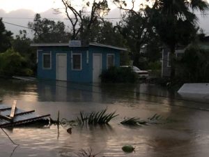
Cyclone wreaks havoc in Tonga’s capital, parliament flattened, homes wrecked

The aftermath of cyclone Gita is seen in Nuku'alofa, Tonga, February 13, 2018 in this picture obtained from social media. Twitter Virginie Dourlet/via REUTERS THIS IMAGE HAS BEEN SUPPLIED BY A THIRD PARTY. MANDATORY CREDIT. NO RESALES. NO ARCHIVES

By John Mair

WELLINGTON (Reuters) – Tonga’s neighbors scrambled to deliver emergency relief on Tuesday after Cyclone Gita tore across the Pacific island nation in the middle of the night, flattening the parliament, tearing roofs off homes and causing widespread flooding.

There were no confirmed reports of deaths from the Category 4 storm that bought winds of around 200 km (125 miles) per hour, but there were a lot of injured people, some seriously, said Graham Kenna, an Australian government adviser at Tonga’s National Emergency Management Office.

Photos posted on social media showed a wrecked Parliament House building in the capital, as well as extensive flooding and downed power lines. Access to areas outside the capital were hindered by the storm damage and debris.

“The full extent of damage caused by Cyclone Gita is still being assessed but there is an immediate need for assistance on the ground,” NZ Foreign Affairs Minister Winston Peters said in a statement.

“About 5,700 people sought shelter in evacuation centres overnight, and it is expected these numbers will increase substantially tonight.”

New Zealand is donating NZ$750,000 ($545,000) in aid, and a NZ Air Force Hercules aircraft was due to fly emergency relief supplies into Tonga on Tuesday.

Australia is donating A$350,000 ($275,000) worth of emergency shelter, kitchen and hygiene kits, while the country’s foreign minister said the Australian Defence Force personnel would assist with clean-up efforts.

The cyclone was heading towards Fiji’s southern islands on Tuesday, with some forecasts reporting it intensifying towards a Category 5 storm. Fijian Prime Minister Frank Bainimarama warned residents to “heed warnings and prepare”, although the storm is expected to bypass heavily populated areas.

Gita had pummeled Samoa and American Samoa, about 900 km (560 miles) to the northeast, over the weekend, flooding the Samoan capital, Apia.

The aftermath of cyclone Gita is seen in Nuku'alofa, Tonga, February 13, 2018 in this picture obtained from social media. Facebook Noazky Langi/via REUTERS THIS IMAGE HAS BEEN SUPPLIED BY A THIRD PARTY. MANDATORY CREDIT. NO RESALES. NO ARCHIVES

The aftermath of cyclone Gita is seen in Nuku’alofa, Tonga, February 13, 2018 in this picture obtained from social media. Facebook Noazky Langi/via REUTERS THIS IMAGE HAS BEEN SUPPLIED BY A THIRD PARTY. MANDATORY CREDIT. NO RESALES. NO ARCHIVES

POWER DOWN

Tonga’s clean-up began in the early hours of Tuesday as the tail of the cyclone was still over the capital, Nuku’alofa.

“Every second power pole has been knocked over and the lines are just everywhere,” Kenna said, saying it would likely be days before power could be restored. Water supplies and radio networks were also disrupted.

“They turned the power off very early before the cyclone came, knowing that the power lines would be blown down, which was a good move.”

The worst of the cyclone hit around a low tide, so there were no reports of storm surges worsening the impact of the wind and rains.

Kenna estimated around 40 percent of houses in the capital had suffered some damage, many with roofs blown off.

“A lot of the older houses, especially some of the older heritage houses, have been badly damaged or destroyed, which is very sad, they’re quite historical,” he said. “They’ve been through cyclones before, but this is the biggest cyclone this island has had for at least 60 odd years.”

($1 = 1.3776 New Zealand dollars)

($1 = 1.2718 Australian dollars)

(Reporting by John Mair in Wellington.; Additional reporting by Colin Packham in Sydney; Editing by Jane Wardell and SImon Cameron-Moore)

Nearly 1,500 evacuated in Paris region as rising Seine poses flood risk

A view shows the flooded banks of the Seine River and the Eiffel Tower.

PARIS (Reuters) – Nearly 1,500 people have been evacuated from homes in the Paris region, with authorities on alert for any major flood risk after the levels of the swollen River Seine rose further on Sunday.

Michel Delpuech, head of the Paris police body, told reporters that around 1,500 people had been moved out of homes in the Ile de France region comprising the French capital and its suburbs.

“The waters will only go away slowly,” added Delpuech.

The Seine’s waters were set to peak later on Sunday or early on Monday close to levels which led to similar flooding in 2016, authorities said.

The overflowing waters have already engulfed riverside walkways in Paris and led the world-famous Louvre museum to close a basement display of Islamic art.

Paris’s “Bateaux Mouches” tourist boats have been shut down due to the high waters while swans have been seen swimming where there are usually pavements and rats forced up onto the streets.

Flooding caused destruction in Paris in 1910 when the Seine rose by 8.65 meters, although no deaths were recorded there.

(Reporting by Sudip Kar-Gupta and Pascale Antonie; Editing by Catherine Evans)

California mudslide death toll up to 15 as rescues continue

Emergency personnel carry a woman rescued from a collapsed house after a mudslide in Montecito, California, U.S. January 9, 2018.

By Alex Dobuzinskis

LOS ANGELES (Reuters) – California rescuers worked through the night plucking stranded Santa Barbara residents from mudslides that have killed at least 15 people and devastated the coastal community after it was drenched by rain, authorities said on Wednesday.

The death toll could go higher still as rescuers continued searching for victims, mostly in the upscale enclave of Montecito – where mudslides slammed into homes, covered highways and swept away vehicles – officials warned.

“We don’t know how many additional people are still trapped,” Santa Barbara County Sheriff Bill Brown said on the “CBS This Morning” program. “We know there are some, and we’re still making our way into certain areas of Montecito and the adjacent areas to determine if anyone is still there and still alive.”

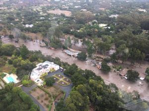
An aerial view from a Ventura County Sheriff helicopter shows a site damaged by mudslide in Montecito, California, U.S. January 9, 2018.

FILE PHOTO: An aerial view from a Ventura County Sheriff helicopter shows a site damaged by mudslide in Montecito, California, U.S. January 9, 2018. Ventura County Sheriff’s Office/via REUTERS

The mudslides followed an ordeal of fire and water for the area northwest of Los Angeles. A torrential downpour on Tuesday soaked the area, which was left vulnerable after much of its vegetation burned in the state’s largest wildfire last month.

Forecasters were calling for clear skies on Wednesday.

Emergency workers began their task on Tuesday using search dogs and helicopters to rescue dozens of people stranded in mud-coated rubble in the normally pristine area, sandwiched between the ocean and the sprawling Los Padres National Forest.

A 14-year-old girl was found alive on Tuesday after firefighters using rescue dogs heard cries for help from what was left of her Montecito home, the Los Angeles Times reported.

“I thought I was dead there for a minute,” the teenager Lauren Cantin, covered in mud, told NBC News after workers spent six hours rescuing her.

Rescuers worked through the night, searching for victims amid the dozens of homes that were destroyed, and using helicopters to lift more than 50 stranded residents from the mud.

“We’re finding people continuously,” said Yaneris Muniz, spokeswoman for the Santa Barbara County Joint Information Center. “We had a helicopter and several crews out all night, and now that it’s day, we’ll be able to intensify those searches.”

Officials have ordered residents in a large swath of Montecito to stay in their homes so that rescuers can better go about their work.

About 300 people were stranded in a canyon. Local rescue crews, using borrowed helicopters from the U.S. Coast Guard, worked to airlift them out, officials said.

Emergency personnel evacuate local residents and their dogs through flooded waters after a mudslide in Montecito, California, U.S. January 9, 2018. Kenneth Song/Santa Barbara

Emergency personnel evacuate local residents and their dogs through flooded waters after a mudslide in Montecito, California, U.S. January 9, 2018. Kenneth Song/Santa Barbara News-Press via REUTERS

The county initially ordered 7,000 residents to evacuate and urged another 23,000 to do so voluntarily, but only 10 to 15 percent complied with mandatory orders, said Amber Anderson, a spokeswoman for the Santa Barbara County Fire Department.

The county set up an evacuation shelter at Santa Barbara City College, where some people showed up drenched in mud, and also provided a place for people to take their animals.

The number of fatalities surpassed the death toll from a California mudslide on Jan. 10, 2005, when 10 people were killed as a hillside gave way in the town of La Conchita, less than 20 miles south of the latest disaster.

Last month’s wildfires, the largest in California history, left the area vulnerable to mudslides. The fires burned away grass and shrubs that hold the soil in place and also baked a waxy layer into the earth that prevents water from sinking deeply into the ground.

Some local residents had to flee their homes due to the fires last month and again this week because of the rains.

(Reporting by Peter Szekely in New York, Rich McKay in Atlanta and Brendan O’Brien in Milwaukee; Editing by Raissa Kasolowsky and Jonathan Oatis)

At least six dead in Southern California flooding, mudslides

A search dog looks for victims in damaged homes after a mudslide in Montecito, California, U.S. in this photo provided by the Santa Barbara County Fire Department, January 9, 2018.

By Alex Dobuzinskis

LOS ANGELES (Reuters) – At least six people died and thousands fled their homes in Southern California on Tuesday as a powerful rainstorm triggered flash floods and mudslides on slopes where a series of intense wildfires had burned off protective vegetation last month.

The heavy downpours subsided early Tuesday after prompting evacuation orders for residents along the Pacific Coast north of Los Angeles, but forecasters warned of more rain throughout the day. Rainfall totals ranged from 2 inches to 4-1/2 inches (5 to 11 cm) in the area, said the National Weather Service.

At least six people died in the storm and mudslides in Santa Barbara County, the hardest-hit county in the region, incident command spokeswoman Amber Anderson said in a telephone interview. She did not specify the cause of the fatalities, but said they occurred in several locations in Santa Barbara where there were mudslides.

The threat of mudslides prompted the county to order 7,000 residents to leave their homes before the rains came and to urge 23,000 others to evacuate voluntarily.

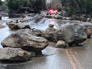
Boulders block a road after a mudslide in Montecito, California, U.S. in this photo provided by the Santa Barbara County Fire Department, January 9, 2018.

Boulders block a road after a mudslide in Montecito, California, U.S. in this photo provided by the Santa Barbara County Fire Department, January 9, 2018. Mike Eliason/Santa Barbara County Fire Department/Handout via REUTERS

The county set up an evacuation shelter at Santa Barbara City College, and also gave residents a place to take their animals. The weather in Southern California was mild this week, so residents who fled their homes did not have to endure the cold snap that has gripped the U.S. Midwest and East Coast in recent weeks.

A neighborhood in the upscale community of Montecito, where mudslides ravaged homes near the city of Santa Barbara, residents had not been put under mandatory evacuation orders before mud from a creek cascaded toward their homes, Anderson said.

But she could not immediately say whether any of the fatalities were in the area that was not evacuated.

An unknown number of people in the county were unaccounted for, Anderson said, and 25 residents have been injured.

Photos posted by the local fire department showed a teenager covered in black mud being led away from the rubble of a house that had been destroyed by the Montecito mudslide. She had been trapped in the home for hours before rescuers came to her aid, the Santa Barbara County Fire Department said on Twitter.

Other pictures showed ankle-deep mud, logs and boulders in residential areas.

Emergency workers, using search dogs and helicopters, have rescued dozens of people stranded in rubble, Anderson said.

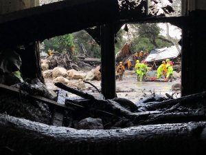
Emergency personnel search through debris and damaged homes after a mudslide in Montecito, California, U.S. in this photo provided by the Santa Barbara County Fire Department, January 9, 2018.

Emergency personnel search through debris and damaged homes after a mudslide in Montecito, California, U.S. in this photo provided by the Santa Barbara County Fire Department, January 9, 2018. Mike Eliason/Santa Barbara County Fire Department/Handout via REUTERS

Last month’s wildfires, the largest in California history, left the area vulnerable to mudslides. The fires burned away grass and shrubs that hold the soil in place, and also baked a waxy layer into the earth which prevents water from sinking deeply into the ground.

The overnight rains forced road closures, including a 30-mile (48-km) stretch of U.S. Highway 101, essentially cutting off traffic between Santa Barbara and Ventura counties northwest of Los Angeles. Ventura County escaped with little damage, the county sheriff’s office said.

(Additional reporting by Peter Szekely in New York and Brendan O’Brien in Milwaukee; editing by Jeffrey Benkoe and Jonathan Oatis)

Thousands in California flee homes ahead of possible mudslides

California wildfire fight aided by better weather

(Reuters) – Thousands of Southern Californians fled their homes on Monday as a powerful rain storm that could cause flash floods and trigger mudslides soaked steep slopes where a series of intense wildfires burned off vegetation last month.

Heavy downpours that could produce more than 1 inch (2.5 cm) of rain per hour were expected through Tuesday evening, forcing officials to order or advise Ventura, Santa Barbara and Los Angeles county residents who live near where wildfires burned to evacuated their homes.

“Recent burn areas will be especially vulnerable where dangerous mud and debris flows are possible,” the National Weather Service said in a statement.

Several December wildfires, included a blaze known as the Thomas Fire which was the largest in the state’s history, burned away vegetation that holds the soil in place and baked a waxy layer into the earth that prevents water from sinking deeply into the ground.

About 30,000 residents were under evacuation orders or advisories on Monday, ABC news reported.

“I’m just tired. I can’t seem to get my life kick-started,” Teri Lebow, whose Montecito, California was damaged by the wildfires, told the Los Angeles Times.

The storm system was expected to produce 4 inches to 7 inches (10 to 18 cm) in the foothills and mountains with 9 inches (23 cm) in isolated areas. Three inches (7 cm) to two feet (61 cm) of snow was also forecast for higher elevations, the National Weather Service said.

(Reporting by Brendan O’Brien in Milwaukee; Editing by Robin Pomeroy)

Storm Eleanor causes flood damage on Ireland’s west coast

People view large waves and high winds associated with Storm Eleanor as they hit the lighthouse and seawall at Porthcawl in south Wales, Britain January 3, 2018.

GALWAY (Reuters) – Homes and business on Ireland’s west coast suffered flood damage and 27,000 were still without electricity on Wednesday after Storm Eleanor brought heavy rain and winds of up to 155 kilometers per hour.

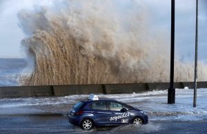
A car drives along a flooded road in New Brighton, on the coast of the Wirral peninsula, in Merseyside, Britain, January 3, 2018.

A car drives along a flooded road in New Brighton, on the coast of the Wirral peninsula, in Merseyside, Britain, January 3, 2018. REUTERS/Phil Noble


The storm hit Ireland’s fourth largest city, Galway, particularly hard as high tides late on Tuesday forced road closures and wreaked havoc for shop owners.

Cars are seen in a flooded multi-storey car park as flood waters reached up to 1.5 meters and destroyed multiple cars, in Galway, Ireland January 3, 2018.

Cars are seen in a flooded multi-storey car park as flood waters reached up to 1.5 meters and destroyed multiple cars, in Galway, Ireland January 3, 2018. REUTERS/Clodagh Kilcoyne

Ireland’s Electricity Supply Board (ESB) said at one stage on Tuesday 150,000 homes and business were without electricity.

“We’re really hopeful, given that it’s the last week of a lot of people’s Christmas holidays, that we will have power back to pretty much everybody by tonight,” Derek Hynes, Operations Manager for ESB, told national broadcaster RTE.

The weather service’s second highest level of alert remained in place for the west and northwest of the country. Met Eireann said a combination of high tides and exceptionally high seas would result in coastal damage and further flooding.

Three people died in October when Tropical Storm Ophelia battered every corner of Ireland, bringing down trees and power lines and whipping up 10-meter (30-foot) waves.

(Writing by Padraic Halpin in Dublin; editing by Stephen Addison)

Landslides kill 26 in storm-hit Philippine province

A general view shows search, retrieval, and relief operations ongoing at the flooded areas at Tzu Chi Village in Barangay Liloan, Phillipines, December 17, 2017 in this picture obtained from social media. ORMOC CITY POLICE OFFICE/via REUTERS

MANILA (Reuters) – At least 26 people were killed while several residents were missing in an island province in central Philippines after tropical storm Kai-tak brought heavy rains that triggered landslides, local authorities and media said on Sunday.

Kai-tak cut power supplies in many areas, forced the cancellation of several flights, stranded more than 15,000 people in various ports in the region and prompted nearly 88,000 people to seek shelter in evacuation centers.

An aerial shot shows an impassable Caraycaray Bridge after it was destroyed when Typhoon Kai-tak, locally name Urduja, ravaged Biliran Province, Philippines December 18, 2017. Malacanang Presidential Photo/Handout via REUTERS

An aerial shot shows an impassable Caraycaray Bridge after it was destroyed when Typhoon Kai-tak, locally name Urduja, ravaged Biliran Province, Philippines December 18, 2017. Malacanang Presidential Photo/Handout via REUTERS

The Provincial Disaster Risk Reduction and Management Office of Biliran island said 26 residents had died, but the National Disaster Risk Reduction and Management Council (NDRRMC) has yet to make any official announcement about fatalities.

Biliran Governor Gerardo Espina Jr confirmed the deaths in an interview with DZMM radio, with 23 people still missing, he said.

“We received reports of three deaths coming from the DILG (Department of the Interior and Local Government) but these are for confirmation,” said NDRRMC spokeswoman Romina Marasigan. “We are still trying to check the others.”

Many areas were flooded, damaging crops and infrastructure.

Kai-tak has weakened to a tropical depression after barrelling through the eastern region of Visayas on Saturday, hitting islands and coastal towns such as Tacloban City where supertyphoon Haiyan claimed 8,000 lives in 2013.

Locally known as Urduja, Kai-tak was packing winds of 55 kilometers (31 miles) per hour with gusts of up to 80 km/h, according to a weather bureau bulletin issued at 2000 GMT.

(Reporting by Enrico dela Cruz, editing by David Evans)

Cyclone batters southwestern India coast killing 14, many missing

Cyclone batters southwestern India coast killing 14, many missing

MUMBAI (Reuters) – Cyclone Ockhi barrelled into the Lakshwadeep islands in southwestern India on Saturday after drenching the neighboring states of Kerala and Tamil Nadu, claiming so far around 14 lives with many fishermen still feared trapped at sea.

Authorities including the National Disaster Management Authority (NDMA), India’s Coast Guard and Navy have rescued about 223 fishermen and evacuated thousands of people from cyclone hit areas, officials said, as they continued their operations on Saturday.

Prime Minister Narendra Modi has spoken to the chief minister of Tamil Nadu, assuring him of support operations including necessary funds, according to local media.

Ockhi is expected to travel north towards Mumbai and Gujarat in the next 48 hours, according to Indian Meteorological Department (IMD) Director S. Sudevan in Trivandrum, though it is likely to lose intensity.

“The intensity of the wind may come down and the cyclone could change into depression,” Sudevan said adding fishermen have been warned not go to the sea for the next few days as waves are likely to be 3-5 meters (12-15 feet) high.

(Reporting by D Jose in KERALA and Suvashree Dey Choudhury in MUMBAI; Editing by Michael Perry)

Greece to give millions in compensation to flood victims

Greece to give millions in compensation to flood victims

ATHENS (Reuters) – Greece said on Monday it would offer emergency compensation worth millions of euros to hundreds of households affected by flash flooding west of Athens that killed at least 20 people on Nov. 15.

Hundreds of homes and businesses were extensively damaged in the coastal towns of Mandra and Nea Peramos when a torrent of mud and water smashed into the settlements, built along dry gullies on the foothills of a mountain range.

Twenty people died and two remain missing from the early-morning deluge, the worst casualty toll from flooding since 1977 when more than 30 people died.

The disaster has prompted recriminations and finger-pointing over a perceived inability of Greek authorities to act on prior warnings that areas with poor infrastructure and unlicensed construction were vulnerable to flooding. Critics also asked why flood prevention projects had been delayed.

Authorities will offer flood victims up to 5,000 euros ($5,896.50) for households and 8,000 euros for businesses, government spokesman Dimitris Tzanakopoulos said.

It was not immediately clear how much the state had budgeted for compensation. Tzanakopoulos told Reuters the amount would come from the national budget.

That assistance would be over and above compensation residents were entitled to, comprised of 60 percent government aid and 40 percent interest-free loan, he said.

The flash flooding hit many areas of the country, including housing settlements where town planning regulations are often flouted.

(Reporting by Michele Kambas; editing by Mark Heinrich)