U.S. mail carriers emerge as heroes in Puerto Rico recovery

Luis Menendez, a mail man for the U.S. Postal Service, delivers mail at an area affected by Hurricane Maria in the island of Vieques, Puerto Rico.

By Hugh Bronstein

GUAYNABO, Puerto Rico (Reuters) – With the Puerto Rico power grid shredded by Hurricane Maria, the U.S. Postal Service has taken the place of cellphone service at the forefront of island communications.

Only 15 percent of electrical power has been restored since the storm bludgeoned the U.S. territory on Sept. 20, but 99 of Puerto Rico’s 128 post offices are delivering mail. Tents have taken the place of post offices wrecked by Maria.

Mail carriers gather information on sick and elderly residents in far-flung parts where hospitals have closed. Data is fed into the Federal Emergency Management Agency disaster relief office in San Juan so medical attention can be provided.

Restoration of the power grid is months away and many rural roads are blocked by mudslides, sink holes and downed trees and telephone poles. Since the start of the month the Postal Service has nonetheless been delivering letters and care packages to family members desperate for news.

“It’s been a clutch situation, and you guys have totally come through,” a FEMA worker was heard telling Postal Service Caribbean customer service manager Martin Caballero on Sunday.

“We might know the general area where people need help, but the mail carriers are the only ones who really have the exact addresses,” the FEMA worker told Reuters, asking not to be named because he was not authorized to speak to news media.

Caballero regularly goes on AM radio, which can be heard by listeners lucky enough to have diesel to run generators, to tell people in inaccessible parts of the island where their mail is being held. He invites them to pick it up, but only when travel conditions become safe.

Even for urban middle-class customers in the San Juan suburb of Guaynabo, whose concrete homes were not smashed by the storm, it was a chore to recover their blown-away mailboxes or build new ones. Hurricane or not, the Postal Service will not drop off mail without a designated box.

“The wind took them all,” said resident Jenny Amador, a 42-year-old teachers’ assistant.

“I found mine in those trees,” she said, pointing to a gnarl of branches and trunks on the road. She re-attached her mailbox in a cockeyed position in front of her house, using a clothes hanger.

One plucky woman, having heard the postman was on the way, stood stoically with her mailbox tucked under her arm. No one minded when mail carrier Alfredo Martinez showed up out of uniform, unable to do laundry for lack of clean water.

One resident said the return of the mail service was comforting, a sign of a return to normalcy. But another greeted Martinez with a warning.

“If you are bringing me any utility bills, go away,” she said.


(Reporting by Hugh Bronstein; Editing by Howard Goller)


Hundreds leave homes near dangerously crumbling Puerto Rico dam

Local residents look at the flooded houses close to the dam of the Guajataca lake. REUTERS/Carlos Garcia Rawlins

By Dave Graham and Robin Respaut

SAN JUAN (Reuters) – Most people living near a crumbling dam in storm-battered Puerto Rico have been moved to safety, Governor Ricardo Rossello said on Monday, as he urged the U.S. Congress to fund an aid package to avert a humanitarian crisis after Hurricane Maria.

Most of the Caribbean island, a U.S. territory with a population of 3.4 million, is still without electricity five days after Maria swept ashore with ferocious winds and torrential rains, the most powerful hurricane to hit Puerto Rico for nearly a century.

There have been growing concerns for some 70,000 people who live in the river valley below the Guajataca Dam in the island’s northwest, where cracks were seen appearing on Friday in the 88-year-old earthen structure.

An aerial view shows the damage to the Guajataca dam. REUTERS/Alvin Baez

An aerial view shows the damage to the Guajataca dam. REUTERS/Alvin Baez

Rossello said he was working on the assumption that the dam would collapse. “I’d rather be wrong on that front than doing nothing and having that fail and costing people lives,” he said in an interview with CNN.

“Some of the dam has fallen apart and now we’re making sure that we can assess if the other part is going to fall down as well. … Most of the people in the near vicinity have evacuated.”

It was unclear if the governor was saying that most of the 70,000 valley inhabitants had left the area, or only the several hundred people living in the small towns closest to the dam. About 320 people from those towns have moved to safety, according to local media.

The fear of a potentially catastrophic dam break added to the difficulties facing disaster relief authorities after Maria, which was the second major hurricane to strike Caribbean this month and which killed at least 29 people in the region.

At least 10 of those who died were in Puerto Rico, including several people who drowned or were hit by flying debris, and three elderly sisters who died in a mudslide.

Many structures on the island, including hospitals, remain badly damaged and flooded. Clean drinking water is hard to find in some areas. Very few planes have been able to land or take off from damaged airports.

After Maria caused widespread flooding, the National Weather Service warned of further flash floods in some western parts of the island on Monday as thunderstorms moved in.

The hurricane hit at a time when Puerto Rico was already battling economic crisis. [nL2N1M31LR]

Rossello said on Monday that before the storms struck he had been embarking on an aggressive fiscal agenda that included more than $1.5 billion in cuts.

“This is a game changer,” the governor told CNN. “This is a completely different set of circumstances. This needs to be taken into consideration otherwise there will be a humanitarian crisis.”

In Washington, U.S. House of Representatives Speaker Paul Ryan said Congress was working with President Donald Trump’s administration to make sure the necessary assistance reaches Puerto Rico.

“Our fellow citizens in Puerto Rico remain in our prayers as we make sure they have what they need,” Ryan said in a statement.

Local residents react while they look at the water flowing over the road at the dam of the Guajataca lake.

Local residents react while they look at the water flowing over the road at the dam of the Guajataca lake.
REUTERS/Carlos Garcia Rawlins

Maria continued to weaken and would likely be downgraded from a hurricane to a tropical storm by Tuesday night, the National Hurricane Center said. As of 11 a.m. ET (1500 GMT) on Monday, it was about 315 miles (505 km) south-southeast of Cape Hatteras, North Carolina, heading slowly north, the center said.

The storm was unlikely to hit the continental United States directly, but a tropical storm warning was in effect for much of the North Carolina coast. Officials issued a mandatory evacuation order for visitors to Ocracoke Island in the Outer Banks, beginning at 5 a.m. ET (0900 GMT) on Monday.


(Reporting by Dave Graham and Robin Respaut; Additional reporting by Jonathan Allen and Peter Szekely in New York and Doina Chiacu in Washington; Editing by Daniel Wallis and Frances Kerry)


Bangladesh raises highest danger warning as cyclone takes aim

A Sri Lankan Navy rescue team member carries an old man on a flooded road during a rescue mission in Nagoda village in Kalutara, Sri Lanka May

By Ruma Paul and Dinuka Liyanawatte

DHAKA/AGALAWATTE, Sri Lanka/ (Reuters) – Bangladesh raised its storm danger signal to the highest level of 10 on Monday as a severe and intensifying cyclone churned toward its low-lying coast and was expected to make landfall in the early hours of Tuesday.

Impoverished Bangladesh, hit by cyclones every year, warned that some coastal areas were “likely to be inundated by a storm surge of four to five feet (1.2 to 1.5 meters)” above normal because of approaching Cyclone Mora.

The Disaster Ministry ordered authorities to evacuate people from the coast, the ministry’s additional secretary, Golam Mostafa, told reporters in Dhaka. About 10 million of Bangladesh’s population of 160 million live in coastal areas.

River ferries had suspended operations and fishing boats called in to safety.

“Maritime ports of Chittagong and Cox’s Bazar have been advised to lower danger signal number seven but instead hoist great danger signal number ten (repeat) ten,” a government weather bulletin said.

“The coastal districts of Chittagong, Cox’s Bazar, Noakhali, Laxmipur, Feni, Chandpur and their offshore islands … will come under danger signal number ten (repeat) ten.”

Bangladesh is hit by storms, many of them devastating, every year. Half a million people had their lives disrupted in coastal areas such as Barisal and Chittagong in May last year.

It is still recovering from flash floods that hit the northeast, affecting millions of people, in April. Rice prices have reached record highs and state reserves are at 10-year lows in the wake of flooding that wiped out around 700,000 tonnes of rice.

The cyclone formed after monsoon rains triggered floods and landslides in neighboring Sri Lanka, off India’s southern tip, which have killed at least 177 people in recent days, authorities said, with 24 killed in storms in the eastern Indian state of Bihar, either by lightning strikes or under collapsed village huts.

India warned of heavy rain in the northeastern states of Tripura, Mizoram, Manipur, Nagaland and Arunachal Pradesh as Mora moved further up the Bay of Bengal.

RUBBER AND TEA PLANTATIONS HIT

Floods reached roof level and cut off access to many rural Sri Lankan villages, disrupting life for 557,500 people, many of them workers on rubber plantations, officials said. Nearly 75,000 people had been forced out of their homes.

Villagers in Agalawatte, in a key rubber-growing area 74 km (46 miles) southeast of the capital, Colombo, said they were losing hope of water levels falling soon after the heaviest rain since 2003. Fifty-three villagers died and 58 were missing.

“All access to our village is cut off. A landslide took place inside the village and several houses are buried,” Mohomed Abdulla, 46, told Reuters.

Some areas in the southern coastal district of Galle, popular with foreign tourists, have not received relief due to lack of access.

“My entire village is cut off and nobody can come to this village,” C.M. Chandrapla, 54, told Reuters by phone from the tourist village of Neluwa.

“There have been no supplies for the past two days. Water has gone above three-storey buildings and people survive by running to higher ground.”

A boy rides his bike along a flooded road in Nagoda village, in Kalutara, Sri Lanka May 29, 2017.

A boy rides his bike along a flooded road in Nagoda village, in Kalutara, Sri Lanka May 29, 2017. REUTERS/Dinuka Liyanawatte

The Sri Lankan military has sent in helicopters and boats in rescue efforts in the most widespread disaster since the 2004 Boxing Day tsunami. About 100 people were missing in total.

The meteorology department forecast torrential rains over the next 36 hours.

Residents in seven densely populated districts in the south and center of Sri Lanka were asked to move away from unstable slopes in case of further landslides.

The wettest time of the year in Sri Lanka’s south is usually during the southern monsoon, from May to September. The island also receives heavy rains in the North West monsoonal season from November to February.

Reuters witnessed some people stranded on the upper floors of their homes. Civilians and relief officials in boats  distributed food, water and other relief items.

One of the worst-hit areas was the southern coastal district of Matara which is home to black tea plantations. Rohan Pethiyagod, head of the Tea Board in the world’s largest exporter of top quality teas, said supplies would be disrupted for the next auction due to a lack of transportation.

Sri Lanka has already appealed for international assistance from the United Nations and neighboring countries.

(Additional reporting by Ranga Sirilal in Colombo; Writing by Shihar Aneez and Sanjeev Miglani; Editing by Nick Macfie)

Rescuers, locals dig for Colombia flood victims, 254 die

A man walks among the ruins after flooding and mudslides, caused by heavy rains leading several rivers to overflow, pushing sediment and rocks into buildings and roads, in Mocoa, Colombia

By Jaime Saldarriaga

MOCOA, Colombia (Reuters) – Families and rescuers searched desperately on Sunday through mud-plastered rubble for victims of flooding and landslides in Colombia that have killed 254 people, injured hundreds and devastated entire neighborhoods.

Several rivers burst their banks near the southwestern city of Mocoa in the early hours of Saturday, sending water, mud and debris crashing down streets and into houses as people slept.

Volunteers and firefighters tended to 82 bodies downstream in the town of Villagarzon and said many corpses were still caught in debris.

“We had to recover them ourselves. We think we’ll find more,” Villagarzon Mayor Jhon Ever Calderon told Reuters. He said the town had no coffins or sanitary storage.

Many families in Mocoa stayed up through the night to search through the debris, despite the lack of electricity in the city.

“I need to know where they are, if they are injured or where to find them,” sobbed Maria Lilia Tisoy, 37, looking through the rubble for her two daughters, one pregnant, and a 4-year-old granddaughter.

“If they are dead, please God deliver them to me,” she said.

President Juan Manuel Santos made a second visit to the area on Sunday. He said water and energy services would be restored as soon as possible.

Santos blamed climate change for the disaster, saying Mocoa had received one-third of its usual monthly rain in just one night, causing the rivers to burst their banks.

A man walks among the ruins after flooding and mudslides, caused by heavy rains leading several rivers to overflow, pushing sediment and rocks into buildings and roads, in Mocoa, Colombia

A man walks among the ruins after flooding and mudslides, caused by heavy rains leading several rivers to overflow, pushing sediment and rocks into buildings and roads, in Mocoa, Colombia April 2, 2017. REUTERS/Jaime Saldarriaga

There was disagreement over the death toll for most of Sunday but, late in the evening, the government’s total was increased to match the 254-person figure released by the army. Just over 200 were injured.

Disaster officials said more than 500 people were staying in emergency housing and social services had helped 10 lost children find their parents.

The disaster came after deadly flooding in Peru killed more than 100 people and destroyed infrastructure.

Families of the dead will receive about $6,400 in aid and the government will cover hospital and funeral costs.

Even in a country where heavy rains, a mountainous landscape and informal construction combine to make landslides a common occurrence, the scale of the Mocoa disaster was daunting compared to recent tragedies, including a 2015 landslide that killed nearly 100 people.

Colombia’s deadliest landslide, the 1985 Armero disaster, killed more than 20,000 people.

Santos urged Colombians to take precautions against flooding and continued rains.

The president also thanked China and the Inter-American Development Bank for donating $1 million and $200,000 respectively toward relief efforts.

(Additional reporting by Julia Symmes Cobb, Nelson Bocangra and Luis Jaime Acosta in Bogota; Editing by Andrea Ricci, Sandra Maler and Paul Tait)

California faces more rain, snow as deadly storm moves south

People with umbrellas walk along street in Los Angeles

(Reuters) – California was bracing on Saturday for another wave of torrential rain as well as heavy snow as a massive storm triggered flooding, mudslides and power outages and killed two people, officials said.

The National Weather Service warned that rain totals could reach 10 inches (25 cm) in parts of southern California and 2 feet (60 cm) of snow in higher areas to the east as the storm continues to roll through the region.

The severe storm has brought California its heaviest rainfall in six years and comes after months of wet weather that has dramatically eased a years-long drought in the key agricultural state.

The rain and melting snowpack also are threatening to undermine a spillway at one of the largest dams in the country. Some 188,000 residents were evacuated from the area earlier this week.

Utility crews were working to restore electricity to more than 78,000 customers affected by power outages throughout the Los Angeles area.

Early on Saturday, an evacuation order remained in effect for 180 homes in Duarte, a city about 20 miles (32 km) east of Los Angeles, because of fears of mudslides.

One man died after he was electrocuted by a downed wire, the Los Angeles Fire Department said, adding that it had responded to 150 reports of downed wires on Friday. Another person was found dead in a submerged vehicle in Victorville, about 100 miles east of Los Angeles, fire officials said on Twitter.

A woman was injured when the car she was in fell into a 20-foot sinkhole in Studio City on Friday night. A second car fell into the sinkhole after the woman was rescued, an ABC affiliate reported.

Local television news also showed video footage of a San Bernardino County fire truck tumbling over the side of a freeway as the road gave out.

“All firefighters confirmed safe. The lane under the fire engine has failed, and the engine has gone over the side,” the San Bernardino County Fire Department said on Twitter.

Amtrak railroad service was suspended for trains between the cities of Oxnard and San Luis Obispo in the central and southern areas of the state due to extreme weather conditions, according to the transportation service’s website.

In higher areas of eastern California and western Nevada, snowfall and wind gusts of up to 50 mph (80 kph) were in the forecast until Saturday night, the National Weather Service said.

“This will make travel hazardous or impossible,” the service said in an advisory.

(Reporting by Brendan O’Brien in Milwaukee Editing by Ed Osmond and Paul Simao)

Snow, rain pummel parts of California, Nevada and Oregon

clearing snow from a driveway

(Reuters) – Heavy rain and snowfall hit parts of California, Nevada and Oregon early on Wednesday, causing roads to be closed, schools to cancel classes and widespread flooding along already swollen waterways.

A National Weather Service blizzard warning remained in effect until late on Wednesday morning for ski resort towns in the greater Lake Tahoe area, including Truckee and South Lake Tahoe, California, and neighboring Nevada enclaves of Stateline and Incline Village.

Snow accumulations of 5 to 10 feet (1.5 to 3 meters) were forecast above elevations of 7,000 feet, with fierce wind gusts reaching 100 miles (160 km) per hour along the ridge of the Sierra Nevada mountain range, the National Weather Service reported.

An avalanche warning was issued for much of the same mountain regions.

“Those venturing outdoors may become lost or disoriented so persons in the warning area are advised to stay indoors,” the weather service said.

Roadways, including Interstate 80 near the border of California and Nevada, were closed on Wednesday morning.

Schools throughout the region canceled Wednesday classes, including the Portland Public Schools district in Oregon, attended by about 50,000 students.

Several flood warnings remained in effect until Wednesday morning for lower elevations in northern and central California and in western Nevada, where creeks and rivers were expected to overrun their banks.

Several communities in the region opened evacuation centers for people who heeded warnings from officials to move to higher ground to avoid flooding.

Heavy downpours sent a wall of mud down onto a house in Fairfax, California, trapping an elderly couple and their two granddaughters, according to local media. Firefighters rescued the couple and children and no one was injured, an ABC affiliate reported.

A series of floodgates on the Sacramento River, just upstream of California’s capital, were opened for the first time in 11 years on Tuesday to divert high water around the city and into a special drainage channel, said Lauren Hersh, a spokeswoman for the state Water Resources Department.

The cascade of rain and snow marked the fourth round of extreme precipitation unleashed during the past month by a weather pattern meteorologists call an “atmospheric river” – a dense plume of moisture flowing from the tropical Pacific into California.

The storms have brought some sorely needed replenishment to many reservoirs left low by five years of drought, while restoring California’s mountain snowpack to 135 percent of its average water-content level for this time of year as of Tuesday, state water officials said.

(Reporting by Brendan O’Brien in Milwaukee; editing by Dominic Evans)

Powerful storms head for U.S. West after thousands flee floods

Partially submerged building in California

(Reuters) – Powerful storms packing heavy rain and snow will lash the U.S. West on Tuesday, a day after thousands of people fled their homes to escape floods, forecasters said.

A band of heavy downpours will drench northern California and heavy snow will fall in the Sierra Nevada mountains into Wednesday, exacerbating the threat of flooding, the National Weather Service said.

The storms are part of weather system called the “Pineapple Express” that has soaked a vast area from Hawaii to the typically drought-prone states of California and Nevada.

Just north of San Francisco, the Russian River in Sonoma County flooded early on Monday, forcing the evacuation of more than 3,000 residents, officials said.

In Nevada, residents of about 400 homes in Reno were ordered to leave as rains swelled the Truckee River, which flows through the city, a county official said.

A woman died after she was struck by a falling tree in the San Francisco area, local officials and media reported.

Over the weekend, an ancient giant sequoia tree with a hollowed-out tunnel was toppled by floods in Calaveras Big Trees State Park just southeast of Sacramento.

California’s Napa Valley vinyards largely escaped undamaged and the rain was expected to replenish water supplies after five years of drought, said Patsy McGaughy, Napa Valley Vintners spokeswoman.

California officially remains in a state of drought as water is still scarce in the south.

But northern California’s Lake Oroville, the principal reservoir for the State Water Project, has 2.25 million acre feet of water, more than double the amount it had a year ago, Michael Anderson, state climatologist for the California Department of Water Resources, said.

(Reporting by Brendan O’Brien in Milwaukee)

More rain, snow forecast as U.S. storm brings floods to California

Flooded street in Calfornia

(Reuters) – Forecasters expect another half foot of rain to soak central and northern California and the Sierra Nevada mountains through early Tuesday, coming on the heels of powerful storms that walloped the state and other parts of the U.S. west on Sunday.

The drenching rains and blowing snow flooded rivers and shut down roads from mudslides in a state that has struggled with drought for years.

From 3 to 8 inches (7.6 to 20 cm) of rain is forecast in the region while several feet (1-2 metres) of snow are likely for higher elevations, said meteorologist Andrew Orrison at the National Weather Service’s Weather Prediction Center in Maryland.

“We’re going to see heavy rain going into (Monday) evening and early morning,” he said.

Heavy snow is expected in Nevada and the northern Rocky Mountains could get several feet of snow over the next day or two.

The weather service said almost 40 rivers or creeks in Northern California and western Nevada were flooded or threatened to top their banks. But an emergency agency spokesman said there had been no reports of fatalities or serious damage.

Authorities said a section of Interstate 80 near Truckee, southwest of Reno, Nevada, was closed by a mudslide.

The upper Napa River north of San Francisco was expected to cause “extreme damage to all towns along the reach,” the California emergency agency said in a statement. Anticipated flooding brought voluntary evacuations in neighboring Sonoma County.

Residents of Cambria, near the famous Hearst Castle along California’s central coast, were advised to move to higher ground due a flash flood warning.

Several other California highways were closed from landslides or high water. In Washington state, high winds, ice and heavy snow shut roads and created hazardous driving conditions.

Iridium Communications said Elon Musk’s SpaceX rocket company had delayed Monday’s launch of a Falcon 9 rocket carrying 10 of its satellites from Vandenberg Air Force Base, north of Los Angeles. The launch was now set for Saturday.

The storm is drawing strength from the interaction between an “atmospheric river,” a plume of water vapor flowing from the tropics toward the West Coast, and a low-pressure area near Oregon, the National Weather Service said.

After years of drought, the storm is the latest in a strong wet season for California that began in the autumn. Another front is expected on Tuesday.

In an encouraging sign, the U.S. Forest Service said the rain had restored moisture levels in Southern California vegetation to a seasonal normal for the first time in five years.

The eastern United States experienced low temperatures on Sunday, the day after a massive storm dumped snow from Georgia to Massachusetts.

(Editing by Chris Michaud)

Hurricane Matthew hammers Haiti and Cuba, bears down on U.S.

Damage from Hurricane Matthew

By Makini Brice and Sarah Marsh

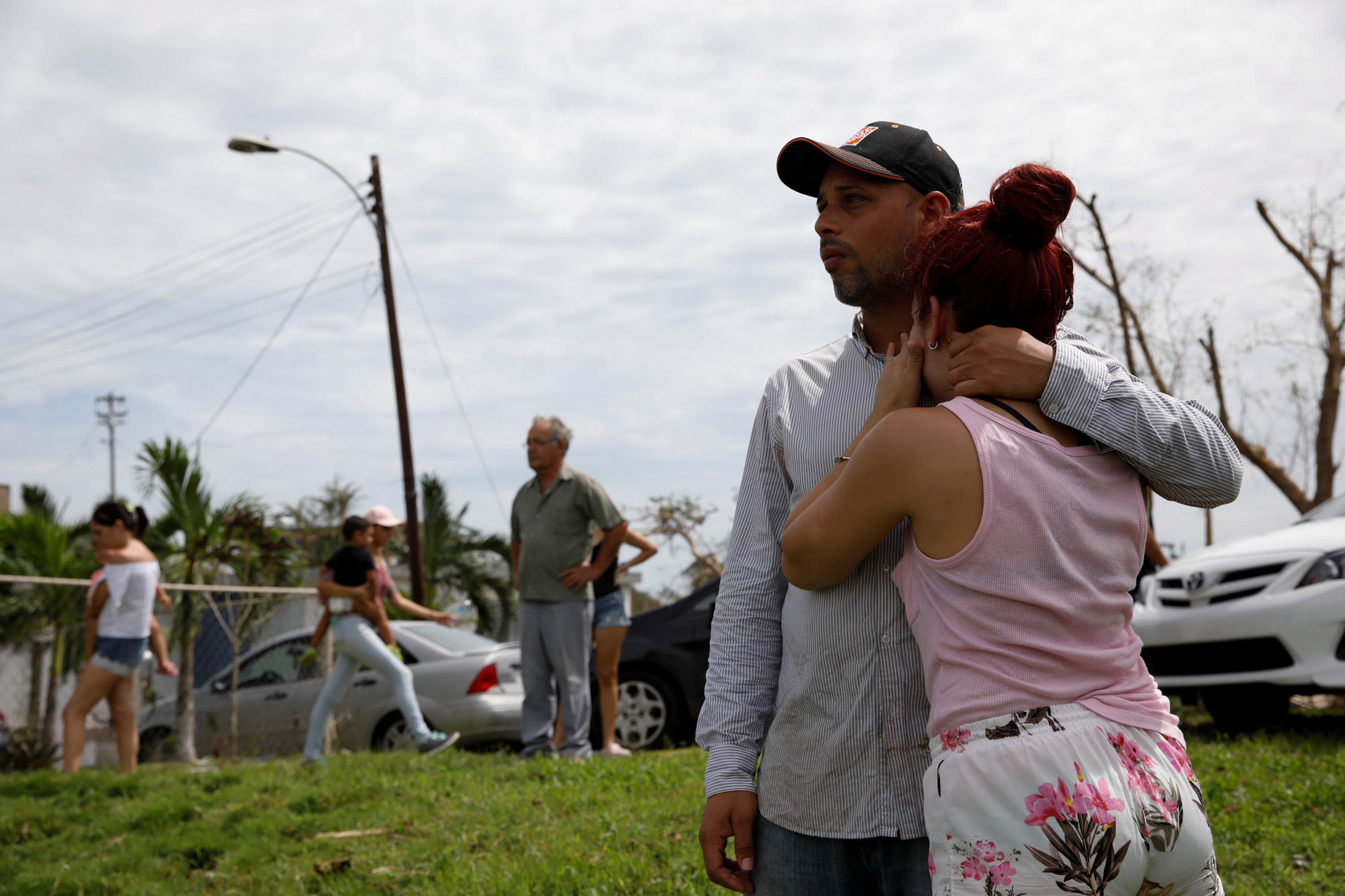
LES CAYES, Haiti/GUANTANAMO, Cuba (Reuters) – Hurricane Matthew, the fiercest Caribbean storm in almost a decade, hit Cuba and Haiti with winds of well over 100 miles-per-hour on Tuesday, pummeling towns, farmland and resorts and forcing hundreds of thousands of people to take cover.

Dubbed by the U.N. the worst humanitarian crisis to hit Haiti since a devastating 2010 earthquake, the Category Four hurricane unleashed torrential rain on the island of Hispaniola that Haiti shares with the Dominican Republic.

As it barreled towards the United States, the eye of the storm had moved off the northeastern coast of Cuba by Tuesday night, the Miami-based National Hurricane Center (NHC) said.

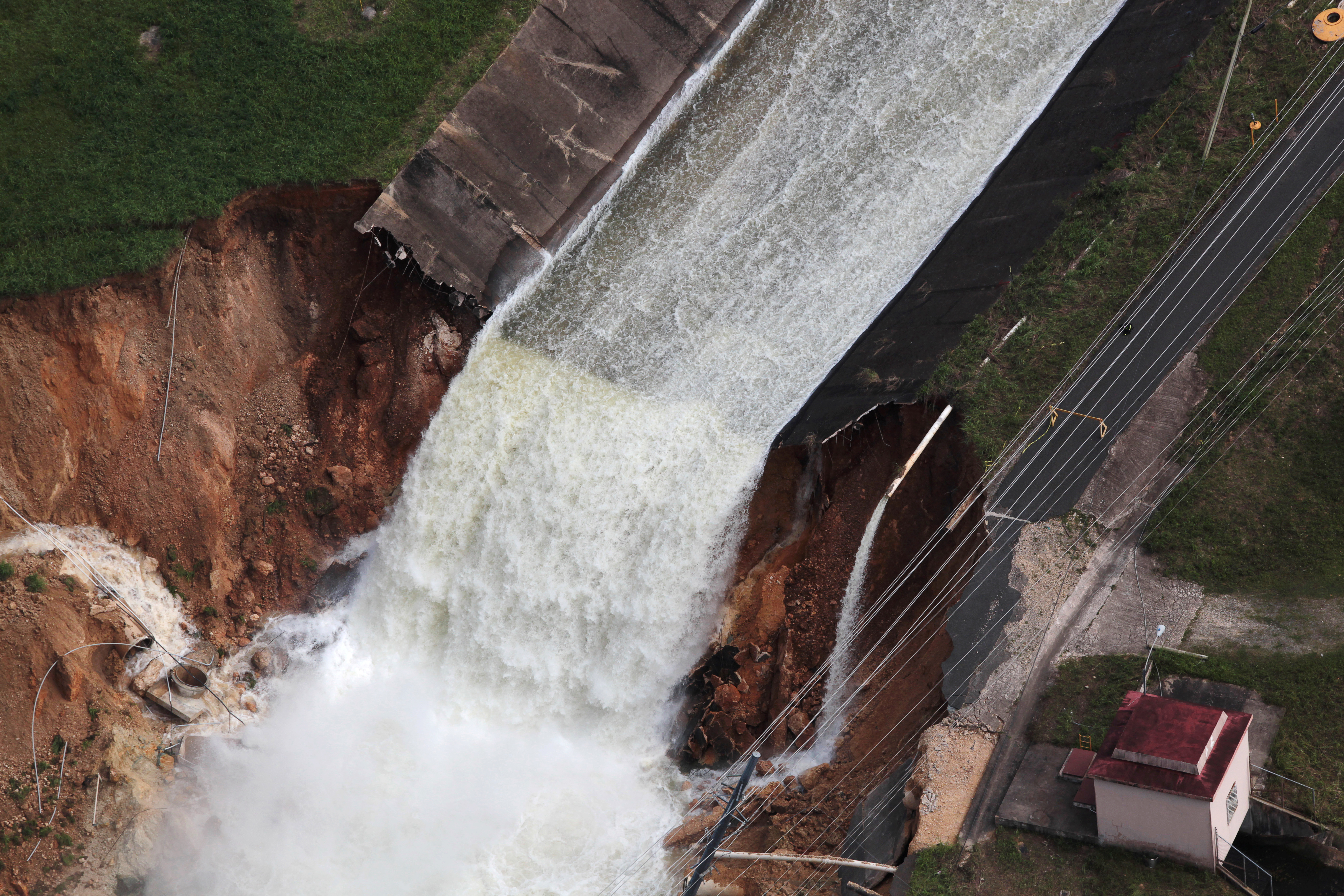
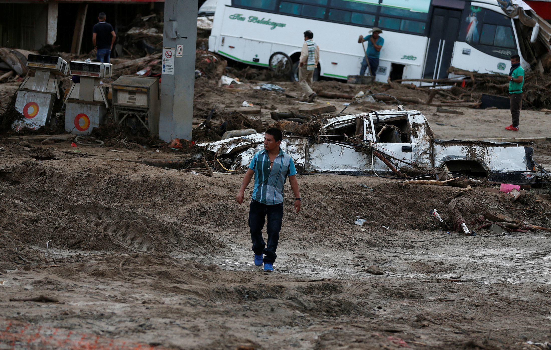
At least four people were killed in the Dominican Republic by collapsing walls and mudslides, as well as two in Haiti, where communications in the worst-hit areas were down, making it hard for authorities to assess the scale of the damage.

“Haiti is facing the largest humanitarian event witnessed since the earthquake six years ago,” said Mourad Wahba, the U.N. Secretary-General’s Deputy Special Representative for Haiti.

Over 200,000 people were killed in Haiti, the poorest nation in the Western Hemisphere, by the January 2010 earthquake.

Matthew was blowing sustained winds of 140 mph (230 kph) or more for much of Tuesday, though as night fell, the windspeed eased to about 130 mph, the NHC said.

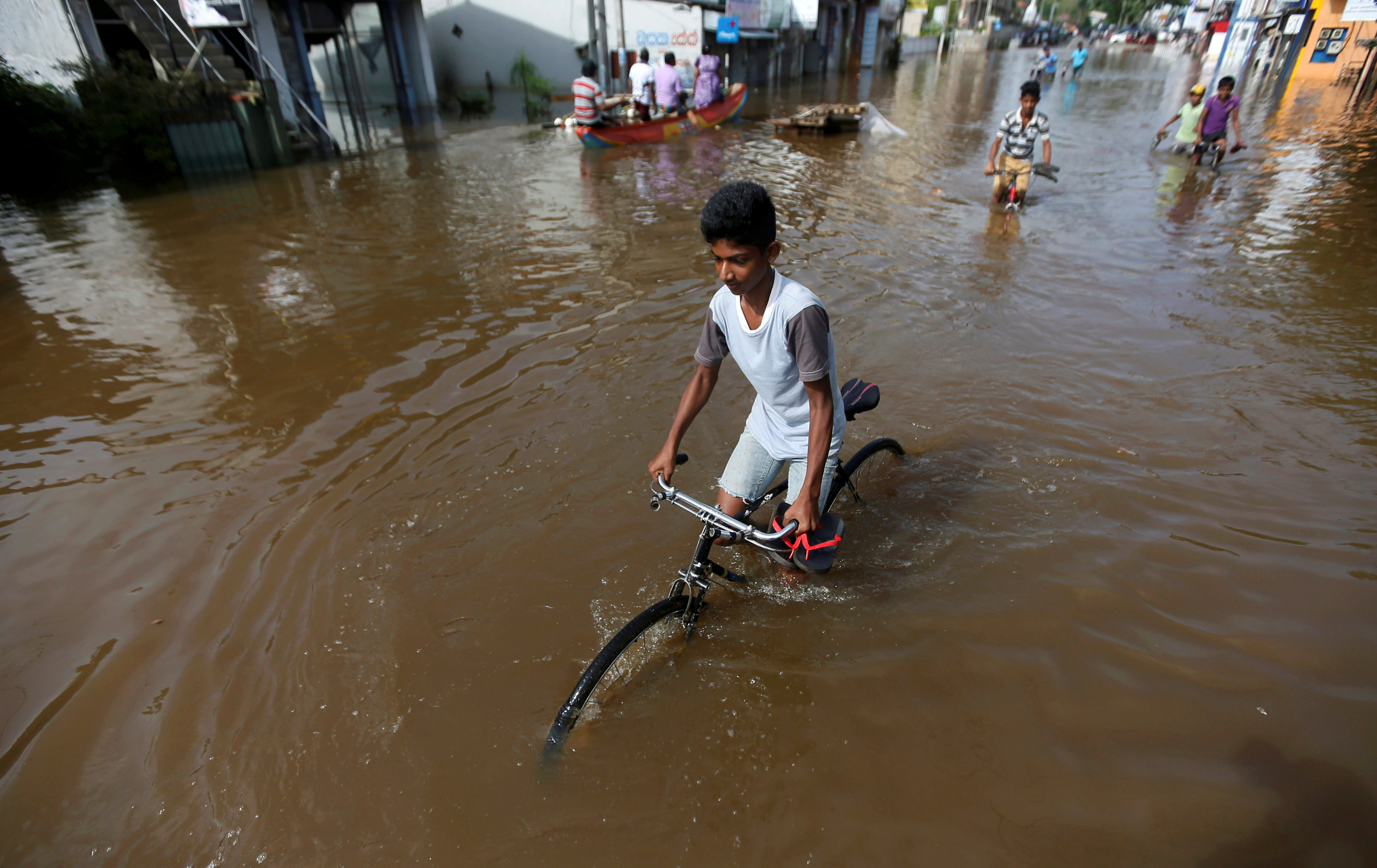
Early reports suggested that Cuba had not been hit as hard as Haiti, where the situation was described as “catastrophic” in the port town of Les Cayes.

In the Cuban city of Guantanamo, streets emptied as people moved to shelters or inside their homes.

Matthew is likely to remain a powerful hurricane through at least Thursday night as it sweeps through the Bahamas towards Florida and the Atlantic coast of the southern United States, the NHC said. The storm is expected to be very near the east cost of Florida by Thursday evening, the center added.

The governor of South Carolina ordered the evacuation of more than 1 million people from Wednesday afternoon.

With communications out across most of Haiti and a key bridge impassable because of a swollen river, there was no immediate word on the full extent of potential casualties and damage from the storm in the poorest country in the Americas.

But Pentagon spokesman Peter Cook told reporters in Washington the U.S. Navy was considering sending an aircraft carrier and other ships to the region to aid relief efforts.

The United States has already offered Haiti the use of some helicopters, said Haitian Interior Minister Francois Anick Joseph, who added that damage to housing and crops in the country was apparently extensive.

Twice destroyed by hurricanes in the 18th century, Les Cayes was hit hard by Matthew.

“The situation in Les Cayes is catastrophic, the city is flooded, you have trees lying in different places and you can barely move around. The wind has damaged many houses,” said Deputy Mayor Marie Claudette Regis Delerme, who fled a house in the town of about 70,000 when the wind ripped the roof off.

One man died as the storm crashed through his home in the nearby beach town of Port Salut, Haiti’s civil protection service said. He had been too sick to leave for a shelter, officials said. The body of a second man who went missing at sea was also recovered, the government said. Another fisherman was killed in heavy seas over the weekend as the storm approached.

STARTING FROM SCRATCH

As much as 3 feet (1 meter) of rain was forecast to fall over hills in Haiti that are largely deforested and prone to flash floods and mudslides, threatening villages as well as shantytowns in the capital Port-au-Prince.

The hurricane has hit Haiti at a time when tens of thousands of people are still living in flimsy tents and makeshift dwellings because of the 2010 earthquake.

“Farms have been hit really hard. Things like plantains, beans, rice – they’re all gone,” said Hervil Cherubin, country director in Haiti for Heifer International, a nonprofit organization that is working with 30,000 farming families across Haiti. “Most of the people are going to have to start all over again. Whatever they accumulated the last few years has been all washed out.”

Matthew was churning around 20 miles (32 km) northwest of the eastern tip of Cuba at 11 p.m. EDT (0300 GMT). It was moving north at about 8 miles per hour (13 kph), the NHC said.

Cuba’s Communist government traditionally puts extensive efforts into saving lives and property in the face of storms, and authorities have spent days organizing teams of volunteers to move residents to safety and secure property.

The storm thrashed the tourist town of Baracoa in the province of Guantanamo, passing close to the disputed U.S. Naval base and military prison.

The U.S. Navy ordered the evacuation of 700 spouses and children along with 65 pets of service personnel as the storm approached. U.S. President Barack Obama had earlier canceled a trip to Florida scheduled for Wednesday because of the potential impact of the storm, the White House said.

A hurricane watch was in effect for Florida from an area just north of Miami Beach to the Volusia-Brevard county line, near Cape Canaveral, which the storm could reach on Thursday, the hurricane center said.

Tropical storm or hurricane conditions could affect parts of Georgia, South Carolina, and North Carolina later this week, even if the center of Matthew remained offshore, the NHC said.

Governor Rick Scott declared a state of emergency for Florida on Monday, designating resources for evacuations and shelters and putting the National Guard on standby.

(Reporting by Joseph Guyler Delva in Port-au-Prince and Makini Brice in Les Cayes; Additional reporting by Marc Frank in Cuba and Jorge Pineda in Dominican Republic; Writing by Frank Jack Daniel and Dave Graham; Editing by Simon Gardner, Sandra Maler and Nick Macfie)

Mudslides triggered by storm claim 40 in Eastern Mexico

A view of the house where three members of a family died after a mudslide following heavy showers caused by the passing of Tropical Storm Earl in the town of Temazolapa

MEXICO CITY (Reuters) – Mudslides triggered by intense rainfall in eastern Mexico killed 40 people at the weekend as saturated hillsides collapsed onto modest homes in the wake of now-dissipated Tropical Storm Earl.

The death toll rose late on Sunday after state governors in the two most affected states confirmed two more deaths from a series of mudslides that struck hillside communities.

The head of national emergency services previously put the death toll at 38, the vast majority of whom were found in Puebla state, while the remainder died in neighboring Veracruz.

Rafael Morena Valle, governor of Puebla state, said canine units were searching for the missing, but the number of unaccounted for residents was unclear.

Images of the damage from Earl, broadcast on Mexican television, showed massive mudslides burying entire hillsides, trees felled and buildings creaking under collapsed walls and roofs.

On the Pacific coast, Mexico’s Baja California peninsula braced for another major storm to strike as early as Monday.

Tropical Storm Javier was generating maximum sustained winds of 50 miles per hour (80 kph) on Sunday night and was forecast to become a hurricane late Monday, the U.S. National Hurricane Center said in a statement.

The center of the storm was expected to strike the southern tip of Baja, home to the beach resort of Los Cabos, by Monday night.

At least 25 of the deaths in Puebla state were confirmed on Sunday near the town of Huauchinango in the rugged Sierra Norte de Puebla mountains, site of the worst destruction so far.

Eleven people have died in Veracruz, buried in landslides after intense rainfall and flooding struck the Gulf coast state after Earl crossed the Yucatan peninsula.

“We continue to monitor rivers that are above critical levels,” Veracruz Governor Javier Duarte said in a post on Twitter on Sunday.

Before striking Mexico, Earl battered Belize last Thursday, smashing car windows and punching holes in the roofs of Belize City’s wooden houses. It also flooded parts of the coast.

(Reporting by Adriana Barrera and David Alire Garcia; Editing by David Gregorio, Bill Trott and Paul Tait)