By Kanupriya Kapoor and Fathin Ungku
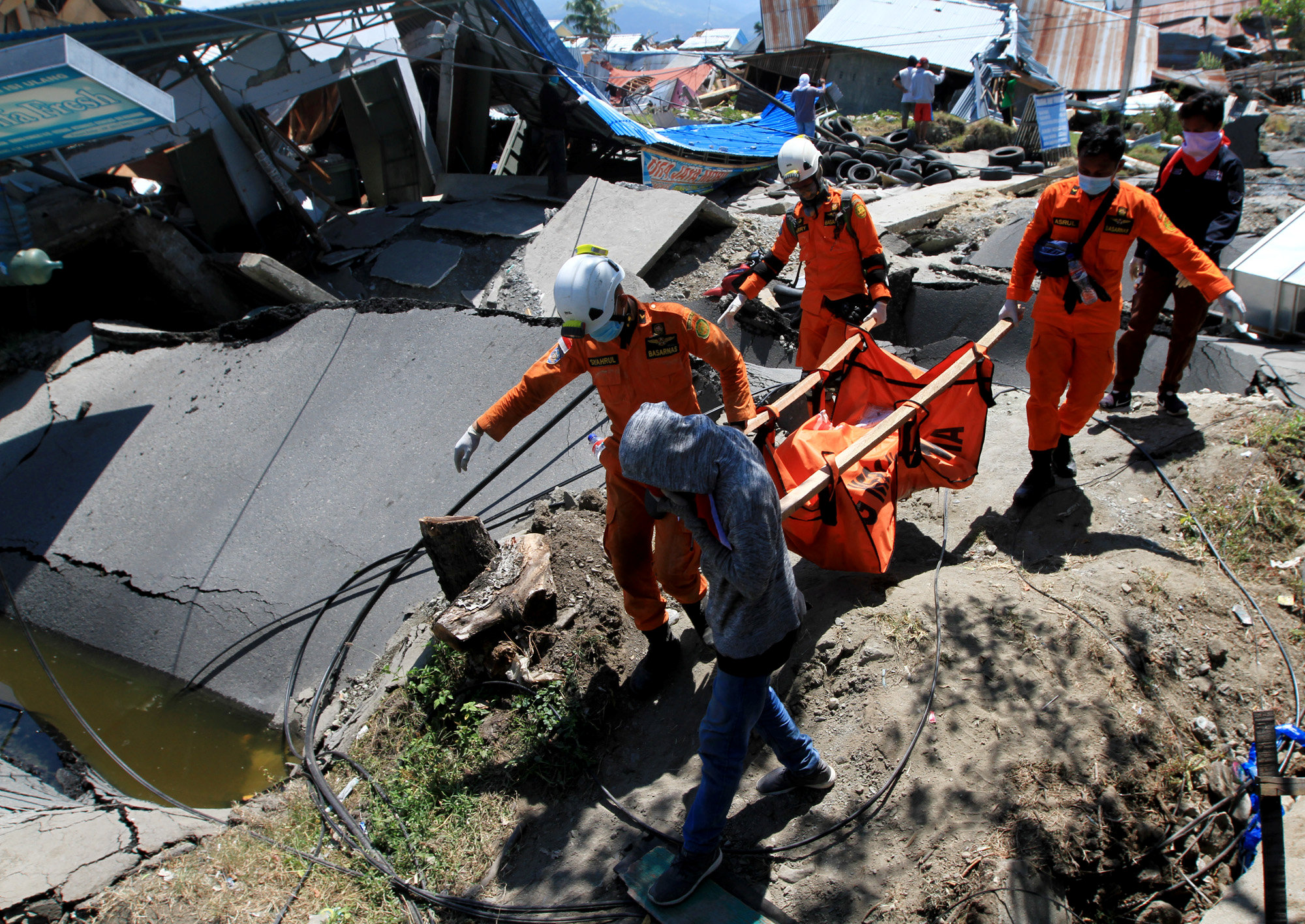
PALU, Indonesia (Reuters) – Indonesia is in a race against time to save victims of a devastating earthquake and tsunami on Sulawesi island, the government said on Tuesday, as the official death toll rose to more than 1,200 and looting fueled fears of lawlessness.
Four days after the double disaster struck, officials feared the toll could soar, as most of the confirmed dead had come from Palu, a small city 1,500 km (930 miles) northeast of Jakarta.
Some remote areas have been largely cut off after Friday’s 7.5 magnitude quake triggered tsunami waves, destroying roads and bridges, and their losses have yet to be determined.
“The team is racing against time because it’s already D+four,” Sutopo Purwo Nugroho, spokesman of National Disaster Mitigation Agency, told a briefing in Jakarta, referring to four days since the quake.
He said rescuers had reached all four of the badly affected districts, which together have a population of 1.4 million, but he declined to give an estimate of casualties.
He gave few details of the conditions rescuers had found, saying they were similar to those in Palu.
Earlier, President Joko Widodo called for reinforcements in the search for survivors saying everyone had to be found.
The official death toll surged to 1,234 with 800 people seriously injured.
There has been particular concern about Donggala, a district of 300,000 people north of Palu and close to the epicenter of the quake, which only a few aid workers have managed to reach.
Nugroho said it had been “devastated” by the tsunami.
A video from the district, broadcast by the Antara state news agency, showed widespread destruction, including flattened buildings and a ship hurled into port buildings by the tsunami.
“What we need is food, water, medicine, but to up now we’ve got nothing,” said an unidentified man standing in ruins.
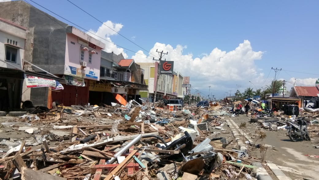
In Palu, tsunami waves as high as six meters (20 feet) smashed into the beachfront, while hotels and shopping malls collapsed in ruins.
About 1,700 houses in one neighborhood were swallowed up by ground liquefaction, which happens when soil shaken by an earthquake behaves like a liquid, and hundreds of people are believed to have perished, the disaster agency said.
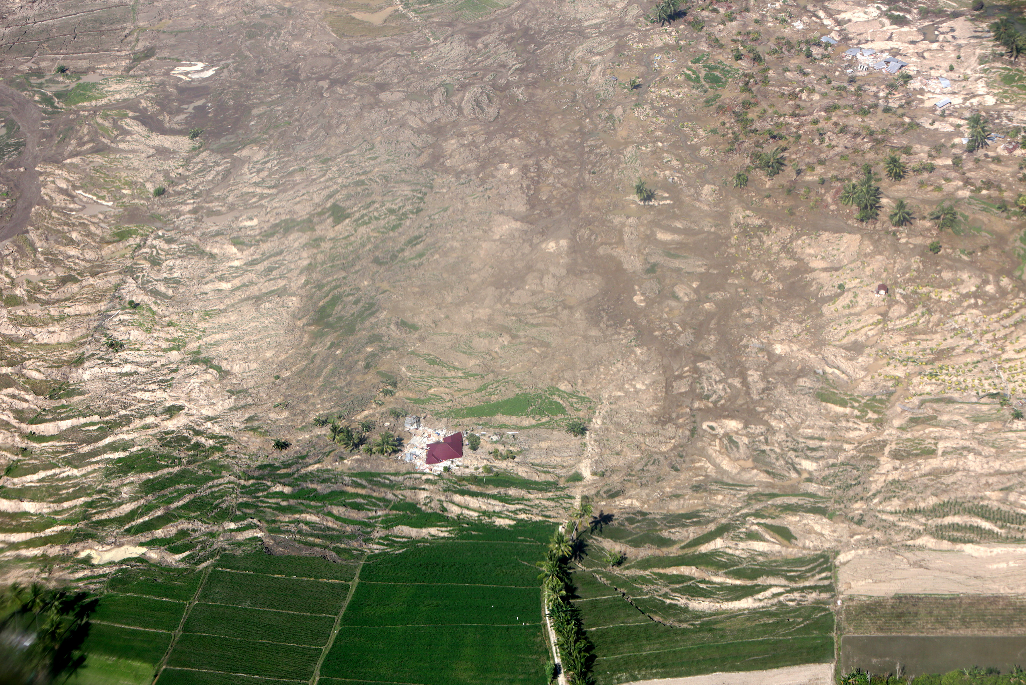
An aerial view of liquefaction, or shifting ground, following an earthquake in Palu, Central Sulawesi, Indonesia, October 1, 2018 in this photo taken by Antara Foto. Antara Foto/Irwansyah Putra/ via REUTERS.
Before-and-after satellite pictures showed a largely built-up neighborhood just south of Palu’s airport seemingly wiped clean of all signs of life by liquefaction.
Nugroho said Sigi district was “flattened” by liquefaction. Among the dead were 34 children killed at a Christian bible study camp.
LEAVING AND LOOTING
More than 65,000 homes were damaged and more than 60,000 people have been displaced and are in need of emergency help.
Thousands of people have been streaming out of stricken areas. Commercial airlines have struggled to restore operations at Palu’s damaged airport but military aircraft have taken some survivors out. Many more want to leave.
The government has ordered that aid be airlifted in but there’s little sign of help on Palu’s shattered streets and survivors appeared increasingly desperate.
A Reuters news team saw a shop cleared by about 100 people, shouting, scrambling and fighting each other for items including clothes, toiletries, blankets and water.
Many people grabbed diapers while one man clutched a rice cooker as he headed for the door. Non-essential goods were scattered on the floor amid shards of broken glass.
Police were at the scene but did not intervene. The government has played down looting saying victims could take essentials and shops would be compensated.
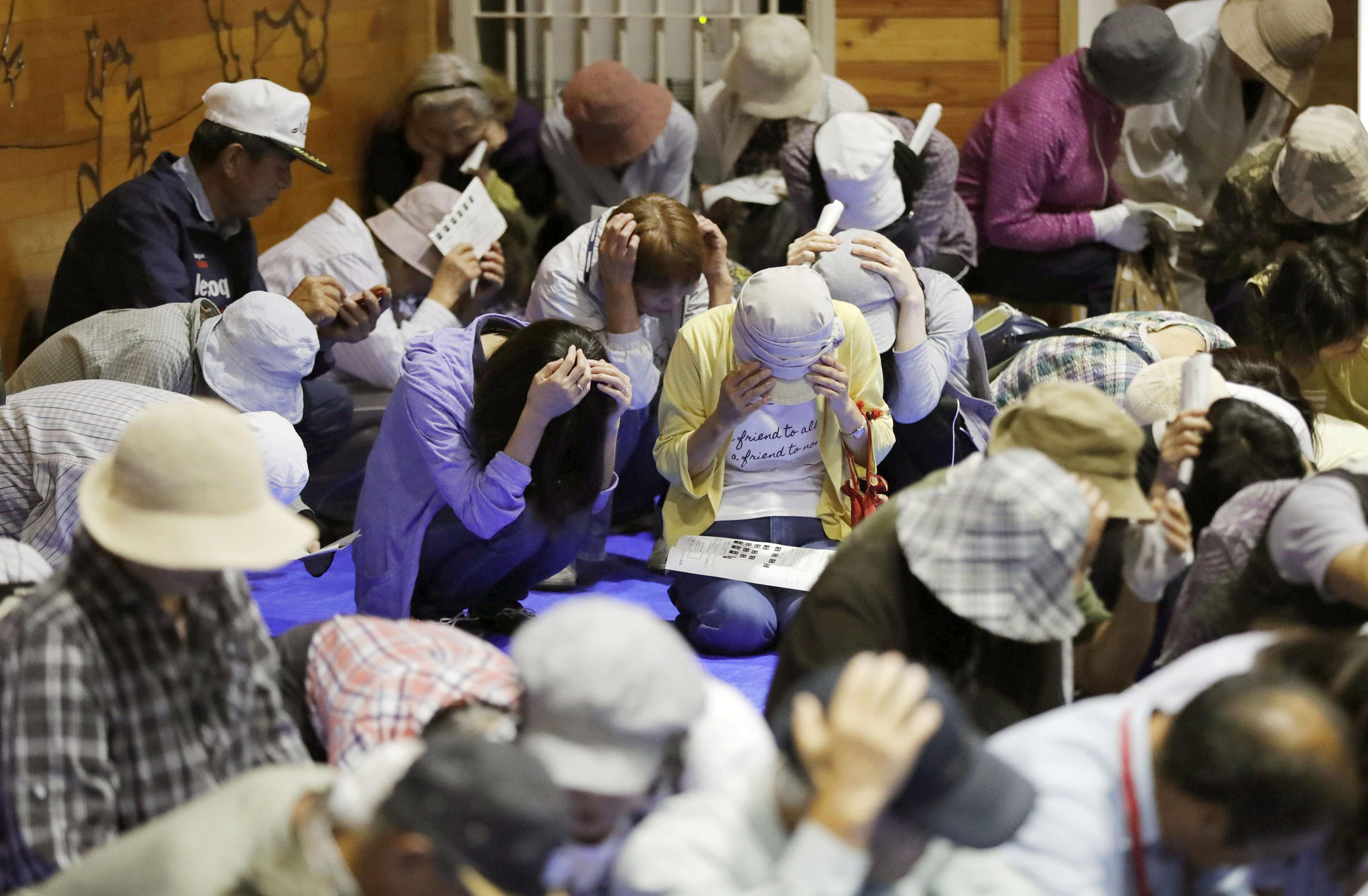
Indonesia is all too familiar with earthquakes and tsunamis. A quake in 2004 triggered a tsunami across the Indian Ocean that killed 226,000 people in 13 countries, including more than 120,000 in Indonesia.
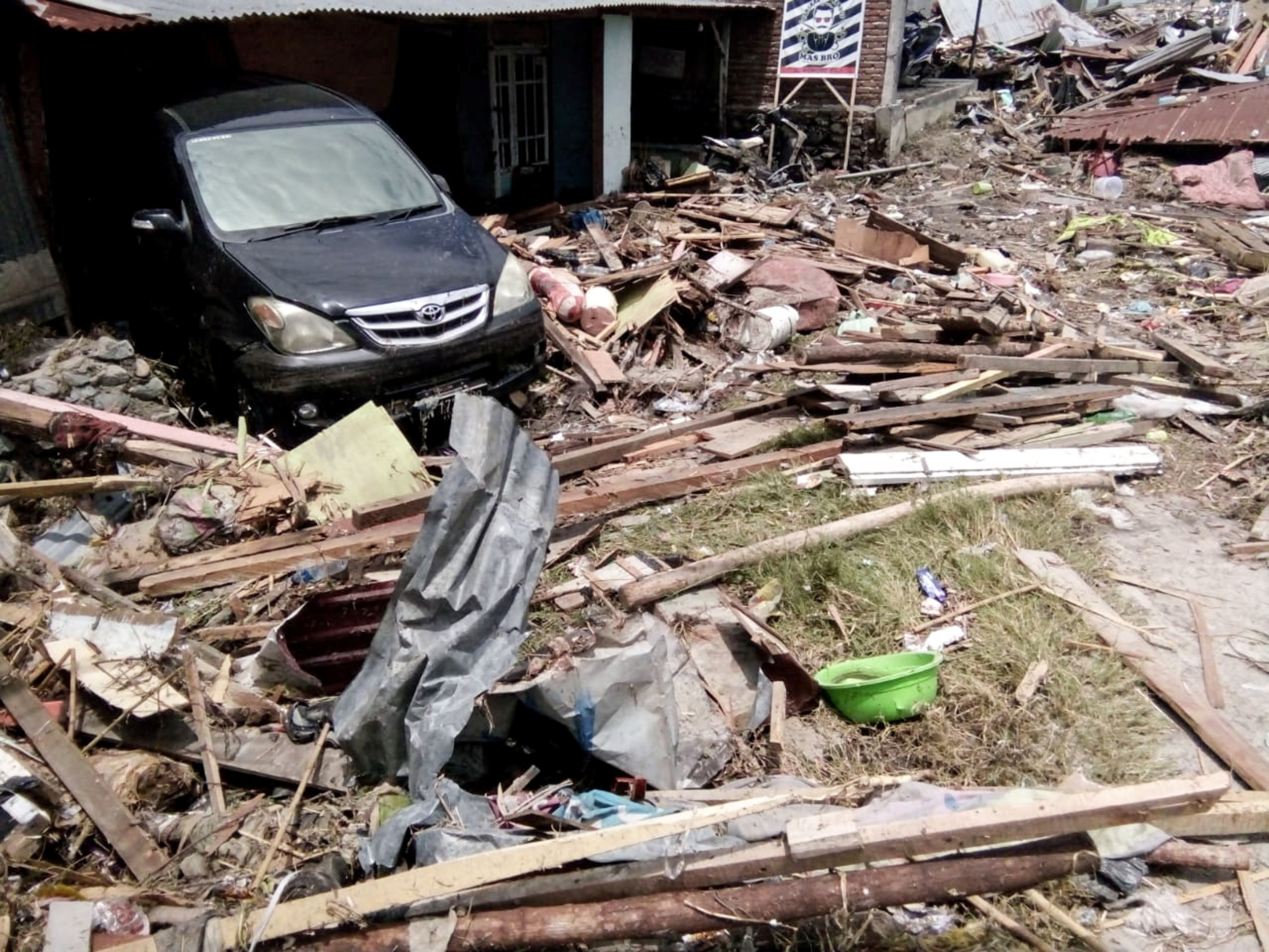
A damaged car is seen at a broken house after earthquake hit in Palu, Indonesia September 29, 2018. REUTERS/Stringer
It has said it would accept offers of international aid, after shunning outside help this year when an earthquake struck Lombok island.
A spokesman for the main U.N. aid coordinating agency, OCHA, said humanitarian agencies were in contact with the government and ready to help.
“There is an immediate need for food, clean water, shelter, medical care and psycho-social support,” the spokesman, Jens Laerke, told a briefing in Geneva.
State port operator Pelindo IV said a ship carrying 50 tonnes of supplies including rice and baby milk had arrived in Palu on Monday. It was unclear if the aid had been distributed.
‘BURIED FAST’
Power has yet to be restored and aftershocks have rattled nerves but rescuers in Palu held out hope they could still save lives.
“We suspect there are still some survivors trapped inside,” the head of one rescue team, Agus Haryono, told Reuters at the collapsed Hotel Roa Roa as he pored over its blueprints.
About 50 people were believed to have been caught inside the hotel when it was brought down. About nine bodies have been recovered and three rescued alive.
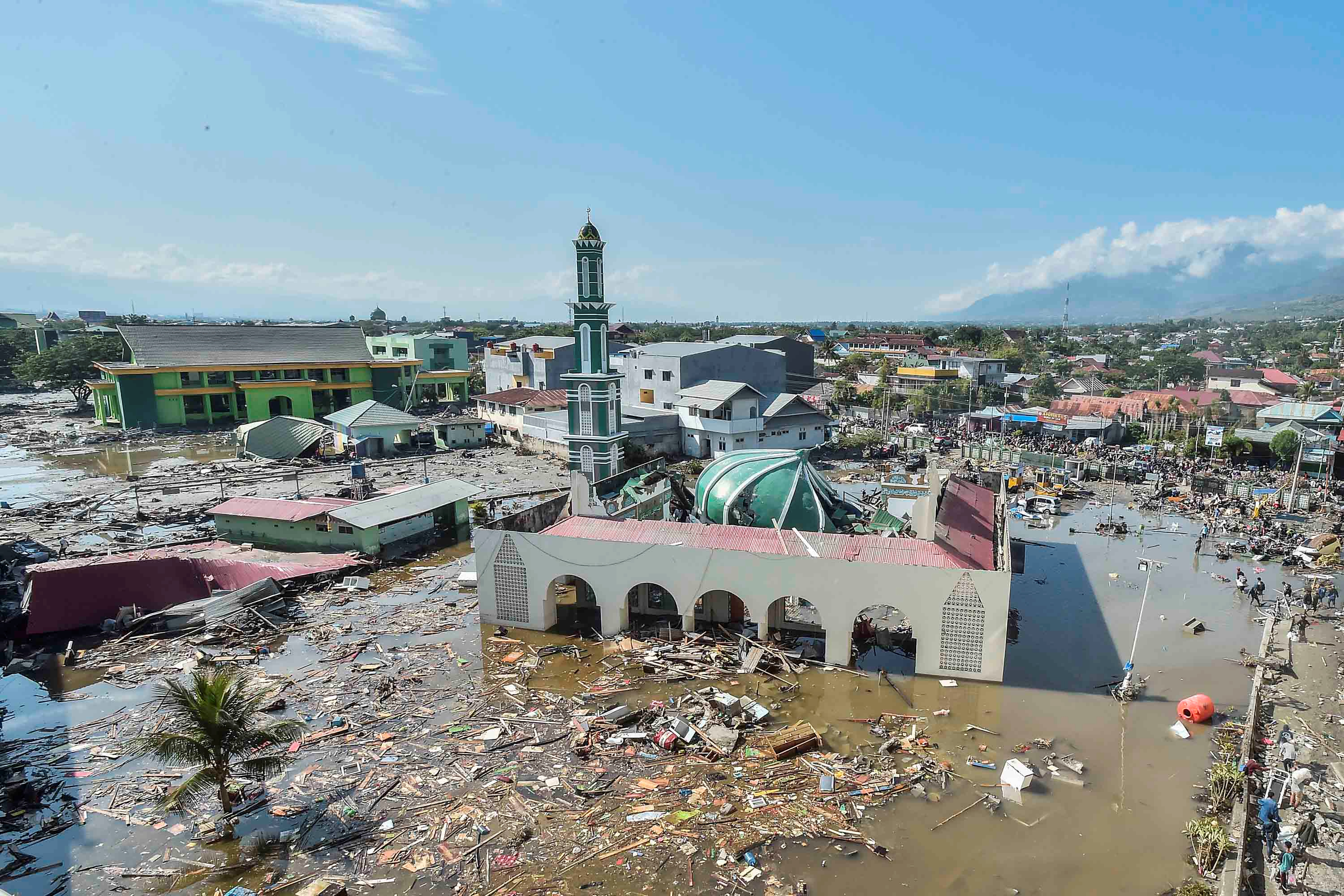
An aerial view of the Baiturrahman mosque which was hit by a tsunami, after a quake in West Palu, Central Sulawesi.
Antara Foto/Muhammad Adimaja/via REUTERS
Elsewhere, on the outskirts of Palu, lorries brought 54 bodies to a mass grave. Most had not been claimed, a policeman said, but some relatives came to pay respects to loved ones at the 50-meter (165 ft) trench.
Rosmawati Binti Yahya, 52, was still looking for her missing daughter. But her husband was among the victims laid in the grave.
“It’s OK if he’s buried in the mass grave, it’s better to have him buried fast,” she said.
(Additional reporting by Agustinus Beo Da Costa, Maikel Jefriando, Tabita Diela, Gayatri Suroyo, Fransiska Nangoy, Fanny Potkin, Ed Davies and Fergus Jensen in JAKARTA, Stephanie Ulmer-Nebehay in GENEVA; Writing by Robert Birsel; Editing by Nick Macfie and Simon Cameron-Moore)