Philippines evacuates coastal areas ahead of typhoon Yutu

A general view of the damage after Super Typhoon Yutu hit Saipan, Northern Mariana Islands, U.S., October 25, 2018 in this picture taken through a cracked vehicle window, obtained from social media. Brad Ruszala via REUTERS

MANILA (Reuters) – The Philippines raised storm warning levels on Monday and began evacuating some coastal communities in the path of a typhoon that threatened storm surges, landslides and floods triggered by heavy winds and rain.

Typhoon Yutu, which caused havoc last week with a direct hit on the U.S. Northern Mariana islands, was set to make landfall on Tuesday morning and move across the main island of Luzon before leaving the Philippines 24 hours later, the state weather agency PAGASA said.

By mid-morning on Monday, Yutu was about 400 km (249 miles)east of the mainland and had weakened to sustained wind speeds of 150 km per hour (93 mph), with gusts of 185 kph, from 170 kph recorded a few hours earlier.

That was less intense than four days ago, when as a super typhoon with wind speeds of over 270 kph barreled through the Marianas, a U.S. Western Pacific archipelago of 52,000 people, tearing off roofs, overturning vehicles and cutting off power and water.

Authorities in Isabela and Cagayan provinces started moving residents in coastal towns to evacuation centers while the mountainous Cordillera region was put on red alert for landslides.

Three provinces in north Luzon were elevated to warning signal 3 on the severity scale of 5, and 28 more put on the earliest warnings of 1 and 2, with strong winds and rains expected later on Monday.

Known locally as Rosita, the typhoon will be the 18th to hit the Philippines this year and comes six weeks after super typhoon Mangkhut tore across Luzon, triggering landslides that killed dozens of people and damaged about $180 million of crops.

School classes were suspended in at least five provinces and fishermen in Luzon and the eastern seaboard advised not to go to sea, with warnings of storm surges of up to three metres in six provinces.

All boat services in the port city of Batangas, about 83 km (52 miles) south of Manila, were suspended on Monday.

About half of the Philippines’ 105 million population live in the Luzon region. The country is hit by an average 20 typhoons each year.

(Reporting by Martin Petty and Karen Lema; editing by Darren Schuettler)

Japan braces as typhoon charts course for main island

Super typhoon Trami is seen from the International Space Station as it moves in the direction of Japan, September 25, 2018 in this image obtained from social media on September 26, 2018. ESA/NASA-A.Gerst/via REUTERS

By Elaine Lies

TOKYO (Reuters) – Japan braced for high winds and heavy rain as a typhoon roared north on Friday, enveloping outlying islands in high seas before taking aim at the rest of the nation and raking across its biggest main island at the weekend.

Typhoon Trami, rated category 2 by Tropical Storm Risk, with category 5 the highest, is the latest storm to threaten Japan in a year filled with more than the usual number of disasters, including punishing heat, heavy rains, and landslides.

Less than a month ago, a typhoon flooded Kansai International airport near Osaka, leaving thousands of tourists stranded.

Outlying islands in the Okinawan chain, some 1,000 km southwest of Tokyo, were being pounded by heavy seas and strong winds, just two days before an Okinawan gubernatorial election, forcing some areas to hold voting early. The central government set up an emergency office to deal with the storm.

Trami was about 300 km (186 miles) southeast of Miyako island, with winds gusting as high as 216 kilometers an hour (134 mph).

Churning north across Okinawa on Saturday, Trami is then predicted to rake across the islands of Kyushu and the main island of Honshu on Sunday, a path similar to that taken by typhoon Jebi early in September.

Though the Japanese capital of Tokyo is set for heavy rain, current predictions show it avoiding a direct hit.

Jebi, the most powerful storm to hit Japan in 25 years, brought some of the highest tides since a 1961 typhoon and flooded Kansai airport near Osaka, taking it out of service for days.

Seventeen people died in the storm, whose high winds sent trees crashing to the ground and cars scudding across parking lots.

Even for a nation accustomed to disasters, this year has been hard for Japan, starting with a volcanic eruption in January that rained rocks down on a ski resort, killing one.

July brought record-breaking heat that killed at least 80 people and sent over 20,000 to the hospital for treatment, along with torrential rains in western Japan that set off floods and landslides, killing more than 200.

Just two days after Jebi hit in September, the northernmost main island of Hokkaido was rocked by an earthquake that set off landslides, knocked out power throughout the island and killed at least 44 people.

(Editing by Nick Macfie)

In quake-prone Japan, attention shifts to flood risks as heavy rains increase

FILE PHOTO: The staff of metropolitan outer floodway management office looks around a pressure-adjusting water tank, part of an underground water discharge tunnel which was constructed to protect Tokyo and its suburb areas against floodwaters and overflow of the city's major waterways and rivers during heavy rain and typhoon seasons, at the facility in Kasukabe, north of Tokyo, Japan August 29, 2018. REUTERS/Toru Hanai

By Kiyoshi Takenaka

TOKYO (Reuters) – Japanese have long been conditioned to prepare for earthquakes, but recent powerful typhoons and sudden, heavy rains have brought to the forefront another kind of disaster: flooding.

Experts warn that thousands could die and as many as 5 million people would need to be evacuated if massive dikes and levees in low-lying eastern Tokyo are overwhelmed by surging floodwaters.

The cities of Osaka and Nagoya also face flood risks, experts say, amid an increase in sudden heavy rainfall across the country in recent years, a symptom linked to global warming.

“Japan’s major metropolitan areas are, in a way, in a state of national crisis,” said Toshitaka Katada, a professor of disaster engineering at the University of Tokyo.

In July, parts of western Japan were deluged with more than 1,000 millimeters (39 inches) of torrential rain. Gushing water broke levees and landslides destroyed houses, killing more than 200 people in the country’s worst weather disaster in 36 years.

“If this happened to Tokyo, the city would suffer catastrophic damage,” said Nobuyuki Tsuchiya, director of the Japan Riverfront Research Center and author of the book “Capital Submerged,” which urges steps to protect the city, which will host the 2020 Olympics and Rugby World Cup games next year.

Particularly vulnerable are the 1.5 million people who live below sea level in Tokyo, near the Arakawa River, which runs through the eastern part of the city.

In June, the Japan Society of Civil Engineers estimated that massive flooding in the area would kill more than 2,000 people and cause 62 trillion yen ($550 billion) in damage.

Experts could not say how likely that scenario was. But in recent years, the government has bolstered the city’s water defenses by building dams, reservoirs and levees.

But the pace of construction is too slow, said Satoshi Fujii, a special adviser to Prime Minister Shinzo Abe who is known for pushing big infrastructure projects.

“They need to be taken care of as soon as possible,” he told Reuters.

John Coates, chairman of the International Olympic Committee’s coordination commission for the Tokyo 2020 Games, said the city should “take into account the potential for some of these disasters that seem to beset your country.”

In tacit acknowledgement that more needs to be done, the transport ministry late last month asked the finance ministry for 527 billion yen for levee reinforcement and evacuation preparation in next year’s budget. That’s a third more than the current year.

SURROUNDED BY WATER

Tokyo was last hit by major flooding in 1947, when Typhoon Kathleen inundated large swaths of the city and killed more than 1,000 people across Japan.

A survivor from that disaster, 82-year-old Eikyu Nakagawa, recalled living on the roof of his one-story house with his father for three weeks, surrounded by water. He remembered a pregnant woman who had taken refuge in a two-story house next door.
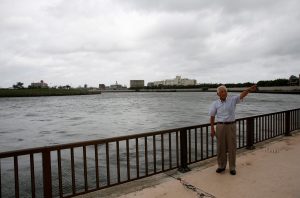
FILE PHOTO: Eikyu Nakagawa talks about flood preparation on a bank along the Nakagawa River near his house during an interview with Reuters in Tokyo, Japan August 24, 2018. REUTERS/Kim Kyung-Hoon

FILE PHOTO: Eikyu Nakagawa talks about flood preparation on a bank along the Nakagawa River near his house during an interview with Reuters in Tokyo, Japan August 24, 2018. REUTERS/Kim Kyung-Hoon

“The baby could come any minute, but we could not bring a midwife to her or take her to a doctor,” he said. “I was just a kid, but I lost sleep worrying that she might die.”

A similar disaster today would be much worse, Nakagawa predicted, because the area around his house in Tokyo’s eastern Katsushika ward, once surrounded by rice paddies, is now packed with buildings.

“It’s going to be terrible,” he said. “Now it’s so crowded with houses. Little can be done if water comes.”

Intense rainfall is on the upswing across Japan. Downpours of more than 80 millimeters in an hour happened 18 times a year on average over the 10 years through 2017, up from 11 times between 1976-85.

Warming global temperatures contribute to these bouts of extreme weather, scientists say.

“Higher ocean temperatures cause more moisture to get sucked up into the air,” said University of Tokyo’s Katada. “That means a very large amount of rain falling at once, and typhoons are more likely to grow stronger.”

Just last week, western Japan was battered by Typhoon Jebi, the strongest typhoon to make landfall in 25 years, which killed at least 13 people and inundating the region’s biggest international airport.
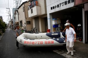
FILE PHOTO: Residents of Tokyo's Katsushika ward show a floating boat which they keep for a possible flood in Tokyo, Japan August 24, 2018. REUTERS/Kim Kyung-Hoon

FILE PHOTO: Residents of Tokyo’s Katsushika ward show a floating boat which they keep for a possible flood in Tokyo, Japan August 24, 2018. REUTERS/Kim Kyung-Hoon

EVACUATION NIGHTMARE

In late August, five low-lying wards in Tokyo jointly unveiled hazard maps outlining areas at high risk of flooding, and warned that up to 2.5 million residents may need to evacuate in case of a major disaster.

The maps, which will be available to residents online and via hard copy, show how deep floodwater would likely be for each area, and how long each area would remain underwater.

But such maps were largely ignored during the deadly flooding in western Japan in July.

If a disaster hits during weekday working hours, the number of evacuees could swell to 5 million, including those from neighboring wards, says Tsuchiya – a logistical nightmare. Tokyo prefecture has grown to 14 million people, with millions more in surrounding areas.

Abe’s ruling Liberal Democratic Party has called for a new ministry that would focus on disaster prevention and recovery. Currently that is overseen by the Cabinet Office, which handles other disparate tasks such as laying out basic fiscal policy and nurturing technological innovation.

Companies also are waking up to the danger of floods, said Tomohisa Sashida, senior principal consultant at Tokio Marine & Nichido Risk Consulting.

“We have been often approached for quake-related business continuity plans.” he said. “But now they realize they need to keep flood risks in mind and flood-related consultations are certainly on the rise.”

(Reporting by Kiyoshi Takenaka and Kwiyeon Ha; Editing by Malcolm Foster and Gerry Doyle)

Death toll from Japan quake hits 44, power supply, Toyota output disrupted

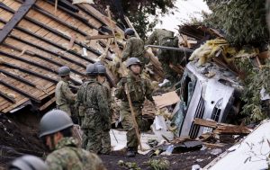
Police officers and members of the Japan Self-Defense Forces (JSDF) carry a missing person found from an area damaged by a landslide caused by an earthquake in Atsuma town, Hokkaido, northern Japan, in this photo taken by Kyodo September 8, 2018. Mandatory credit Kyodo/via REUTERS

By Kaori Kaneko and Osamu Tsukimori

TOKYO (Reuters) – The death toll from a powerful earthquake in northern Japan last week rose to 44, with 660 injured, the government said on Monday, as electricity supply remained short and top automaker Toyota suspended work at most of its assembly plants.

The pre-dawn, 6.7-magnitude quake on Thursday temporarily paralyzed the island of Hokkaido, cutting off access by air and train and knocking out power to an island the size of Austria.

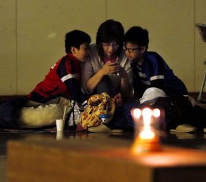
A family is seen at a gymnasium of elementary school, acting as an evacuation shelter at an area damaged by an earthquake in Sapporo, Hokkaido, northern Japan, in this photo taken by Kyodo September 7, 2018. Mandatory credit Kyodo/via REUTERS

A family is seen at a gymnasium of elementary school, acting as an evacuation shelter at an area damaged by an earthquake in Sapporo, Hokkaido, northern Japan, in this photo taken by Kyodo September 7, 2018. Mandatory credit Kyodo/via REUTERS

About 2,500 people remain in evacuation centers, according to the Fire and Disaster Management Agency, after landslides buried houses and rain at the weekend loosened soil in a further threat to unstable houses.

Yoshihide Suga, the top government spokesman, said a team of about 40,000 Self-Defense Force troops, police, firefighters and others were working on clearing debris and other clean-up operations. There were no more missing residents, he said.

Power supply has been restored to nearly all customers in Hokkaido but trade minister Hiroshige Seko called on the island’s businesses and 5.3 million residents to use about 20 percent less energy to prevent further blackouts.

“It’s very important now for all residents, businesses, the government, and electricity suppliers to work together towards this goal of 20 percent energy-saving,” Seko told a news conference late on Sunday.

The government has no plans for rolling blackouts on Monday and Tuesday despite the continued closure of a fossil fuel-fired power plant that supplies about half the island’s power, he said.

With electricity restored, Toyota Motor Corp said on Monday its parts factory in Tomakomai, Hokkaido, which builds transmissions and other components, was preparing to resume production during the night shift.

However, the fallout has already spread beyond the island, with Toyota suspending production at 16 of its 18 domestic car assembly plants on Monday to assess its parts inventory. The automaker said it would gradually restore production from Tuesday, resuming work fully by Thursday.

(Reporting by Kaori Kaneko, Maki Shiraki, Osamu Tsukimori; Writing by Chang-Ran Kim; Editing by Paul Tait)

Rescuers with dogs search for survivors after deadly Japan quake

A woman (C) wipes her tears after her missing father was found at an area damaged by a landslide caused by an earthquake in Atsuma town, Hokkaido, northern Japan, in this photo taken by Kyodo September 7, 2018. Kyodo/via REUTERS

By Kaori Kaneko and Malcolm Foster

TOKYO (Reuters) – Rescue workers with dogs searched for survivors on Friday in debris-strewn landslides caused by an earthquake in Japan’s northern island of Hokkaido, as electricity was restored to just over half of households.

Public broadcaster NHK put the death toll at 12, with five people unresponsive. Earlier, Prime Minister Shinzo Abe said 16 had died, but Chief Cabinet Secretary Yoshihide Suga later clarified in updated numbers that nine had been confirmed dead and nine others were in a state of cardiopulmonary arrest, a term typically used before death is confirmed.

Another 24 were still missing after Thursday’s pre-dawn magnitude-6.7 quake, the latest deadly natural disaster to hit Japan over the past two months, coming after typhoons, floods and a record-breaking heat wave.

Members of the Japan Self-Defense Forces (JSDF) search for survivors from a house damaged by a landslide caused by an earthquake in Atsuma town, Hokkaido, northern Japan, in this photo taken by Kyodo September 7, 2018. Kyodo/via REUTERS

Members of the Japan Self-Defense Forces (JSDF) search for survivors from a house damaged by a landslide caused by an earthquake in Atsuma town, Hokkaido, northern Japan, in this photo taken by Kyodo September 7, 2018. Kyodo/via REUTERS

Nearly 5,000 Hokkaido residents spent the night in evacuation centers where food was distributed in the morning.

“It was an anxious night with several aftershocks, but we took encouragement from being together and now we’re grateful for some food,” one woman told public broadcaster NHK.

Some 22,000 rescue workers had worked through the night to search for survivors, Abe told an emergency meeting on Friday. With rain forecast for Friday afternoon and Saturday, he urged people to be careful about loose soil that could cause unstable houses to collapse or further landslides.

“We will devote all our energy to saving lives,” Abe said.

As of Friday afternoon, Hokkaido Electric Power Co had restored power to 1.54 million of the island’s 2.95 million households. The utility aimed to raise that number to 2.4 million, or over 80 percent, by the end of Friday, industry minister Hiroshige Seko said.

Flights resumed from midday at Hokkaido’s main airport, New Chitose. The island, about the size of Austria and with 5.3 million people, is a popular tourist destination known for its mountains, lakes, rolling farmland and seafood.

Members of the Japan Self-Defense Forces (JSDF) search for survivors from a house damaged by a landslide caused by an earthquake in Atsuma town, Hokkaido, northern Japan, in this photo taken by Kyodo September 7, 2018. Kyodo/via REUTERS

Members of the Japan Self-Defense Forces (JSDF) search for survivors from a house damaged by a landslide caused by an earthquake in Atsuma town, Hokkaido, northern Japan, in this photo taken by Kyodo September 7, 2018. Kyodo/via REUTERS

LANDSLIDES WRECK HOMES

Soldiers in fatigues and orange-clad rescue workers searched for survivors, picking through debris on huge mounds of earth near the epicenter in Atsuma in southern Hokkaido. Aerial footage showed rescuers with dogs walking through the destruction.

All the missing people are from the Atsuma area, where dozens of landslides wrecked homes and other structures and left starkly barren hillsides.

“I just hope they can find him quickly,” one unidentified man told NHK as he watched the search for his missing neighbor.

The quake damaged the big Tomato-Atsuma plant, which normally supplies half of Hokkaido’s power and is located near the epicenter, forcing it to automatically shut down. That caused such instability in the grid that it tripped all other power stations on the island, causing a full blackout.

Hokkaido Electric was bringing other smaller plants back on line and also receiving some power transferred through undersea cables from the main island of Honshu.

Kansai International Airport in western Japan has been shut since Typhoon Jebi ripped through Osaka on Tuesday, although some domestic flights operated by Japan Airlines Co Ltd and ANA Holdings Inc’s low-cost carrier Peach Aviation resumed on Friday, the carriers said.

JR Hokkaido planned to resume bullet train operations from midday. It was also trying to resume other train services on Friday afternoon, a spokesman said.

Manufacturers were still affected by power outages.

Toyota Motor Corp’s Tomakomai factory, which makes transmissions and other parts, said operations remained suspended indefinitely until power was restored, a spokesman said.

Toppan Printing Co Ltd’s operations at a plant in Chitose, which makes food packages, would remain suspended until it regained power, a spokesman said.

The quake prompted Japan’s Self-Defense Forces to cancel two joint military exercises in Hokkaido, including the first-ever drill with Australian fighter jets, and a training exercise with the U.S. Marine Corps.

A soccer friendly between Japan and Chile scheduled for Friday in Hokkaido’s main city of Sapporo was also called off.

(Reporting by Chris Gallagher, Kaori Kaneko, Makiko Yamazaki and Osamu Tsukimori; Writing by Malcolm Foster and Chris Gallagher; Editing by Paul Tait and Christopher Cushing)

Powerful quake paralyzes Hokkaido in latest disaster to hit Japan

Police officers and rescue workers search for survivors from a building damaged by a landslide caused by a powerful earthquake in Atsuma town in Japan's northern island of Hokkaido, Japan, in this photo taken by Kyodo September 6, 2018. Mandatory credit Kyodo/via REUTERS ATTENTION EDITORS - THIS IMAGE WAS PROVIDED BY A THIRD PARTY. MANDATORY CREDIT. JAPAN OUT. NO COMMERCIAL OR EDITORIAL SALES IN JAPAN.

By Kaori Kaneko and Chang-Ran Kim

TOKYO (Reuters) – A powerful earthquake paralyzed Japan’s northern island of Hokkaido on Thursday, killing at least seven people, triggering landslides and knocking out power to its 5.3 million residents.

The death toll from the 6.7-magnitude, pre-dawn quake was likely to rise as rescuers searched houses buried by landslides.

About 33 people were missing and 300 were injured, public broadcaster NHK said. Four people were in cardiopulmonary arrest, a term used before death is officially confirmed.

The quake was the latest in a string of natural disasters to batter Japan after typhoons, flooding, and a record-breaking heat wave within the past two months.

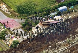
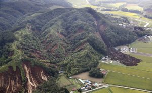
Aerial footage showed dozens of landslides exposing barren hillsides near the town of Atsuma in southern Hokkaido, with mounds of red earth and toppled trees piled at the edge of green fields.

The collapsed remains of what appeared to be houses or barns were strewn about.

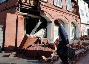
A building damaged by a powerful earthquake is seen in Abira town in Japan's northern island of Hokkaido, Japan, in this photo taken by Kyodo September 6, 2018. Mandatory credit Kyodo/via REUTERS

A building damaged by a powerful earthquake is seen in Abira town in Japan’s northern island of Hokkaido, Japan, in this photo taken by Kyodo September 6, 2018. Mandatory credit Kyodo/via REUTERS

“It came in four big jerks – boom! boom! boom! boom!” one unidentified woman told NHK. “Before we knew it our house was bent and we couldn’t open the door.”

Prime Minister Shinzo Abe said 25,000 Self-Defense Force troops would be deployed for rescue operations.

The island, a tourist destination about the size of Austria known for its mountains, lakes, and seafood, lost its power when Hokkaido Electric Power Co shut down of all its fossil fuel-fired power plants after the quake as a precaution.

It was the first time since the utility was established in 1951 that had happened.

Almost 12 hours later, power was restored to parts of Sapporo, Hokkaido’s capital, and Asahikawa, its second-biggest city.

The government said there was damage to Hokkaido Electric’s Tomato-Atsuma plant, which supplies half the island’s 2.95 million households. It could take a week to restore power fully to all residents, Industry Minister Hiroshige Seko said.

All trains across the island were halted.

Abe’s Liberal Democratic Party begins a leadership contest on Friday but said there would be no campaigning through to Sunday. Abe and rival Shigeru Ishiba both canceled campaign media appearances slated for Friday.

Landslides caused by an earthquake are seen in Atsuma town in Japan's northern island of Hokkaido, Japan, in this photo taken by Kyodo September 6, 2018. Kyodo/via REUTERS

Landslides caused by an earthquake are seen in Atsuma town in Japan’s northern island of Hokkaido, Japan, in this photo taken by Kyodo September 6, 2018. Kyodo/via REUTERS

‘NOTHING I CAN DO’

Television footage from Sapporo showed crumbled roads and mud covering a main street. Police directed traffic because signal lights were out while drink-vending machines, ubiquitous in Japan, and most ATMs were not working.

“Without electricity, there’s nothing I can do except to write prescriptions,” a doctor in Abira, the town next to Atsuma, told NHK.

Media reported a baby girl at a Sapporo hospital was in critical condition after the power was cut to her respirator. It wasn’t clear if the hospital had a generator.

The quake hit at 3:08 a.m. (1808 GMT Wednesday) at a depth of 40 km (25 miles), with its epicenter about 65 km (40 miles) southeast of Sapporo, according to the Japan Meteorological Agency. In Atsuma, it registered a 7 on Japan’s 7-point quake intensity scale, the agency said, revising an earlier measurement.

Hokkaido’s main airport was closed, at least for the day. Debris and water could be seen on the terminal floors.

Kyodo news agency said more than 200 flights and 40,000 passengers would be affected on Thursday alone.

The closure comes just days after Kansai Airport, another major regional hub, in western Japan, was shut by Typhoon Jebi, which killed 11 people and injured hundreds.

The storm, the most powerful to hit Japan in 25 years, stranded thousands of passengers and workers at the airport, whose operator said it would resume some domestic flights on Friday.

In July, torrential rain in west Japan caused flooding that killed more than 200 people and widespread destruction. That was followed by a heat wave that reached a record 41.1 Celsius and led to the deaths of at least 80 people.

FACTORIES HALTED

Farming, tourism and other services are big economic drivers on Hokkaido, which accounts for just 3.6 percent of Japan’s gross domestic product, but there is some industry. Kirin Brewery and Sapporo Breweries both said factories were shut by the power outage.

A series of smaller shocks followed the initial quake, the JMA said. Residents were warned to take precautions.

By the afternoon, backhoes and other earth-moving equipment in Atsuma had begun clearing debris.

Japan is situated on the “Ring of Fire” arc of volcanoes and oceanic trenches that partly encircles the Pacific Basin.

Northeast Japan was hit by a 9 magnitude earthquake on March 11, 2011, that triggered a tsunami that killed nearly 20,000 people and led to meltdowns at the Fukushima Daiichi nuclear power plant.

Hokkaido’s Tomari nuclear power station, which has been shut since the 2011 earthquake and tsunami, suffered a power outage but officials said it was cooling its spent nuclear fuel safely.

Saturday marked the 95th anniversary of the Great Kanto earthquake, which had a magnitude of 7.9 and killed more than 140,000 people in the Tokyo area. Seismologists have said another such quake could strike the capital at any time.

(Reporting by Kaori Kaneko and Chang-Ran Kim; Additional reporting by William Mallard, Osamu Tsukimori, Aaron Sheldrick, Elaine Lies and Takaya Yamaguchi; Writing by Malcolm Foster; Editing by Paul Tait, Robert Birsel)

Typhoon slices through western Japan, killing at least six

An aerial view shows a flooded runway at Kansai airport, which is built on a man-made island in a bay, after Typhoon Jebi hit the area, in Izumisano, western Japan, in this photo taken by Kyodo September 4, 2018. Mandatory credit Kyodo/via REUTERS

By Elaine Lies

TOKYO (Reuters) – Japan issued evacuation advisories for more than a million people and canceled hundreds of flights as Typhoon Jebi sliced across the west on Tuesday, cutting power, overturning cars and killing at least six people.

Jebi, or “swallow” in Korean, was briefly a super typhoon and is the most powerful storm to hit Japan in 25 years following rains, landslides, floods and record-breaking heat that killed hundreds of people this summer.

Television footage showed waves pounding the coastline, sheet metal tumbling across a parking lot, cars turned on their sides, dozens of used cars on fire at an exhibition area, and a big Ferris wheel spinning around in the strong wind.

Parts of the roof of Kyoto train station fall to the ground during Typhoon Jebi, in Kyoto, Japan September 4, 2018, in this still image taken from a video obtained from social media. TWITTER/@CRAZY904KAZ/via REUTERS

Parts of the roof of Kyoto train station fall to the ground during Typhoon Jebi, in Kyoto, Japan September 4, 2018, in this still image taken from a video obtained from social media. TWITTER/@CRAZY904KAZ/via REUTERS

As the typhoon made landfall, a 71-year-old man was found dead under a collapsed warehouse, likely due to a strong wind, and a man in his 70s fell from the roof of a house and died, NHK public television reported, adding more than 90 were injured.

NHK and broadcaster TBS put the number of deaths at six.

Tides in some areas were the highest since a typhoon in 1961, NHK said, with flooding covering one runway at Kansai airport near Osaka, forcing the closure of the airport and leaving about 3,000 tourists stranded.

“This storm is super (strong). I hope I can get home,” a woman from Hong Kong told NHK at the airport.

The strong winds and high tides sent a 2,591-tonne tanker crashing into a bridge connecting the airport, built on a man-made island in a bay, to the mainland. The bridge was damaged and closed, but the tanker was empty and none of its crew was injured, the coast guard said.

The storm made landfall on Shikoku, the smallest main island, around noon. It raked across the western part of the largest main island, Honshu, near the city of Kobe, several hours later, before heading into the Sea of Japan in the evening.

The center of Jebi was about 100 km west-northwest of Sado in Niigata prefecture, central Japan, and heading north-northeast, NHK said.

Evacuation advisories were issued for more than a million people at one point, the Fire and Disaster Management Agency said. Wind gusts of up to 208 km/h (129 mph) were recorded in one part of Shikoku.

Around 100 mm (3.9 inches) of rain drenched one part of the tourist city of Kyoto in an hour, with as much as 500 mm (20 inches) set to fall in some areas in the 24 hours to noon on Wednesday.

Video posted on Twitter showed a small part of the roof of Kyoto train station falling to the ground. Other video showed roofs being torn off houses, transformers on electric poles exploding and a car scudding on its side across a parking lot.

Nearly 800 flights were canceled, along with scores of ferries and trains, NHK said. Shinkansen bullet train services between Tokyo and Okayama were suspended and Universal Studios Japan, a popular amusement park near Osaka, was closed.

Some 1.6 million households were without power in Osaka and its surrounding areas at 5 p.m. (0800 GMT) Toyota Motor Corp said it was canceling the night shift at 14 plants.

The capital, Tokyo, escaped the center of the storm but was set for heavy rains and high winds.

Jebi’s course brought it close to parts of western Japan hit by rains and flooding that killed more than 200 people in July but most of the damage this time appeared to be from the wind.

(Additional reporting by Osamu Tsukimori, Naomi Tajitsu, and Tetsushi Kajimoto; Editing by Nick Macfie)

Hurricane Lane lashes Hawaii with heavy rain, winds

A chicken hops through floodwaters in Hilo, Hawaii, U.S. August 23, 2018, in this still image from video obtained from social media. Kehau Comilla/via REUTERS

By Jolyn Rosa

HONOLULU (Reuters) – Hurricane Lane, a powerful Category 3 storm, lashed Hawaii on Thursday with high winds and torrential rain, causing flash floods, landslides and raging surf as residents hunkered down to ride out the storm.

The storm spun in the Pacific Ocean about 165 miles (260 km) southwest of Kailua-Kona and nearly 20 inches (51 cm) of rain had fallen on the eastern side of the Big Island of Hawaii, the National Weather Service (NWS) said.

“There’s lots and lots of rain, torrential rain, with a lot of moisture in the atmosphere,” NWS meteorologist Chevy Chevalier said, noting there were reports of 50 miles per hour (80 km/h) wind gusts. “We’re in it now.”

There were no reports of injuries, but roads were closed because of flash floods and landslides in the Pacific island state. Tourists were advised to stay away from a popular attraction on the island of Maui called the Seven Sacred Pools, a scenic cluster of waterfalls and grottos.

“Life threatening flash floods. This is a very dangerous situation. Avoid unnecessary travel,” Governor David Ige said on Twitter.

Evacuations were underway on parts of Molokai and Maui islands while power outages were being reported on social media.

The latest predictions showed the eye of the storm twisting west of the Big Island on Friday morning before glancing past Maui and several other islands later in the day on its way to Oahu. But authorities warned the islands could still expect to be hit hard.

Lane shifted from heading northwest and was headed north at 6 miles per hour as the Category 3 storm on the five-step Saffir-Simpson scale was packing winds of 120 mph (195 kph), the service said in an evening advisory.

“We’re telling everybody to take the storm seriously, make your final preparations, and be prepared to ride out what is going to be a prolonged rain event,” said Andrew Pereira, communications director for the city and county of the state capital Honolulu.

Incoming waves tower over bystanders in Kona, Hawaii, U.S. August 23, 2018 in this still image from video obtained from social media. Ryan Leinback/via REUTER

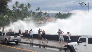
Incoming waves tower over bystanders in Kona, Hawaii, U.S. August 23, 2018, in this still image from video obtained from social media. Ryan Leinback/via REUTERS

REMEMBERING INIKI

The National Hurricane Center warned storm surges could raise water levels 3 to 5 feet (1 to 1.5 meters) above normal along the western shores of the Big Island and that extreme rainfall could mean “numerous evacuations and rescues.”

Ige has urged residents to set aside a 14-day supply of water, food, and medicine. All public schools, University of Hawaii campuses and non-essential government offices on the islands of Oahu and Kauai were closed at least through Friday.

“We are in our room at Alohilani Resort waiting for Hurricane Lane to arrive,” said Janina Ballali on Twitter. “Hopefully, the hurricane will have mercy with our beloved Oahu.”

Par Pacific Holdings Inc said it had shut its 93,500 barrel-per-day refinery in Kapolei due to the storm.

In Hanalei on Kauai, rain fell Thursday as residents and businesses prepared for the hurricane while tourists continued to shop and dine in places that were still open.

Dave Stewart, owner of Kayak Hanalei, had boarded up the windows on his shop by mid-afternoon and moved the company’s rental kayaks to high ground.

He said he wasn’t taking any chances, having lived through severe flooding on Kauai’s North Shore in April and through Hurricane Iniki in 1992.

“That was total destruction,” he said of Iniki. “Seven out of 10 telephone poles were down, so even if your house was OK, you couldn’t get out.”

Iniki was the most powerful hurricane on record to hit Hawaii, making landfall on Kauai island on Sept. 11, 1992, as a Category 4. It killed six people and damaged or destroyed more than 14,000 homes.

The shelves of a downtown Honolulu Walmart were stripped of items ranging from canned tuna to dog food, bottled water and coolers full of ice.

Video footage showed whipping palm trees and darkening skies in Maui. In the Manoa Valley neighborhood in Honolulu, sidewalks typically full of joggers and dog walkers were empty as residents stood outside their homes watching the skies and businesses closed early for the day.

President Donald Trump declared a state of emergency for Hawaii and ordered federal authorities to help supplement state and local responses, the White House said on Thursday.

The Coast Guard has ordered all harbors to close to incoming vessels and the U.S. Navy moved most of its fleet out of Pearl Harbor, where ships could provide aid after the storm.

Since Hurricane Maria devastated Puerto Rico last year, the Federal Emergency Management Agency has made changes to how it works, FEMA Administrator Brock Long said at a briefing in Washington, making sure generators are in place so they can provide power to residents and quickly restart the water system.

“It’s not just providing food and water. If you fix the power first, you solve 90 percent of the problems,” he said.

(Reporting by Jolyn Rosa; Additional reporting by Gina Cherelus in New York, Brendan O’Brien in Milwaukee, Doina Chiacu and Lisa Lambert in Washington and Steve Gorman and Dan Whitcomb in Los Angeles; Writing by Dan Whitcomb; Editing by Janet Lawrence and Raissa Kasolowsky)

Approaching hurricane sparks runs in Hawaii on plywood, water and gasoline

Paul Akamine fills propane tanks for customers as Hurricane Lane approaches Honolulu, Hawaii, U.S. August 22, 2018. REUTERS/Hugh Gentry

By Sue Horton

HANALEI, Hawaii (Reuters) – Micco Godinez, who rents out kayaks on the island of Kauai and loves surfing, said he was twice tempted to hit the waves on Wednesday but kept his focus on a more pressing concern – getting ready to board up his home for a major hurricane.

With forecasts calling for Hurricane Lane to strike or brush past Hawaii’s “Garden Isle” on Friday, Godinez, 66, has joined tens of thousands of others on Kauai, and across the state, in the rituals of disaster preparation.

A long line of cars wait as people fill up their vehicles with gasoline as Hurricane Lane approaches Kauai, Hawaii, U.S., August 22, 2018. REUTERS/ Sue Horton

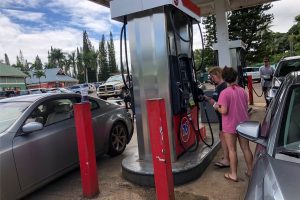
A long line of cars wait as people fill up their vehicles with gasoline as Hurricane Lane approaches Kauai, Hawaii, U.S., August 22, 2018. REUTERS/ Sue Horton

Lane, wavering between Category 4 and Category 5 strength on the five-step Saffir-Simpson hurricane scale, churned toward the U.S. Pacific island state with sustained winds of up to 155 miles per hour (250 kph) on Wednesday, as authorities urged residents to stock up on water, food and medicines.

Across Hawaii, jittery residents lined up at hardware centers, gasoline stations and grocery stores. But nowhere was the sense of urgency perhaps more palpable than on Kauai, where torrential rains four months ago triggered widespread flooding that destroyed homes and washed out roads.

“Some people here were just wiped out in that flood. It rained 50 inches (127 cm) in 24 hours,” said Hanalei resident Charlie Cowden, who owns several surf shops on the island. “Now there is this.”

Many older residents recalled even greater devastation from the last Category 4 storm to pummel Hawaii, Hurricane Iniki, which made landfall on Kauai in September 1992, killing six people and leveling or damaging more than 14,000 dwellings.

Luke Yamanuha loads plywood into his truck as Hurricane Lane approaches Honolulu, Hawaii, U.S. August 22, 2018. REUTERS/Hugh Gentry

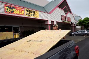
Luke Yamanuha loads plywood into his truck as Hurricane Lane approaches Honolulu, Hawaii, U.S. August 22, 2018. REUTERS/Hugh Gentry

‘SLIM PICKINGS’

Godinez, who lives two blocks from the ocean in the bayside town of Hanalei on Kauai’s north shore, said he spent part of his day shopping for lumber and a recharging device for his portable drill.

He described the mood in town as “pleasantly apprehensive” and said he even felt the familiar pang of one of his favorite pastimes. “Twice the surf was up, and twice I wanted to go surfing, but I had other things pressing on my mind.”

He recalled getting up early to drive to a Home Depot building-supply outlet before it opened at 6 a.m., only to find two dozen others already lined up ahead of him.

“There’s a run on plywood,” he said. “It was slim pickings when I was there.”

Pausing later after filling up jugs of water, Godinez said he and his wife would spend the rest of the day taking measurements and cutting plywood to fit over more than 18 windows on their two-story house.

“Measure twice, cut once, and away we go,” he said, adding they would wait until Thursday for the latest forecasts before deciding whether to go ahead with fastening the boards to the windows.

Since Hanalei is on the opposite side of Kauai from where the hurricane is most likely to come ashore, Godinez said he was less concerned about ocean storm surge than ferocious winds.

Godinez said he, his wife and two guests planned to “hunker down” in a first-floor laundry room at the height of the storm, should it make landfall by late Thursday or early on Friday.

With two small laundry windows sealed up and probably no electricity, except for battery-powered flashlights, “It’s going to be hot and dark,” he said.

(Reporting by Sue Horton; Additional reporting and writing by Steve Gorman in Los Angeles; Editing by Bill Tarrant and Peter Cooney)

Hurricane Lane threatens direct hit on Hawaii, churns toward Oahu

A photo taken from the International Space Station and moved on social media by astronaut Ricky Arnold shows Hurricane Lane in the early morning hours near Hawaii, U.S., August 22, 2018. Courtesy @astro_ricky/NASA/Handout via REUTERS

y Jolyn Rosa

HONOLULU (Reuters) – Hurricane Lane, threatening a direct hit as Hawaii’s worst storm in a quarter century, on Thursday churned toward Oahu, the island with the largest population, as schools, government offices, and business closed and residents stocked up on supplies.

Packing sustained winds of up to 130 miles per hour (215 km per hour), Lane could dump 10 to 20 inches (25-50 cm) of rain, triggering flash floods and landslides, the National Weather Service (NWS) said. More than 30 inches could fall in some places, it said.

“Preparations to protect life and property should be rushed to completion,” the NWS Central Pacific Hurricane Center in Honolulu said in an advisory.

As of early Thursday, Lane was centered about 210 miles (335 km) south-southwest of Kailua-Kona, a town on the west coast of the Big Island, the NWS said. It was classified as a powerful Category 4 storm on the five-step Saffir-Simpson scale of hurricane strength.

The NWS said the storm weakened slightly overnight but excessive rainfall would affect the Hawaiian islands into the weekend, “leading to significant and life-threatening flash flooding and landslides.”

More than a foot of rain has already fallen on part of the Big Island, the NWS said on Thursday morning.

The center also warned of “very large and damaging surf” along exposed west- and south-facing shorelines, likely leading to significant coastal erosion.

A hurricane warning was in effect for Oahu, Maui County, and Hawaii County. The islands of Kauai and Niihau remained on hurricane watch and could face similar conditions starting Friday morning.

Governor David Ige has urged residents to take the threat seriously and prepare for the worst by setting aside a 14-day supply of water, food, and medicines.

All public schools, University of Hawaii campuses and nonessential government offices on the islands of Oahu and Kauai will be closed for at least two days starting on Thursday, Ige said Wednesday.

The shelves of a downtown Honolulu Walmart were stripped of items ranging from canned tuna to dog food as well as bottled water and coolers full of ice after warnings of possible power outages.

“I went to Safeway last night for regular groceries. Everyone was in a panic,” said Thao Nguyen, 35, an employee at a Honolulu branch of Hawaiian shirt retailer Roberta Oaks.

Long lines of cars formed at gasoline stations in Honolulu and people pulled small boats from the water ahead of the expected storm surge. U.S. Navy ships and submarines based in Hawaii were instructed to leave port, a common practice when a hurricane approaches to avoid damage.

President Donald Trump declared a state of emergency for Hawaii and ordered federal authorities to help supplement state and local responses, the White House said on Thursday.

The most powerful hurricane on record to hit Hawaii was Category 4 Iniki, which made landfall on Kauai island on Sept. 11, 1992, according to the National Oceanic and Atmospheric Administration. It killed six people and damaged or destroyed more than 14,000 homes.

(Additional reporting by Gina Cherelus in New York, Brendan O’Brien in Milwaukee, Doina Chiacu in Washington, and Steve Gorman and Dan Whitcomb in Los Angeles; Editing by Jeffrey Benkoe and Marguerita Choy)