Hurricane Michael, among strongest in U.S. history, slams Florida Panhandle

Waves crash on stilt houses along the shore due to Hurricane Michael at Alligator Point in Franklin County, Florida, U.S., October 10, 2018. REUTERS/Steve Nesius

By Rod Nickel

PANAMA CITY, Fla. (Reuters) – Hurricane Michael, the fiercest storm to hit Florida in a quarter century and the third-most powerful ever to strike the U.S. mainland, roared into the state’s Gulf coast on Wednesday with tree-snapping winds and towering waves.

Michael, whose rapid intensification as it churned north over the Gulf of Mexico caught many by surprise, made landfall early in the afternoon near Mexico Beach, about 20 miles (32 km) southeast of Panama City in Florida’s Panhandle region, with top sustained winds reaching 155 miles per hour (249 kph).

The storm came ashore as a Category 4 hurricane on the five-step Saffir-Simpson wind scale. Its sustained winds were just 2 mph (3.2 kph) shy of an extremely rare Category 5.

As predicted, the storm was downgraded hours later to a still-formidable Category 3 with maximum sustained winds of 125 mph (205 kph) and higher gusts as it pushed inland to the Alabama-Georgia border.

Causing major disruptions to oil and gas production in the Gulf even before its arrival, the storm was forecast to unleash waves as high as 14 feet (4.3 meters) above normal sea levels in some areas, the National Hurricane Center said.

“My God, it’s scary. I didn’t expect all this,” said Bill Manning, 63, a grocery clerk who fled his camper van in Panama City for safer quarters in a hotel, only to see the electricity there go out. “Panama City, I don’t know if there will be much left.”

Only a couple of hours after Michael came ashore, floodwaters were more than 7-1/2 feet (2.3 meters) deep near Apalachicola on Florida’s Panhandle, National Hurricane Center Director Ken Graham said.

Authorities had urged coastal residents in 20 Florida counties along a 200-mile (320-km) stretch of shoreline to head to higher ground before the storm, but anyone who had not fled by Wednesday morning was told it was too late to evacuate.

An estimated 6,000 evacuees took cover in emergency shelters, most of them in Florida, and that number was expected to swell to 20,000 across five states by week’s end, said Brad Kieserman of the American Red Cross.

Even before Michael made full landfall, it was whipping trees with its winds and flooding the town of Port St. Joe.

“It feels like you don’t know when the next tree is going to fall on top of you because its blowing so ferociously,” said Port St. Joe Mayor Bo Patterson. “It’s very, very scary. We have trees being uprooted, heavy, heavy rain.”
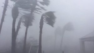
Palm trees are seen during a Hurricane Michael in Panama City, Florida, U.S., October 10, 2018 in this picture obtained from social media. WeatherNation/via REUTERS

Palm trees are seen during a Hurricane Michael in Panama City, Florida, U.S., October 10, 2018 in this picture obtained from social media. WeatherNation/via REUTERS

‘JAW-DROPPING’ STRENGTH

Patterson said about 2,500 of the town’s 3,500 people had stayed put, including about 100 in a beachside area who ignored a mandatory evacuation order. “This happened so quickly, we weren’t exactly prepared,” he said.

Brock Long, head of the Federal Emergency Management Agency (FEMA), said early evacuation efforts in the area were slow.

Michael grew from a tropical storm into a Category 4 hurricane over the course of about 40 hours.

“Satellite images of Michael’s evolution on Tuesday night were, in a word, jaw-dropping,” wrote Bob Henson, a meteorologist with weather site Weather Underground.

With minimum barometric pressure recorded at 919 millibars, a measure of hurricane strength, Michael stood as the strongest storm ever to hit Florida’s Panhandle and the most intense anywhere in the state since Hurricane Andrew in 1992.

Michael also ranked as the third-most powerful storm on record to make landfall in the continental United States, after Hurricane Camille on the Mississippi Gulf Coast in 1969 and the so-called Labor Day hurricane of 1935 in the Florida Keys.

President Donald Trump declared a state of emergency for the entire state of Florida, freeing up federal assistance to supplement state and local disaster responses. He was briefed by FEMA’s Long in the Oval Office on preparations.

At mid-afternoon, about 192,000 homes and business customers were already without power in Florida alone, with more outages reported in Georgia and Alabama, utility companies said.

Michael was forecast to move across southeastern Alabama and southwestern Georgia on Wednesday night.

Helen Neal, 88, and her husband, J.W. Neal, 87, preferred to take their chances in a hotel rather than stay in their two-story Panama City Beach beachfront house about a mile away.

“We just finished renovating and updating,” she said. “We’re kind of nervous. God willing, we’ll still have some place.”

About 3,500 Florida National Guard troops were deployed to assist with evacuations and storm recovery, along with more than 1,000 search-and-rescue personnel, Governor Rick Scott said.

NHC’s Graham warned that the storm would continue to pack tropical storm-force winds when it reached the Carolinas, still reeling from severe flooding in the aftermath of Hurricane Florence last month. Up to a foot (30 cm) of rainfall was forecast for some areas from Michael.

Scott declared a state of emergency in 35 Florida counties. Georgia Governor Nathan Deal declared an emergency for 92 counties in his state, and a state of emergency also was announced in North Carolina.

(Reporting by Devika Krishna Kumar in Tallahassee, Florida; Additional reporting by Rod Nickel in Panama City, Florida, Susan Heavey, Steve Holland and Roberta Rampton in Washington, Gina Cherelus and Barbara Goldberg in New York, Brendan O’Brien in Milwaukee, Liz Hampton in Houston, Andrew Hay in New MexicoWriting by Lisa Shumaker and Bill Trott; Editing by Bill Berkrot and Cynthia Osterman)

Punishing Hurricane Michael bears down on Florida Panhandle

Hurricane Michael is seen in this National Oceanic and Atmospheric Administrations's Geostationary Operational Environmental Satlellite (NOAA GOES-East satellite) image in the Gulf of Mexico, October 9, 2018. Courtesy NOAA GOES-East/Handout via REUTERS

By Devika Krishna Kumar

TALLAHASSEE, Fla. (Reuters) – Hurricane Michael was still strengthening as it closed in on the Florida Panhandle on Wednesday with the threat of catastrophic surges of sea water and roof-shredding winds, and was expected to be the worst hurricane ever recorded in the region.

Michael caught many by surprise with its rapid intensification as it churned north over the Gulf of Mexico. Shortly after 11 a.m. ET (1500 GMT) it was carrying top winds of 150 miles per hour (241 km per hour), making it a very dangerous Category 4 storm on five-step Saffir-Simpson scale, the National Hurricane Center said.

Authorities told residents along the affected areas of Florida’s northwest coast that they had run out of time to evacuate and should hunker down.

The storm caused major disruption to oil and gas production in the U.S. Gulf of Mexico.

Michael’s core was forecast to make landfall on Wednesday afternoon on Florida’s Panhandle and could drive sea water levels as high as 14 feet (4.3 meters) above normal in some areas, the hurricane center said. The storm could still strengthen further before coming ashore, it said.

As the outer bands arrived, ocean water was already flooding parts of Port St. Joe.

Mayor Bo Patterson said about 2,500 of the town’s 3,500 people were still there, including about 100 in a beachside area who did not follow a mandatory evacuation order. The two bridges leading out of Port St. Joe were closed, meaning no one could get out now.

“People are finally getting it, that this is going to be pretty strong,” Patterson said. “This happened so quickly, we weren’t exactly prepared.”

Michael grew from a tropical storm to Category 4 hurricane in about 40 hours.

“This kind of sprung up for us quite quickly,” said Andrew Gillum, mayor of the state capital, Tallahassee, which lies about 25 miles (40 km) from the coast and was preparing for a battering.

“We honestly felt we might have a tropical system and weren’t sure where it would go and now we’re staring down the barrel of a Category 4 storm,” Gillum told CNN.

“Satellite images of Michael’s evolution on Tuesday night were, in a word, jaw-dropping,” wrote Bob Henson, a meteorologist with weather site Weather Underground.

People in coastal parts of 20 Florida counties had been told to leave their homes. Much of the area is rural and known for small tourist cities, beaches and wildlife reserves, as well as Tallahassee.

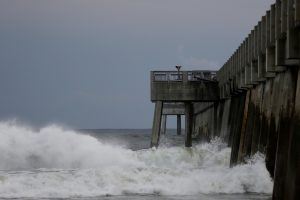
Waves crash along a pier as Hurricane Michael approaches Panama City Beach, Florida, U.S. October 9, 2018. REUTERS/Jonathan Bachman

Waves crash along a pier as Hurricane Michael approaches Panama City Beach, Florida, U.S. October 9, 2018. REUTERS/Jonathan Bachman

TOO LATE TO LEAVE

Governor Rick Scott said on Twitter on Wednesday morning that it was too late to evacuate the target zone and that people who had stayed should immediately seek refuge.

Hurricane center Director Ken Graham said on Facebook that Michael would be the worst storm in recorded history to hit the Panhandle.

“Going back through records to 1851 we can’t find another Cat 4 in this area, so this is unfortunately a historical and incredibly dangerous and life-threatening situation,” he said.

Nearly 40 percent of daily crude oil production and more than one-third of natural gas output was lost from offshore U.S. Gulf of Mexico wells on Wednesday because of platform evacuations and shut-ins caused by Michael.

The hurricane was about 60 miles (95 km) south-southwest of Panama City, Florida, and moving north-northeast at 14 mph (22 kph), the hurricane center said in its 11 a.m. ET advisory.

Apalachicola Mayor Van Johnson said his city, which could suffer some of the worst of the storm surge, was under mandatory evacuation orders.

“My greatest concern is that some people are just now starting to take this storm seriously and are evacuating,” he told CNN. “And I just hope the others that have not made that decision get out while the roads are still passable and before the bridges close.”

President Donald Trump declared a state of emergency for the entire state of Florida, freeing up federal assistance to supplement state and local disaster responses.

POWER CUTS START

Authorities warned of coming disruptions for those in Michael’s path. About 10,000 customers were already without power around midday.

The region should brace for “major infrastructure damage,” specifically to electricity distribution, wastewater treatment systems and transportation networks, Jeff Byard, associate administrator for the Federal Emergency Management Agency, told reporters on a conference call.

Many state offices, schools and universities in the area have been closed since Tuesday.

Helen Neal, 88, and her husband, J.W. Neal, 87, preferred to take their chances in a hotel rather than in their two-story beachfront house about a mile away in Panama City.

“We just finished renovating and updating,” she said. “We’re kind of nervous. God willing we’ll still have some place.”

About 2,500 National Guard troops were deployed to assist with evacuations and storm preparations, and more than 4,000 others were on standby. Some 17,000 utility restoration workers were also on call.

NHC Director Graham said Michael represented a “textbook case” of a hurricane system growing stronger as it drew near shore, in contrast to Hurricane Florence, which struck North Carolina last month after weakening in a slow, halting approach.

He said the storm would still have hurricane-force winds as it pushed through Florida into Georgia and tropical storm-force winds when it reaches the Carolinas, which are still reeling from post-Florence flooding. Up to a foot (30 cm) of rainfall was forecast for some areas.

Scott, a Republican running for the U.S. Senate in November’s congressional elections, declared a state of emergency in 35 Florida counties.

Georgia Governor Nathan Deal declared a state of emergency on Tuesday for 92 counties in his state and a state of emergency also was announced in North Carolina.

The last major hurricane, a storm of Category 3 or above, to hit the Panhandle was Dennis in 2005, according to hurricane center data.

(Reporting by Devika Krishna Kumar in Tallahassee, Florida; additional reporting by Rod Nickel in Panama City, Florida, Susan Heavey and Roberta Rampton in Washington, Gina Cherelus and Barbara Goldberg in New York, Brendan O’Brien in Milwaukee, Liz Hampton in Houston, Andrew Hay in New Mexico; Writing by Lisa Shumaker and Bill Trott; Editing by Frances Kerry)

North Carolina devastated as floodwaters rise from deadly storm Florence, 17 killed

People clean their house after the passing of Hurricane Florence in New Bern, North Carolina, U.S., September 16, 2018. REUTERS/Eduardo Munoz

By Ernest Scheyder and Anna Mehler Paperny

WILMINGTON/WILSON, N.C. (Reuters) – Deadly storm Florence drenched North Carolina with more downpours on Sunday, cutting off the coastal city of Wilmington, damaging tens of thousands of homes and threatening worse flooding as rivers fill to the bursting point.

The death toll rose to at least 17.

Florence, a onetime hurricane that weakened to a tropical depression by Sunday, dumped up to 40 inches (100 cm) of rain on parts of North Carolina since Thursday, and continued to produce widespread heavy rain over much of North Carolina and eastern South Carolina, the National Weather Service said.

“The storm has never been more dangerous than it is right now,” North Carolina Governor Roy Cooper told a news conference. Many rivers “are still rising, and are not expected to crest until later today or tomorrow.”

Some rivers were not expected to crest until Monday or Tuesday, the National Weather Service said.

More than 900 people were rescued from rising floodwaters and 15,000 remained in shelters in the state, Cooper said.

Many of those rescues took place on swift boats in Wilmington, a historic coastal city of about 117,000 people on a peninsula between the Cape Fear River and the Atlantic Ocean.

Rescue crews negotiated downed trees and power lines to reach stranded residents, Mayor Bill Saffo told WHQR radio.

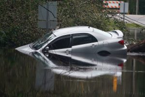
A partially submerged car is pictured on a flooded street after Hurricane Florence struck Piney Green, North Carolina, U.S., September 16, 2018. REUTERS/Carlo Allegri

A partially submerged car is pictured on a flooded street after Hurricane Florence struck Piney Green, North Carolina, U.S., September 16, 2018. REUTERS/Carlo Allegri

“There are no roads … that are leading into Wilmington that are passable because of the flooding that is taking place now inland,” Saffo said.

The National Weather Service issued a flash flood warning for the area until at least Monday morning and said up to 8 inches (20 cm) more rain could fall in some areas, creating an elevated risk for landslides in Western North Carolina.

Officials urged those who had evacuated to stay away.

“Our roads are flooded, there is no access into Wilmington,” New Hanover County Commission Chairman Woody White told a news conference. “We want you home, but you can’t come yet.”

In Leland, a low-lying city north of Wilmington, homes, and businesses were engulfed by water that rose up to 10 feet (3 meters) over Highway 17, submerging stop signs in what local people called unprecedented flooding.

The sheriff’s department and volunteers, including locals and some who came from Texas, rescued stranded residents by boat, extracting families, infants, the elderly and pets.

Gas stations were abandoned and fallen trees made many roads impassable. The whir of generators could be heard throughout the city, a sound not expected to dim soon as crews work to restore power.

In New Bern, a riverfront city near North Carolina’s coast, Bryan Moore and his nephew Logan did exactly what authorities warned against: they left their homes to go swimming in the floodwaters after having spent days at home without electricity or running water.

“We were stir-crazy from being inside so long,” Moore said. “Feels great. The water’s really cool. … We’re just having a good old time out here, enjoying the weather.”

Ember Kelly (C), 5 years old, runs with Iva Williamson (2nd L), 4 years old, to a boat brought up to the edge of flood waters on a street in their neighborhood, during their rescue from rising flood waters in the aftermath of Hurricane Florence in Leland, North Carolina, U.S., September 16, 2018. REUTERS/Jonathan Drake

Ember Kelly (C), 5 years old, runs with Iva Williamson (2nd L), 4 years old, to a boat brought up to the edge of flood waters on a street in their neighborhood, during their rescue from rising flood waters in the aftermath of Hurricane Florence in Leland, North Carolina, U.S., September 16, 2018. REUTERS/Jonathan Drake

More than 641,000 homes and businesses were without electricity in North and South Carolina and surrounding states, down from a peak of nearly 1 million.

Florence set a record in the state for rain from a hurricane, surpassing the previous record of 24 inches (61 cm) set by Hurricane Floyd, which killed 56 people in 1999, said Bryce Link, a meteorologist with private forecasting service DTN Marine Weather.

The storm killed at least 11 people in North Carolina, including a mother and child killed by a falling tree, state officials said. Six people died in South Carolina, including four in car accidents and two from carbon monoxide from a portable generator.

South Carolina’s governor urged anyone in a flood-prone area to evacuate.

“Those rivers in North Carolina that have received heavy rainfall are coming our way,” Governor Henry McMaster said during a news conference. “They have not even begun (to crest). But they will. And the question is how high will the water be, and we do not know.”

By Sunday night, Florence’s winds had dropped to about 30 miles per hour (45 kph), the National Hurricane Center said, with some weakening forecast over the next 24 hours before intensifying once again as an extratropical low-pressure center.The center of the storm was about 45 miles (70 km) north-northeast of Greenville and moving north at 10 mph (17 kph), the hurricane center said.

(Reporting by Anna Mehler Paperny and Ernest Scheyder; Additional reporting by Bernie Woodall in Miami; Jessica Resnick-Ault in New York and Makini Brice in Washington; Writing by Lisa Shumaker and Daniel Trotta; Editing by Frances Kerry, Peter Cooney and Jonathan Oatis)

Wind, flooded roads herald approach of Hurricane Florence in North Carolina

The Union Point Park Complex is seen flooded as the Hurricane Florence comes ashore in New Bern, North Carolina, U.S., September 13, 2018. REUTERS/Eduardo Munoz

By Ernest Scheyder and Anna Mehler Paperny

WILMINGTON/WASHINGTON, N.C. (Reuters) – The outer reaches of Hurricane Florence began lashing coastal North Carolina with heavy winds and flooded roads on Thursday ahead of an expected landfall that will bring walls of water and lingering downpours.

The center of Florence is expected to hit North Carolina’s southern coast Friday, then drift southwest before moving inland on Saturday, enough time to drop as much as 40 inches (1 meter) of rain in places, according to the National Hurricane Center.

Pararescue personnel from the Alaska Air National Guard's 212th Rescue Squadron, 176th Wing, and California ANG's 131st Rescue Squadron, 129th Rescue Wing, settle into a C-17 Globemaster III aircraft in preparation for offering support to Hurricane Florence relief operations, at Moffett Federal Airfield, California, in this September 12, 2018 handout photo. Staff Sgt. Balinda O'Neal Dresel/U.S. Army National Guard/Handout via REUTERS

Pararescue personnel from the Alaska Air National Guard’s 212th Rescue Squadron, 176th Wing, and California ANG’s 131st Rescue Squadron, 129th Rescue Wing, settle into a C-17 Globemaster III aircraft in preparation for offering support to Hurricane Florence relief operations, at Moffett Federal Airfield, California, in this September 12, 2018 handout photo. Staff Sgt. Balinda O’Neal Dresel/U.S. Army National Guard/Handout via REUTERS

An estimated 10 million people live in the storm’s path, according to the U.S. Weather Prediction Center, and coastal businesses and homes were boarded up in anticipation. More than 1 million people had been ordered to evacuate the coasts of the Carolinas and Virginia and thousands moved to emergency shelters, officials said.

Florence’s maximum sustained winds were clocked on Thursday at 105 miles per hour (165 kph) after it was downgraded to a Category 2 on the five-step Saffir-Simpson scale, according to the NHC. The winds had been as high as 140 mph earlier in the week.

Some people who had rejected calls to evacuate the targeted area took walks along the water as they tried to enjoy a few final hours of normalcy before Florence’s fury arrived.

In Sea Breeze, Roslyn Fleming, 56, made a video of the inlet where her granddaughter was baptized because “I just don’t think a lot of this is going to be here” after the storm.

Ten miles (16 km) away in Wilmington, wind gusts were stirring up frothy white caps into the Cape Fear River.

“We’re a little worried about the storm surge so we came down to see what the river is doing now,” said Linda Smith, 67, a retired nonprofit director. “I am frightened about what’s coming. We just want prayers from everyone.”

North Carolina Governor Roy Cooper warned against complacency.

“Hurricane Florence was uninvited but she’s just about here anyway,” he said at a news conference. “Stay on guard. This is a powerful storm that can kill. Today the threat becomes a reality.”

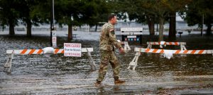
An Army member walks near the flooded Union Point Park Complex as the Hurricane Florence comes ashore in New Bern, North Carolina, U.S., September 13, 2018. REUTERS/Eduardo Munoz

An Army member walks near the flooded Union Point Park Complex as the Hurricane Florence comes ashore in New Bern, North Carolina, U.S., September 13, 2018. REUTERS/Eduardo Munoz

FLOODING, POWER OUTAGES BEGIN

The storm’s center was about 110 miles (180 km) east of Wilmington, North Carolina, at 2 p.m. EDT (1800 GMT) but tropical storm-strength winds and heavy rains already were hitting North Carolina’s Outer Banks barrier islands. The main highway in the Outer Banks was closed in parts as seawater pushed in. Flooding from rain and rising rivers also was reported in New Bern.

Some 11,000 power outages have been reported in North Carolina.

The hurricane center also said the threat of tornadoes was increasing as the storm neared shore.

Florence could bring wind-driven storm surges of seawater as high as 13 feet (4 meters) and NHC Director Ken Graham said on Facebook they could push in as far as 2 miles (3 km). Heavy rains were forecast to extend into the Appalachian mountains, affecting parts of Alabama, Tennessee, Kentucky and West Virginia.

The storm will be a test of President Donald Trump’s administration less than two months before elections to determine control of Congress. After criticism for its response in Puerto Rico to last year’s Hurricane Maria, which officials there said was responsible for 3,000 deaths, Trump has vowed a vigorous response to Florence and defended his handling of Maria.

“3000 people did not die in the two hurricanes that hit Puerto Rico,” Trump said on Twitter. “When I left the Island, AFTER the storm had hit, they had anywhere from 6 to 18 deaths … Then, a long time later, they started to report really large numbers, like 3000.”

Trump provided no evidence to support his challenge on Maria.

Emergency declarations were in force in Georgia, South and North Carolina, Virginia, Maryland and the District of Columbia. Millions of people are expected to lose power and it could take weeks to resolve the outages.

Near the beach in Wilmington, a Waffle House restaurant, part of a chain with a reputation for staying open during disasters, had no plans to close, even if power is lost. It had long lines on Thursday.

GRAPHIC: Hurricane Florence heads toward Carolinas – https://tmsnrt.rs/2oZ5m1v

GRAPHIC: Forecast rainfall in inches from Hurricane Florence – https://tmsnrt.rs/2oZFKSb

(Additional reporting by Bernie Woodall in Fort Lauderdale, Florida, Carlo Allegri in Wilmington, Mana Raibee in Sea Breeze, North Carolina, Brendan O’Brien in Milwaukee and Stephanie Nebehay in Geneva; Writing by Brendan O’Brien and Bill Trott; Editing by Scott Malone and Nick Zieminski)

U.S. southeast braces for ‘days and days’ of floods from Florence

Hurricane Florence is seen from the International Space Station as it churns in the Atlantic Ocean towards the east coast of the United States, September 10, 2018. NASA/Handout via REUTERS

By Anna Driver

HOLDEN BEACH, N.C. (Reuters) – The powerful Hurricane Florence threatened to bring “days and days” of rain and potentially deadly flooding to the U.S. southeast coast, North Carolina’s governor warned on Tuesday, as some 1 million people were ordered to evacuate their homes.

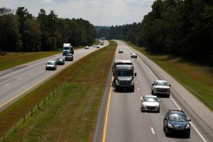
Vehicles travel westbound on Interstate 26 ahead of the arrival of Hurricane Florence near Orangeburg, South Carolina, U.S., September 11, 2018. REUTERS/Chris Keane

Vehicles travel westbound on Interstate 26 ahead of the arrival of Hurricane Florence near Orangeburg, South Carolina, U.S., September 11, 2018. REUTERS/Chris Keane

The storm threatened to hit coastal North and South Carolina with 130 mile per hour (210 kph) winds and massive waves when it makes landfall on Friday, and its rains will take a heavy toll for miles inland, the National Hurricane Center in Miami warned.

“This storm is a monster,” North Carolina Governor Roy Cooper said at a news conference on Tuesday. “It’s an extremely dangerous, life-threatening, historic hurricane … the forecast shows Florence stalling over North Carolina, bringing days and days of rain.”

Cooper and his counterparts in neighboring South Carolina and Virginia ordered about 1 million people to evacuate coastal homes, including along the Outer Banks barrier islands that protect North Carolina’s shore. Officials in South Carolina reversed the flow of traffic on some highways so that all major roads led away from the sea to speed evacuations.

The slow-moving storm, the most severe hurricane to threaten the U.S. mainland this year, was rated a Category 4 on the five-step Saffir-Simpson scale and located about 905 miles (1,455 km) east-southeast of Cape Fear, North Carolina, at 11 a.m. EDT, according to the NHC.

U.S. President Donald Trump on Tuesday signed declarations of emergency for both North Carolina and South Carolina, freeing up federal money and resources for storm response. Officials have declared states of emergency in North and South Carolina, Virginia, Maryland and the District of Columbia.

In addition to flooding the coast with wind-driven storm surges of seawater as high as 12 feet (3.7 m), Florence could drop 20 inches to as much as 30 inches (51 cm to 76 cm) of rain in places, forecasters said.

GRAPHIC: Hurricane Florence heads toward Carolinas – https://tmsnrt.rs/2oZ5m1v

‘PLANNING FOR DEVASTATION’

“This storm is going to be a direct hit on our coast,” said Jeff Byard, associate administrator for response and recovery at the Federal Emergency Management Agency. “We are planning for devastation.”

Not everyone was in a hurry to leave. Charles Mullen, 81, a longtime resident of Hatteras Island, North Carolina, said he had ridden out many storms and that most locals were planning to stay unless Florence took aim at Hatteras.

“If it decides to come here, we’re gone,” he said.

Residents prepared by boarding up their homes and stripping grocery stores bare of food, water and supplies. Some gas stations also ran low on fuel.

“This is still a very dangerous storm,” South Carolina Governor Henry McMaster said at a Tuesday news conference. “We are in a very deadly and important game of chess with Hurricane Florence.”

McMaster lifted an earlier evacuation order for parts of three southern coastal counties but left them in effect for the state’s northern coast and urged residents to flee.

Wall Street was sniffing out companies that could gain or lose at the storm’s hands. Generator maker Generac Holdings Inc rose 2.2 percent and reached its highest price since April 2014.

Insurers Allstate Corp and Travelers Companies Inc were up slightly in early trade after falling sharply on Monday on worries about claims losses.

U.S. Nuclear Regulatory Commission spokesman Roger Hannah said all nuclear power plants in the area were preparing but that Duke Energy Corp’s Brunswick and Harris plants in North Carolina were most likely to be affected and, if Florence turns north, Dominion Energy Inc’s Surry plant in Virginia.

Plants in the storm’s path are shut down about 12 hours in advance of being hit.

(Additional reporting by Gene Cherry in Raleigh, North Carolina, Liz Hampton in Houston, Susan Heavey in Washington, Bernie Woodall in Fort Lauderdale, Florida, Alden Bentley in New York and Brendan O’Brien in Milwaukee; Writing by Nick Zieminski and Bill Trott; Editing by Scott Malone)

Hurricane Florence nears Carolinas, forcing 1.5 million in westward exodus

Hurricane Florence is seen from the International Space Station as it churns in the Atlantic Ocean towards the east coast of the United States, September 10, 2018. NASA/Handout via REUTERS

By Anna Driver

HOLDEN BEACH, N.C. (Reuters) – More than 1.5 million people were ordered to evacuate their homes along the U.S. southeast coast as Hurricane Florence, the most powerful to menace the Carolinas in nearly three decades, barreled closer on Tuesday.

Florence, a Category 4 storm packing winds of 130 miles per hour (210 kph), was expected to make landfall on Friday, most likely in southeastern North Carolina near the South Carolina border, the National Hurricane Center in Miami said.

U.S. President Donald Trump on Tuesday signed declarations of emergency for both North Carolina and South Carolina, a step that frees up federal money and resources for storm response.

Empty shelves are seen at a supermarket as residents prepare for Storm Florence's descent in Columbia, South Carolina, U.S., September 10, 2018, in this still image taken from a video obtained from social media. @missgil/via REUTERS

Empty shelves are seen at a supermarket as residents prepare for Storm Florence’s descent in Columbia, South Carolina, U.S., September 10, 2018, in this still image taken from a video obtained from social media. @missgil/via REUTERS

Residents boarded up their homes and stripped grocery stores bare of food, water and supplies. The South Carolina Highway Patrol sent “flush cars” eastbound on major highways to clear traffic, before reversing lanes on major roadways to speed the evacuation of the coast, state officials said on Twitter.

South Carolina Governor Henry McMaster ordered about 1 million residents along his state’s coastline to leave starting at noon on Tuesday, when the highways will become westbound only. He evoked the memory of 1989’s Hurricane Hugo, which killed 27 people in the state, in urging people to comply.

“I’d rather be safe than sorry,” McMaster told ABC’s “Good Morning America” TV show on Tuesday. “We want people to get out and get safe.”

Virginia Governor Ralph Northam issued an evacuation order for about 245,000 residents in flood-prone coastal areas beginning at 8 a.m. local time.

GENERATOR, HOME REPAIR STOCKS UP

The storm was located about 950 miles (1,530 km) east-southeast of Cape Fear, North Carolina, at 8 a.m. ET, according to the NHC, which warned it would be “an extremely dangerous major hurricane” through Thursday night.

In addition to flooding the coast with wind-driven storm surges of seawater as high as 12 feet (3.7 m), Florence could drop 20 inches to as much as 30 inches (51 cm to 76 cm) of rain in places, posing the risk of deadly flooding miles inland, forecasters said. They warned the storm could linger for days after making landfall, drenching an already saturated landscape.

Shares of generator maker Generac Holdings Inc rose 3 percent, adding to Monday’s more than 5-percent gain, in expectation that the company will benefit from increased demand as the storm knocks out power for residents in the storm’s path.

Anticipating a rush for home protection and repair materials, investors also pushed up the shares of Home Depot Inc and Lowe’s Cos Inc for the second day.

STAY OR FLEE?

Customers line up to buy propane at Socastee Hardware store, ahead of the arrival of Hurricane Florence in Myrtle Beach, South Carolina, U.S. September 10, 2018. REUTERS/Randall Hill

Customers line up to buy propane at Socastee Hardware store, ahead of the arrival of Hurricane Florence in Myrtle Beach, South Carolina, U.S. September 10, 2018. REUTERS/Randall Hill

At least 250,000 more people were due to be evacuated from the northern Outer Banks in North Carolina on Tuesday after more than 50,000 people were ordered on Monday to leave Hatteras and Ocracoke, the southernmost of the state’s barrier islands.

“We haven’t plywooded our house for several years but I am for this one,” said Tom Pahl, 66, by phone from Ocracoke Island. Pahl, who serves as a Hyde County commissioner, said he had not yet made up his mind about leaving the island, which is reachable only by ferry and plane.

Retired Maryland State Police pilot Paul Jones and his wife hit the road early on Tuesday to avoid traffic from Hatteras Island to their Maryland residence.

“I will not stay for a hurricane,” Jones, 68, said. “I have had enough excitement in my life.”

Classified as a Category 4 on the five-step Saffir-Simpson scale of hurricane strength, Florence is the most severe storm to threaten the U.S. mainland this year.

The United States was hit with a series of high-powered hurricanes last year, including Hurricane Maria, which killed some 3,000 people in Puerto Rico, and Hurricane Harvey, which killed about 68 people and caused an estimated $1.25 billion in damage with catastrophic flooding in Houston.

(Additional reporting by Gene Cherry in Raleigh, North Carolina, Susan Heavey in Washington and Brendan O’Brien in Milwaukee; Writing by Nick Zieminski; Editing by Scott Malone and Bill Rigby)

Evacuations in North Carolina as hurricane Florence roars closer

A photo taken from the International Space Station by astronaut Ricky Arnold shows Hurricane Florence over the Atlantic Ocean in the early morning hours of September 6, 2018. Courtesy @astro_ricky/NASA/Handout via REUTERS

By Rich McKay and Letitia Stein

(Reuters) – North Carolina officials on Monday ordered residents to evacuate the state’s Outer Banks barrier islands beginning on Monday ahead of Hurricane Florence, the first major hurricane to threaten the eastern United States this year.

With winds of 115 miles per hour (185 kph), the storm had reached Category 3 strength on the five-step Saffir-Simpson scale by 11 a.m. on (1500 GMT) on Monday, according to the National Weather Service.

It warned the storm would be “an extremely dangerous major hurricane” by the time it made landfall, forecast in the Carolinas on Thursday.

The hurricane was gaining strength as it traveled over warm Atlantic waters, about 1,240 miles (2,000 km) east-southwest of Cape Fear, North Carolina, the National Hurricane Center said in an advisory.

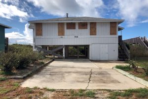
A beachfront home is boarded up ahead of Hurricane Florence, at Holden Beach, North Carolina, U.S., September 10, 2018. REUTERS/Anna Driver

A beachfront home is boarded up ahead of Hurricane Florence, at Holden Beach, North Carolina, U.S., September 10, 2018. REUTERS/Anna Driver

All of Hatteras Island was under mandatory evacuation order and other parts of the Outer Banks will have to evacuate by 7 a.m. EDT (1100 GMT) on Tuesday, Dare County Emergency Management said in a statement.

Hurricane-force winds could buffet the Carolinas by Wednesday night with landfall likely in South Carolina and North Carolina on Thursday, followed by heavy rains that could cause flooding in much of the U.S. Southeast, the NHC said.

The governors of Virginia, North Carolina, and South Carolina all declared states of emergency.

Residents as far north as Virginia were warned that Florence could bring a life-threatening coastal storm surge, as well as inland flooding from “prolonged and exceptionally heavy rainfall,” the NHC said.

North Carolina Governor Roy Cooper urged his state’s residents to get ready, noting the storm was generating swelling waves and dangerous currents.

NHC spokesman Dennis Feltgen said historically, 90 percent of fatalities from hurricanes, tropical storms, and tropical depressions have been caused by water. Some 27 percent of the deaths have come from rain-driven flooding, sometimes hundreds of miles inland.

The NHC also was tracking two other hurricanes farther out in the Atlantic.

Isaac strengthened into the fifth hurricane of the 2018 Atlantic season on Sunday, the NHC said, and as of early Monday, it was about 1,230 miles east 1,305 miles (1,985 km) east of the Windward Islands with maximum sustained winds of 75 mph (120 kph).

Hurricane Helene was spinning in the Atlantic off West Africa’s Cape Verde islands with 85-mph (140-kph) winds on Monday but did not appear to pose an immediate threat to land.

As Florence gathered strength far out in the Atlantic, Wall Street was trying to pick winners and losers from any havoc it might cause.

Generac Holdings Inc, building materials maker Owens Corning and roofing supplier Beacon Roofing Supply Inc, which were up between 4 percent and 8 percent. Retailers Lowe’s Companies Inc and Home Depot Inc gained more than 2 percent.

On the downside, several insurers that are seen vulnerable to potential claims losses slipped, led by a 1.8 percent drop in Allstate Corp and a 1.7 percent decline in Travelers Companies Inc.

(Reporting by Rich McKay in Atlanta, Letitia Stein in Tampa, Florida, and Bernie Woodall in Fort Lauderdale, Florida; Editing by Alison Williams and Bill Trott)

Hurricane Florence to become major hurricane soon, forecasters say

A photo taken from the International Space Station by astronaut Ricky Arnold shows Hurricane Florence over the Atlantic Ocean in the early morning hours of September 6, 2018. Courtesy @astro_ricky/NASA/Handout via REUTER

By Rich McKay and Letitia Stein

(Reuters) – Hurricane Florence strengthened early on Monday, packing maximum sustained winds of 105 mph (170 kph), and forecasters warned that it is “expected to become a major hurricane very soon” as it churns toward the U.S. East Coast.

The category 2 hurricane was mustering might as it traveled over warm Atlantic waters, about 625 miles southeast of Bermuda at 5.am. ET, the National Hurricane Center (NHC) said in an advisory.

It is expected to pickup speed, moving between Bermuda and the Bahamas on Tuesday and Wednesday and could make landfall possibly as a category 3 or higher on the five-step Saffir-Simpson scale, forecasters said.

Landfall could be made between South Carolina and North Carolina on Thursday, according to NHC predictions.

Storm-force winds could begin buffeting the Carolina coast by Wednesday night, forecasters said.

A photo taken from the International Space Station by astronaut Ricky Arnold shows Hurricane Florence over the Atlantic Ocean in the early morning hours of September 6, 2018. Courtesy @astro_ricky/NASA/Handout via REUTERS

A photo taken from the International Space Station by astronaut Ricky Arnold shows Hurricane Florence over the Atlantic Ocean in the early morning hours of September 6, 2018. Courtesy @astro_ricky/NASA/Handout via REUTERS

“Make your plans now,” South Carolina Governor Henry McMaster urged residents during a news conference on Sunday. “Presume that a major hurricane is going to hit right smack dab in the middle of South Carolina.”

McMaster said he had asked President Donald Trump to declare a federal emergency in South Carolina in anticipation of the storm’s arrival.

Residents as far north as Virginia were warned that Florence posed an increasing risk of generating a life-threatening coastal storm surge, as well as flooding from heavy rainfall should the slow-moving storm stall over the southeast.

North Carolina Governor Roy Cooper also urged his state’s residents to get ready, noting the storm already was generating swelling waves and dangerous currents along the coast.

“Everyone in North Carolina needs to keep a close eye on Florence and take steps now to get ready for impacts later this week,” Cooper said in a statement on Sunday.

The governors of Virginia, North Carolina and South Carolina have all declared states of emergency.

The storm’s center was on track to pass between Bermuda and the Bahamas on Wednesday, the NHC said.

The NHC was also tracking two other storms farther out in the Atlantic.

Isaac, previously a tropical storm, strengthened into the fifth hurricane of the 2018 Atlantic season on Sunday, the NHC said.

As of early Monday, Isaac was about 1,230 miles east 1,305 miles (1,985 km) east of the Windward Islands with maximum sustained winds of 75 mph (120 kph), the NHC said.

Hurricane Helene, was spinning in the Atlantic off West Africa’s Cape Verde islands with 85-mph (140-kph) winds on Monday, but did not appear to pose an immediate threat to land.

(This refiled version of the story corrects to show strength of hurricane as category 2 not category 1 in paragraph 2.)

(Reporting by Rich McKay and Letitia Stein; Editing by Alison Williams)

Tropical Storm Gordon hits southern Florida, spins toward U.S. Gulf Coast

FILE PHOTO: Homes sit on the edge of the Gulf of Mexico in the Myrtle Grove Estates development in Plaquemines Parish, Louisiana, U.S. October 7, 2017. REUTERS/Jessica Resnick-Ault/File Photo

By Jon Herskovitz and Rich McKay

(Reuters) – A tropical storm whipped the southern tip of Florida with high winds and rain on Monday morning and was forecast to gain strength as it passed over the Gulf of Mexico toward Louisiana, officials said.

Tropical Storm Gordon was forecast to drop as much as 8 inches (20 cm) of rain in some areas of the U.S. South still reeling from hurricanes a year ago.

The storm was generating winds of 45 miles per hour (72 km/h) on Monday as it steamed west-northwest at 17 miles an hour (27 km/h), National Hurricane Center Director Kenneth Graham said in a video briefing on Facebook.

“It looks like for the next three or four days we’re going to be having to really watch close,” Graham said, “and remember if you’re even inland you can get some of these heavy rainfall totals so now is the time to be prepared.”

Last year, hurricanes walloped Texas, Florida and Puerto Rico, causing thousands of deaths, hundreds of billions of dollars in damage, massive power outages and devastation to hundreds of thousands of structures.

The National Hurricane Center warned of high winds around parts of Florida as the storm passed over the southern tip of the state on Monday morning.

The storm was expected to strengthen over the Gulf of Mexico, and reach the central Gulf Coast states of Alabama, Mississippi and Louisiana late on Tuesday, the National Hurricane Center said.

At the mouth of the Mississippi River, around the area of New Orleans, the storm could generate a surge of up to 4 feet (1 meter) and smaller surges could hit coastland along other parts of the Gulf Coast, Graham said.

“The combination of a dangerous storm surge and the tide will cause normally dry areas near the coast to be flooded by rising waters moving inland from the shoreline,” the National Hurricane Center said in a statement.

Louisiana Governor John Bel Edwards said on Sunday he had activated the state’s Crisis Action Team as a precaution.

There were no immediate indications that the storm had affected energy operations in the Gulf of Mexico area.

(Reporting by Rich McKay in Atlanta, Alex Dobuzinskis in Los Angeles; Editing by Frank McGurty and Andrea Ricci)

Hurricane Lane strengthens to Category 5 as it heads for Hawaii

Members of the Alapahoe outrigger canoe club move their canoes off the beach to higher ground as Hurricane Lane approaches Honolulu, Hawaii, U.S. August 21, 2018. REUTERS/Hugh Gentry

By Jolyn Rosa

HONOLULU (Reuters) – Hurricane Lane strengthened to a Category 5 storm on Tuesday as it charged toward Hawaii where residents braced for “life threatening” winds and flooding, the National Hurricane Center (NHC) said.

Forecasters said it was still uncertain whether the eye of the powerful hurricane would hit land in the U.S. island chain, whose Big Island is reeling from a three-month eruption of Kilauea volcano.

But “preparations to protect life and property should be rushed to completion,” the center said.

The center of the storm is expected to track “dangerously” close to or over the islands Thursday through Saturday, the NHC said.

Jaycee Sotello fills her truck up with gas as Hurricane Lane approaches Honolulu, Hawaii, U.S. August 21, 2018. REUTERS/Hugh Gentry

Jaycee Sotello fills her truck up with gas as Hurricane Lane approaches Honolulu, Hawaii, U.S. August 21, 2018. REUTERS/Hugh Gentry

A direct hit anywhere in Hawaii “would be a worst-case scenario,” said Thomas Birchard, a meteorologist with the hurricane center.

The powerful hurricane was about 350 miles (565 km) south-southeast of Kailua-Kona, Hawaii, with maximum sustained winds of 160 miles per hour (260 km/h) at about 11:30 p.m. local time, the NHC said.

As of late Tuesday night, a hurricane warning was in effect for the Big Island and a hurricane watch was in effect for the rest of the state, the hurricane center said.

The storm, which was moving west-northwest near 9 mph (15 km/h), was expected to turn toward the northwest on Wednesday, followed by a turn to the north-northwest on Thursday, the center said.

Winds and rain from the storm are expected to hit the Big Island, then churn north over the islands of Maui, Lanai, and Moloka’i, which were all under hurricane and flash flood watches.

Rainfall of 20 inches (51 cm) in some areas could lead to major flash flooding, landslides, and mudslides, the NHC said.

Devastation caused by winds and flooding may make locations uninhabitable for weeks and Hawaii residents to be prepared to evacuate their homes, local authorities warned.

(Reporting by Andrew Hay and Brendan O’Brien; Editing by Bill Tarrant, Sandra Maler, and Andrew Heavens)